
Raton is a city and the county seat of Colfax County in northeastern New Mexico. The city is located just south of Raton Pass. The city is also located about 6.5 miles south of the New Mexico–Colorado border and 85 miles west of Texas.
Magdalena is a village in Socorro County, New Mexico, United States. The population was 938 at the 2010 census.
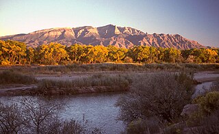
The Sandia Mountains are a mountain range located in Bernalillo and Sandoval counties, immediately to the east of the city of Albuquerque in New Mexico in the southwestern United States. The mountains are just due south of the southern terminus of the Rocky Mountains, and are part of the Sandia–Manzano Mountains. This is largely within the Cibola National Forest and protected as the Sandia Mountain Wilderness. The highest point is Sandia Crest, 10,678 feet (3,255 m).

The Santa Fe Trail was a 19th-century route through central North America that connected Franklin, Missouri, with Santa Fe, New Mexico. Pioneered in 1821 by William Becknell, who departed from the Boonslick region along the Missouri River, the trail served as a vital commercial highway until 1880, when the railroad arrived in Santa Fe. Santa Fe was near the end of El Camino Real de Tierra Adentro which carried trade from Mexico City. The trail was later incorporated into parts of the National Old Trails Road and U.S. Route 66.

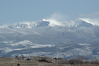
The Sangre de Cristo Mountains are the southernmost subrange of the Rocky Mountains. They are located in southern Colorado and northern New Mexico in the United States. The mountains run from Poncha Pass in South-Central Colorado, trending southeast and south, ending at Glorieta Pass, southeast of Santa Fe, New Mexico. The mountains contain a number of fourteen thousand foot peaks in the Colorado portion, as well as several peaks in New Mexico which are over thirteen thousand feet.

Fort Union National Monument is a unit of the United States National Park Service located 7.7 miles north of Watrous in Mora County, New Mexico.

The Old Spanish Trail is a historical trade route that connected the northern New Mexico settlements of Santa Fe, New Mexico with those of Los Angeles, California and southern California. Approximately 700 mi (1,100 km) long, the trail ran through areas of high mountains, arid deserts, and deep canyons. It is considered one of the most arduous of all trade routes ever established in the United States. Explored, in part, by Spanish explorers as early as the late 16th century, the trail was extensively used by traders with pack trains from about 1830 until the mid-1850s. The area was part of Mexico from Mexican independence in 1821 to the Mexican Cession to the United States in 1848.

Santa Fe Baldy is a prominent summit in the Sangre de Cristo Mountains of New Mexico, United States, located 15 mi (24 km) northeast of Santa Fe. There are no higher mountains in New Mexico south of Santa Fe Baldy. It is prominent as seen from Los Alamos and communities along the Rio Grande in northern New Mexico, but is relatively inconspicuous from Santa Fe, as its north-south trending main ridge line is seen nearly end-on, disguising the size of the mountain. Tree line in the Sangre de Cristos is unusually high and only the top 600 to 800 feet of the mountain is perpetually free of trees, but several severe forest fires have created bare spots extending to lower elevations. An extensive region of aspen trees on its flanks produces spectacular orange-yellow coloration during the fall that is the subject of many photographic studies.

The Ute Mountain Ute Tribe is one of three federally recognized tribes of the Ute Nation, and are mostly descendants of the historic Weeminuche Band who moved to the Southern Ute reservation in 1897. Their reservation is headquartered at Towaoc, Colorado on the Ute Mountain Ute Indian Reservation in southwestern Colorado, northwestern New Mexico and small sections of Utah.

Carson National Forest is a national forest in northern New Mexico, United States. It encompasses 6,070 square kilometers and is administered by the United States Forest Service. The Forest Service's "mixed use" policy allows for its use for recreation, grazing, and resource extraction.
Truchas Peak is the second highest peak in the U.S. State of New Mexico behind Wheeler Peak. It is in the Sangre de Cristo Mountains 26 miles (42 km) northeast of Santa Fe. It lies within the Pecos Wilderness, part of the Santa Fe National Forest. The name of the peak is Spanish for "trout" (plural). It is the highest point in both Rio Arriba and Mora counties. It is also the most southerly peak and land area in the continental United States to rise above 13,000 feet (3,962 m).
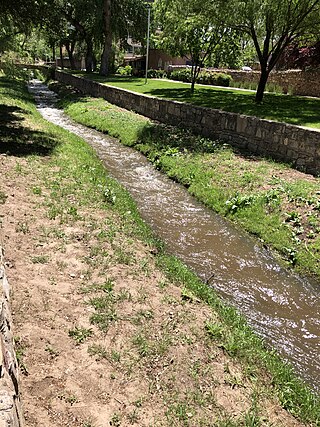
The Santa Fe River is a river in Santa Fe and Sandoval counties in New Mexico, United States, that is a tributary of the Rio Grande.
State Road 120 (NM 120) is a 119.031-mile-long (191.562 km) state road in the U.S. state of New Mexico. The route traverses four counties: Colfax, Mora, Harding, and Union, and is the longest state road in New Mexico. The highway's only grade-separated interchange is with Interstate 25 (I-25) in Wagon Mound.

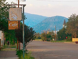
Rayado was the first permanent settlement in Colfax County, New Mexico, United States and an important stop on the Santa Fe Trail. The name Rayado derives from the Spanish term for "streaked", perhaps in reference to the lot lines marked out by Lucien Maxwell.
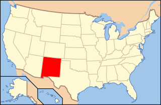
The following is an alphabetical list of articles related to the U.S. state of New Mexico.

The Rabbit Ears are a pair of mountain peaks in northeastern New Mexico, United States, 8 kilometres (5.0 mi) north of the city of Clayton. The two peaks were a distinctive landmark along the Cimarron Cutoff of the Santa Fe Trail, a major route for westbound settlers in the 19th century. The formation was designated a National Historic Landmark in 1963. The name is that of a Native American chief who was killed here in a battle with the Spanish in 1717.
Ocate is an unincorporated community located in Mora County, New Mexico, United States. The community is located at the junction of State Routes 442 and 120, 22.3 miles (35.9 km) west-northwest of Wagon Mound. Ocate has a post office with ZIP code 87734, which opened on January 10, 1870.
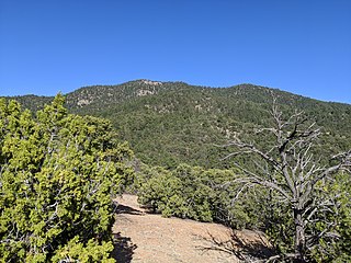
Atalaya Mountain is a mountain peak located within the Santa Fe National Forest, in northern New Mexico, United States. It is part of the Santa Fe Mountains in the Sangre de Cristo Range, a subrange of the Southern Rocky Mountains. A relevant viewscape from the city of Santa Fe, there are no higher peaks between the city and Atalaya Mountain to the east. Viewed from the city, Atalaya Mountain is framed by Sun Mountain to the right (south), Picacho Peak to the left (north), and Thompson Peak behind it. Atalaya Mountain is accessible by following the Atalaya Trail, or via the Dale Ball Trails from the direction of Picacho Peak and trail marker number 36.
Sunlit Hills is an unincorporated community and census-designated place (CDP) in Santa Fe County, New Mexico, United States. It was first listed as a CDP prior to the 2020 census.

