
Playas is a census-designated place (CDP) in Hidalgo County, New Mexico, United States. As of the 2010 census it had a population of 74.
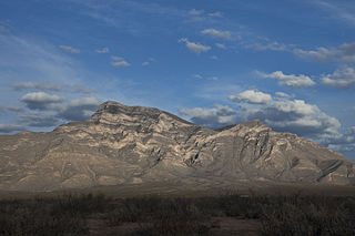
Big Hatchet Peak is the high point of the Big Hatchet Mountains, a small but rugged range in the southwest corner of New Mexico, in the United States. The mountains are located in southeast Hidalgo County, about 50 miles (80 km) southwest of Deming. The range runs roughly northwest-southeast, and is about 12 miles (19 km) long; the southeastern edge of the range is within 3.5 miles (6 km) of the border with Mexico. They lie primarily on BLM land.

Malpai Borderlands is a land area along the U.S.-Mexico border. It encompasses the southeast corner of Arizona and the southwest corner of New Mexico. It is sometimes defined as including areas in the Mexican states of Chihuahua and Sonora. The Malpai is part of the Madrean Region which includes the arid and semi-arid borderlands of the United States and Mexico from California to Texas.

The Big Hatchet Mountains are an 18 mi (29 km) long mountain range in southeast Hidalgo County, New Mexico, adjacent to the northern border of Chihuahua state, Mexico.
State Road 9 (NM 9) is a 109.154-mile-long (175.666 km) state road in the U.S. state of New Mexico. The highway spans Hidalgo, Grant, and Luna counties from its western terminus at NM 80 to its eastern terminus at CR A003 at the Doña Ana county line. NM 9 and NM 338 are the only remaining New Mexico State Roads to form a concurrency.

Animas is an unincorporated community and census-designated place (CDP) in west-central Hidalgo County, New Mexico, United States, in the southwestern corner of the state. As of the 2010 census it had a population of 237.
Doubtful Canyon was the name of two canyons in the Peloncillo Mountains, once considered in the 19th century as one canyon that served as the pass through those mountains.

The Peloncillo Mountains of Cochise County is a mountain range in northeast Cochise County, Arizona. A northern north–south stretch of the range extends to the southern region of Greenlee County on the northeast, and a southeast region of Graham County on the northwest. The north stretch of the Peloncillos forms the border between the two counties. It lies east and northeast of the Willcox Playa, and the San Simon Valley.

The Peloncillo Mountains of Hidalgo County,, is a major 35-mile (56 km) long mountain range southwest of New Mexico's Hidalgo County, and also part of the New Mexico Bootheel region. The range continues to the northwest into Arizona as the Peloncillo Mountains of Cochise County, Arizona. The extreme southwest corner of the range also lies in Arizona. It is a linear range bordering the linear San Bernardino Valley of southeast Cochise County, Arizona.
The Little Burro Mountains are a short 15 mi (24 km) long mountain range located in Grant County, New Mexico. The range lies adjacent to the southeast border of the larger Big Burro Mountains. The Little Burro Mountains are located 8 mi southwest of Silver City. State Road 90 from Silver City skirts the southern perimeter of the range on its route to Lordsburg.
The Playas Valley is a lengthy and narrow 60-mi (97-km) long, valley located in Hidalgo County, New Mexico in the Bootheel Region; the extreme south of the valley lies in Chihuahua. Playas, New Mexico is located in the northeast. The valley is noteworthy for the Playas Lake, a dry lake in the north.
The Cedar Mountain Range is a short 20 mi (32 km) long, mountain range in southwest Luna County, New Mexico, USA, just north of the Mexico–United States border with Chihuahua.
The Pyramid Mountains are a 30 mi (48 km) long, mountain range in central-east Hidalgo County, New Mexico. The city of Lordsburg and Interstate 10 lie at its northern border.

The Alamo Hueco Mountains are a 15-mile (24 km) long mountain range, located in the southeast of the New Mexico Bootheel region, southeast Hidalgo County, New Mexico, adjacent to the border of Chihuahua state, Mexico. The range lies near the southern end of the mountains bordering the extensive north–south Playas Valley; the Little Hatchet and Big Hatchet Mountains are adjacent, and mostly attached north; the mountain range series, ends south into the flatland plains of the Chihuahuan Desert. The much smaller Dog Mountains are adjacent south.

The Big Burro Mountains are a moderate length 35-mile (56 km) long, mountain range located in central Grant County, New Mexico. The range's northwest-southeast 'ridgeline' is located 15 mi southwest of Silver City.

The New Mexico Bootheel is a salient (protrusion) which comprises the southwestern corner of New Mexico. As part of the Gadsden Purchase it is bounded on the east by the Mexican state of Chihuahua along a line at 31°47′0″N108°12′30″W extending south to latitude 31°20′0″N at 31°20′0″N108°12′30″W. The southern border is shared between the Mexican states of Chihuahua and Sonora along latitude 31°20′0″N, while the western border with Arizona is along meridian 109°03′0″W at 31°20′0″N109°03′0″W, bounding an area of 50 by 30 miles and comprising 1,500 square miles (3,900 km2).
The Animas Valley is a lengthy and narrow north–south valley 85 miles long, located in western Hidalgo County, New Mexico, in the Bootheel Region; the extreme south of the valley lies in Sonora-Chihuahua, in the extreme north-west of the Chihuahuan Desert, the large desert region of the north-central Mexican Plateau and the Rio Grande valley and river system.
West Doubtful Canyon was the name of one of two canyons in the Peloncillo Mountains, once considered in the 19th century as one canyon "Doubtful Canyon" that served as the pass through those mountains. Today the canyon bearing the name Doubtful Canyon, is mostly in Cochise County, Arizona, United States, near the New Mexico border. It descends to the east into the Animas Valley past Steins Peak it is in Hidalgo County, New Mexico. The western canyon is now called West Doubtful Canyon and it descends into the San Simon Valley, in Cochise County, Arizona.
Playas Lake is a dry lake or playa in Hidalgo County, New Mexico, United States. It lies at an elevation of 4,278 feet (1,304 m). It consists of a long dry lake running north northwest south southeast within the Playas Valley between the Animas Mountains on the west and the Little Hatchet Mountains on the east.


