McKnight Mountain

Last updated
McKnight Mountain
USA New Mexico location map.svg
Red triangle with thick white border.svg
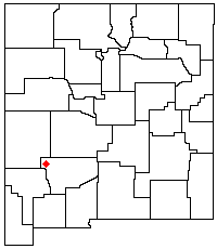
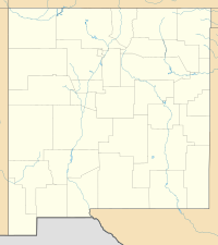
McKnight Mountain
Location in New Mexico
Highest point
Elevation 10,165 ft (3,098 m) [1]
Prominence 2,525 ft (770 m) [1]
Coordinates 33°03′07″N107°51′01″W / 33.052016°N 107.8503149°W / 33.052016; -107.8503149 Coordinates: 33°03′07″N107°51′01″W / 33.052016°N 107.8503149°W / 33.052016; -107.8503149 [2]
Geography
Location Sierra / Grant counties, New Mexico, U.S.
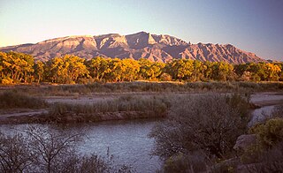
Parent range Black Range
Topo map USGS Victorio Park
Climbing
Easiest route Trail hike

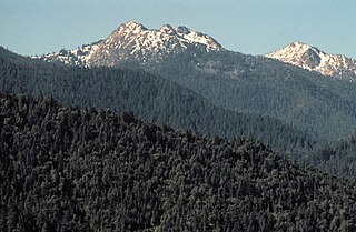
McKnight Mountain is the highest peak in the Black Range of southwestern New Mexico, in the southwestern United States. It is located about 30 miles (48 km) northeast of Silver City, in the Aldo Leopold Wilderness of the Gila National Forest.

Black Range mountain range in New Mexico, USA

The Black Range is an igneous mountain range running north-south in Sierra and Grant counties in west-central New Mexico, in the southwestern United States. Its central ridge forms the western and eastern borders, respectively, of the two counties through much of their contact. The range is about 55 miles (88 km) long from north to south and up to 18 miles (29 km) wide. The highest point is McKnight Mountain. The Black Range lies almost entirely within the Gila National Forest. The Mimbres River originates from the mountain snow pack and run-off. The Mimbres Mountains, the southernmost part of the range, are usually included as part of the Black Range.

New Mexico State of the United States of America

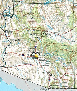
New Mexico is a state in the Southwestern region of the United States of America; its capital and cultural center is Santa Fe, which was founded in 1610 as capital of Nuevo México, while its largest city is Albuquerque with its accompanying metropolitan area. It is one of the Mountain States and shares the Four Corners region with Utah, Colorado, and Arizona; its other neighboring states are Oklahoma to the northeast, Texas to the east-southeast, and the Mexican states of Chihuahua to the south and Sonora to the southwest. With a population around two million, New Mexico is the 36th state by population. With a total area of 121,592 sq mi (314,920 km2), it is the fifth-largest and sixth-least densely populated of the 50 states. Due to their geographic locations, northern and eastern New Mexico exhibit a colder, alpine climate, while western and southern New Mexico exhibit a warmer, arid climate.

Silver City, New Mexico Town in New Mexico, United States

Silver City is a town in Grant County, New Mexico, United States. It is the county seat and the home of Western New Mexico University. As of the 2010 census the population was 10,315. In 2015 the population was estimated to be 10,004.

The mountain is topped by a flat ridge running roughly north–south for about one-half mile; the north and south ends of the ridge are both listed at 10,165 feet. The mountain is forested up to near its summit, which is rocky and provides panoramic views. Its west slopes are the headwaters of the East Fork of the Mimbres River, which flows through McKnight Canyon, and its northwest slopes also feed into the Mimbres. The east side is drained by Las Animas Creek, which flows into the Rio Grande at Caballo Lake. While the Continental Divide runs along much of the Black Range, McKnight Mountain is not on the divide itself, which separates from the crest of the Black Range at Red Peak a few miles to the north.

Mimbres River river in the United States of America

The Mimbres is a 91-mile-long (146 km) river in southwestern New Mexico. It forms from snow pack and runoff on the south-western slopes of the Black Range at 33°06′58″N107°51′04″W in Grant County. It flows southward into a small endorheic basin east of Deming, New Mexico in Luna County. The uplands watershed are administered by the US Forest Service, while the land in the Mimbres Valley is mostly privately owned. The upper reaches of the river are perennial. The river flows south from the Black Range and the surface flow of the river dissipates in the desert north of Deming, but the river bed and storm drainage continue eastward, any permanent flow remaining underground. The Mimbres River Basin has an area of about 13,000 km² (5,140 mi²) and extends slightly into northern Chihuahua.

Rio Grande River forming part of the US-Mexico border

The Rio Grande is one of the principal rivers in the southwest United States and northern Mexico. The Rio Grande begins in south-central Colorado in the United States and flows to the Gulf of Mexico. Along the way, it forms part of the Mexico–United States border. According to the International Boundary and Water Commission, its total length was 1,896 miles (3,051 km) in the late 1980s, though course shifts occasionally result in length changes. Depending on how it is measured, the Rio Grande is either the fourth- or fifth-longest river system in North America.

Caballo Lake

Caballo Lake is a reservoir on the Rio Grande in southern New Mexico, United States. It is the fourth largest reservoir in New Mexico in terms of surface area and the fifth largest body of water in New Mexico in terms of volume. The lake is in Caballo Lake State Park, which is approximately 16 miles (26 km) south of Truth or Consequences.

McKnight Mountain is accessible via several trails. One is Trail 79, which runs along the crest of the Black Range, with a trailhead about 5 miles (8 km) south of the peak, located near McKnight Cabin at the end of Forest Road 152. Another, Trail 82, approaches the peak from the west through McKnight Canyon.

Related Research Articles

Mount Whitney mountain in Sierra Nevada, California

Mount Whitney is the tallest mountain in California, as well as the highest summit in the contiguous United States and the Sierra Nevada—with an elevation of 14,505 feet (4,421 m). It is in Central California, on the boundary between California's Inyo and Tulare counties, 84.6 miles (136.2 km) west-northwest of the lowest point in North America at Badwater Basin in Death Valley National Park at 282 ft (86 m) below sea level. The west slope of the mountain is in Sequoia National Park and the summit is the southern terminus of the John Muir Trail which runs 211.9 mi (341.0 km) from Happy Isles in Yosemite Valley. The east slope is in the Inyo National Forest in Inyo County.

Rocky Mountain National Park national park of the United States

Rocky Mountain National Park is an American national park located approximately 76 mi (122 km) northwest of Denver International Airport in north-central Colorado, within the Front Range of the Rocky Mountains. The park is situated between the towns of Estes Park to the east and Grand Lake to the west. The eastern and westerns slopes of the Continental Divide run directly through the center of the park with the headwaters of the Colorado River located in the park's northwestern region. The main features of the park include mountains, alpine lakes and a wide variety of wildlife within various climates and environments, from wooded forests to mountain tundra.

Mount McLoughlin Stratovolcano in the Cascade Range of southern Oregon

Mount McLoughlin is a steep-sided stratovolcano, or composite volcano, in the Cascade Range of southern Oregon and within the Sky Lakes Wilderness. It is one of the volcanic peaks in the Cascade Volcanic Arc, within the High Cascades sector. A prominent landmark for the Rogue River Valley, the mountain is north of Mount Shasta, and Crater Lake lies to the north-northeast. It was named around 1838 after John McLoughlin, a Chief Factor for the Hudson's Bay Company. McLouglin's prominence has made it a landmark to Native American populations for thousands of years.

Sandia Mountains mountain range located to the east of the city of Albuquerque in New Mexico in the southwestern United States

The Sandia Mountains are a mountain range located in Bernalillo and Sandoval counties, immediately to the east of the city of Albuquerque in New Mexico in the southwestern United States. The range is largely within the Cibola National Forest, and part of the range is protected as the Sandia Mountain Wilderness. Its highest point is Sandia Crest, 10,678 feet (3,255 m).

Santa Ynez Mountains mountain range in Southern California

The Santa Ynez Mountains are a portion of the Transverse Ranges, part of the Pacific Coast Ranges of the west coast of North America. It is the westernmost range in the Transverse Ranges.

Mogollon Mountains

The Mogollon Mountains or Mogollon Range are a mountain range in Grant County and Catron County of southwestern New Mexico, in the Southwestern United States. They are primarily protected within the Gila National Forest.

Black Mountains (North Carolina) mountain range in western North Carolina

The Black Mountains are a mountain range in western North Carolina, in the southeastern United States. They are part of the Blue Ridge Province of the Southern Appalachian Mountains. The Blacks are the highest mountains in the Eastern United States. The range takes its name from the dark appearance of the red spruce and Fraser fir trees that form a spruce-fir forest on the upper slopes which contrasts with the brown or lighter green appearance of the deciduous trees at lower elevations. The Eastern Continental Divide, which runs along the eastern Blue Ridge crest, intersects the southern tip of the Black Mountain range.

Aldo Leopold Wilderness

Aldo Leopold Wilderness, along with Gila Wilderness and Blue Range Wilderness, is part of New Mexico's Gila National Forest. It became part of the National Wilderness Preservation System in 1980 by an act of the United States Congress and has a total of 202,016 acres (81,753 ha). The wilderness area lies along the crest of the Black Range.

Angeles Forest Highway highway in California

The Angeles Forest Highway is a road over the San Gabriel Mountains in Los Angeles County, California. It connects the Los Angeles Basin with the Antelope Valley and western Mojave Desert. The highway is also known as County Road N-3 or FH-59 or the Palmdale cutoff; the route numbers are unsigned, but noted on many maps. It is about 25 miles (40 km) long.

Manzano Mountains

The Manzano Mountains are a small mountain range in the central part of the US State of New Mexico. They are oriented north-south and are about 40 miles (65 km) long. The center of the range lies about 25 miles (40 km) southeast of Albuquerque, and the northern foothills are just a few miles east of the edge of the city. The name "Manzano" is Spanish for "apple tree"; the mountains were named for apple orchards planted at the nearby town of Manzano.

Magdalena Mountains

The Magdalena Mountains are a regionally high, mountain range in Socorro County, in west-central New Mexico in the southwestern United States. The highest point in the range is South Baldy, at 10,783 ft, which is also the tallest peak in Socorro County. The range runs roughly north-south and is about 18 miles (28 km) long. The range lies just south of the village of Magdalena, and about 18 miles (28 km) west of Socorro. The Magdalena Mountains are an east-tilted fault-block range, superimposed on Cenozoic calderas. The complex geologic history of the range has resulted in spectacular scenery, with unusual and eye-catching rock formations. They form part of the western edge of the Rio Grande Rift Valley, fronting the La Jencia Basin. The mountains remain isolated and natural due to the absence of any significant human development within or near the range.

South Baldy (New Mexico) mountain in United States of America

South Baldy is the highest point of the Magdalena Mountains in central New Mexico, in the United States. It is in the Magdalena Ranger District of the Cibola National Forest, about 9 mi (15 km) south of Magdalena and 18 mi (30 km) west-southwest of Socorro. It lies just north of the Langmuir Laboratory for Atmospheric Research of the New Mexico Institute of Mining and Technology, and site of the Magdalena Ridge Observatory Interferometer.

Red Buttes Wilderness

The Red Buttes Wilderness is a wilderness area in the Klamath and Rogue River national forests in the U.S. states of Oregon and California. It comprises 19,940 acres (8,070 ha), approximately 16,190 acres (6,550 ha) of which is located in California, and 3,750 acres (1,520 ha) in Oregon. It was established by the California Wilderness Act of 1984 and the Oregon Wilderness Act of 1984.

Graham Mountain (New York) Highest privately owned summit in New Yorks Catskill Mountains

Graham Mountain is the seventh highest of the Catskill High Peaks and the highest privately owned mountain in the range. It is located in the town of Hardenburgh, New York, United States.

Geography of Arizona

Arizona is a landlocked state situated in the southwestern region of the United States of America. It has a vast and diverse geography famous for its deep canyons, high- and low-elevation deserts, numerous natural rock formations, and volcanic mountain ranges. Arizona shares land borders with Utah to the north, the Mexican state of Sonora to the south, New Mexico to the east, and Nevada to the northwest, as well as water borders with California and the Mexican state of Baja California to the southwest along the Colorado River. Arizona is also one of the Four Corners states and is diagonally adjacent to Colorado.

Marks Knob

Marks Knob is a mountain in the Great Smoky Mountains, in the southeastern United States. It has an elevation of 6,169 feet (1,880 m), with 249 feet (76 m) of clean prominence. Its summit— located near the center of the Eastern Smokies amidst a dense stand of Southern Appalachian spruce-fir forest— is a popular bushwhacking destination and one of the most difficult-to-reach summits of the Southern Sixers.

Boulder River Wilderness

Boulder River Wilderness is a 48,674-acre (197 km2) wilderness area within the Mount Baker-Snoqualmie National Forest in the western Cascade Range of Washington state.

Carr Peak mountain in United States of America

Carr Peak is the third-highest mountain in Cochise County, Arizona and is the second-highest mountain in the Huachuca Mountains. It rises about 10 miles (16 km) south of Sierra Vista, Arizona. The summit is in the Miller Peak Wilderness on the Coronado National Forest and about 4 miles (6 km) south of the Nature Conservancy's Ramsey Canyon Preserve. The area is well known among birders because of the variety of hummingbird species seen in the area as well as the dozens of southwestern specialties such as Apache pine, Chihuahua pine, ridge-nosed rattlesnake, lesser long-nosed bat and elegant trogon.

Manzano Mountain Wilderness

Manzano Mountain Wilderness is a designated Wilderness Area within the Cibola National Forest, located about 50 miles (80 km) south-southeast of Albuquerque. It is located in western Torrance County and eastern Valencia County. The Wilderness area includes 36,875 acres (14,923 ha) with elevations ranging from 6,100 feet (1,900 m) to 10,098 feet (3,078 m) at Manzano Peak.

References