Blackrock is an affluent suburb of Dublin, Ireland, 3 km (1.9 mi) northwest of Dún Laoghaire. It is named after the local geological rock formation to be found in the area of Blackrock Park. In the late 18th century, the Blackrock Road was a common place for highway robberies. The Blackrock baths, provided for by the railway company in 1839, became popular in the 19th century but Blackrock is now a tourist destination.

Shankill is an outlying suburb of Dublin, Ireland, on the southeast of County Dublin, close to the border with County Wicklow. It is in the local government area of Dún Laoghaire–Rathdown and had a population of 14,257 as of the 2016 census. It runs from the coast, between Loughlinstown and Bray, inland towards the foothills of the Dublin Mountains. Shankill borders Rathmichael, as well as Loughlinstown, Killiney, Ballybrack and Bray in County Wicklow. It is part of the civil parish of Rathmichael and contains the formerly separate district of Shanganagh, and in its southern parts, the locality of Crinken.

Dún Laoghaire–Rathdown is a county in Ireland. It is in the province of Leinster and the Eastern and Midland Region. It is one of three successor counties to County Dublin, which was disestablished in 1994. It is named after the former borough of Dún Laoghaire and the barony of Rathdown. Dún Laoghaire–Rathdown County Council is the local authority for the county. The population of the county was 233,860 at the time of the 2022 census.

Foxrock is an affluent suburb of Dublin, Ireland. It is within the county of Dún Laoghaire–Rathdown, in the postal district of Dublin 18 and in the Roman Catholic parish of Foxrock.

Cabinteely is a suburb of Dublin's southside. It is in Dún Laoghaire–Rathdown, County Dublin, Ireland. The population of all electoral divisions labelled as Cabinteely was 15,864 as of the 2022 census.

Dún Laoghaire is a parliamentary constituency represented in Dáil Éireann, the lower house of the Irish parliament or Oireachtas. The constituency elects four deputies on the system of proportional representation by means of the single transferable vote (PR-STV). It is in the eastern part of the county of Dún Laoghaire–Rathdown.

Marlay Park is a 121 hectares suburban public park located in Rathfarnham in Dún Laoghaire–Rathdown, Ireland. Lying about nine kilometres from Dublin city centre, the parkland comprises woodlands, ponds and walks. Recreational spaces include a nine-hole, par-three golf course, tennis courts, six soccer pitches, five GAA pitches, a cricket pitch,a dog park, two children's playgrounds and a miniature railway run by the Dublin Society of Model and Experimental Engineers. There is also a craft courtyard with home craft shops and a coffee shop.

Sallynoggin is an area of Dublin in Ireland, in Dún Laoghaire–Rathdown, County Dublin. The area consists mainly of former local authority housing built between the late 1940s and the mid-1950s by the Corporation of Dún Laoghaire.

Cornelscourt is a small suburban area within the traditional County Dublin, now in the jurisdiction of Dún Laoghaire–Rathdown. Situated between Cabinteely, Carrickmines and Foxrock, it is a primarily residential area, but is perhaps best known for being the site of Ireland's first big-box store, a branch of Dunnes Stores, and the country's first drive-through bank.

Cherrywood is a developing suburb of Dublin, Ireland, bordering Cabinteely, Loughlinstown and Rathmichael. It is located to the southeast of the city, in Dún Laoghaire–Rathdown. The development commenced on a greenfield site in 1998 and primarily comprises Cherrywood Business Park and new residential and retail development. Development of the suburb stalled following the economic downturn, but resumed in the late 2010s and remains in continuous state of development as of late 2024.

Rathmichael is a suburb south-east of Dublin, in the local government area of Dún Laoghaire–Rathdown, near the southern border of the traditional County Dublin. It is situated west of Shankill from which it is, roughly, separated by the M50/M11 motorways. It is also a civil parish in the barony of Rathdown.

The R116 road is a regional road in Ireland which runs east–west from the N11 at Loughlinstown to the R115 in Ballyboden. It runs through the South of County Dublin for its entire length.

Carrickmines is an outer suburb of Dublin in Dún Laoghaire–Rathdown, Ireland. The area, still semi-rural, was historically on the border of English control and featured a defensive construction, Carrickmines Castle, which became the subject of national controversy during the building of a late stage of Dublin's M50 orbital motorway.

The Dublin Mountains Way is a waymarked long-distance trail in the Dublin Mountains, Counties South Dublin and Dún Laoghaire–Rathdown, Ireland. The route is approximately 42 kilometres long and runs from Shankill in the east to Tallaght in the west. It has been developed by the Dublin Mountains Partnership, an umbrella group of relevant state agencies and recreational users working to improve recreational facilities in the Dublin Mountains.

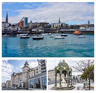
Dún Laoghaire is a suburban coastal town in County Dublin in Ireland. It is the administrative centre of the county of Dún Laoghaire–Rathdown. The town was built up alongside a small existing settlement following 1816 legislation that allowed the building of a major port to serve Dublin. It was known as Dunleary until it was renamed Kingstown in honour of King George IV's 1821 visit, and in 1920 was given its present name, the original Irish form from which "Dunleary" was anglicised. Over time, the town became a residential location, a seaside resort, the terminus of Ireland's first railway and the administrative centre of the former borough of Dún Laoghaire, and from 1994, of the county of Dún Laoghaire–Rathdown.

The R119 road is a regional road in Dún Laoghaire–Rathdown, Ireland.

Carrickgollogan is a hill in Dún Laoghaire–Rathdown in Ireland, towards the southern border of the traditional County Dublin. It is 276 metres high, on the eastern edge of the Dublin Mountains, rising above the districts of Rathmichael and Shankill. Its summit is noted for the panoramic views it offers of south Dublin and north Wicklow.

Kill of the Grange, often Kill o' the Grange, is a suburban community and ancient parish in the half-barony of Rathdown, within the traditional County Dublin, in the jurisdiction of Dún Laoghaire–Rathdown. It contains an early religious site, which is a National Monument. The area, sometimees described as a twin of, and sometimes as part of, Deansgrange, is 5 miles southeast of Dublin.

Dingle Glen is a steep-sided and V-shaped valley "gash", or glen, extending for 550-metres through the bedrock of the lowlands of the Dublin Mountains, located between Carrickmines and Kilternan. In an ecological impact assessment for a proposed development nearby, Dingle Glen was categorised as "a secluded mature broadleaf woodland, mixed with rocky outcrops, within a glacier meltwater channel, thus providing a diversity of habitats within a small undisturbed area".

The Barnacullia quarries are a number of former, and current, granite quarries in the townland of Barnacullia on the north-eastern slopes of Three Rock Mountain in the county of Dún Laoghaire–Rathdown, Ireland. According to a Historic Landscape Character Assessment (HLCA) conducted in 2006, the area was at one point "an important source of granite for the buildings of nearby Dublin".


