Old Orchard Shoal Light

Last updated
Old Orchard Shoal Light
Oldorchardshoal.JPG
Lighthouse at Old Orchard Shoal
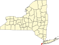
Old Orchard Shoal Light
Location New York City, US
Coordinates 40°30′44.272″N74°5′55.369″W / 40.51229778°N 74.09871361°W / 40.51229778; -74.09871361
Tower
ConstructedApril 5, 1893 (1893-04-05)
FoundationConcrete/Cast Iron Caisson
Construction Cast iron
Automated1955 (1955)
Height35 feet (11 m)
ShapeConical "Spark Plug"
MarkingsLower half brown, upper half white, on black pier
HeritageNational Register of Historic Places listed place  OOjs UI icon edit-ltr-progressive.svg
Fog signal Air siren and horn
Light
First litApril 5, 1893 (1893-04-05)
DeactivatedOctober 29, 2012 (2012-10-29) (destroyed)
Focal height51 feet (16 m)
LensFourth Order Fresnel lens (original), 9.8 inches (250 mm)
RangeW 7 nautical miles (13 km; 8.1 mi)
R 5 nautical miles (9.3 km; 5.8 mi)
Characteristic Fl W 6s  OOjs UI icon edit-ltr-progressive.svg
Orchard Shoal Light Station, Old
Nearest city Staten Island, New York
Arealess than one acre
ArchitectUS Lighthouse Board
NRHP reference No. 06000864 [1]
Added to NRHPSeptember 20, 2006

Old Orchard Shoal Light was a sparkplug lighthouse in lower New York Bay marking a large shoal area. It was destroyed by Hurricane Sandy on October 29, 2012. [2] [3] [4]

History

The ruins of the Old Orchard Shoal Light after being destroyed by Hurricane Sandy on October 29, 2012. Old orchard w.jpg
The ruins of the Old Orchard Shoal Light after being destroyed by Hurricane Sandy on October 29, 2012.

Old Orchard Shoal Light was completed and lit on April 25, 1893. [5] The Fresnel lens was removed in 1950.

Before moving on to Governor's Island and then finally Coney Island Light, Frank Schubert, said to be the last civilian lighthouse keeper in the United States, was stationed at Old Orchard Shoal Light.

Old Orchard Shoal Light is listed on the National Park Service's Maritime Heritage Program as Lighthouse to visit [6] and as one of New York's Historic Light Stations. [7]

On May 29, 2007, the Secretary of the Interior identified Old Orchard Shoal Light Station as surplus under the National Historic Lighthouse Preservation Act of 2000. The property was described as

Gedney Channel/Lower New York Bay, 3.5 miles south of New Dorp Beach. Remote 35 ft. conical, 3-story "spark plug" style light (1893) with keeper's quarters (approx. 1000 SF). Interior lined in brick up to 3rd floor. On 0.72 acre submerged land. Constructed of cast iron on concrete/cast iron caisson. Markings: white upper/black. Protective riprap and breakwater sheltering light's boat basin. Accessible by boat only. [8]

No group was identified under the National Historic Lighthouse Preservation Act as willing and able to preserve the Old Orchard Shoal Light, and on June 5, 2008, the General Services Administration placed the light up for sale via an auction. The initial bid was $10,000 and the light finally closed on August 27, 2008 at a final bid of $235,000. [9]

The lighthouse was destroyed by Hurricane Sandy on October 29, 2012. [10] [11]

Related Research Articles

<span class="mw-page-title-main">Cape Hatteras Lighthouse</span> Lighthouse in North Carolina, United States

Cape Hatteras Light is a lighthouse located on Hatteras Island in the Outer Banks in the town of Buxton, North Carolina and is part of the Cape Hatteras National Seashore. The lighthouse's semi-unique pattern makes it easy to recognize and famous. It is often ranked high on lists of most beautiful, and famous lighthouses in the US.

<span class="mw-page-title-main">Thomas Point Shoal Light</span> Lighthouse in Maryland, United States

The Thomas Point Shoal Light, also known as Thomas Point Shoal Light Station, is a historic lighthouse in the Chesapeake Bay on the east coast of the United States, and the most recognized lighthouse in Maryland. It is the only screw-pile lighthouse in the bay which stands at its original site. The current structure is a 1½ story hexagonal wooden cottage, equipped with a foghorn as well as the light.

<span class="mw-page-title-main">Cape Canaveral Light</span> Lighthouse in Florida, USA

The Cape Canaveral Light is a historic lighthouse on the east coast of the U.S. state of Florida. The light was established in 1848 to warn ships of the dangerous shoals that lie off its coast. It is located inside the Cape Canaveral Space Force Station and managed by the Space Launch Delta 45 of the U.S. Space Force with the assistance of the Cape Canaveral Lighthouse Foundation. It is the only fully operational lighthouse owned by the United States Space Force.

<span class="mw-page-title-main">St. Helena Island Light</span> Lighthouse in Michigan, United States

The buildings of the St Helena Light complex are the sole surviving structures on St. Helena Island, in Mackinac County in the U.S. state of Michigan. The lighthouse on the St. Helena Island's southeastern point was built in 1872-1873 and went into operation in September 1873. It became one of a series of lighthouses that guided vessels through the Straits of Mackinac, past a dangerous shoal that extends from the island.

<span class="mw-page-title-main">Ile Aux Galets Light</span> Lighthouse in Michigan, United States

Ile Aux Galets Light, also known as Skillagalee Island Light, is located on Ile Aux Galets, a gravelly, low-lying island in northeast Lake Michigan, between Beaver Island and the mainland, approximately 7 miles (11 km) northwest of Cross Village in Emmet County, Michigan. Along with nearby Grays Reef, Waugoshance, and White Shoal Lights, it warns shipping away from the reefs and shoals of Waugoshance Point, which pose an imminent hazard to navigation.

<span class="mw-page-title-main">DeTour Reef Light</span> Lighthouse in Michigan, United States

The DeTour Reef Light is a non-profit-operated lighthouse marking the southern entrance of the DeTour Passage between the eastern end of Michigan's Upper Peninsula and Drummond Island. The light is an automated active aid to navigation. It marks the northern end of Lake Huron. The passage is used by almost all of the Great Lakes commercial freighter traffic moving to and from Lake Superior, with approximately 5,000 vessel movements annually. It is said to be "the gateway to Lake Superior." In addition, many recreational boaters use the passage. The Light is located in Lake Huron, three miles (5 km) south of the nearest town, DeTour Village, Michigan.

<span class="mw-page-title-main">Texas Tower (lighthouse)</span>

A Texas Tower lighthouse is a structure which is similar to an off-shore oil platform. Seven of these structures were built in the 1960s off the shores of the United States. Automation started in the late 1970s, which led to the obsolescence of the housing built for the keepers which resulted in such a large structure. Three of the towers were dismantled over time due to deteriorating structural conditions among other problems, while another one was destroyed in a ship collision. The last Texas Tower was deactivated in 2016 having served for over half a century. Today only three of the former lights remain.

<span class="mw-page-title-main">Hudson–Athens Lighthouse</span> Lighthouse in New York, United States

The Hudson–Athens Lighthouse, sometimes called the Hudson City light, is a lighthouse located in the Hudson River in the state of New York in the United States. The light is located between Hudson and Athens, closer to the Hudson side. Constructed in 1874, it marks a sandy ridge known as Middle Ground Flats and also acts as a general aid to navigation of the river. The station is built on a granite caisson with a unique shape designed to protect it from ice floes and river debris. The dwelling is constructed in the Second Empire architectural style, with a mansard roof. It is considered to be virtually a twin of the Stepping Stones Light in Long Island Sound, which was constructed just a few years later.

<span class="mw-page-title-main">Sturgeon Point Light</span> Lighthouse in Michigan, United States

The Sturgeon Point Light Station is a lighthouse on Lake Huron in Haynes Township, Alcona County, northeastern lower Michigan. Established to ward mariners off a reef that extends 1.5 miles (2.4 km) lakeward from Sturgeon Point, it is today regarded as a historic example of a Cape Cod style Great Lakes lighthouse.

<span class="mw-page-title-main">Sandy Point Shoal Light</span> Lighthouse in Maryland, United States

Sandy Point Shoal Light is a brick three story lighthouse on a caisson foundation that was erected in 1883. It lies about 0.6 mi (0.97 km) off Sandy Point, north of the Chesapeake Bay Bridge, from whose westbound span it is readily visible.

<span class="mw-page-title-main">East Point Light</span> Lighthouse

The East Point Light, known as the Maurice River Light before 1913, is a lighthouse located in Heislerville, New Jersey on the Delaware Bay at the mouth of the Maurice River in Maurice River Township, Cumberland County, New Jersey, United States. The lighthouse was built in 1849 and is the second oldest in New Jersey, with only the Sandy Hook Light, which was built in 1764, being older. The light was inactive from 1941 and was nearly destroyed by fire in 1971. The light was reinstated by the United States Coast Guard in 1980. Exterior restoration was completed in 1999.

<span class="mw-page-title-main">Wolf Trap Light</span> Lighthouse in Virginia, United States

Wolf Trap Light is a caisson lighthouse in the Virginia portion of the Chesapeake Bay, about seven and a half miles northeast of New Point Comfort Light. It is listed on the National Register of Historic Places.

<span class="mw-page-title-main">New Point Comfort Light</span> Lighthouse in Virginia, United States

New Point Comfort Light is a lighthouse in the Virginia portion of the Chesapeake Bay, United States, off the tip of the Middle Peninsula. Finished in 1804, it is the third-oldest surviving light in the bay, and the tenth-oldest in the United States.

<span class="mw-page-title-main">Sambro Island Light</span> Lighthouse

Sambro Island Lighthouse is a landfall lighthouse located at the entrance to Halifax Harbour, Nova Scotia, on an island near the community of Sambro in the Halifax Regional Municipality. It is the oldest surviving lighthouse in North America and its construction is a National Historic Event.

<span class="mw-page-title-main">Edgartown Harbor Light</span> Lighthouse in Massachusetts, United States

Edgartown Harbor Light is a lighthouse located in Edgartown, Massachusetts, United States, where it marks the entrance to Edgartown Harbor and Katama Bay. It is one of five lighthouses on the island of Martha's Vineyard. The first lighthouse, a two-story wooden structure that also served as the keeper's house, was constructed in 1828. It was demolished, and replaced by the current cast-iron tower, in 1939. Originally located on an artificial island 1/4 miles from shore, the lighthouse is now surrounded by a beach formed, since 1939, by sand accumulating around the stone causeway connecting it to the mainland.

<span class="mw-page-title-main">Fourteen Foot Shoal Light</span> Lighthouse in Michigan, United States

The lighthouse at Fourteen Foot Shoal was named to note that the lake is only 14 feet (4.3 m) deep at this point, which is a hazard to navigation, ships and mariners.

<span class="mw-page-title-main">East Charity Shoal Light</span> Lighthouse

East Charity Shoal Light is an offshore lighthouse located near the Saint Lawrence River's entrance in northeastern Lake Ontario, due south of the city of Kingston, Ontario and approximately five miles (8 km) southwest of Wolfe Island. It is on the southeast rim of a 3,300-foot-diameter (1,000 m) submerged circular depression known as Charity Shoal Crater that may be the remnants of a meteorite impact.

<span class="mw-page-title-main">Horse Island Light</span> Lighthouse

Horse Island Light, also known as Sackets Harbor Light, is located on Horse Island in Sackets Harbor, Jefferson County in New York on Lake Ontario. In July 2017 the 24-acre island was acquired for preservation by the Civil War Trust, aided by a grant from the National Park Service. This was the first grant in the United States made for a War of 1812 site under the NPS battlefield grants program.

<span class="mw-page-title-main">Rock Island Light</span> Lighthouse

Rock Island Light is a lighthouse on Rock Island in the Saint Lawrence River in Jefferson County, New York, United States. The island is owned by the New York State Office of Parks, Recreation and Historic Preservation and operated as Rock Island Lighthouse State Park.

<span class="mw-page-title-main">Romer Shoal Light</span> Lighthouse

Romer Shoal Light is a sparkplug lighthouse in Lower New York Bay, on the north edge of the Swash Channel, about 34 nautical mile south of Ambrose Channel and 2+12 nautical miles north of Sandy Hook, New Jersey, in the entrance to New York Harbor. It is in New Jersey, very close to the border with New York. Named as Romer Shoal Light Station, it was added to the National Register of Historic Places on January 24, 2007, for its significance in architecture, engineering, transportation, and maritime history.

References

  1. "National Register Information System". National Register of Historic Places . National Park Service. March 13, 2009.
  2. Light List, Volume I, Atlantic Coast, St. Croix River, Maine to Shrewsbury River, New Jersey (PDF). Light List. United States Coast Guard. 2009. p. 297.
  3. "Historic Light Station Information and Photography: New York". United States Coast Guard Historian's Office. Archived from the original on 2017-05-01.
  4. "ARLHS World List of Lights". Archived from the original on December 1, 2008. Retrieved 2009-01-24.
  5. Annual report of the Light-House Board to the Secretary of the Treasury for the Fiscal Year ended June 30, 1893, Treasury Department, Document No 1647
  6. "Maritime Heritage Program" . Retrieved 7 April 2016.
  7. "Maritime Heritage Program" . Retrieved 7 April 2016.
  8. "Maritime Heritage Program" . Retrieved 7 April 2016.
  9. GSA listing (1-PR-08-005) for Old Orchard Shoal
  10. "Old Orchard Shoal Light Is No More", Mai Armstrong for Working Harbor Committee, blog post November 9, 2012. Archived November 16, 2012, at the Wayback Machine
  11. USCG 'Local Notice to Mariners" week 44/12, LLNR 35395 states "Structure Destroyed" Archived 2012-11-19 at the Wayback Machine