West Point Light (New York)

Last updated
West Point Light
Light 39 on Gee's Point at sight of old West Point (NY) Lighthouse.JPG
Light #39 on Gee's Point
West Point Light (New York)
Location New York, US
Coordinates 41°23′45″N73°57′3″W / 41.39583°N 73.95083°W / 41.39583; -73.95083
Tower
Constructed1853
ConstructionWooden
ShapeSquare
MarkingsWhite
Light
Deactivated1946
Focal height40 ft (12 m)
LensSixth order Fresnel lens
Characteristic Fixed white

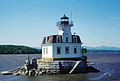
West Point Light was a lighthouse at the United States Military Academy in West Point, New York. It was located at Gee's Point and was sometimes referred to as Gee's Point Light.

Contents

West Point Light would be shown on the NOAA Chart 12343 [1] if it were still active. Today, Light 39 (USCG 1-38005), [2] on a skeleton tower with a fixed green light characteristic, has replaced West Point Light on Gee's Point.

History

West Point, 45 miles (72 km) above the Battery, is the site of the United States Military Academy. The northeastern extremity of West Point descends to a rocky point, upon the extremity of which was West Point lighthouse. On the opposite side of the river and north of West Point is Constitution Island; the bend between the two is locally known as Worlds End, and has very deep water of 36 fathoms (216 ft; 66 m).

A little above Constitution Island, on the west bank of the river, is a steep, rocky, wooded hill 1,396 feet (426 m) high, known as Crow's Nest, and just above it is a prominent hill 1,340 feet (410 m) high known as Storm King Mountain. [3]

West Point is a high, bluff thickly wooded point, almost entirely occupied by the grounds and buildings of the United States Military Academy. On the northeast it descends to a bare rocky point, upon the extremity of which stood a low square wooden tower, painted white. This was West Point Lighthouse. [4]

Cultural

The Archives Center at the Smithsonian National Museum of American History has a collection (#1055) of souvenir postcards of lighthouses and has digitized 272 of these and made them available online. These include postcards of West Point Light (New York) [5] with links to customized nautical charts provided by the National Oceanographic and Atmospheric Administration.

Related Research Articles

<span class="mw-page-title-main">New York–New Jersey Harbor Estuary</span> One of the most intricate natural harbors in the world

The New York–New Jersey Harbor Estuary, also known as the Hudson-Raritan Estuary, is in the northeastern states of New Jersey and New York on the East Coast of the United States. The system of waterways of the Port of New York and New Jersey forms one of the most intricate natural harbors in the world and one of the busiest ports of the United States. The harbor opens onto the New York Bight in the Atlantic Ocean to the southeast and Long Island Sound to the northeast.

<span class="mw-page-title-main">Fire Island Lighthouse</span> Lighthouse in New York, United States

The Fire Island Lighthouse is a visible landmark on the Great South Bay, in southern Suffolk County, New York on the western end of Fire Island, a barrier island off the southern coast of Long Island. The lighthouse is located within Fire Island National Seashore and just to the east of Robert Moses State Park. It is part of the Fire Island Light Station which contains the light, keepers quarters, the lens building containing the original first-order Fresnel lens, and a boat house.

<span class="mw-page-title-main">Esopus Meadows Light</span> Lighthouse

Esopus Meadows Lighthouse, nicknamed "Maid of the Meadows" and often simply referred to as the Esopus Light or Middle Hudson River Light is an active lighthouse on the Hudson River near Esopus, New York. The lighthouse stands on the west side of the channel, in the river, its granite foundation built atop piles that have been driven into the riverbed, and is accessible only by boat.

<span class="mw-page-title-main">Stony Point Light</span> Lighthouse

The Stony Point Light is the oldest lighthouse on the Hudson River. It is located at the Stony Point Battlefield in Stony Point, New York.

<span class="mw-page-title-main">Old Field Point Light</span> Lighthouse

Old Field Point Light is a lighthouse within the village of Old Field, New York between the entrances to Port Jefferson Harbor and Stony Brook Harbor on the North Shore of Long Island.

<span class="mw-page-title-main">Orient Point Light</span> Lighthouse off Long Island, New York

Orient Point Light is a sparkplug lighthouse off Orient Point, New York in Plum Gut of Long Island Sound – the deep and narrow gap between Orient Point and Plum Island. It was built in 1899 and was automated in 1954. The lighthouse was listed on the National Register of Historic Places in 2007.

<span class="mw-page-title-main">Hudson–Athens Lighthouse</span> Lighthouse in New York, United States

The Hudson–Athens Lighthouse, sometimes called the Hudson City light, is a lighthouse located in the Hudson River in the state of New York in the United States. The light is located between Hudson and Athens, closer to the Hudson side. Constructed in 1874, it marks a sandy ridge known as Middle Ground Flats and also acts as a general aid to navigation of the river. The station is built on a granite caisson with a unique shape designed to protect it from ice floes and river debris. The dwelling is constructed in the Second Empire architectural style, with a mansard roof. It is considered to be virtually a twin of the Stepping Stones Light in Long Island Sound, which was constructed just a few years later.

<span class="mw-page-title-main">Coxsackie Light</span> Lighthouse

Coxsackie Light was a lighthouse near the town of Coxsackie, New York on the northerly end of the Low island northerly of Coxsackie island and on the westerly side of the main channel of the Hudson River.

<span class="mw-page-title-main">Little Gull Island Light</span> Lighthouse

Little Gull Island Light is a lighthouse on Little Gull Island, a small island in Long Island Sound, located approximately 0.4 miles (0.6 km) northeast of Great Gull Island. Both islands are located in the Town of Southold, in Suffolk County, New York, and lie roughly midway between Plum Island and Fishers Island. Little Gull Island is approximately 4.6 miles (7.4 km) southwest of Fishers Island and the channel of water between them is the main entrance to Long Island Sound, known as "The Race".

<span class="mw-page-title-main">Tibbetts Point Light</span> Lighthouse

The Tibbetts Point Lighthouse is located in Cape Vincent (town), New York. The land upon which the lighthouse stands is a part of a 600-acre (240 ha) grant of land to Captain John Tibbetts of Troy, New York. The lighthouse is a circular tower that stands 69 feet (21 m) above the water

<span class="mw-page-title-main">Saugerties Light</span> Lighthouse

Saugerties Light, known also as the Saugerties Lighthouse, is a lighthouse on the Hudson River north of Saugerties, New York.

<span class="mw-page-title-main">Plum Island Light</span> Lighthouse

Plum Island Light is located on the western end of Plum Island, which lies in the Long Island Sound, east of Orient Point at the end of the North Fork of Long Island, New York. An historic granite lighthouse originally built in 1869 sits at the site, but no longer serves as an active aid to navigation. It was listed on the National Register of Historic Places in 2011.

<span class="mw-page-title-main">Latimer Reef Light</span> Lighthouse

Latimer Reef Light is a sparkplug lighthouse on Latimer's Reef in Fishers Island Sound. The lighthouse is located one mile northwest of East Point on Fisher's Island, Suffolk County, New York. Originally called Latemore's Reef after James Latemore.

<span class="mw-page-title-main">Ogdensburg Harbor Light</span> Lighthouse

Ogdensburg Harbor Light is a privately owned lighthouse on the St. Lawrence River, listed on the National Park Service's Maritime Heritage Program as Lighthouse to visit. and as one of New York's Historic Light Stations. In 2016 it was listed on the National Register of Historic Places.

<span class="mw-page-title-main">North Brother Island Light</span> Lighthouse

North Brother Island Light was a lighthouse located on North Brother Island in the East River in New York City. The lighthouse was at the southern tip of the island. Before the lighthouse was erected, the island was uninhabited and saw no formal use. The tower utilized an occulting light which lit for five seconds and eclipsed for five seconds. It stood 47 feet above the water.

<span class="mw-page-title-main">Deer Isle Thorofare Light</span> Lighthouse in Maine, US

Deer Isle Thorofare Light, also known as Mark Island Light, is a lighthouse on Penobscot Bay, Maine, about 1.8 nautical miles west-southwest of Stonington. It was built in 1857.

<span class="mw-page-title-main">Hospital Point Range Rear Light</span> Lighthouse

The Hospital Point Range Rear Light is part of a pair of range lights in Beverly, Massachusetts. It is located in the steeple of the First Baptist Church of Beverly.

References

  1. NOAA Chart 12343
  2. Light List, Volume I, Atlantic Coast, St. Croix River, Maine to Shrewsbury River, New Jersey (PDF). Light List. United States Coast Guard.
  3. United States Coast Pilot, Atlantic Coast, Section B, Cape Cod to Sandy Hook, 1918, pg 287
  4. United States Atlantic Coast Pilot, Boston Bay to New York, 1878, pg 568
  5. "Smithsonian lighthouse postcards". Archived from the original on 2010-03-11. Retrieved 2009-01-25.