
The John Humphreys House, also known as Sir John Humphreys House, is a historic house museum located in Swampscott, Massachusetts. Although it was long thought to be associated with John Humphrey, an early deputy governor of the Massachusetts Bay Colony, it was more likely built about 1700, based on architectural analysis. In 1641 Deborah Moody bought the Humphrey house and 900 acres when the Humphreys returned to England giving her over 1300 acres of what would become Swampscott, Massachusetts. The house was originally located on what is now Elmwood Road, but moved to its current location in 1891 as the Olmsted district was developed. It is currently owned by the Swampscott Historical Society. It was listed on the National Register of Historic Places in 1990.

Fenway, commonly referred to as The Fenway, is a mostly one-way, one- to three-lane parkway that runs along the southern and eastern edges of the Back Bay Fens in the Fenway–Kenmore neighborhood of Boston, in the east-central part of the U.S. state of Massachusetts. As part of the Emerald Necklace park system mainly designed by Frederick Law Olmsted in the late 19th century, the Fenway, along with the Back Bay Fens and Park Drive, connects the Commonwealth Avenue Mall to the Riverway. For its entire length, the parkway travels along the Muddy River and is part of the Metropolitan Park System of Greater Boston. Like others in the park system, it is maintained by the Massachusetts Department of Conservation and Recreation.

Edgewood Historic District is a historic district located in the west-central portion of New Haven, Connecticut. It was listed on the National Register of Historic Places in 1986. A predominantly residential area roughly bisected by Edgewood Avenue, a broad boulevard which features a large central esplanade and forms the principal east-west artery through the heart of the district. The area includes 232 contributing buildings, 4 other contributing structures, and 1 contributing object. Most of these were built between about 1888 and 1900, and represent the city's first neighborhood planned under the tenets of the City Beautiful movement. They are generally either Queen Anne or Colonial Revival in style, and are set on larger lots.

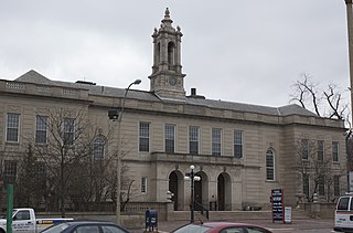
Swampscott station is a historic railroad station in Swampscott, Massachusetts. Located in the southwest portion of Swampscott near the Lynn border, it serves the MBTA Commuter Rail Newburyport/Rockport Line. The historic Stick/Eastlake-style depot building, was originally built in 1868 for the Eastern Railroad, but is no longer in use. The location still serves as an accessible MBTA Commuter Rail stop and park-and-ride location for Swampscott and adjoining Marblehead. The building was added to the National Register of Historic Places in 1998 as Swampscott Railroad Depot.

The Ocean Drive Historic District is a historic district that covers the long street of the same name along the southern shore of Newport, Rhode Island, United States. It was designated a National Historic Landmark District in 1976, in recognition for its distinctive landscape and architecture, which is less formal and generally not as ostentatious as the grand summer properties of Bellevue Avenue.

The Tavern Acres Historic District encompasses a residential development known as Tavern Acres, which was built in the 1920s with a landscape design by Henry Vincent Hubbard, then with the Olmsted Brothers landscape design firm. It is bounded by Bradstreet Rd., Green and Main Sts. and Park Way in North Andover, Massachusetts. The district encompasses Memorial Park, the Stevens Library, and properties facing Memorial Park and further along Bradstreet Road. The district was listed on the National Register of Historic Places in 1995.
The Arlington Center Historic District includes the civic and commercial heart of Arlington, Massachusetts. It runs along the town's main commercial district, Massachusetts Avenue, from Jason Street to Franklin Street, and includes adjacent 19th- and early 20th-century residential areas roughly bounded by Jason Street, Pleasant Street, and Gray Street. The district was listed on the National Register of Historic Places in 1974.
The Tyler Park Historic District encompasses a planned residential development in western Lowell, Massachusetts. The development was designed by Olmsted, Olmsted and Eliot, and is centered on Tyler Park; this area is the only Olmsted design in the city. It is roughly bounded by Princeton, Foster, and Pine Streets. Except for a few early houses that predate the subdivision, the area was built out between 1888 and 1936, and reflect the architectural styles popular in the period.

The U.S. Capitol Gatehouses and Gateposts — designed circa 1827 by celebrated architect Charles Bulfinch — originally stood on the grounds of the United States Capitol in Washington, D.C. Two of the gatehouses are listed on the National Register of Historic Places in their new locations.

The parkway system of Louisville, Kentucky, also known as the Olmsted Park System, was designed by the firm of preeminent 19th century landscape architect Frederick Law Olmsted. The 26-mile (42 km) system was built from the early 1890s through the 1930s, and initially owned by a state-level parks commission, which passed control to the city of Louisville in 1942.

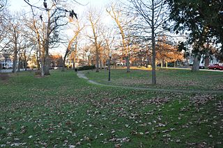
Washington Park in Albany, New York is the city's premier park and the site of many festivals and gatherings. As public property it dates back to the city charter in 1686, and has seen many uses including that of gunpowder storage, square/parade grounds, and cemetery. The park is often mistaken as being designed by Frederick Law Olmsted, as it incorporate many of the philosophical ideals used by Olmsted when he designed Central Park in Manhattan. The park is about 81 acres (33 ha) in size with the 5.2-acre (2.1 ha) Washington Park Lake, a roughly 1,600-foot-long (490 m) and 140-foot-wide (43 m) lake, in the southwestern corner.

The Monadnock Road Historic District is a residential historic district encompassing a cohesive subdivision of a former estate in the 1920s in the Chestnut Hill section of Newton, Massachusetts. The development was typical of Newton's explosive residential growth at that time, and includes primarily Tudor Revival houses. The district was listed on the National Register of Historic Places in 1990.

Furnace Brook Parkway is a historic parkway in Quincy, Massachusetts. Part of the Metropolitan Park System of Greater Boston, it serves as a connector between the Blue Hills Reservation and Quincy Shore Reservation at Quincy Bay. First conceived in the late nineteenth century, the state parkway is owned and maintained by the Massachusetts Department of Conservation and Recreation (DCR) and travels through land formerly owned by the families of John Adams and John Quincy Adams, passing several historic sites. It ends in the Merrymount neighborhood, where Quincy was first settled by Europeans in 1625 by Captain Richard Wollaston. The road was started in 1904, completed in 1916 and added to the National Register of Historic Places (NRHP) in 2004.

Blue Hills Parkway is a historic parkway that runs in a straight line from a crossing of the Neponset River, at the south border of Boston to the north edge of the Blue Hills Reservation in Milton, Massachusetts. It was built in 1893 to a design by the noted landscape architect, Charles Eliot, who is perhaps best known for the esplanades along the Charles River. The parkway is a connecting road between the Blue Hills Reservation and the Neponset River Reservation, and was listed on the National Register of Historic Places in 2003.
The Beacon Street Historic District is a historic district running most of the length of Beacon Street in Brookline, Massachusetts, roughly from Saint Mary's Road, near Kenmore Square, to Ayr Road near Cleveland Circle. It includes a small number of properties on adjacent streets, and was listed on the National Register of Historic Places in 1985.

The Fisher Hill Historic District encompasses a residential area in central Brookline, Massachusetts. The area was subdivided and built out beginning in the 1880s, with landscaping design by Frederick Law Olmsted and John Charles Olmsted. The district is bounded on the west by Chestnut Hill Avenue, Baxter Road, and Channing Road, and on the south by Massachusetts Route 9. Its eastern boundary runs along Buckminster Street to Dean Road, joining the northern boundary of Clinton Road, running between Dean Road and Chestnut Hill Avenue. Prior to its development in the 1880s, Fisher Hill had a relatively small number of landowners. Some of them banded together, hiring the Olmsteds to design a subdivision plan for the entire district. Lots were sold to wealthy individuals, who built fashionable houses, often designed by architects. In 1914 a restrictive covenant was entered into by a significant number of property owners, restricting their properties to strictly single-family residential uses.

Park Drive is a mostly one-way, two-lane parkway in the Fenway-Kenmore neighborhood of Boston that runs along the northern and western edges of the Back Bay Fens before ending at Mountfort Street. As part of the Emerald Necklace park system mainly designed by Frederick Law Olmsted in the late 19th century, Park Drive, along with the Back Bay Fens and the Fenway, connects the Commonwealth Avenue Mall and Boylston Street to Beacon Street and the Riverway. For a portion of its length, the parkway runs along the Muddy River and is part of the Metropolitan Park System of Greater Boston's Muddy River Reservation. Like others in the park system, it is maintained by the Massachusetts Department of Conservation and Recreation.

Brevet Lt. General Winfield Scott is an equestrian statue in Washington, D.C., that honors career military officer Winfield Scott. The monument stands in the center of Scott Circle, a traffic circle and small park at the convergence of 16th Street, Massachusetts Avenue and Rhode Island Avenue NW. The statue was sculpted by Henry Kirke Brown, whose best-known works include statues of George Washington in New York and Nathanael Greene in Washington, D.C. It was the first of many sculptures honoring Civil War generals that were installed in Washington, D.C.'s traffic circles and squares and was the second statue in the city to honor Scott.

The High Rock Reservation is a city park in the Highlands neighborhood of Lynn, Massachusetts. Designed in 1907 by the Olmsted Brothers, the roughly 7-acre (2.8 ha) park encompasses the summit area of a hill with commanding views of the surrounding area, as well as the Atlantic Ocean which is approximately half a mile away.


