Canora Airport is located adjacent to Canora, Saskatchewan, Canada.

Coronach/Scobey Border Station Airport is located 8 nautical miles southeast of Coronach, Saskatchewan, Canada and 13 mi (21 km) north of Scobey, Montana, United States. In the United States, the airport is known by the names Scobey Border Station Airport and East Poplar International Airport. It is owned by the U.S. and Canadian governments.
Key Lake Airport is a regional airport near the Key Lake mine in Saskatchewan, Canada.

Luseland Airport is located adjacent to Luseland, Saskatchewan, Canada. This a general aviation airport with no landing fees. It offers one asphalt runway with night landing lights.
Moose Jaw Municipal Airport is a general aviation facility located 7 nautical miles east north-east of Moose Jaw, Saskatchewan, Canada.

North Battleford Airport is located 1.5 nautical miles east of North Battleford, Saskatchewan, Canada.
North Battleford/Hamlin Airport(TC LID: CJD4) was located 1 nautical mile north-east of Hamlin, Saskatchewan, Canada, in the RM of North Battleford No. 437.
Points North Landing Airport is a regional airport adjacent to Points North Landing in Saskatchewan, Canada.
Points North Landing Water Aerodrome is located adjacent to Points North Landing, Saskatchewan, Canada.

Prince Albert Airport is located 1 nautical mile northeast of Prince Albert, Saskatchewan, Canada.

Swift Current Airport is located 4 nautical miles east of Swift Current, Saskatchewan, Canada.
Yorkton Municipal Airport is located 2.8 nautical miles north of Yorkton, Saskatchewan, Canada.

Alidaə-LEE-də is a village in the Canadian province of Saskatchewan within the Rural Municipality of Reciprocity No. 32 and Census Division No. 1. The village is approximately 85 km (53 mi) east of the City of Estevan. Farming and oil are the major local industries. Several ghost towns are in the vicinity, including Nottingham to the east, Auburnton, to the west, and Cantal to the north-west. With the investment of oil and other industries, the area continues to grow.

Wollaston Lake is a lake in north-eastern part of the Canadian province of Saskatchewan. It is about 550 kilometres (340 mi) north-east of Prince Albert. With a surface area of 2,286 square kilometres (883 sq mi), it is the largest bifurcation lake in the world – that is, a lake that drains naturally in two directions.
Highway 995, also known as Welcome Street, is a provincial highway in the far north region of the Canadian province of Saskatchewan. It is one of the few highways in Saskatchewan that is completely isolated from the other highways. Seasonal access is provided to Highway 905 by way of the Wollaston Lake Barge.
Highway 954 is a provincial highway in the Canadian province of Saskatchewan. It runs from Highway 26 on the north side of Goodsoil to a dead end at Northern Cross Resort on Lac des Îles within Meadow Lake Provincial Park. At the eastern end of the highway is the Goodsoil Airport. It is about 12.9 kilometres (8.0 mi) long.

The Rural Municipality of Arborfield No. 456 is a rural municipality (RM) in the Canadian province of Saskatchewan within Census Division No. 14 and SARM Division No. 4.
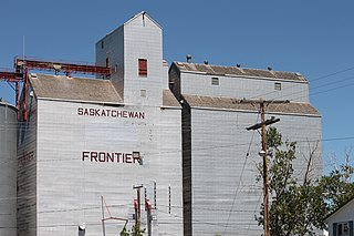
Frontier is a village in the Canadian province of Saskatchewan within the Rural Municipality of Frontier No. 19 and Census Division No. 4. Frontier is on Highway 18 and is served by the Frontier Airport located (3.7 km) south of the village.

