Oyón Uyun | |
---|---|
Patun Lake, Oyón District | |
Country | |
Region | Lima |
Province | Oyón |
Capital | Oyón |
Government | |
• Mayor | Reynaldo Alcocer (2019-2022) |
Area | |
• Total | 887.61 km2 (342.71 sq mi) |
Elevation | 3,620 m (11,880 ft) |
Population (2017) | |
• Total | 12,150 |
• Density | 14/km2 (35/sq mi) |
Time zone | UTC-5 (PET) |
UBIGEO | 150901 |
Oyón District is one of six districts of the province Oyón in Peru. [1]
The districts of Peru are the third-level country subdivisions of Peru. They are subdivisions of the provinces, which in turn are subdivisions of the larger regions or departments. There are 1,838 districts in total.
Oyón Province is a province of the Lima Region in Peru. It measures 1,886 square kilometres (728 sq mi). The capital of the province is the city of Oyón.
Peru, officially the Republic of Peru, is a country in western South America. It is bordered in the north by Ecuador and Colombia, in the east by Brazil, in the southeast by Bolivia, in the south by Chile, and in the west by the Pacific Ocean. Peru is a megadiverse country with habitats ranging from the arid plains of the Pacific coastal region in the west to the peaks of the Andes mountains vertically extending from the north to the southeast of the country to the tropical Amazon Basin rainforest in the east with the Amazon river.
The Rawra mountain range and the Rumi Cruz mountain range traverse the district. Some of the highest peaks of the district are listed below: [2]
Aququcha is a mountain in the Andes of Peru, about 5,000 m (16,000 ft) high. It is located in the Lima Region, Oyón Province, Oyón District. Aququcha lies at the Puka Yaku valley, east of Kinwa Ukru.
Awkin is a 5,183-metre-high (17,005 ft) mountain in the Andes of Peru. It is located in the Lima Region, Cajatambo Province, on the border of the districts of Cajatambo and Gorgor, and in the Oyón Province, Oyón District.
Hirka Kancha is a mountain in the Andes of Peru, about 5,000 m (16,000 ft) high. It is located in the Lima Region, Oyón Province, Oyón District.
The Pasco Province is one of the three provinces that make up the Pasco Region in Peru. The capital of this province is the city Cerro de Pasco.
The Cajatambo Province is one of nine provinces in the Lima Region of Peru. It is bordered to the north by the Ancash Region, to the east by the Huánuco Region, to the south by the Oyón Province, and to the west by the Huaura Province.
The Bolognesi Province is one of 20 provinces of the Ancash Region of Peru.
Huarochirí Province or Waruchiri is located in the Lima Region of Peru. Its capital is Matucana. The western section is part of the Lima Metropolitan Area.
The Tarma Province is a Peruvian province, making up one of the nine provinces that conform the Junín Region. To the north it borders with the Junín Province, the east with the Chanchamayo Province, the south with the Jauja Province and the west with the Yauli Province.
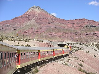
The Yauli Province is one of the nine provinces in Peru that form the Junín Region. It is bordered to the north by the Pasco Region and the Junín Province, to the east by the Tarma Province, to the south by the Jauja Province and to the west by the Lima Region. The population of the province was estimated at 66,093 inhabitants in 2002. The capital of the Yauli Province is La Oroya.
The Daniel Alcides Carrión Province is the smallest of three provinces that make up the Pasco Region in Peru. It was named after the medical student Daniel Alcides Carrión. The capital of this province is Yanahuanca.
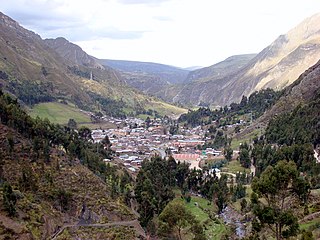
Huallanca or Wallanka is a district of the Bolognesi Province in the Ancash Region of Peru.
The Dos de Mayo Province is one of eleven provinces of the Huánuco Region in Peru. The capital of this province is the city of La Unión.
Huayllay District is one of thirteen districts of the province Pasco in Peru.
Ticlacayán District is one of thirteen districts of the Pasco Province in the Pasco Region of Peru. Its seat is Ticlacayán.
Cajatambo or Qaqatampu (Quechua) is one of five districts of the province Cajatambo in Peru.
Canchayllo District is one of thirty-four districts of the Jauja Province in Peru. Its seat is Canchayllo.
Chicla District is one of thirty-two districts of the province Huarochirí in Peru.
Huamantanga is one of seven districts of the Canta Province in Peru.
Ambo District is one of eight districts of the Ambo Province in Peru.
Marías District is one of nine districts of the province Dos de Mayo in Peru.
Huancavelica District is one of nineteen districts of the province Huancavelica in Peru.
Cotaparaco District is one of ten districts of the Recuay Province in Peru.
Coordinates: 10°40′06″S76°46′13″W / 10.6684°S 76.7702°W
A geographic coordinate system is a coordinate system that enables every location on Earth to be specified by a set of numbers, letters or symbols. The coordinates are often chosen such that one of the numbers represents a vertical position and two or three of the numbers represent a horizontal position; alternatively, a geographic position may be expressed in a combined three-dimensional Cartesian vector. A common choice of coordinates is latitude, longitude and elevation. To specify a location on a plane requires a map projection.
This Lima Region geography article is a stub. You can help Wikipedia by expanding it. |