Pailin municipality

Last updated • 3 min readFrom Wikipedia, The Free Encyclopedia
Pailin municipality
ក្រុងប៉ៃលិន
View from Phnom Yat. , Pailin.jpg
Outskirts of Pailin City as viewed from Phnom Yat, 2011
2401 Pailin Municipality.svg
Pailin Municipality (red) within Pailin Province
Cambodia adm location map.svg
Red pog.svg
Pailin municipality
Location in Cambodia
Coordinates: 12°51′16″N102°36′23″E / 12.85444°N 102.60639°E / 12.85444; 102.60639
CountryFlag of Cambodia.svg  Cambodia
Province Pailin
Government
  TypeCity Municipality
Area
  Total575 km2 (222 sq mi)
Population
 (2019) [1]
  Total37,393
Time zone UTC+7 (ICT)

Pailin municipality (Khmer : ក្រុងប៉ៃលិន) is a municipality ( krong ) covering the southern part of Pailin province in north-western Cambodia on the border with Thailand. The municipality is subdivided into 4 communes (sangkat) and 36 villages (phum). According to the 1998 and 2008 census of Cambodia, the 575 km2 city had a population of 15,800 and 36,354 respectively. [2] [3]

Contents

History

Pailin City was founded under the Khmer Empire, where it was an important trading centre. It continued to be an important centre for commerce during French colonial control, where several French-owned businesses and plantations were established. [4] During the late 1800s, the area saw an influx of migrants from Burma who became the Kula people of the Pailin-Chanthaburi region. In 1922, the Kula people established a pagoda on top of the 60 metres (200 ft) tall Phnom Yat. [5]

During the Cambodian Conflict

After the Vietnamese invasion of Cambodia and the flight of the Khmer Rouge government from Phnom Penh, the municipality and wider province was occupied by the remaining forces of the Khmer Rouge under the Provisional Government of National Union and National Salvation of Cambodia and its predecessors. [6]

Since 1979, the urban centre of Pailin has been abandoned due to the war. In July 1989, Khmer Rouge forces began attacking the area. [7] In September 1989, Vietnam began withdrawing its forces from Cambodia. Meanwhile, Khmer Rouge forces increased engagements against the Vietnamese-backed State of Cambodia over control of Pailin City and surrounding ruby and sapphire mines. [8] Beginning on 17 September, the Khmer Rouge began launching 800 to 2,000 shells per day onto Pailin, and according to Deputy Defence Minister Ke Kim Yan, the shells were being fired from Khmer Rouge positions in Thailand. [7] On 23 September, Defense Minister Tea Banh acknowledged the Khmer Rouge's capture of land around Pailin in the government's first admission of losing territory in the war. [8]

Under Khmer Rouge control

During the 1980s and 1990s, Pailin municipality served as a stronghold and resource centre for the Khmer Rouge. In particular, the municipality served as source of gems and logging which financed guerrilla fighters. [6] Gems such as rubies, sapphires, and amethysts allowed Khmer Rouge guerrilla fighters to finance themselves.

The ruby mining workforce numbered in the thousands and consisted mostly Thai and Burmese miners. The conditions for the miners were tough, with frequent cases of malaria and typhoid among themselves. For them to work on 1 cubic yard (0.76 m3), each miner required a license issued by the Khmer Rouge costing ฿‎6,000 ($240 USD in 1990). The rubies were then traded to makeshift markets on the other side of the border in Bo Rai district in Thailand, earning the Khmer Rouge around a million dollars per month. According to the Los Angeles Times in 1990, there was an estimated 15-year supply of rubies left in Pailin. [9]

Cassava plantation with the Cardamom Mountains in the background pairinZhou niaruHUGS Agrico Yun Ying noNong Di 450ha.JPG
Cassava plantation with the Cardamom Mountains in the background

Under Khmer Rouge control, the area was ruled with little freedoms and under strict control. [6] Khmer Rouge authorities also discouraged religion among the population. [10] According to Human Rights Watch, the Khmer Rouge established a re-education camp for civilian administrators near Pailin City in the early 1990s. The 1994 rice harvest in Pailin was disastrous due to flooding, deforestation, and placer mining. [11]

In early 1994, the new monarchist government in Phnom Penh launched its 1994 dry season offensives. The offensive aimed at taking Pailin began on 17 March and consisted of 7,000 soldiers. During the push along Route 10, many villages and homes were pillaged by government forces. On 19 March, government forces retook Pailin while Khmer Rouge forces dispersed into surrounding areas. The offensive caused the exodus of 25,000 to 30,000 civilians into Thailand, who were later denied access and sent back to Pailin. However, government control over Pailin was short, and on 19 April recaptured the city with 3,000 troops. By May, the frontlines returned to what they were before the offensive. The loss of Pailin initiated King Sihanouk to propose peace talks between the government and Khmer Rouge, which failed. [11]

Administration

Communes (sangkat)Villages (phum) [12]
PailinOu Tapuk Loeu, O Ta Prang, Sound Am Pao Khang Lech, Suon Ampov Khang Koet, Wat, Toek Thla, Ta Gen Loeu, Ba Den Neiv, Toul Kheiv, Pa Hi Tboang, Pa Hi Choeng
Ou Ta VauKhlong, Koun Phnum, Ou Tavau, Kbal Pralean, Die Kra Hom, Kra Chab, Ou Process
Tuol LveaTuol Lvea, Chamkar Kaphe, Ou Chra Kandal, Ou Chra Khang Kaeut, Ou Chra Leu, Ou Ta Puk Kraom, Ou Peut, Tuol Sralau, Tuol Nimit, Viel Vong, Thmey
Bar YakhaOu Chra Lech, Ou Snguot, Roung Chak Tuek Kak, Ba Yakha, Ba Tangsu, Bahuy Khmaer Cheung, Bahuy Khmaer Tboung

Related Research Articles

<span class="mw-page-title-main">Phnom Penh</span> Capital of Cambodia

Phnom Penh is the capital and most populous city of Cambodia. It has been the national capital since the French protectorate of Cambodia and has grown to become the nation's primate city and its economic, industrial, and cultural centre. Before Phnom Penh became capital city, Oudong was the capital of the country.

Articles related to Cambodia and Cambodian culture include:

<span class="mw-page-title-main">Provinces of Cambodia</span> First-level administrative division of Cambodia

Cambodia is divided into 25 provinces. The capital Phnom Penh is not a province but an "autonomous municipality", equivalent to a province governmentally and administered at the same level as the other 24 provinces.

<span class="mw-page-title-main">Pailin province</span> Province of Cambodia

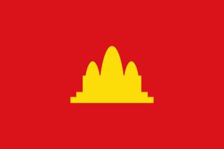
Pailin is a province in western Cambodia at the northern edge of the Cardamom Mountains near the border of Thailand. This province is surrounded by Battambang province, and was officially carved out of Battambang to become a separate administrative division after the surrender of the Ieng Sary faction of the Khmer Rouge in 1996. Pailin is known to much of the world for having long been a stronghold of the Khmer Rouge, remaining under their control long after they were defeated in 1979 and serving from 1994 to 1998 as the capital of the Provisional Government of National Union and National Salvation of Cambodia. Within Cambodia, Pailin is known for its natural resources, namely precious gems and timber.

<span class="mw-page-title-main">Nuon Chea</span> Cambodian politician and war criminal (1926–2019)

Nuon Chea, also known as Long Bunruot or Rungloet Laodi, was a Cambodian communist politician and revolutionary who was the chief ideologist of the Khmer Rouge. He also briefly served as acting Prime Minister of Democratic Kampuchea. He was commonly known as "Brother Number Two", as he was second-in-command to Khmer Rouge leader Pol Pot, General Secretary of the Party, during the Cambodian genocide of 1975–1979. In 2014, Nuon Chea received a life sentence for crimes against humanity, alongside another top-tier Khmer Rouge leader, Khieu Samphan, and a further trial convicted him of genocide in 2018. These life sentences were merged into a single life sentence by the Trial Chamber on 16 November 2018. He died while serving his sentence in 2019.

<span class="mw-page-title-main">Dhammayietra</span>

The Dhammayietra is an annual peace walk in Cambodia that originated during the historic repatriation of refugees along the Thai border camps during the United Nations monitored transition to democracy in 1992. The Khmer word "dhammayietra", derived from the Pāli dhamma and yātrā, means "pilgrimage" but is often translated as "pilgrimage of truth". The peace walk takes place in early May and usually involves an assemblage of Buddhist monks and laity who travel various routes in Cambodia.

<span class="mw-page-title-main">Ethnic groups in Cambodia</span>

The largest of the ethnic groups in Cambodia are the Khmer, who comprise 95.8% of the total population and primarily inhabit the lowland Mekong subregion and the central plains. The Khmer historically have lived near the lower Mekong River in a contiguous arc that runs from the southern Khorat Plateau where modern-day Thailand, Laos and Cambodia meet in the northeast, stretching southwest through the lands surrounding Tonle Sap lake to the Cardamom Mountains, then continues back southeast to the mouth of the Mekong River in southeastern Vietnam.

<span class="mw-page-title-main">Teng Bunma</span> Cambodian tycoon

Teng Bunma 許銳騰, also written as Teng Boonma, Theng Boonma, and Theng Bunma, was one of the wealthiest businessmen in Cambodia. He was one the founders of Thai Boon Roong Group and, along with Sok Kong and Meng Retthy, he was well known as one of the “four tigers” of the Cambodian economy after the fall of the Khmer Rouge, between the 1980s-2000s.

<span class="mw-page-title-main">Democratic Kampuchea</span> 1975–1979 state in Southeast Asia

Democratic Kampuchea was the official name of the Cambodian state from 1976 to 1979, under the totalitarian dictatorship of Pol Pot and the Communist Party of Kampuchea (CPK), commonly known as the Khmer Rouge. The Khmer Rouge's capture of the capital Phnom Penh in 1975 effectively ended the United States-backed Khmer Republic of Lon Nol.

<span class="mw-page-title-main">Operation Eagle Pull</span> Part of the Vietnam War (1975)

Operation Eagle Pull was the United States military evacuation by air of Phnom Penh, Cambodia, on 12 April 1975. At the beginning of April 1975, Phnom Penh, one of the last remaining strongholds of the Khmer Republic, was surrounded by the Khmer Rouge and totally dependent on aerial resupply through Pochentong Airport. With a Khmer Rouge victory imminent, the US government made contingency plans for the evacuation of US nationals and allied Cambodians by helicopter to ships in the Gulf of Thailand. Operation Eagle Pull took place on the morning of 12 April 1975 and was a tactical success carried out without any loss of life. Five days later the Khmer Republic collapsed and the Khmer Rouge occupied Phnom Penh.

<span class="mw-page-title-main">Mongkol Borey district</span> District in Banteay Meanchey, Cambodia

Mongkol Borey is a district (srok) in the south of Banteay Meanchey Province, in northwestern Cambodia. The district capital is the town of Mongkol Borey, around nine kilometres south of the provincial capital of Serei Saophoan by road. The district shares a border with Battambang Province to the south. The main railway line from Phnom Penh to Poipet on the border with Thailand runs through the district from north to south.

<span class="mw-page-title-main">National Army of Democratic Kampuchea</span>

The National Army of Democratic Kampuchea (NADK) was a Cambodian guerrilla force. NADK were the armed forces of the Party of Democratic Kampuchea also known as "Khmer Rouge", operating between 1979 and the late 1990s.

Sala Krau is a district located in Pailin Province, western Cambodia. The district is subdivided into 4 communes and 43 villages. According to the 1998 census of Cambodia, it had a population of 7,106.

<span class="mw-page-title-main">Kula people (Asia)</span> Ethnic group

The Kula people are the descendants of migrants from Burma who settled in the Pailin-Chanthaburi region along the Cambodia–Thailand border during the 19th century. To which Burmese ethnic group the Kulas belong remains uncertain, with some speculating a Bamar, Shan or multi-ethnic heritage.

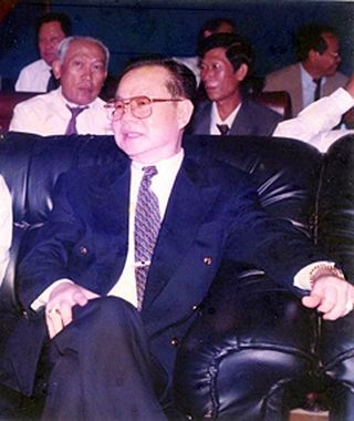
The Democratic National Union Movement (DNUM) was a Cambodian political party founded after senior Khmer Rouge official Ieng Sary's defection from the Cambodian National Unity Party in August 1996. A magazine entitled Phka Rik is associated with it. It was created primarily to facilitate Ieng Sary's reentry into civilian political life, claiming neutrality and that he had broken away from the Khmer Rouge and from the "fascism and cruelty of Pol Pot's regime," naming Nuon Chea, Ta Mok, Son Sen and Yun Yat as Pol Pot's cohorts and "mass murderers of Cambodia." He stated that he was a supporter of "limited democracy"; he named Thailand, Singapore, and Japan as examples.

<span class="mw-page-title-main">Communist Party of Kampuchea</span> Ruling party of Cambodia from 1975 to 1979

The Communist Party of Kampuchea (CPK), also known as the Khmer Communist Party, was a communist party in Cambodia. Its leader was Pol Pot, and its members were generally known as the Khmer Rouge. Originally founded in 1951, the party was split into pro-Chinese and pro-Soviet factions as a result of the Sino–Soviet split with the former being the Pol Pot faction, and the latter adopting a more revisionist approach to Marxism. As such, it claimed that 30 September 1960 was its founding date; it was named the Workers' Party of Kampuchea before it was renamed the Communist Party in 1966.

<span class="mw-page-title-main">Fall of Phnom Penh</span> 1975 Khmer Rouge capture of the Cambodian capital

The Fall of Phnom Penh was the capture of Phnom Penh, capital of the Khmer Republic, by the Khmer Rouge on 17 April 1975, effectively ending the Cambodian Civil War. At the beginning of April 1975, Phnom Penh, one of the last remaining strongholds of the Khmer Republic, was surrounded by the Khmer Rouge and totally dependent on aerial resupply through Pochentong Airport.

The following lists events that happened during 1975 in Cambodia.

<span class="mw-page-title-main">Khmer nationalism</span> Form of nationalism found in Cambodia

Khmer nationalism is a form of nationalism found in Cambodia, that asserts that Khmers (Cambodians) are a nation and promotes the cultural unity of the Khmer (Cambodian) race.

<span class="mw-page-title-main">Battle of Pailin</span> Last battle of the Khmer Rouge

The battle of Pailin also known as the Siege of Pailin is an armed conflict which extended from 1989 to 1997 as the last military act of the Khmer Rouge insurgency which took place in the Northwest of Cambodia in the last military stronghold of the Khmer Rouge.

References

  1. "General Population Census of the Kingdom of Cambodia 2019 – Final Results" (PDF). National Institute of Statistics. Ministry of Planning. 26 January 2021. Retrieved 4 February 2021.
  2. "General Population Census of Cambodia 1998, Final Census Results" (PDF). National Institute of Statistics, Ministry of Planning, Cambodia. August 2002. Retrieved 2010-11-25. See page 296.
  3. All districts, communes and villages in Pailin, National Institute of Statistics, http://www.bridgeinternational.biz/download/villages/Pailin.pdf Archived 2012-07-04 at the Wayback Machine
  4. "Cambodia's Pailin History: A Journey Through Time". gems.travel. Retrieved 18 August 2024.
  5. "Phnom Yat, Attraction in Pailin | Tourism Cambodia". www.tourismcambodia.com. Retrieved 2024-08-18.
  6. 1 2 3 "Pailin - Destination Cambodia - Angkor Wat". About Cambodia Travel & Tours. Retrieved 2024-08-18.
  7. 1 2 "Cambodian troops battle Khmer Rouge in fierce fighting - UPI Archives". UPI. Retrieved 2024-08-18.
  8. 1 2 Tribune, Chicago (1989-09-24). "KHMER ROUGE STEP UP ATTACKS FOR CONTROL OF JEWEL MINES". Chicago Tribune. Retrieved 2024-08-18.
  9. McCULLOUGH, ERSKINE (1990-11-18). "Rubies Are Swelling the War Coffers of Cambodia's Feared Khmer Rouge Rebels". Los Angeles Times. Retrieved 2024-08-18.
  10. "Wat Phnom Yaht, Attraction in Pailin | Tourism Cambodia". www.tourismcambodia.com. Retrieved 2024-08-18.
  11. 1 2 "Cambodia at War". Refworld. Retrieved 2024-08-18.
  12. All districts, communes and villages in Pailin, National Institute of Statistics, http://www.bridgeinternational.biz/download/villages/Pailin.pdf Archived 2012-07-04 at the Wayback Machine

12°50′56″N102°36′33″E / 12.8489°N 102.6092°E / 12.8489; 102.6092