
Palm Beach International Airport is a public airport in Palm Beach County, Florida, located just west of the city of West Palm Beach, Florida, United States, for which it serves as the primary airport. It is also the primary airport for most of Palm Beach County, serving the suburbs and cities of Wellington, Boynton Beach, Jupiter, and Palm Beach Gardens. It is the third busiest airport in the Miami metropolitan area after Miami International Airport and Fort Lauderdale–Hollywood International Airport. The airport is operated by Palm Beach County's Department of Airports. Road access to the airport is direct from I-95, Southern Boulevard, and Congress Avenue. The airport is bordered on the west by Military Trail.

Merritt Island Airport is a general aviation public airport under the administration of the Titusville-Cocoa Airport Authority. It located in Merritt Island, Brevard County, Florida, United States, northwest of Patrick Space Force Base.

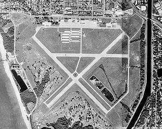
Boca Raton Airport is a state-owned public-use airport located two miles (3 km) northwest of the central business district of Boca Raton, a city in Palm Beach County, Florida, United States. The airport is immediately adjacent to Florida Atlantic University and to Interstate 95.

Palm Beach County Park Airport is a county-owned, public-use airport in Palm Beach County, Florida, United States. It is located six nautical miles south of the central business district of West Palm Beach, Florida. This airport is included in the National Plan of Integrated Airport Systems for 2011–2015, which categorized it as a reliever airport. It is also commonly referred to as the Lantana Airport.
North Palm Beach County Airport, also known as North County Airport, is an uncontrolled (non-towered) general aviation airport located 12 nautical miles northwest of West Palm Beach off the Bee Line Highway in Palm Beach Gardens, Florida. The airport is owned by Palm Beach County and operated by the Palm Beach County Airports Department.

Apalachicola Regional Airport is a county-owned, public-use airport located two nautical miles (4 km) west of the central business district of Apalachicola, a city in Franklin County, Florida, United States. It is included in the National Plan of Integrated Airport Systems for 2011–2015, which categorized it as a general aviation facility. It was previously known as Apalachicola Municipal Airport. The airport supports general aviation activity in the area and provides service via a tenant fixed-base operator (FBO).

Auburn University Regional Airport with the Robert G. Pitts Field is a public use airport located two nautical miles (4 km) east of the central business district of Auburn, a city in Lee County, Alabama, United States. The airport is owned by Auburn University and was formerly known as Auburn–Opelika Robert G. Pitts Airport. It is included in the National Plan of Integrated Airport Systems for 2011–2015, which categorized it as a general aviation facility.
Airlake Airport is a public use airport in Dakota County, Minnesota, United States. Owned by the Metropolitan Airports Commission, It is approximately 20 miles (32 km) south of both downtown Minneapolis and downtown St. Paul The airport is located near the Twin Cities suburbs of Lakeville and Farmington.
Iowa City Municipal Airport, is two miles southwest of downtown Iowa City, in Johnson County, Iowa. It is the oldest civil airport west of the Mississippi River still in its original location.
Venice Municipal Airport is a city managed public-use airport located two miles (3.2 km) south of the central business district of Venice, a city in Sarasota County, Florida, United States.

Cape May Airport or Cape May County Airport is a public use airport in Lower Township, Cape May County, New Jersey, United States. Owned by the Delaware River and Bay Authority, the airport is four nautical miles (7 km) northwest of the central business district of Wildwood.

Corvallis Municipal Airport is five miles southwest of Corvallis, in Benton County, Oregon. The National Plan of Integrated Airport Systems for 2011–2015 categorized it as a general aviation facility.

Canton–Plymouth Mettetal Airport is a public use airport located in Canton Township, Michigan, United States. The airport lies two nautical miles (3.7 km) south of the central business district of Plymouth, in Wayne County. The airport is owned and operated by the Michigan Department of Transportation (MDOT). It is also referred to as Mettetal Airport. The airport is uncontrolled (non-towered), and is used for general aviation purposes.

Foley Municipal Airport is a city-owned public-use airport located three nautical miles northwest of the central business district of Foley, a city in Baldwin County, Alabama, United States.
Colorado Plains Regional Airport is a public-use airport located on the north side city limits of Akron, Colorado, a town in Washington County, Colorado, United States. The airport is approximately 115 miles (185 km) northeast of Denver.

Pekin Municipal Airport is a city-owned public-use airport located four nautical miles south of the central business district of Pekin, a city in Tazewell County, Illinois, United States. It is included in the FAA's National Plan of Integrated Airport Systems for 2011–2015, which categorized it as a general aviation facility.
Big Sky Airport is a county-owned, public-use airport located six nautical miles southeast of the central business district of Ennis, a town in Madison County, Montana, United States. It is included in the National Plan of Integrated Airport Systems for 2011–2015, which categorized it as a general aviation airport.
Ravalli County Airport is a public use airport in Ravalli County, Montana, United States. It is owned by Ravalli County and located one nautical mile (2 km) east of the central business district of Hamilton, Montana. This airport is included in the National Plan of Integrated Airport Systems for 2011–2015, which categorized it as a general aviation facility.
Ontonagon County Airport, also known as Schuster Field, is a county-owned public-use airport located 3 miles (5 km) west of the central business district of Ontonagon, Michigan, a village in Ontonagon County, Michigan, United States. It is included in the Federal Aviation Administration (FAA) National Plan of Integrated Airport Systems for 2021–2025, in which it is categorized as a basic general aviation facility.

