
India is the second most populated country in the world with nearly a fifth of the world's population. According to the 2017 revision of the World Population Prospects population stood at 1,324,171,354.

Balussery, also spelt as Balusseri, Balisseri or Balussheri) is a small but developing town area located in Kozhikode district in Kerala state, south India.
Koyilandy is a municipality in the taluk of the same name in Kozhikode district, Kerala on the Malabar Coast. The town is located between Kozhikode (Calicut) and Vadakara (Badagara) on National Highway 66.. Koyilandy is sometimes identified with Tyndis in Periplus of the Erythraean Sea.

Unnikulam is a Gram Panchayat in Kozhikode district in the state of Kerala, India. It is further divided into two revenue villages, Unnikulam and Shivapuram.Unnikulam Online is the First Online News Portal From Unnikulam And second news portal is [Unnikulam News]. Important small towns in this Panchayat are Ekarool, the capital town and Poonoor. State Highway 34 (Kerala) passes through the Panchayat, connecting these two towns.

Puducode is a village and gram panchayat in Palakkad district in the state of Kerala, India. It is situated in Alathur taluk, around 12 km from Alathur and 4 km from Vadakkancherry, on the western bank of Mangalam River, a sub-tributary of Bharathapuzha.

Belagali is a panchayat village in the southern state of Karnataka, India. It is located in the Mudhol taluka of Bagalkot district in Karnataka, about 4 km east of the town of Mahalingpur.
Halaga is a village in the southern state of Karnataka, India. It is located in the Belgaum taluk of Belgaum district in Karnataka.
Nidagundi is a village in the southern state of Karnataka, India. It is located in the Raybag taluk of Belgaum district in Karnataka.
Uchagaon is a village in the southern state of Karnataka, India. It is located in the Belgaum taluk of Belgaum district in Karnataka. Last village on the way towards maharastra.
Yadwad is a village in the southern state of Karnataka, India. It is located in the Gokak taluk of Belgaum district in Karnataka.
Yaragatti is a village in the southern state of Karnataka, India. It is located in the Saundatti taluk of Belgaum district in Karnataka.
Karajagi is a village in jath, in the state of Maharashtra]], India. It is located in the [jath]] taluk of sangli district.
Panangad refers to the following places:
Hirekoppa K.S. is a village in Belgaum district in the southern state of Karnataka, India.
Ingalagi is a panchayat village in Belgaum district in the southern state of Karnataka, India.

The Kerala University of Fisheries and Ocean Studies (KUFOS) is a university established by government of Kerala devoted to studies in fisheries and ocean sciences. The bill seeking to establish the university was passed by the Kerala Legislative Assembly on 30 December 2010. KUFOS has its headquarters in the premises of the College of Fisheries, Panangad, near Madavana junction along the Kochi Bypass. The College of Fisheries, established in 1979, was a constituent college of the Kerala Agricultural University. KUFOS is the first university in India exclusively dedicated to studies in fisheries and allied disciplines. The university was inaugurated and dedicated to the nation in a function held at the campus of the College of Fisheries, Panangad, on 20 February 2011.
Panangad Grama panchayat is one among the 75 grama panchayat in Kozhikode district. It is near Balussery and coming under Balussery block.
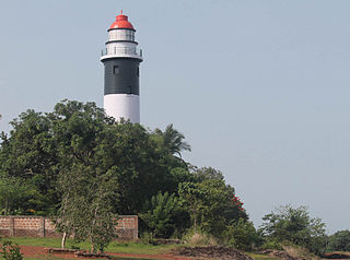
Panangad, Kochi is a small suburban village located in Kochi, a part of Kerala state in India. It is a small village grown to a suburban that lies in the skirts of Kochi Bypass. Located only 7.5 km from Vytilla junction and accessible through the national highway 66(N.H.66) by taking a left from Madavana junction while travelling south along the Kochi Bypass. Panangad is one of the suburban villages that make up the urban agglomeration of Kochi.


