Pangaea Ultima

Last updated
A rough approximation of Pangaea Ultima PangeaUltimaRoughEstimation.png
A rough approximation of Pangaea Ultima

Pangaea Ultima (also called Pangaea Proxima, Neopangaea, and Pangaea II) is a possible future supercontinent configuration. Consistent with the supercontinent cycle, Pangaea Ultima could occur within the next 100 million to 200 million years. This potential configuration, hypothesized by Christopher Scotese, earned its name from its similarity to the previous Pangaea supercontinent. Scotese later changed Pangaea Ultima (Last Pangaea) to Pangaea Proxima (Next Pangaea) to alleviate confusion about the name Pangaea Ultima which could imply that it would be the last supercontinent. [1] The concept was based on examination of past cycles of formation and breakup of supercontinents, not on current understanding of the mechanisms of tectonic change, which are too imprecise to project that far into the future. "It's all pretty much fantasy to start with," Scotese has said. "But it's a fun exercise to think about what might happen. And you can only do it if you have a really clear idea of why things happen in the first place." [2]

Supercontinent Landmass comprising more than one continental core, or craton

In geology, a supercontinent is the assembly of most or all of Earth's continental blocks or cratons to form a single large landmass. However, many earth scientists use a different definition: "a clustering of nearly all continents", which leaves room for interpretation and is easier to apply to Precambrian times.

Supercontinent cycle The quasi-periodic aggregation and dispersal of Earths continental crust

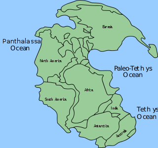
The supercontinent cycle is the quasi-periodic aggregation and dispersal of Earth's continental crust. There are varying opinions as to whether the amount of continental crust is increasing, decreasing, or staying about the same, but it is agreed that the Earth's crust is constantly being reconfigured. One complete supercontinent cycle is said to take 300 to 500 million years. Continental collision makes fewer and larger continents while rifting makes more and smaller continents.

Christopher R. Scotese is a geologist and paleogeographer. He received his PhD from the University of Chicago in 1985. He is the creator of the Paleomap Project, which aims to map Earth over the last billion years, and is credited with predicting Pangaea Ultima, a possible future supercontinent configuration. Of course later Dr. Scotese changed Pangaea Ultima to Pangaea Proxima to alleviate confusion about the name Pangaea Ultima, which would imply that it would be the last supercontinent.

Contents

Supercontinents describe the merger of all, or nearly all, of the Earth's landmass into a single contiguous continent. In the Pangaea Ultima scenario, subduction at the western Atlantic, east of the Americas, leads to the subduction of the Atlantic mid-ocean ridge followed by subduction destroying the Atlantic and Indian basin, causing the Atlantic and Indian Oceans to close, bringing the Americas back together with Africa and Europe. As with most supercontinents, the interior of Pangaea Proxima would probably become a semi-arid desert prone to extreme temperatures. [3]

Earth Third planet from the Sun in the Solar System

Earth is the third planet from the Sun and the only astronomical object known to harbor life. According to radiometric dating and other sources of evidence, Earth formed over 4.5 billion years ago. Earth's gravity interacts with other objects in space, especially the Sun and the Moon, which is Earth's only natural satellite. Earth orbits around the Sun in 365.26 days, a period known as an Earth year. During this time, Earth rotates about its axis about 366.26 times.

Continent Very large landmass identified by convention

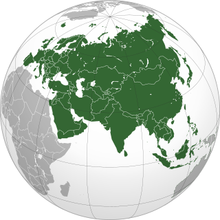
A continent is one of several very large landmasses. Generally identified by convention rather than any strict criteria, up to seven regions are commonly regarded as continents. Ordered from largest in area to smallest, they are: Asia, Africa, North America, South America, Antarctica, Europe, and Australia.

Subduction A geological process at convergent tectonic plate boundaries where one plate moves under the other

Subduction is a geological process that takes place at convergent boundaries of tectonic plates where one plate moves under another and is forced to sink due to gravity into the mantle. Regions where this process occurs are known as subduction zones. Rates of subduction are typically in centimeters per year, with the average rate of convergence being approximately two to eight centimeters per year along most plate boundaries.

Formation

According to the Pangaea Ultima hypothesis, the Atlantic and Indian Oceans will continue to get wider until new subduction zones bring the continents back together, forming a future Pangaea. Most continents and microcontinents are predicted to collide with Eurasia, just as they did when most continents collided to Laurentia. [4]

Indian Ocean The ocean between Africa, Asia, Australia and Antarctica (or the Southern Ocean)

The Indian Ocean is the third-largest of the world's oceanic divisions, covering 70,560,000 km2 (27,240,000 sq mi) or 19.8% of the water on the Earth's surface. It is bounded by Asia to the north, Africa to the west, and Australia to the east. To the south it is bounded by the Southern Ocean or Antarctica, depending on the definition in use.

Eurasia The combined continental landmass of Europe and Asia

Eurasia is the largest continent on Earth, comprising all of Europe and Asia. Located primarily in the Northern and Eastern Hemispheres, it is bordered by the Atlantic Ocean to the west, the Pacific Ocean to the east, the Arctic Ocean to the north, and by Africa, the Mediterranean Sea, and the Indian Ocean to the south. The division between Europe and Asia as two different continents is a historical social construct, with no clear physical separation between them; thus, in some parts of the world, Eurasia is recognized as the largest of the six, five, or even four continents on Earth. In geology, Eurasia is often considered as a single rigid megablock. However, the rigidity of Eurasia is debated based on paleomagnetic data.

Laurentia A large continental craton that forms the ancient geological core of the North American continent

Laurentia or the North American Craton is a large continental craton that forms the ancient geological core of the North American continent. Many times in its past, Laurentia has been a separate continent, as it is now in the form of North America, although originally it also included the cratonic areas of Greenland and also the northwestern part of Scotland, known as the Hebridean Terrane. During other times in its past, Laurentia has been part of larger continents and supercontinents and itself consists of many smaller terranes assembled on a network of Early Proterozoic orogenic belts. Small microcontinents and oceanic islands collided with and sutured onto the ever-growing Laurentia, and together formed the stable Precambrian craton seen today.

Around 50 million years from now, North America is predicted to shift slightly west and Eurasia would shift to the east, and possibly even to the south, bringing Great Britain closer to the North Pole and Siberia southward towards warm, subtropical latitudes. Africa is predicted to collide with Europe and Arabia, closing the Mediterranean Sea (completely closing the Tethys Ocean (or Neotethys) and the Red Sea) and forming a supercontinent called Afro-Eurasia. A long mountain range would then extend from Iberia, across Southern Europe (the Mediterranean Mountain Range) into Asia. Some are even predicted to have peaks higher than Mount Everest. Similarly, Australia is predicted to beach itself past the doorstep of Southeast Asia, causing the islands to be compressed inland, forming another potential mountain range, and forming a supercontinent, called Afro-Euraustralasia. Meanwhile, Southern and Baja California are predicted to have already collided with Alaska with new mountain ranges formed between them. [5]

North America Continent entirely within the Northern Hemisphere and almost all within the Western Hemisphere

North America is a continent entirely within the Northern Hemisphere and almost all within the Western Hemisphere. It is also considered by some to be a northern subcontinent of the Americas. It is bordered to the north by the Arctic Ocean, to the east by the Atlantic Ocean, to the west and south by the Pacific Ocean, and to the southeast by South America and the Caribbean Sea.

Great Britain island in the North Atlantic off the north-west coast of continental Europe

Great Britain is an island in the North Atlantic Ocean off the northwest coast of continental Europe. With an area of 209,331 km2 (80,823 sq mi), it is the largest of the British Isles, the largest European island, and the ninth-largest island in the world. In 2011, Great Britain had a population of about 61 million people, making it the world's third-most populous island after Java in Indonesia and Honshu in Japan. The island of Ireland is situated to the west of Great Britain, and together these islands, along with over 1,000 smaller surrounding islands, form the British Isles archipelago.

North Pole Northern point where the Earths axis of rotation intersects its surface

The North Pole, also known as the Geographic North Pole or Terrestrial North Pole, is defined as the point in the Northern Hemisphere where the Earth's axis of rotation meets its surface.

About 125 million years from now, the Atlantic Ocean is predicted to stop widening and begin to shrink because some of the Mid-Atlantic Ridge will have been subducted. In this scenario, a mid-ocean ridge between South America and Africa will probably be subducted first; the Atlantic Ocean is predicted to have narrowed as a result of subduction beneath the Americas. The Indian Ocean is also predicted to be smaller due to northward subduction of oceanic crust into the Central Indian trench. Antarctica is expected to shift upwards, colliding with Madagascar and Australia, enclosing a remnant of the Indian Ocean (called the Indo-Atlantic Ocean), and creating a supercontinent named Terra Orientalis. [6]

Atlantic Ocean Ocean between Europe, Africa and the Americas

The Atlantic Ocean is the second largest of the world's oceans, with an area of about 106,460,000 square kilometers. It covers approximately 20 percent of Earth's surface and about 29 percent of its water surface area. It separates the "Old World" from the "New World".

Mid-Atlantic Ridge A divergent tectonic plate boundary that in the North Atlantic separates the Eurasian and North American plates, and in the South Atlantic separates the African and South American plates

The Mid-Atlantic Ridge (MAR) is a mid-ocean ridge, a divergent tectonic plate or constructive plate boundary located along the floor of the Atlantic Ocean, and part of the longest mountain range in the world. In the North Atlantic, it separates the Eurasian and North American plates, and in the South Atlantic, it separates the African and South American plates. The ridge extends from a junction with the Gakkel Ridge northeast of Greenland southward to the Bouvet Triple Junction in the South Atlantic. Although the Mid-Atlantic Ridge is mostly an underwater feature, portions of it have enough elevation to extend above sea level. The section of the ridge that includes Iceland is known as the Reykjanes Ridge. The ridge has an average spreading rate of about 2.5 centimetres (0.98 in) per year.

Mid-ocean ridge An underwater mountain system formed by plate tectonic spreading

A mid-ocean ridge (MOR) is a seafloor mountain system formed by plate tectonics. It typically has a depth of ~ 2,600 meters (8,500 ft) and rises about two kilometers above the deepest portion of an ocean basin. This feature is where seafloor spreading takes place along a divergent plate boundary. The rate of seafloor spreading determines the morphology of the crest of the mid-ocean ridge and its width in an ocean basin. The production of new seafloor and oceanic lithosphere results from mantle upwelling in response to plate separation. The melt rises as magma at the linear weakness in the oceanic crust, and emerges as lava, creating new crust and lithosphere upon cooling. The Mid-Atlantic Ridge is a spreading center that bisects the North and South Atlantic basins; hence the origin of the name 'mid-ocean ridge'. Most oceanic spreading centers are not in the middle of their hosting ocean basis but regardless, are called mid-ocean ridges. Mid-ocean ridges around the globe are linked by plate tectonic boundaries and the outline of the ridges across the ocean floor appears similar to the seam of a baseball. The mid-ocean ridge system thus is the longest mountain range on Earth, reaching about 65,000 km (40,000 mi).

When the last of the Mid-Atlantic Ridge is subducted beneath the Americas, the Atlantic Ocean is predicted to close rapidly. [7]

At 200 million years in the future, the Atlantic is predicted to have closed. North America is predicted to have already collided with Africa, but be in a more southerly position than where it drifted. South America is predicted to be wrapped around the southern tip of Africa, completely enclosing the Indo-Atlantic Ocean. The Pacific Ocean will have grown wider, encircling half the Earth. [7]

Other suggested supercontinents

Paleogeologist Ronald Blakey has described the next 15 to 85 million years of tectonic development as fairly settled and predictable, without supercontinent formation. [8] Beyond that, he cautions that the geologic record is full of unexpected shifts in tectonic activity that make further projections "very, very speculative". [8] In addition to Pangaea Ultima, two other hypothetical supercontinents"Amasia" and "Novopangaea"were illustrated in an October 2007 New Scientist article. [9]

Related Research Articles

Plate tectonics The scientific theory that describes the large-scale motions of Earths lithosphere

Plate tectonics is a scientific theory describing the large-scale motion of seven large plates and the movements of a larger number of smaller plates of the Earth's lithosphere, since tectonic processes began on Earth between 3.3 and 3.5 billion years ago. The model builds on the concept of continental drift, an idea developed during the first decades of the 20th century. The geoscientific community accepted plate-tectonic theory after seafloor spreading was validated in the late 1950s and early 1960s.

Laurasia Northern supercontinent that formed part of the Pangaea supercontinent

Laurasia was the more northern of two supercontinents that formed part of the Pangaea supercontinent around 335 to 175 million years ago (Mya). It separated from Gondwana 215 to 175 Mya during the breakup of Pangaea, drifting farther north after the split.

Panthalassa Prehistoric superocean that surrounded Pangaea

Panthalassa, also known as the Panthalassic Ocean or Panthalassan Ocean, was the superocean that surrounded the supercontinent Pangaea. During the Paleozoic–Mesozoic transition c. 250 Ma it occupied almost 70% of Earth's surface. Its ocean floor has completely disappeared because of the continuous subduction along the continental margins on its circumference. Panthalassa is also referred to as the Paleo-Pacific or Proto-Pacific because the Pacific Ocean developed from its centre in the Mesozoic to the present.

Antarctic Plate A tectonic plate containing the continent of Antarctica and extending outward under the surrounding oceans

The Antarctic Plate is a tectonic plate containing the continent of Antarctica, the Kerguelen Plateau and extending outward under the surrounding oceans. After breakup from Gondwana, the Antarctic plate began moving the continent of Antarctica south to its present isolated location causing the continent to develop a much colder climate. The Antarctic Plate is bounded almost entirely by extensional mid-ocean ridge systems. The adjoining plates are the Nazca Plate, the South American Plate, the African Plate, the Somali Plate, the Indo-Australian Plate, the Pacific Plate, and, across a transform boundary, the Scotia Plate.

Iapetus Ocean An ocean that existed in the late Neoproterozoic and early Paleozoic eras

The Iapetus Ocean was an ocean that existed in the late Neoproterozoic and early Paleozoic eras of the geologic timescale. The Iapetus Ocean was situated in the southern hemisphere, between the paleocontinents of Laurentia, Baltica and Avalonia. The ocean disappeared with the Acadian, Caledonian and Taconic orogenies, when these three continents joined to form one big landmass called Euramerica. The "southern" Iapetus Ocean has been proposed to have closed with the Famatinian and Taconic orogenies, meaning a collision between Western Gondwana and Laurentia.

Pannotia Hypothesized Neoproterozoic supercontinent from the end of the Precambrian

Pannotia, also known as Vendian supercontinent, Greater Gondwana, and the Pan-African supercontinent, was a relatively short-lived Neoproterozoic supercontinent that formed at the end of the Precambrian during the Pan-African orogeny and broke apart 560 Ma with the opening of the Iapetus Ocean. Pannotia formed when Laurentia was located adjacent to the two major South American cratons, Amazonia and Río de la Plata. The opening of the Iapetus Ocean separated Laurentia from Baltica, Amazonia, and Río de la Plata.

Siberia (continent) An ancient craton forming the Central Siberian Plateau

Siberia, also known as Angaraland and Angarida, is an ancient craton located in the heart of Siberia. Today forming the Central Siberian Plateau, it formed an independent continent before the Permian period.

Amasia is a possible, future supercontinent that could be formed by the merger of Asia and North America. This prediction relies mostly on the fact that the Pacific Plate is already subducting under Eurasia and North America, a process which if continued will eventually cause the Pacific to close. Meanwhile, because of the Atlantic mid-ocean ridge, North America would be pushed westward. Thus, the Atlantic at some point in the future would be larger than the Pacific. In Siberia, the boundary between the Eurasian and North American Plates has been stationary for millions of years. The combination of these factors would cause North America to be combined with Asia, thus forming a supercontinent. A February 2012 study predicts Amasia will form over the North Pole, in about 50 million to 200 million years.

The Rheic Ocean was an ocean which separated two major palaeocontinents, Gondwana and Laurussia (Laurentia-Baltica-Avalonia). One of the principal oceans of the Palaeozoic, its sutures today stretch 10,000 km (6,200 mi) from Mexico to Turkey and its closure resulted in the assembly of the supercontinent Pangaea and the formation of the Variscan–Alleghenian–Ouachita orogenies.

Paleo-Tethys Ocean An ocean on the margin of Gondwana between the Middle Cambrian and Late Triassic

The Paleo-Tethys or Palaeo-Tethys Ocean was an ocean located along the northern margin of the paleocontinent Gondwana that started to open during the Middle Cambrian, grew throughout the Paleozoic, and finally closed during the Late Triassic; existing for about 400 million years.

Geological history of Earth The sequence of major geological events in Earths past

The geological history of Earth follows the major events in Earth's past based on the geological time scale, a system of chronological measurement based on the study of the planet's rock layers (stratigraphy). Earth formed about 4.54 billion years ago by accretion from the solar nebula, a disk-shaped mass of dust and gas left over from the formation of the Sun, which also created the rest of the Solar System.

Afro-Eurasia Landmass consisting of Africa, Asia and Europe

Afro-Eurasia is a landmass comprising the continents of Africa and Eurasia. The terms are portmanteaus of the names of its constituent parts. Its mainland is the largest contiguous landmass on Earth.

Pangaea Supercontinent from the late Paleozoic to early Mesozoic eras

Pangaea or Pangea was a supercontinent that existed during the late Paleozoic and early Mesozoic eras. It assembled from earlier continental units approximately 335 million years ago, and it began to break apart about 175 million years ago. In contrast to the present Earth and its distribution of continental mass, much of Pangaea was in the Southern Hemisphere and surrounded by a superocean, Panthalassa. Pangaea was the most recent supercontinent to have existed and the first to be reconstructed by geologists.

This is a list of articles related to plate tectonics and tectonic plates.

Novopangaea or Novopangea is a possible future supercontinent postulated by Roy Livermore in the late 1990s. It assumes closure of the Pacific, docking of Australia with East Asia, and northward motion of Antarctica.

Opening of the North Atlantic Ocean

The opening of the North Atlantic Ocean is a geological event that occurred over millions of years, during which the supercontinent Pangea broke up. As modern-day Europe and North America separated during the final breakup of Pangea in the early Cenozoic Era, they formed the North Atlantic Ocean. Geologists believe the breakup occurred either due to primary processes of the Iceland plume or secondary processes of lithospheric extension from plate tectonics.

References

  1. Willams, Caroline; Nield, Ted (2007). "Earth's next supercontinent". New Scientist. 196 (2626): 36–40. doi:10.1016/S0262-4079(07)62661-X.
  2. "Continents in collision: Pangaea Ultima". NASA Science News. October 6, 2000.
  3. Kargel, Jeffrey S. (2004). "New World". Mars: a warmer, wetter planet. Springer. ISBN   978-1-85233-568-7.
  4. Broad, William J. (January 9, 2007). "Long-Term Global Forecast? Fewer Continents". The New York Times.
  5. "Our globe in next 50 million years". Volcano World. Oregon State University. Archived from the original on 2009-04-05.
  6. Scotese, Christopher R. "The Atlantic Ocean begins to Close". Paleomap Project. Retrieved 2012-03-24.
  7. 1 2 Scotese, Christopher R. ""Pangea Ultima" will form 250 million years in the Future". Paleomap Project. Retrieved 2006-03-13.
  8. 1 2 Manaugh, Geoff; Twilley, Nicola (23 September 2013). "What Did the Continents Look Like Millions of Years Ago?". The Atlantic. Retrieved 2014-07-22.
  9. Williams, Caroline; Nield, Ted (2007-10-20). "Pangaea, the comeback". NewScientist. Retrieved 2009-08-28.

Further reading