Panteg

Last updated

Panteg
St Mary's Church, Panteg.jpg
St Mary's Church, Panteg
Torfaen UK location map.svg
Red pog.svg
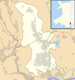
Panteg
Location within Torfaen
Area3.22 km2 (1.24 sq mi)  [1]
Population7,217 (2011) [2]
  Density 2,241/km2 (5,800/sq mi)
OS grid reference ST 294 989
Community
  • Panteg
Principal area
Ceremonial county
Country Wales
Sovereign state United Kingdom
Post town PONTYPOOL
Postcode district NP4
Dialling code 01495
Police Gwent
Fire South Wales
Ambulance Welsh
UK Parliament
Senedd Cymru – Welsh Parliament
List of places
UK
Wales
Torfaen
51°41′05″N3°01′19″W / 51.684858°N 3.021899°W / 51.684858; -3.021899 Coordinates: 51°41′05″N3°01′19″W / 51.684858°N 3.021899°W / 51.684858; -3.021899
A steam hammer from Panteg steelworks is preserved outside the Griffithstown railway museum Steam hammer, Griffithstown.jpg
A steam hammer from Panteg steelworks is preserved outside the Griffithstown railway museum

Panteg (Welsh : Pant-teg) is a large village and community in the county borough of Torfaen, Wales. It is adjacent to Griffithstown, between the towns of Cwmbran and Pontypool. The village is best known for Panteg Steel Works, which finally closed in 2004. [3]

Contents

Prior to 1935 Panteg was also an urban district. It had a population of 11,499 in 1931. It was amalgamated into Pontypool in 1935. [4] It is now a community and electoral ward of Torfaen.

Notable people

See Category:People from Panteg

See also

Related Research Articles

Abersychan Human settlement in Wales

Abersychan is a settlement and community north of Pontypool in Torfaen, Wales, and lies within the boundaries of the historic county of Monmouthshire and the preserved county of Gwent.

Cwmbran Human settlement in Wales

Cwmbran is a town in the county borough of Torfaen in South Wales.

Pontypool Human settlement in Wales

Pontypool is a town and the administrative centre of the county borough of Torfaen, within the historic boundaries of Monmouthshire in South Wales. It has a population of over 28,000.

Blaenavon Human settlement in Wales

Blaenavon is both a town and a community in Torfaen county borough, Wales, high on a hillside on the source of the Afon Lwyd. It is within the boundaries of the historic county of Monmouthshire and the preserved county of Gwent. The population is 6,055.

Croesyceiliog Human settlement in Wales

Croesyceiliog is a suburb of Cwmbran, Wales.

New Inn Human settlement in Wales

New Inn - - is a village and community directly south east of Pontypool, within the County Borough of Torfaen in Wales, within the historic boundaries of Monmouthshire. It had a population of over 5,000.

Pontnewydd Human settlement in Wales

Pontnewydd is a suburb of Cwmbran in the county borough of Torfaen, south-east Wales.

Fairwater, Torfaen Human settlement in Wales

Fairwater is a community and suburb of Cwmbran in the county borough of Torfaen, in south east Wales, and was built by the Cwmbran Development Corporation between 1963 and 1966.

Llantarnam Human settlement in Wales

Llantarnam is a suburban village of Cwmbran, and is a community and electoral ward in the county borough of Torfaen in south east Wales. The ward covers the same area as the community, but also includes Southville. It is equidistant from Cwmbran town centre and the town of Caerleon.

Trevethin Human settlement in Wales

Trevethin is a suburb of Pontypool in Torfaen, Wales, a community in Torfaen, and includes two electoral wards for Torfaen County Borough Council. It is in the historic county of Monmouthshire.

Griffithstown Human settlement in Wales

Griffithstown is a large community of Pontypool in the borough of Torfaen, Wales, within the historic boundaries of Monmouthshire. It is an ecclesiastical parish, formed in May 1898, from Llanfrechfa Upper and Panteg, and includes Sebastopol, but, under the provisions of the Local Government Act 1894, became a separate civil parish.

Sebastopol is the southernmost suburb of Pontypool in the county borough of Torfaen, within the historic boundaries of Monmouthshire in South Wales. It is named in honour of the Crimean city Sevastopol that was taken during the Crimean War. It is a working-class area consisting of mainly privately owned terraced houses and a substantial number of local authority/ex-local authority housing.

Pontymoile Human settlement in Wales

Pontymoile is a large suburb of the town of Pontypool in Torfaen, south east Wales and a Community. It is all but merged with the nearby suburbs of Cwmynyscoy and Upper Race.

County Hospital, Torfaen Hospital in Wales

The County Hospital is a community hospital in Griffithstown in the county borough of Torfaen, Wales. It is often referred to locally as Panteg Hospital. It is managed by the Aneurin Bevan Local Health Board.

The Panteg Steel Works was situated in the village of Panteg, adjacent to Sebastopol, and Griffithstown, in the district of Torfaen, South Wales. The steel works was founded in 1873, and operated for over 130 years until its closure in 2004. A number of 'firsts' occurred at Panteg Steel Works during its long life, including the first full production of stainless steel in the UK outside Sheffield in 1944, the installation of the first production vertical caster in the UK in 1960 and the commissioning of British Steel's first Argon Oxygen Decarburizer in 1972. Planning permission was given to turn the works into residential housing in 2010, when the site became the Parc Panteg housing estate.

Sebastopol railway station was a railway halt which served the village of Sebastopol near Pontypool in Torfaen, South Wales, UK.

Panteg and Griffithstown railway station was a railway station which served Griffithstown near Pontypool in Torfaen, South Wales, UK.

Pen Tranch Human settlement in Wales

Pen Tranch is a large village and a community in Torfaen, South East Wales.

Panteg AFC is a Welsh football club located in Griffithstown, Pontypool, Torfaen, South Wales. The club was founded in 1935 and currently runs two senior teams and one youth team at its home ground, Panteg House Sportsgrounds. The club plays in the Ardal Leagues South East, tier 3 of the Welsh football pyramid.

References

  1. "2011 Census:Quick Statistics:Population Density for Panteg". Office for National Statistics. Retrieved 29 November 2013.
  2. "2011 Census:Key Statistics:Key Figures for Panteg". Office for National Statistics. Retrieved 25 November 2013.
  3. "Archived copy". Archived from the original on 6 January 2009. Retrieved 15 August 2009.CS1 maint: archived copy as title (link)
  4. Columbia-Lippincott Gazetteer. 1952 Edition. p. 1424