Peach Orchard, Arkansas

Last updated

Peach Orchard, Arkansas
Peach-Orchard-Main-ar.jpg
North Main Street
Clay County Arkansas Incorporated and Unincorporated areas Peach Orchard Highlighted 0554140.svg
Location of Peach Orchard in Clay County, Arkansas.
Coordinates: 36°16′52″N90°39′39″W / 36.28111°N 90.66083°W / 36.28111; -90.66083
Country United States
State Arkansas
County Clay
Area
[1]
  Total1.03 sq mi (2.67 km2)
  Land1.03 sq mi (2.67 km2)
  Water0.00 sq mi (0.00 km2)
Elevation
[2]
285 ft (87 m)
Population
 (2020)
  Total105
  Density101.94/sq mi (39.36/km2)
Time zone UTC-6 (Central (CST))
  Summer (DST) UTC-5 (CDT)
ZIP code
72453
Area code 870
FIPS code 05-54140
GNIS feature ID2404493 [2]

Peach Orchard is a city [3] in Clay County, Arkansas, United States. The population was 135 at the 2010 census. [4]

Contents

History

Peach Orchard is rooted in an estate known as "Petit Baril," established by French explorer Pierre Le Mieux in the early 19th century. Local English-speakers were calling it "Peach Orchard" by the time Le Mieux sold the estate in 1816. A trading post operated at Peach Orchard during the mid-19th century, and was frequently raided by guerrilla forces during the Civil War. [5]

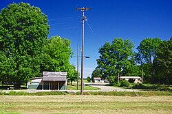
The construction of the St. Louis, Iron Mountain and Southern Railway in the 1870s brought increased development to Peach Orchard, focused primarily on the railroad and the timber industry. A post office opened in 1873, and a depot was constructed. The city incorporated in 1910. [5]

Geography

Peach Orchard is located southwest of Corning along Arkansas Highway 90, between Knobel and Delaplaine.

According to the United States Census Bureau, the town has a total area of 1.0 square mile (2.6 km2), all land.

Demographics

Historical population
CensusPop.Note
1920 484
1930 361−25.4%
1940 3743.6%
1950 327−12.6%
1960 3486.4%
1970 256−26.4%
1980 243−5.1%
1990 197−18.9%
2000 195−1.0%
2010 135−30.8%
2020 105−22.2%
U.S. Decennial Census [6]

As of the census [7] of 2000, there were 195 people, 78 households, and 56 families residing in the town. The population density was 197.9 inhabitants per square mile (76.4/km2). There were 97 housing units at an average density of 98.5 per square mile (38.0/km2). The racial makeup of the town was 97.44% White, 2.56% from other races. 2.56% of the population were Hispanic or Latino of any race.

There were 78 households, out of which 32.1% had children under the age of 18 living with them, 57.7% were married couples living together, 9.0% had a female householder with no husband present, and 28.2% were non-families. 28.2% of all households were made up of individuals, and 17.9% had someone living alone who was 65 years of age or older. The average household size was 2.50 and the average family size was 2.98.

In the town, the population was spread out, with 25.1% under the age of 18, 6.2% from 18 to 24, 28.2% from 25 to 44, 23.6% from 45 to 64, and 16.9% who were 65 years of age or older. The median age was 40 years. For every 100 females, there were 89.3 males. For every 100 females age 18 and over, there were 89.6 males.

The median income for a household in the town was $30,000, and the median income for a family was $25,750. Males had a median income of $25,833 versus $20,500 for females. The per capita income for the town was $11,051. About 24.5% of families and 18.3% of the population were below the poverty line, including 5.6% of those under the age of eighteen and 42.3% of those 65 or over.

Economy

In 2011 there was no restaurant even though there used to be one such establishment and two grocery stores. [8]

Government and infrastructure

Post Office Peach-Orchard-post-office-ar.jpg
Post Office

The community has a post office made of brick, operated by the U.S. Postal Service. In 2011 the postal agency considered closing the post office. [8]

Education

Peach Orchard is in an exclave of the Greene County Tech School District of Paragould, surrounded by territory of the Corning School District. [9] Its zoned high school is Greene County Tech High School.

Previously Peach Orchard had its own schools. At some point they consolidated into the Delaplaine School District of Delaplaine. [8] That district operated Delaplaine High School.

In 2004 the Delaplaine school district consolidated into the Greene County Tech school district. [10] In 2006 the Delaplaine schools closed and the students were moved to the Greene County schools. [8]

Related Research Articles

<span class="mw-page-title-main">Clay County, Arkansas</span> County in Arkansas, United States

Clay County is a county located in the U.S. state of Arkansas. Originally incorporated as Clayton County, as of the 2020 census, its population was 14,552. The county has two county seats, Corning and Piggott. It is a dry county, in which the sale of alcoholic beverages is restricted or prohibited.

<span class="mw-page-title-main">Greene County, Arkansas</span> County in Arkansas, United States

Greene County is a county located in the U.S. state of Arkansas. As of the 2020 census, the population was 45,736. The county seat is Paragould, which sits atop Crowley's Ridge.

<span class="mw-page-title-main">Craighead County, Arkansas</span> County in Arkansas, United States

Craighead County is a county located in the U.S. state of Arkansas. As of the 2020 census, the population was 111,231. The county has two county seats — Jonesboro and Lake City. Craighead County is Arkansas's 58th county, formed on February 19, 1859, and named for state Senator Thomas Craighead. It is one of several dry counties within the state of Arkansas, in which the sale of alcoholic beverages is largely prohibited.

<span class="mw-page-title-main">Springtown, Arkansas</span> Town in Arkansas, United States

Springtown is a town in Benton County, Arkansas, United States. The population was 83 at the 2020 census. It is part of the Northwest Arkansas region.

<span class="mw-page-title-main">Corning, Arkansas</span> City in Arkansas, United States

Corning is a city in Clay County, Arkansas, United States. The population was 3,377 at the 2010 census. It is one of the two county seats of Clay County, along with Piggott.

<span class="mw-page-title-main">Datto, Arkansas</span> Town in Arkansas, United States

Datto is a town in Clay County, Arkansas, United States. The population was 100 at the 2010 census.

<span class="mw-page-title-main">Greenway, Arkansas</span> City in Arkansas, United States

Greenway is a city in eastern Clay County, Arkansas, United States. The population was 209 at the 2010 census.

<span class="mw-page-title-main">Knobel, Arkansas</span> City in Arkansas, United States

Knobel (/ˈnoʊbəl/) is a city in Clay County, Arkansas, United States. The population was 147 at the 2020 census.

<span class="mw-page-title-main">Piggott, Arkansas</span> City in Arkansas, United States

Piggott is a city in Clay County, Arkansas, United States. It is one of the two county seats of Clay County, along with Corning. It is the northern terminus of the Arkansas segment of the Crowley's Ridge Parkway, a National Scenic Byway. As of the 2010 census, Piggott's population was 3,849. The town was named after James A. Piggott, one of the early settlers and initiator of the local post office.

<span class="mw-page-title-main">Success, Arkansas</span> Town in Arkansas, United States

Success is a town in Clay County, Arkansas, United States. The population was 149 at the 2010 census.

<span class="mw-page-title-main">Delaplaine, Arkansas</span> Town in Arkansas, United States

Delaplaine is a town in Greene County, Arkansas, United States. The population was 116 at the time of the 2010 census.

<span class="mw-page-title-main">Lafe, Arkansas</span> Town in Arkansas, United States

Lafe is a town in Greene County, Arkansas, United States on Crowley's Ridge. The population was 448 at the 2010 census, up from 385 in 2000.

<span class="mw-page-title-main">Alexander, Arkansas</span> City in Arkansas, United States

Alexander is a city in Pulaski and Saline counties in the U.S. state of Arkansas. Located in Central Arkansas, the town was founded as a construction camp for the nearby railroad. Following its completion, the citizens decided to incorporate in 1887. Alexander is home to the Arkansas Juvenile Assessment and Treatment Center. The population was 2,901 at the 2010 census.

<span class="mw-page-title-main">O'Kean, Arkansas</span> Town in Arkansas, United States

O'Kean is a town in Randolph County, Arkansas, United States. The population was 192 at the 2020 census.

<span class="mw-page-title-main">Greene, Iowa</span> City in Iowa, United States

Greene is a city in Butler County, Iowa, United States, along the Shell Rock River, and along Butler County's northern border, where Butler and Floyd counties meet. The population was 990 at the time of the 2020 census.

Greene County Tech High School (GCTHS) is a comprehensive public high school located in Paragould, Arkansas, United States. It is one of two public high schools in Greene County, Arkansas, along with cross-town rival Paragould High School, and is the sole high school managed by the Greene County Tech School District. It serves as the main feeder school for Greene County Tech Junior High School.

Corning School District is a public school district based in Corning, Arkansas, United States. The school district encompasses 364.77 square miles (944.7 km2) of land, including portions of Clay County and Randolph County. Clay County communities include Corning, Datto, Knobel, McDougal, and Success. Randolph County communities include Reyno and almost all of Biggers. Peach Orchard is not in the Corning district, but is in an exclave of the Greene County Tech School District, and an enclave of the Corning district.

Greene County Technical School District is a public school district based in Paragould, Arkansas, United States. The school district encompasses 344.38 square miles (891.9 km2) of land, including portions of Greene County, Randolph County, Craighead County, and Clay County.

Delaplaine School District was a school district headquartered in Delaplaine, Arkansas. It served Delaplaine, O'Kean, and Peach Orchard.

Delaplaine High School was a middle school and senior high school in Delaplaine, Arkansas. It was initially controlled by the Delaplaine School District, which merged into the Greene County Tech School District on July 1, 2004. After the consolidation it was operated by the GCT school district and served students from the former Delaplaine School District boundary. It served Delaplaine, O'Kean, and Peach Orchard.

References

  1. "2020 U.S. Gazetteer Files". United States Census Bureau. Retrieved October 29, 2021.
  2. 1 2 U.S. Geological Survey Geographic Names Information System: Peach Orchard, Arkansas
  3. Local.Arkansas.gov - Peach Orchard , retrieved September 3, 2012
  4. "Geographic Identifiers: 2010 Demographic Profile Data (G001): Peach Orchard city, Arkansas". U.S. Census Bureau, American Factfinder. Archived from the original on February 12, 2020. Retrieved June 16, 2014.
  5. 1 2 Steven Teske, "Peach Orchard (Clay County," Encyclopedia of Arkansas, 2017.
  6. "Census of Population and Housing". Census.gov. Retrieved June 4, 2015.
  7. "U.S. Census website". United States Census Bureau . Retrieved January 31, 2008.
  8. 1 2 3 4 Heard, Kenneth (July 4, 2011). "Postal closures trouble tiny towns". Arkansas Democrat-Gazette . Retrieved May 15, 2023.
  9. "2020 CENSUS - SCHOOL DISTRICT REFERENCE MAP: Clay County, AR" (PDF). U.S. Census Bureau . Retrieved May 12, 2023. - 2010 map - Note the 13080 and boundary indicates that Peach Orchard is in a part of Greene County Tech district territory surrounded by Corning School District territory. The article in The Encyclopedia of Arkansas stated that Peach Orchard is in the Corning district, but the finder of ArcGIS used by the State of Arkansas confirms it is an exclave of Greene County Tech.
  10. "ConsolidationAnnex_from_1983.xls." Arkansas Department of Education. Retrieved on April 25, 2018.