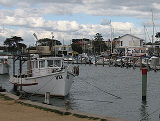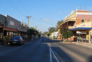
Morwell is a town in the Latrobe Valley area of Gippsland, in South-Eastern Victoria, Australia approximately 152 km (94 mi) east of Melbourne.

Warragul is a town in Victoria, Australia, 102 kilometres south-east of Melbourne. Warragul lies between the Strzelecki Ranges to the south and the Mount Baw Baw Plateau of the Great Dividing Range to the north. As of the 2021 census, the town had a population of 19,856 people. Warragul forms part of a larger urban area that includes nearby Drouin that had an estimated total population of 42,827 as of the 2021 census.

The City of Melbourne is a local government area in Victoria, Australia, located in the central city area of Melbourne. In 2021, the city has an area of 37.7 square kilometres (14.6 sq mi) and had a population of 149,615. The city's motto is "vires acquirit eundo" which means "we gather strength as we go".
Ashwood is a suburb in Melbourne, Victoria, Australia, 14 km south east of Melbourne's Central Business District, located within the City of Monash local government area. Ashwood recorded a population of 7,154 at the 2021 census.

Portsea is a seaside suburb on the Mornington Peninsula in Melbourne, Victoria, Australia, approximately 60 kilometres (37 mi) south-west of Melbourne's Central Business District, located within the Shire of Mornington Peninsula local government area. Portsea recorded a population of 787 at the 2021 census.

Oakleigh is a suburb in Melbourne, Victoria, Australia 14 km south-east of Melbourne's Central Business District, located within the City of Monash local government area. Oakleigh recorded a population of 8,442 at the 2021 census.

Mordialloc is a beachside suburb in Melbourne, Victoria, Australia, 24 km south-east of Melbourne's Central Business District, located within the City of Kingston local government area. Mordialloc recorded a population of 8,886 at the 2021 census.

Williamstown is a suburb in Melbourne, Victoria, Australia, 11 km (6.8 mi) south-west of Melbourne's Central Business District, located within the City of Hobsons Bay local government area. Williamstown recorded a population of 14,407 at the 2021 census.

The Williamstown line is a commuter railway line in the city of Melbourne, Victoria, Australia. Operated by Metro Trains Melbourne, it is the city's third shortest metropolitan railway line at 16.2 kilometres (10.1 mi).

Rochester is a town in rural Victoria, Australia. It is located 180 km (110 mi) north of Melbourne with a mixture of rural and semi-rural communities on the northern Campaspe River, between Bendigo and the Murray River port of Echuca. At the 2021 census, Rochester had a population of 3,154.

Stratford is a town on the Avon River in Victoria, Australia, 232 kilometres (144 mi) east of Melbourne on the Princes Highway in Shire of Wellington. At the 2016 census, Stratford had a population of 2617. The town services the local regional community and travellers on the Princes Highway. Stratford's principal industries are dairying, sheep, cattle and horse breeding and vegetable crops. The town has numerous coffee shops and cafes, a cellar door for a local winery, Design Gallery, model railway shop, a pub, parks and playgrounds for car travelers to break their journey.

Lang Lang is a town in Victoria, Australia, 73 km south-east of Melbourne's Central Business District, located within the Shires of Bass Coast, Cardinia and South Gippsland local government areas. Lang Lang recorded a population of 2,556 at the 2021 census.

Sea Lake is a town in the Mallee district of north-west Victoria, Australia and is situated on the southern shores of Lake Tyrrell. The town is located on the Calder Highway, 351 kilometres (218 mi) north-west of Melbourne, and 73 kilometres (45 mi) west of Swan Hill. Sea Lake is in the heart of Australia's wheat belt, and is the main township for a number of wheat farms in the region. At the 2021 census, Sea Lake had a population of 619.

Forest Hill is a rural town and locality in the Lockyer Valley Region, Queensland, Australia. In the 2021 census, the locality of Forest Hill had a population of 935 people.

Molesworth is a town in the upper Goulburn Valley region of Victoria, Australia. The town is in the Shire of Murrindindi and on the Goulburn Valley Highway, 125 kilometres (78 mi) northeast of the state capital, Melbourne.
Warne is a locality in the local government area of the Shire of Buloke, Victoria, Australia. It has a grain station on the Kulwin railway line.
Watchupga is a locality in Northern Victoria, Australia. The local government area of Watchupga is the Shire of Buloke. Watchupga has a grain station on the Mildura railway line with a grain silo on the site which is 84 metres tall. However, the station was closed to passenger and parcels traffic on 11 November 1975. Watchupga Post Office opened on 23 July 1900 and was closed on 29 February 1972.
Curyo is a locality in the Mallee Ward of the Shire of Buloke, Victoria, Australia. Curyo has a Grain Depot on the Mildura railway line; however, the station closed to passenger and parcels traffic on 11 November 1975. A CFA fire brigade in the area is located on Pratt Road, adjacent to the grain depot. The post office there opened on 20 January 1900 and was closed on 9 January 1976. Curyo used to have a football club and a golf course.
Kinnabulla is a locality located in the local government area of the Shire of Buloke, Victoria, Australia. The population of the locality is 173 people, 91 being male, and 82 being female. Kinnabulla Railway Station was a station on the Mildura railway line. The station closed to passenger and parcels traffic on 11 November 1975. The post office there opened in 1902 and was closed on 11 November 1973.
Peebinga is a town and locality in the Australian state of South Australia. Peebinga was the terminus of the Peebinga railway line which was built in 1914 as part of a major state government project to open up the Murray Mallee for grazing and cropping.


