Pine Island, Texas

Last updated

Pine Island, Texas
TXMap-doton-PineIsland.PNG
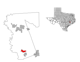
Location of Pine Island, Texas
Waller County PineIsland.svg
Coordinates: 30°3′48″N96°1′23″W / 30.06333°N 96.02306°W / 30.06333; -96.02306
Country United States
State Texas
County Waller
Area
[1]
  Total9.36 sq mi (24.24 km2)
  Land9.34 sq mi (24.20 km2)
  Water0.01 sq mi (0.04 km2)
Elevation
197 ft (60 m)
Population
 (2020)
  Total1,077
  Density120/sq mi (44/km2)
Time zone UTC-6 (Central (CST))
  Summer (DST) UTC-5 (CDT)
ZIP code
77445
Area code 979
FIPS code 48-57615 [2]
GNIS feature ID1388558 [3]
Website https://pineislandtx.com/

Pine Island is a town in Waller County, Texas, United States near the intersection of Farm to Market Road 359 and Farm to Market Road 3346. The population was 1,077 at the 2020 census. It is not affiliated with the uninhabited island of the same name in Lake Livingston.

Contents

Geography

Pine Island is located at 30°3′48″N96°1′23″W / 30.06333°N 96.02306°W / 30.06333; -96.02306 (30.063433, –96.022968). [4] According to the United States Census Bureau, the town has a total area of 9.3 square miles (24.2 km2), of which 9.3 square miles (24.2 km2) is land and 0.11% is water.

The western boundary of the town is formed by Clear Creek, which flows from north to south. U.S. Route 290 Business on either side of FM 359 is part of the northern town limit. Cochran Road from north of Brumlow Road south to Betka Road forms the eastern boundary. The southern boundary is formed by Betka Road and an irregular line running west to Clear Creek. [5]

Demographics

Historical population
CensusPop.Note
1990 571
2000 84948.7%
2010 98816.4%
2020 1,0779.0%
U.S. Decennial Census [6]
2020 Census [7]

As of the census [2] of 2000, there were 849 people, 295 households, and 225 families residing in the town. The population density was 91.0 inhabitants per square mile (35.1/km2). There were 333 housing units at an average density of 35.7 per square mile (13.8/km2). The racial makeup of the town was 73.14% White, 12.13% African American, 0.82% Native American, 0.59% Asian, 10.48% from other races, and 2.83% from two or more races. Hispanic or Latino of any race were 22.03% of the population.

There were 295 households, out of which 36.6% had children under the age of 18 living with them, 62.0% were married couples living together, 11.2% had a female householder with no husband present, and 23.4% were non-families. 15.6% of all households were made up of individuals, and 6.4% had someone living alone who was 65 years of age or older. The average household size was 2.88 and the average family size was 3.21.

In the town, the population distribution was as follows: 28.5% were under the age of 18, 9.2% were between 18 and 24, 28.0% were between 25 and 44, 23.2% were between 45 and 64, and 11.1% were 65 or older. The median age was 34 years. For every 100 females, there were 108.1 males. For every 100 females aged 18 and over, there were 102.3 males.

The median income for a household in the town was $45,000, and the median income for a family was $50,714. Males had a median income of $34,167 versus $31,250 for females. The per capita income for the town was $18,597. About 4.7% of families and 7.2% of the population were below the poverty line, including 7.8% of those under age 18 and 4.8% of those age 65 or over.

Education

The Town of Pine Island is served by the Waller Independent School District. [8]

Zoned schools include:

All of Waller County is in the service area of Blinn College. [11] Blinn operates the Waller-Harris County Campus. [12]

Related Research Articles

<span class="mw-page-title-main">Montgomery County, Texas</span> County in Texas, United States

Montgomery County is a county in the U.S. state of Texas. As of the 2020 U.S. census, the county had a population of 620,443. The county seat is Conroe. The county was created by an act of the Congress of the Republic of Texas on December 14, 1837, and is named for the town of Montgomery. Between 2000 and 2010, its population grew by 55%, the 24th-fastest rate of growth of any county in the United States. Between 2010 and 2020, its population grew by 36%. According to the U.S. Census Bureau, the estimated population is 711,354 as of July 1, 2023.
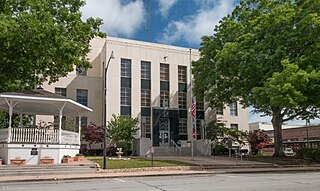
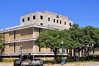
<span class="mw-page-title-main">Washington County, Texas</span> County in Texas, United States

Washington County is a county in Texas. As of the 2020 census, the population was 35,805. Its county seat is Brenham, which is located along U.S. Highway 290, 72 miles northwest of Houston. The county was created in 1835 as a municipality of Mexico and organized as a county in 1837. It is named for George Washington, the first president of the United States.

<span class="mw-page-title-main">Waller County, Texas</span> County in Texas, United States

Waller County is a county in the U.S. state of Texas. As of the 2020 census, its population was 56,794. Its county seat is Hempstead. The county was named for Edwin Waller, a signer of the Texas Declaration of Independence and first mayor of Austin.

<span class="mw-page-title-main">Robertson County, Texas</span> County in Texas, United States

Robertson County is a county in the U.S. state of Texas. As of the 2020 census, its population was 16,757. Its county seat is Franklin. The county was created in 1837 and organized the following year. It is named for Sterling C. Robertson, an early settler who signed the Texas Declaration of Independence.

<span class="mw-page-title-main">Milam County, Texas</span> County in Texas, United States

Milam County is a county located in the U.S. state of Texas. As of the 2020 census, its population was 24,754. The county seat is Cameron. The county was created in 1834 as a municipality in Mexico and organized as a county in 1837. Milam County is named for Benjamin Rush Milam, an early settler and a soldier in the Texas Revolution.

<span class="mw-page-title-main">Lee County, Texas</span> County in Texas, United States

Lee County is a county located in the U.S. state of Texas. As of the 2020 census, its population was 17,478. Its county seat is Giddings. The county was founded in 1874 and is named for Confederate General Robert E. Lee. The county has many Confederate memorials and monuments to the Confederate States of America.

<span class="mw-page-title-main">Burleson County, Texas</span> County in Texas, United States

Burleson County is a county located in the U.S. state of Texas. As of the 2020 census, the population was 17,642. Its county seat is Caldwell. The county is named for Edward Burleson, a general and statesman of the Texas Revolution.

<span class="mw-page-title-main">Brazos County, Texas</span> County in Texas, United States

Brazos County is a county in the U.S. state of Texas. As of the 2020 census, its population was 233,849. The county seat is Bryan. Along with Brazoria County, the county is named for the Brazos River, which forms its western border. The county was formed in 1841 and organized in 1843.
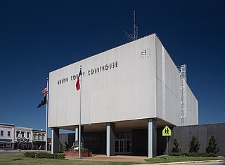
<span class="mw-page-title-main">Austin County, Texas</span> County in Texas, United States

Austin County is a rural, agricultural dominated county in the U.S. state of Texas. As of the 2020 census, the population was 30,167. Its seat is Bellville. The county and region was settled primarily by German emigrants in the 1800s.
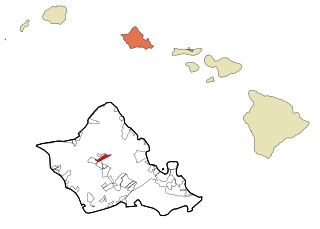
<span class="mw-page-title-main">Wahiawa, Hawaii</span> Census-designated place in Hawaii, United States

Wahiawa is a census-designated place (CDP) in Honolulu County, Hawaii, United States, on the island of Oahu. It is in the Wahiawā District, on the plateau or "central valley" between the two volcanic mountains that bookend the island. In Hawaiian, wahi a wā means "place of the wa people". The population was 18,658 at the 2020 census.

<span class="mw-page-title-main">Hebron, Texas</span> Town in Texas, United States

Hebron is a town in Denton County in the U.S. state of Texas, with a small, disconnected section in Collin County. The population was 803 at the 2020 census, and according to 2023 census estimates, the city is estimated to have a population of 224.

<span class="mw-page-title-main">Shady Shores, Texas</span> Town in Texas, United States

Shady Shores is a town in Denton County, Texas, United States. The population was 2,764 at the 2020 census. It is also one of four communities in the Lake Cities.

<span class="mw-page-title-main">Rose Hill Acres, Texas</span> City in Texas, United States

Rose Hill Acres is a city in Hardin County, Texas, United States. The population was 325 at the 2020 census, down from 441 at the 2010 census. The city consists of two residential neighborhoods situated between Beaumont and Lumberton. It is part of the Beaumont–Port Arthur Metropolitan Statistical Area. Rose Hill Acres has a small government structure led by Mayor David Lang.

<span class="mw-page-title-main">Payne Springs, Texas</span> Town in Texas, United States

Payne Springs is a town in Henderson County, Texas, United States. The population was 741 at the 2020 census, down from 767 at the 2010 census.

<span class="mw-page-title-main">Midway, Texas</span> City in Madison County, Texas, United States

Midway is a city in northeastern Madison County, Texas, United States, at the junction of the La Bahía Road and the Old San Antonio Road.

<span class="mw-page-title-main">Aspermont, Texas</span> Town in Texas, United States

Aspermont is a town and the county seat of Stonewall County, Texas, United States. The population was 789 at the 2020 census.

<span class="mw-page-title-main">Brookshire, Texas</span> City in Texas, United States

Brookshire is a city in Waller County, Texas, United States, with a population of 5,066 as of the 2020 census.
<span class="mw-page-title-main">Pattison, Texas</span> City in Texas, United States

Pattison is a city in Waller County, Texas, United States. As of the 2020 census, the population was 547.

<span class="mw-page-title-main">Prairie View, Texas</span> City in Texas, United States

Prairie View is a city in Waller County, Texas, United States, situated on the northwestern edge of the Houston–The Woodlands–Sugar Land metropolitan area. The population was 8,184 at the 2020 census.

<span class="mw-page-title-main">Waller, Texas</span> City in Harris and Waller counties in Texas, United States

Waller is a city in Harris and Waller counties in Texas, United States, that is within the Houston–Cypress metropolitan area. Its population was 2,682 at the 2020 U.S. census. The Waller area is located along U.S. Route 290 41 miles (66 km) northwest of downtown Houston.

References

  1. "2019 U.S. Gazetteer Files". United States Census Bureau. Retrieved August 7, 2020.
  2. 1 2 "U.S. Census website". United States Census Bureau . Retrieved January 31, 2008.
  3. "US Board on Geographic Names". United States Geological Survey. October 25, 2007. Retrieved January 31, 2008.
  4. "US Gazetteer files: 2010, 2000, and 1990". United States Census Bureau. February 12, 2011. Retrieved April 23, 2011.
  5. "Pine Island, Texas" (Map). Google Maps . Retrieved February 17, 2013.
  6. "Census of Population and Housing". Census.gov. Retrieved June 4, 2015.
  7. "Census Bureau profile: Pine Island, Texas". United States Census Bureau. May 2023. Retrieved May 20, 2024.
  8. "2020 CENSUS - SCHOOL DISTRICT REFERENCE MAP: Waller County, TX" (PDF). U.S. Census Bureau . Retrieved September 9, 2024. - Text list
  9. "Junior High Schools Attendance Zone Map" (PDF). Waller Independent School District . Retrieved September 10, 2024.
  10. "2024-2025 Elementary School Attendance Zones Map (Detail View)" (PDF). Waller Independent School District . Retrieved September 10, 2024.
  11. Texas Education Code Sec. 130.168. BLINN JUNIOR COLLEGE DISTRICT SERVICE AREA.
  12. "Waller-Harris County". Blinn College . Retrieved September 10, 2024.