Brookshire, Texas

Last updated

Brookshire, Texas
Brookshire CIMG7180.JPG
Brookshire, Texas welcome sign.
Brookshire, Texas
Brookshire, Texas
Brookshire, Texas
Brookshire, Texas
Coordinates: 29°47′1″N95°57′16″W / 29.78361°N 95.95444°W / 29.78361; -95.95444
Country United States
State Texas
County Waller
Government
  MayorDarrell Branch
Area
[1]
  Total4.33 sq mi (11.21 km2)
  Land4.33 sq mi (11.21 km2)
  Water0.00 sq mi (0.00 km2)
Elevation
161 ft (49 m)
Population
 (2020)
  Total5,066
  Density1,343.19/sq mi (518.66/km2)
Time zone UTC-6 (Central (CST))
  Summer (DST) UTC-5 (CDT)
ZIP code
77423
Area code(s) 281/346/713/832
FIPS code 48-10636 [2]
GNIS feature ID1331324 [3]
Website Brookshire, Texas Official Website

Brookshire is a city in Waller County, Texas, United States, with a population of 5,066 as of the 2020 census. [4]

Contents

Location

Brookshire is located at 29°47′1″N95°57′16″W / 29.78361°N 95.95444°W / 29.78361; -95.95444 (29.783737, –95.954325)., [5] 34 miles west of downtown Houston along Interstate 10, seven miles west of Katy. It is part of the Interstate 10 Energy Corridor, part of the west Houston and Katy market, and a member of the West I-10 Chamber of Commerce. The population was 4,702 as of the 2010 census, with a total area of 3.5 square miles (9.1 km2).

The city is named for Nathan Brookshire, a large land owner in the vicinity. He was a captain in the Texian Army and participated in the storming and capture of Bexar in 1835. In 1893, John Kellner donated land and filed a plat for the Town of Kellner out of the William Cooper Survey, one of the oldest headrights in the state. Also in 1893, John Brookshire and O. C. Drew filed their plat for the Town of Brookshire out of the H. H. Pennington Survey. On May 24, 1946, the City of Brookshire was incorporated, comprising both the Kellner and the Brookshire/Drew plats.

Demographics

Historical population
CensusPop.Note
1950 1,015
1960 1,33931.9%
1970 1,68325.7%
1980 2,17529.2%
1990 2,92234.3%
2000 3,45018.1%
2010 4,70236.3%
2020 5,0667.7%
U.S. Decennial Census
Brookshire racial composition as of 2020 [6]
(NH = Non-Hispanic) [lower-alpha 1]
RaceNumberPercentage
White (NH)80715.93%
Black or African American (NH)1,34426.53%
Native American or Alaska Native (NH)260.51%
Asian (NH)280.55%
Pacific Islander (NH)10.02%
Some Other Race (NH)80.16%
Mixed/Multi-Racial (NH)1212.39%
Hispanic or Latino 2,73153.91%
Total5,066

As of the 2020 United States census, there were 5,066 people, 1,375 households, and 833 families residing in the city.

As of the 2010 U.S. Census, the population of Brookshire was 4,702, a 36% increase since the 2000 census. As of the census [2] of 2000, 3,450 people, 1,138 households, and 823 families resided in the city. The population density was 983.2 inhabitants per square mile (379.6/km2). The 1,257 housing units averaged 358.2 per square mile (138.3/km2). The racial makeup of the city was 32.67% White, 38.20% African American, 0.58% Native American, 0.38% Asian, 0.03% Pacific Islander, 26.09% from other races, and 2.06% from two or more races. Hispanics or Latinos of any race were 37.16% of the population.

Of the 1,138 households, 40.2% had children under the age of 18 living with them, 44.5% were married couples living together, 21.2% had a female householder with no husband present, and 27.6% were not families; 23.6% of all households were made up of individuals, and 8.7% had someone living alone who was 65 years of age or older. The average household size was 3.03 and the average family size was 3.56.

In the city, the population was distributed as 32.4% under the age of 18, 11.7% from 18 to 24, 30.6% from 25 to 44, 17.3% from 45 to 64, and 8.0% who were 65 years of age or older. The median age was 28 years. For every 100 females, there were 97.3 males. For every 100 females age 18 and over, there were 92.7 males.

The median income for a household in the city was $29,461, and for a family was $32,017. Males had a median income of $25,032 versus $18,674 for females. The per capita income for the city was $12,235. About 14.5% of families and 18.7% of the population were below the poverty line, including 24.1% of those under age 18 and 8.1% of those age 65 or over.

Government and infrastructure

The mayor of Brookshire is Darrell Branch, who was elected May 4, 2019.

The Brookshire Katy Drainage District has its headquarters in Brookshire. [8]

The United States Postal Service operates the Brookshire Post Office – 77423 at 4115 5th Street. [9]

Rex White was serving as the city's chief of police when a riot broke out on July 6, 1978. According to a UPI story, the trouble started when White broke up a fight and put one of the combatants in his squad car. Some sixty people rushed out of their homes to confront White, pounding on the car and eventually chasing him back to the police station. Ten people were arrested in the incident, which White ascribed to there being "little to do in a small town on a hot day". [10]

Economy

Goya Foods has its Texas offices in an unincorporated area near Brookshire. [11]

Education

Royal ISD Administration Building in nearby Pattison Pattison TX Royal ISD Admin.jpg
Royal ISD Administration Building in nearby Pattison

The City of Brookshire is served by the Royal Independent School District. [12] The district operates Royal Early Childhood Center, Royal Elementary School, Royal Middle School, and Royal High School. It also has two schools of choice, Royal STEM Academy and Royal Early College High School.

All of Waller County is in the service area of Blinn College. [13]

The Waller County Library System operates the Brookshire-Pattison Library. [14]

Brazos Valley Sudbury School was located near Brookshire.

Notable person

Related Research Articles

<span class="mw-page-title-main">Washington County, Texas</span> County in Texas, United States

Washington County is a county in Texas. As of the 2020 census, the population was 35,805. Its county seat is Brenham, which is located along U.S. Highway 290, 72 miles northwest of Houston. The county was created in 1835 as a municipality of Mexico and organized as a county in 1837. It is named for George Washington, the first president of the United States.

<span class="mw-page-title-main">Waller County, Texas</span> County in Texas, United States

Waller County is a county in the U.S. state of Texas. As of the 2020 census, its population was 56,794. Its county seat is Hempstead. The county was named for Edwin Waller, a signer of the Texas Declaration of Independence and first mayor of Austin.

<span class="mw-page-title-main">Motley County, Texas</span> County in Texas, United States

Motley County is a county located in the U.S. state of Texas. As of the 2020 census, its population was 1,063, making it the 10th-least populous county in Texas. Its county seat is Matador. The county was created in 1876 and organized in 1891. It is named for Junius William Mottley, a signer of the Texas Declaration of Independence. Mottley's name is spelled incorrectly because the bill establishing the county misspelled his name. Motley County was one of 30 prohibition, or entirely dry, counties in Texas, but is now a wet county.

<span class="mw-page-title-main">Matagorda County, Texas</span> County in Texas, United States

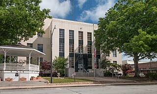
Matagorda County is a county located in the U.S. state of Texas. As of the 2020 census, the population was 36,255. Its county seat is Bay City, not to be confused with the larger Baytown in Harris and Chambers Counties. Matagorda County is named for the canebrakes that once grew along the coast.

<span class="mw-page-title-main">Cooke County, Texas</span> County in Texas, United States

Cooke County is a county in the U.S. state of Texas. At the 2020 census, its population was 41,668. The county seat is Gainesville. The county was founded in 1848 and organized the next year. It is named for William Gordon Cooke, a soldier during the Texas Revolution. It is a part of the Texoma region.

<span class="mw-page-title-main">Richwood, Texas</span> City in Texas, United States

Richwood is a city in Brazoria County, Texas, United States. The population was 4,781 at the 2020 census.

<span class="mw-page-title-main">Ozona, Texas</span> Census-designated place in Texas, United States

Ozona is an unincorporated community and census-designated place (CDP) that serves as the county seat of Crockett County, Texas, United States. The population was 2,663 at the time of the 2020 census. Ozona is the only Census Bureau–recognized community in Crockett County, which is named for Colonel Davy Crockett, a hero of the Alamo.

<span class="mw-page-title-main">Citrus City, Texas</span> Census-designated place in Texas

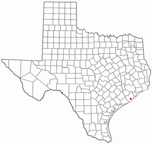
Citrus City is a census-designated place (CDP) in Hidalgo County, Texas, United States. The population was 3,291 at the 2020 census. It is part of the McAllen–Edinburg–Mission Metropolitan Statistical Area. The town was founded in 1943 during World War II by Howard Moffitt, a builder known for his vernacular Moffitt cottage architectural style, as part of a planned regional orange and grapefruit growing community. The local irrigation system proved to be too saline for fruit production, and the plans for a large town were revised. A few Moffitt houses survive in Citrus City.

<span class="mw-page-title-main">Anton, Texas</span> City in Texas, United States

Anton is a city in Hockley County, Texas, United States. The population was 907 at the 2020 census.

<span class="mw-page-title-main">Goldthwaite, Texas</span> City in Texas, United States

Goldthwaite is a town and the county seat of Mills County, Texas, United States. The population was 1,738 at the 2020 census, down from 1,878 at the 2010 census.

<span class="mw-page-title-main">La Rosita, Texas</span> CDP in Texas, United States

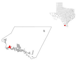
La Rosita is a census-designated place (CDP) in Starr County, Texas, United States. The population was 85 at the 2010 census, a decline from the figure of 1,729 tabulated in 2000 due to the Census Bureau redefining the CDP. By the 2020 census, the population further decreased to 82.

<span class="mw-page-title-main">Roma Creek, Texas</span> Former census designated place in Texas, United States

Roma Creek is a former census-designated place (CDP) in Starr County, Texas, United States. The population was 350 at the 2010 census down from 610 at the 2000 census.

<span class="mw-page-title-main">New Waverly, Texas</span> City in Texas, United States

New Waverly is a city in Walker County, Texas, United States. The population was 914 at the 2020 census.

<span class="mw-page-title-main">Pattison, Texas</span> City in Texas, United States

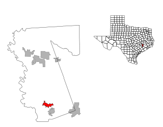
Pattison is a city in Waller County, Texas, United States. As of the 2020 census, the population was 547.

<span class="mw-page-title-main">Prairie View, Texas</span> City in Texas, United States

Prairie View is a city in Waller County, Texas, United States, situated on the northwestern edge of the Houston–The Woodlands–Sugar Land metropolitan area. The population was 8,184 at the 2020 census.

<span class="mw-page-title-main">Liberty Hill, Texas</span> City in Williamson County, Texas, United States

Liberty Hill is a city in Williamson County, Texas, United States. The population was 3,646 at the 2020 census, and according to 2023 census estimates, the city is estimated to have a population of 10,428. Liberty Hill is part of the Greater Austin metropolitan area.

<span class="mw-page-title-main">Carrollton, Texas</span> City in Texas, United States

Carrollton is a city in Dallas, Denton, and Collin counties in the U.S. state of Texas. As of the 2020 census, its population was 133,434, making it the 27th-most populous city in Texas.

<span class="mw-page-title-main">Cinco Ranch, Texas</span> Census-designated place in Texas, United States

Cinco Ranch is a census-designated place and master-planned community located in the extraterritorial jurisdiction of the city of Houston within Fort Bend and Harris counties in the U.S. state of Texas. According to the United States Census Bureau, the CDP has a total area of 4.9 square miles (12.8 km2).The population was 16,899 at the 2020 census. It lies approximately 25 miles (40 km) west of the Harris County seat of Houston and 10 miles (16 km) north of the Fort Bend County seat of Richmond. Cinco Ranch is considered to be part of the Greater Katy area and is roughly 10 miles southeast of the city of Katy.

<span class="mw-page-title-main">Waller, Texas</span> City in Harris and Waller counties in Texas, United States

Waller is a city in Harris and Waller counties in Texas, United States, that is within the Houston–Cypress metropolitan area. Its population was 2,682 at the 2020 U.S. census. The Waller area is located along U.S. Route 290 41 miles (66 km) northwest of downtown Houston.

<span class="mw-page-title-main">Marble Falls, Texas</span> City in Texas, United States

Marble Falls is a city in Burnet County, Texas, United States. As of the 2020 United States Census, the city population was 7,037. Lake Marble Falls is part of the Highland Lakes on the Colorado River, the largest chain of lakes in Texas. Marble Falls was founded by Adam Rankin Johnson in 1887, a former Indian fighter and Confederate general.

References

  1. "2019 U.S. Gazetteer Files". United States Census Bureau. Retrieved August 7, 2020.
  2. 1 2 "U.S. Census website". United States Census Bureau . Retrieved January 31, 2008.
  3. "US Board on Geographic Names". United States Geological Survey. October 25, 2007. Retrieved January 31, 2008.
  4. "Brookshire Demographics - Get Current Census Data for Brookshire, TX".
  5. "US Gazetteer files: 2010, 2000, and 1990". United States Census Bureau. February 12, 2011. Retrieved April 23, 2011.
  6. "Explore Census Data". data.census.gov. Retrieved May 23, 2022.
  7. "About the Hispanic Population and its Origin". www.census.gov. Retrieved May 18, 2022.
  8. "Contact BKDD Archived 2011-09-10 at the Wayback Machine ." Brookshire Katy Drainage District. Retrieved on July 17, 2010.
  9. "Post Office Location - BROOKSHIRE." United States Postal Service. Retrieved on December 4, 2008.
  10. Detroit Free Press via UPI, 7 July 1978, page 8C.
  11. "Contact Us Archived 2011-04-24 at the Wayback Machine ." Goya Foods. Retrieved on March 26, 2016. "Goya Foods of Texas 30602 McAllister Road Brookshire, TX 77423"
  12. "2020 CENSUS - SCHOOL DISTRICT REFERENCE MAP: Waller County, TX" (PDF). U.S. Census Bureau. Archived (PDF) from the original on October 9, 2022. Retrieved September 10, 2024. - Text list
  13. Texas Education Code Sec. 130.168. BLINN JUNIOR COLLEGE DISTRICT SERVICE AREA.
  14. "Home". Waller County Library System. Retrieved September 10, 2024. 3815 6th St. Brookshire, TX 77423
  1. Note: the US Census treats Hispanic/Latino as an ethnic category. This table excludes Latinos from the racial categories and assigns them to a separate category. Hispanics/Latinos can be of any race. [7]