Pino, Haute-Corse

Last updated

Pino
Pino-village.jpg
The church and surrounding buildings in Pino
Location of Pino
Pino, Haute-Corse
France location map-Regions and departements-2016.svg
Red pog.svg
Pino
Corse region location map.svg
Red pog.svg
Pino
Coordinates: 42°54′32″N9°21′06″E / 42.9089°N 9.3517°E / 42.9089; 9.3517
Country France
Region Corsica
Department Haute-Corse
Arrondissement Bastia
Canton Cap Corse
Intercommunality Cap Corse
Government
  Mayor (20202026) Francis Mazotti [1]
Area
1
7.04 km2 (2.72 sq mi)
Population
 (Jan. 2020) [2]
167
  Density24/km2 (61/sq mi)
Time zone UTC+01:00 (CET)
  Summer (DST) UTC+02:00 (CEST)
INSEE/Postal code
2B233 /20228
Elevation0–836 m (0–2,743 ft)
(avg. 250 m or 820 ft)
1 French Land Register data, which excludes lakes, ponds, glaciers > 1 km2 (0.386 sq mi or 247 acres) and river estuaries.

Pino (French pronunciation: [pino] ; Corsican : Pinu) is a commune in the Haute-Corse department of France on the island of Corsica.

Contents

Geography

The town of Pino is located in the Eastern "Alpine Corsica", a distinction limited to the northeast of the island, composed of various terrains, originating from a former oceanic crust called Liguro-Piedmontese (a Tethys Ocean whose age is between -170 to -60 Ma) and its continental margins. In this part of Corsica, it is distinguished that the metamorphic schists or "lustrous schists" and the ophiolites of Cap Corse are of Jurassic and Cretaceous age. [3]

The commune occupies an "alveolus" in the western Cap Corse, a valley surrounded by mountains to the north, east, and south, which are also its territorial limits. Starting from the coast south of the Anse d'Aliso  [ fr ], its boundaries follow a ridge line from Punta d'Alisgia (155 m), Punta Pastricciola (305 m), to Monte Popolu (520 m). It then follows the Cape ridge southwards over the Bocca di Santa Lucia pass (387 m), beneath which lies the Santa Lucia chapel, past the Tour de Sénèque (566 m), Monte Rotto (630 m - Luri), Punta Rasiccia (714 m), and Monte Ventigliole (712 m) towards Monte Grofilieta (836 m). From there, it heads back west towards the sea, passing Monte Cupieta (756 m), Punta di Caterraggio (514 m), Punta di Piestrone (430 m), and follows the course of the small river, fiume di Mare Morto, to the coast.

Hydrography

On Pino's seafront are the mouths of six small rivers, all of which rise from the heights of the Pino Valley. From North to South, they are: the di Marinascu, [4] the di Fichetu, [5] the di Sorbinca, [6] the di A Pietra, [7] the di Cucchiara, and the di Mare Morto.

Climate and vegetation

Pino's geographical location on the Cape's western coastline means it is subject to the prevailing westerly winds. The soil is covered with tall holm oak trres and dense scrubland that conceal the ancient cultivation terraces, developing on a soil composed partly of silky, wrinkled sericite schists, and partly of very resistant ophiolites composed of volcanic rocks, causing sharp, abrupt reliefs in the ground. Many roads are cut into the rock, and feature prasinites on the walls, tinted green by epidote minerals.

The Santa Lucia Chapel is surrounded by laricio pines. On the rocky coastal slopes, are the numerous agave and prickly pear trees that originated in Mexico and have become widespread around the Mediterranean.

Population

Historical population
YearPop.±% p.a.
1800 507    
1821 405−1.06%
1846 426+0.20%
1872 512+0.71%
1901 575+0.40%
1926 529−0.33%
1946 331−2.32%
1962 273−1.20%
1968 269−0.25%
YearPop.±% p.a.
1975 200−4.15%
1982 137−5.26%
1990 143+0.54%
1999 150+0.53%
2007 176+2.02%
2012 148−3.41%
2017 164+2.07%
2020167+0.61%
Source: EHESS [8] and INSEE (1968-2017) [9]

Etymology

Pino derives from the Latin word pinus, meaning umbrella pine, a species of tree endemic to the commune.

See also

Related Research Articles

<span class="mw-page-title-main">Bastia</span> Prefecture and commune in Corsica, France

Bastia is a commune in the department of Haute-Corse, Corsica, France. It is located in the northeast of the island of Corsica at the base of Cap Corse. It also has the second-highest population of any commune on the island after Ajaccio and is the capital of the Bagnaja region and of the department.

<span class="mw-page-title-main">Rapilly</span> Commune in Normandy, France

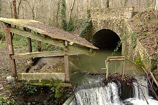
Rapilly is a commune in the Calvados department in the Normandy région in northwestern France. The commune is where the Baize joins the river Orne.

<span class="mw-page-title-main">Asco, Haute-Corse</span> Commune in Corsica, France

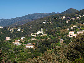
Asco is a commune in the Haute-Corse department of France on the island of Corsica.

<span class="mw-page-title-main">Gravona</span> River

The Gravona is a river on the island of Corsica, France. It flows from the center of the island southwest to the Gulf of Ajaccio. Its entire course is in the Corse-du-Sud Department of France. It is 46.4 km (28.8 mi) long. The Gravona Valley conducts the main highway, Route N193, from the capital city, Ajaccio, to the Col de Vizzavona, where it goes through the pass and down to Corte and Bastia. At its upper end the Gravona is a crystal-clear mountain stream cascading over falls and rapids into trout-filled pools. At its lower end nearly all of the Gravona's flow serves to water the densely urban area of Ajaccio.

<span class="mw-page-title-main">Lac de l'Oriente</span>

Lac de l'Oriente is a lake in Corsica, France.

<span class="mw-page-title-main">Abatesco</span> River of the Haute-Corse department in Corsica

The Abatesco is a French coastal river which flows through the Haute-Corse department and empties into the Tyrrhenian Sea.

<span class="mw-page-title-main">Aglia (Abatesco)</span> Stream in the department of Haute-Corse, Corsica

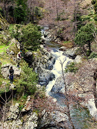
The Aglia is a 9 kilometres (5.6 mi) long stream in the department of Haute-Corse, Corsica, a tributary of the Abatesco.

<span class="mw-page-title-main">Bevinco</span> River in the department of Haute-Corse, Corsica

The Bevinco is a small river in the northeast of the Haute-Corse department on the French island of Corsica. It is the main tributary of the Étang de Biguglia, the largest wetland in Corsica.

<span class="mw-page-title-main">Fango (river)</span> River in the department of Haute-Corse, Corsica

The Fango is a small coastal river in the department of Haute-Corse, Corsica, France. The Fango Valley was designated a biosphere reserve in 1977. It holds flora and fauna representative of all regions of Corsica from the coast to the highest mountains.

<span class="mw-page-title-main">Luri (river)</span> Stream in the department of Haute-Corse, Corsica

The Luri is a coastal stream in the department of Haute-Corse, Corsica, France. It flows across the Cap Corse peninsula to the Tyrrhenian Sea.

<span class="mw-page-title-main">Fium'Albino</span> River in the department of Haute-Corse, Corsica

The Fium'Albino is a small coastal river in the departments of Corse-du-Sud and Haute-Corse, Corsica, France. Its mouth opens into the Gulf of St Florent in the Mediterranean Sea on the west of the Cap Corse peninsula.

<span class="mw-page-title-main">Erco (river)</span> River in France

The Erco is a stream in the department of Haute-Corse, Corsica, France. It is a tributary of the Golo.

<span class="mw-page-title-main">Col Saint-Antoine (Corsica)</span>

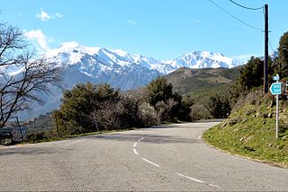
The Col Saint-Antoine, or Saint-Antoine Pass, is a mountain pass in the Haute-Corse department of Corsica, France. It is one of the main passes in the island of Corsica. It rises to 687 metres (2,254 ft).

<span class="mw-page-title-main">Oso (river)</span> River in Corsica, France

The Oso is a small coastal river in the southeast of the department of Corse-du-Sud, Corsica, France.

<span class="mw-page-title-main">Poggiolo (stream)</span> Stream in the department of Haute-Corse, Corsica

The Poggiolo is a small coastal stream in the department of Haute-Corse, Corsica, France. It enters the Tyrrhenian Sea from the east of the Cap Corse peninsula.

<span class="mw-page-title-main">Varagno</span> Stream in the department of Haute-Corse, Corsica

The Varagno is a stream in the department of Haute-Corse, Corsica, France. It is a tributary of the Fiumorbo.

<span class="mw-page-title-main">Saltaruccio</span> Stream in the department of Haute-Corse, Corsica

The Saltaruccio is a stream in the department of Haute-Corse, Corsica, France. It is a tributary of the Fiumorbo.

The Col de Marsolino is a mountain pass in the Haute-Corse department of Corsica, France. The pass is in the west of the Monte Cinto massif. It connects Calvi and Calenzana to Galéria. Its low altitude allows it to be open almost all year round.

<span class="mw-page-title-main">Col de Prato</span> Mountain pass in Corsica, France

The Col de Prato is a mountain pass in the Haute-Corse department of Corsica, France.

<span class="mw-page-title-main">Col de San Quilico</span>

The Col de San Quilico or collo di San Quilico is a mountain pass in the Haute-Corse department of Corsica, France. It is a road pass on Territorial Route 20, between Corte and Ponte Leccia (Morosaglia).

References

  1. "Répertoire national des élus: les maires". data.gouv.fr, Plateforme ouverte des données publiques françaises (in French). 2 December 2020.
  2. "Populations légales 2020". The National Institute of Statistics and Economic Studies. 29 December 2022.
  3. "La Course: Découverte géologique de l'Île de Beauté". Centre de Géologie de l'Oisans. 15 September 2010. Archived from the original (DOC) on 13 June 2023. Retrieved 13 June 2023.
  4. Sandre. "Ruisseau de marinascu [Y7421040] - Cours d'eau selon la version Carthage 2017". www.sandre.eaufrance.fr (in French). Retrieved 12 June 2023.
  5. Sandre. "Ruisseau de fichetu [Y7421080] - Cours d'eau selon la version Carthage 2017". www.sandre.eaufrance.fr (in French). Retrieved 12 June 2023.
  6. "Rechercher une donnée d'un jeu". www.sandre.eaufrance.fr (in French). Retrieved 12 June 2023.
  7. Sandre. "Ruisseau de belli forci [Y7421120] - Cours d'eau selon la version Carthage 2017". www.sandre.eaufrance.fr (in French). Retrieved 12 June 2023.
  8. Des villages de Cassini aux communes d'aujourd'hui: Commune data sheet Pino, EHESS (in French).
  9. Population en historique depuis 1968, INSEE