Pioneer Peak (British Columbia)

Last updated
Pioneer Peak
Pioneer Peak BC.jpg
North aspect
Highest point
Elevation 3,245 m (10,646 ft) [1]
Prominence 195 m (640 ft) [1]
Parent peak Adamant Mountain (3,345 m) [1]
Isolation 1.158 km (0.720 mi) [1]
Listing Mountains of British Columbia
Coordinates 51°44′03″N117°53′15″W / 51.73417°N 117.88750°W / 51.73417; -117.88750 [2]
Geography
Canada British Columbia relief location map.jpg
Red triangle with thick white border.svg
Pioneer Peak
Location of Pioneer Peak in British Columbia
Canada relief map 2.svg
Red triangle with thick white border.svg
Pioneer Peak
Pioneer Peak (Canada)
Country Canada
Province British Columbia
District Kootenay Land District [3]
Parent range Adamant Range [3]
Selkirk Mountains
Topo map NTS 82N12 Mount Sir Sandford [2]
Geology
Type of rock Granite
Climbing
First ascent 1911
Easiest route Scrambling, Northeast Face [4]

Pioneer Peak is a 3,245-metre (10,646-foot) mountain in British Columbia, Canada.

Contents

Description

Pioneer Peak is part of the Adamant Range which is a subrange of the Selkirk Mountains. [3] It is located 80 km (50 mi) northwest of Golden and 30 km (19 mi) north of Glacier National Park. Pioneer Peak is highly glaciated with the Granite Glacier to the north, Gothics Glacier to the east, and the Adamant Glacier to the south. Precipitation runoff and glacial meltwater from the mountain's slopes drains north to Swan Creek, east to Smith Creek, south to Palmer Creek, and each are tributaries of the Columbia River. Topographic relief is significant as the summit rises approximately 2,500 metres (8,200 ft) above Kinbasket Lake in 13 km (8.1 mi). Pioneer is located south of the Bill Putnam hut which makes the peak an excellent ski mountaineering destination. [5]

History

The first ascent of the summit was made in 1911 by Howard Palmer, Edward Holway, and Frederic King Butters. [6] The mountain's toponym was officially adopted on March 4, 1965, by the Geographical Names Board of Canada. [2]

Climate

Based on the Köppen climate classification, Pioneer Peak is located in a subarctic climate zone with cold, snowy winters, and mild summers. [7] Winter temperatures can drop below −20 °C with wind chill factors below −30 °C. This climate supports several glaciers surrounding the peak.

See also

Related Research Articles

<span class="mw-page-title-main">Mount Bute</span>

Mount Bute, also known as Bute Mountain, is a 2,810-metre (9,220-foot) mountain located in the Coast Mountains of British Columbia, Canada. Situated at the southern extreme of the Homathko Icefield, Mount Bute has an impressive 800-metre sheer granite west face, and Bute Glacier dominates the north aspect. This imposing mountain is visible from Waddington Harbour at the head of Bute Inlet, in a remote wilderness area that few visit. Its nearest higher peak is Mount Grenville, 13.0 km (8.1 mi) to the east-northeast. Mount Grenville is the highest summit of the icefield. Mount Bute is 63.0 km (39.1 mi) southeast of Mount Waddington, the highest peak of the entire Coast Mountains range.

<span class="mw-page-title-main">Joffre Peak</span> Mountain in the country of Canada

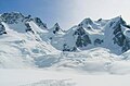
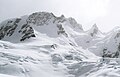
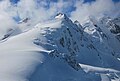
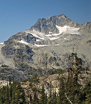
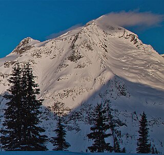
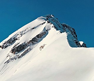
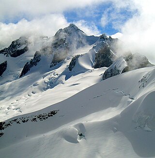
Joffre Peak is a 2,721-metre (8,927-foot) mountain summit located in the Coast Mountains, in Joffre Lakes Provincial Park, in southwestern British Columbia, Canada. It is the second-highest point of the Joffre Group, which is a subset of the Lillooet Ranges. It is situated 26 km (16 mi) east of Pemberton and 11 km (7 mi) northeast of Lillooet Lake. Joffre is more notable for its steep rise above local terrain than for its absolute elevation as topographic relief is significant with the summit rising 1,500 meters (4,920 ft) above Cayoosh Creek in 4 km (2.5 mi). The nearest higher peak is Mount Matier, 1.6 km (1 mi) to the south. The mountain's climate supports the Matier Glacier on the southwest slope, and the Anniversary Glacier on the southeast slope. Precipitation runoff from the peak drains into Joffre Creek and Cayoosh Creek which are both within the Fraser River watershed.

<span class="mw-page-title-main">Otter Mountain</span> Mountain in British Columbia, Canada

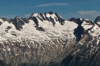
Otter Mountain is a prominent 2,693-metre (8,835-foot) glaciated summit located in the Coast Mountains of British Columbia, Canada. It is situated 16 kilometers northeast of Stewart, British Columbia, and the nearest higher peak is Mount Pattullo, 25.4 km (15.8 mi) to the north. Otter ranks as the 23rd most topographically prominent summit of Canada. Topographic relief is significant as the summit rises 2,380 meters above Bitter Creek Valley in 5 kilometers. This mountain's toponym was adopted as "Mount Otter" on 24 July 1945, and officially renamed Otter Mountain on 5 November 1953 by the Geographical Names Board of Canada. Precipitation runoff from the mountain drains west into Bitter Creek which is a tributary of the Bear River, or east to Nelson Creek which is part of the Nass River drainage basin, and all ultimately finds its way to the Inside Passage.

<span class="mw-page-title-main">Mount Carr</span> Mountain in the country of Canada

Mount Carr is a 2,590-metre (8,497-foot) mountain summit located in British Columbia, Canada.

<span class="mw-page-title-main">Handcar Peak</span> Mountain summit in British Columbia, Canada

Handcar Peak is a 2,338-metre (7,671-foot) mountain summit located in the Railroad Group of the Coast Mountains, in the Pemberton Valley of southwestern British Columbia, Canada. It is situated 38 km (24 mi) northwest of Pemberton and 3 km (2 mi) west of Locomotive Mountain. Precipitation runoff from the peak drains into Sampson Creek and Buck Creek which are both tributaries of the Lillooet River. Handcar Peak is more notable for its steep rise above local terrain than for its absolute elevation as topographic relief is significant with the summit rising over 2,050 meters (6,725 ft) above Lillooet River and Pemberton Valley in approximately 4 km (2.5 mi). The mountain's name was proposed in 1978 by mountaineer Karl Ricker of the Alpine Club of Canada, in association with Railroad Pass, Railroad Creek and other railroad-related names of the immediate vicinity. The toponym was officially adopted January 23, 1979, by the Geographical Names Board of Canada.

<span class="mw-page-title-main">Face Mountain (British Columbia)</span> Mountain summit in British Columbia, Canada

Face Mountain is a 2,485-metre (8,153-foot) mountain summit located in British Columbia, Canada.

<span class="mw-page-title-main">Ipsoot Mountain</span> Glaciated summit in southwest British Columbia, Canada

Ipsoot Mountain is a 2,576-metre (8,451-foot) glaciated summit located in southwest British Columbia, Canada.

<span class="mw-page-title-main">Phyllis's Engine</span> Mountain in the country of Canada

Phyllis's Engine is a 2,517-metre (8,258-foot) granite pinnacle located in British Columbia, Canada.

<span class="mw-page-title-main">Anniversary Peak</span> Mountain in British Columbia, Canada

Anniversary Peak is a 2,947-metre (9,669-foot) summit in The Bugaboos of British Columbia, Canada. It is located southeast of the Bugaboo Glacier, on the southern boundary of Bugaboo Provincial Park. Precipitation runoff from Anniversary Peak drains into Bugaboo Creek which is a tributary of the Columbia River. Anniversary Peak is more notable for its steep rise above local terrain than for its absolute elevation as topographic relief is significant with the summit rising 1,350 meters (4,429 ft) above Bugaboo Creek in 4 km (2.5 mi).

<span class="mw-page-title-main">Beaver Mountain (British Columbia)</span> Mountain in the country of Canada

Beaver Mountain is a 3,212-metre (10,538-foot) mountain summit in British Columbia, Canada.

<span class="mw-page-title-main">Pequod Mountain</span> Mountain in the country of Canada

Pequod Mountain is a 2,979-metre (9,774-foot) summit in British Columbia, Canada.

<span class="mw-page-title-main">Outrigger Peak</span> Mountain in the country of Canada

Outrigger Peak is a 2,850-metre (9,350-foot) mountain summit in British Columbia, Canada.

<span class="mw-page-title-main">Kwoiek Peak</span> Mountain in British Columbia, Canada

Kwoiek Peak is a 2,736-metre (8,976-foot) mountain summit located in British Columbia, Canada.

<span class="mw-page-title-main">Kumkan Peak</span> Mountain in British Columbia, Canada

Kumkan Peak is a 2,742-metre (8,996-foot) mountain summit located in British Columbia, Canada.

<span class="mw-page-title-main">Adamant Mountain</span> Mountain in British Columbia, Canada

Adamant Mountain is a 3,345-metre (10,974-foot) mountain in British Columbia, Canada.

<span class="mw-page-title-main">Ygdrasil Mountain</span> Mountain in British Columbia, Canada

Ygdrasil Mountain is a 2,960-metre (9,710-foot) mountain in British Columbia, Canada.

<span class="mw-page-title-main">Houdini Needles</span> Mountain in British Columbia, Canada

Houdini Needles is a 2,663-metre (8,737-foot) mountain in British Columbia, Canada.

<span class="mw-page-title-main">Sentinel Peak (Adamant Range)</span> Mountain in Columbia-Shuswap Regional District, British Columbia, Canada

Sentinel Peak is a 2,992-metre (9,816-foot) mountain in British Columbia, Canada.

<span class="mw-page-title-main">Austerity Mountain</span> Mountain in British Columbia, Canada

Austerity Mountain is a 3,337-metre (10,948-foot) mountain in British Columbia, Canada.

<span class="mw-page-title-main">Unicorn Mountain</span> Mountain in British Columbia, Canada

Unicorn Mountain is a 3,010-metre (9,880-foot) mountain in British Columbia, Canada.

References

  1. 1 2 3 4 "Pioneer Peak - 10,646' BC". listsofjohn.com. Retrieved 2023-09-08.
  2. 1 2 3 "Pioneer Peak". Geographical Names Data Base . Natural Resources Canada . Retrieved 2023-09-08.
  3. 1 2 3 "Pioneer Peak". BC Geographical Names . Retrieved 2023-09-08.
  4. Fairy Meadow Alpine Granite, Alpine Club of Canada, Retrieved 2023-09-08.
  5. Chic Scott, Summits and Icefields: Columbia Mountains, Rocky Mountain Books Ltd, 2003, ISBN   9781894765473, p. 54.
  6. Appalachia, Volume 13, Appalachian Mountain Club, 1915, p. 397.
  7. Peel, M. C.; Finlayson, B. L. & McMahon, T. A. (2007). "Updated world map of the Köppen−Geiger climate classification". Hydrol. Earth Syst. Sci. 11: 1633–1644. ISSN   1027-5606.