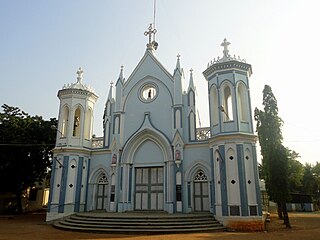
Ilaiyangudi is a town in Sivaganga district, Tamil Nadu state, India. It is the center of government for the surrounding tehsils. The town has a predominant Tamil Rowthers population. The Tamil Muslim community was traditionally engaged in Business. Bazaar(Kadai Theru) is the central business district.

Perambalur is one of the 38 districts in the state of Tamil Nadu, India. The district headquarters is located at Perambalur. The district occupies an area of 1,752 km2 and had a population of 565,223 with a sex-ratio of 1,003 females for every 1,000 males in 2011.

Bharathidasan University (BDU) is a university in the city of Tiruchirappalli, Tamil Nadu, India. It is located on Tiruchirappalli-Pudukkottai National Highway 336. It has affiliated colleges in the districts of Ariyalur district, Karur, Nagapattinam, Perambalur, Pudukkottai, Thanjavur, Tiruvarur and Tiruchirapalli. It is a recognised university, supported by the University Grants Commission of India. All major faculties of science and arts are represented. The university has totally 4 Faculties, 16 Schools, 37 Departments and 29 Specialized Research Centres.
Thuvakudi is a town in Tiruchirapalli district in the Indian state of Tamil Nadu. It is an industrial town housing more than 250 industries and is located in the National Highway NH 65 between Tiruchirapalli and Thanjavur. The town has a dry weather, making it suitable for dry crops like cotton, chillies and millets..

The Marundhuvazh Malai, a part of Sanjeevi hills is also known as the Marundhu Vazhum Malai/Maruthwamalai, forms the part and the southernmost tip of the Western Ghats in Agasteeswaram taluk of Kanyakumari district of Tamil Nadu, India. People living in southern Kerala call it "Maruthuva Mala".
Koothappar is a panchayat town in Tiruchirappalli district in the Indian state of Tamil Nadu. It is located 16 km from Tiruchirappalli.

Crawford is a part of the city of Trichy in the state of Tamil Nadu in India. This area is adjoining Edamalaipatti Pudur and located on Madurai Road (NH45B) 2.5 km from Trichy Central Bus Stand & 2 km from Trichy Railway Station. Crawford is surrounded by Tamil Nadu Special Police Quarters to the north, Military Camp to the east and Railway Quarters to the west.
Manapalli is a small village on the northern bank of the Cauvery River in the Namakkal district of Tamil Nadu, India. Over 5000 people live in this village, which includes Manapalli, GanapathiPalayam, Rasagounden Pudur, Ramanaicken Palyam, Ellaikattuputhur, Kunnipalayam, Theerthampalayam, Aruvankattur, Ganeshapuram, Chennakkal Pudur, and MelaPettapalayam. The village is composed of mostly Hindus.
Ariyamangalam is one of the four zones of the Tiruchirappalli Municipal Corporation. One of SIDCO's two Tiruchirappalli-based industrial estates is located in Ariyamangalam. The estate extends over an area of 17.64 acres (71,400 m2).

Tiruchirappalli (Tamil: திருச்சிராப்பள்ளி, also called Tiruchi or Trichy, is a city in the Indian state of Tamil Nadu and the administrative headquarters of Tiruchirapalli District. It is the fourth largest municipal corporation in Tamil Nadu and also the fourth largest urban agglomeration in the state. It is located almost at the geographic centre of the state.

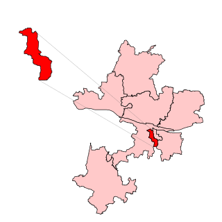
Tiruchirappalli (East) is a constituency of Tamil Nadu Legislative Assembly located in Tiruchirappalli district of Tamil Nadu. Its State Assembly Constituency number is 141. It was called as Tiruchirappalli – II before the constituency delimitations 2008. It comes under Tiruchirappalli Lok Sabha constituency for Parliament elections. It includes Ward Nos. 8- 26, 33- 35, 37 and 38 of Tiruchirappalli City Municipal Corporation. It is one of the 234 State Legislative Assembly Constituencies in Tamil Nadu.

Tiruchirappalli (West) is one of the 234 state legislative assembly constituencies in Tamil Nadu. It comes under Tiruchirappalli Lok Sabha constituency for Parliament elections and includes Ward Nos. 39- 60 of Tiruchirappalli City Municipal Corporation.
Edamalaipatti Pudur or E.Pudur is a large residential neighbourhood and extension of Tiruchirappalli in Tamil Nadu, India. Surrounded by KK Nagar to East, Karumandapam to West, Crawford to North & Panjapur to South. The areas has amenities such as Popular Temples, hospitals,smart mediequip services, Pazhamudircholai, tailors, flour mills, schools and petrol stations.
Prasanna Venkatachalapathi Temple is a Hindu temple situated on top of a hill called Perumalmalai located 3 kms from Thuraiyur in Tiruchirappalli district, Tamil Nadu, India. The presiding deity is the Hindu god Vishnu. The temple is believed to have been constructed by the grandchildren of Karikala, who are worshipped here.
K.Pudur village a small village in the district of Perambalur, It is a greenish village in the district of Perambalur There, Tamil Nadu, India.

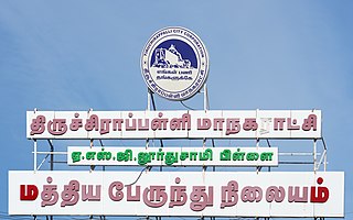
Central Bus Station, popularly known as Central Bus Stand, is one of the bus termini of Trichy, located near Cantonment, the other being the Chatram Bus Stand.
Panjapur is an area of Tiruchirappalli suburbs of Edamalaipatti Pudur of Trichy in Tamil Nadu, India. It comes under the city limit with Tiruchirappalli city corporation and Tiruchirappalli West taluk. Ward 39 of Trichy corporation covers Panjapur.
Dheeran Nagar is a neighbourhood of the city of Tiruchirappalli in Tamil Nadu, India.
Thenkalam, officially called Tenkulam, is a village in the Tirunelveli district of Tamil Nadu, India. It lies about 13 kilometres (8.1 mi) from the city of Tirunelveli and about 5 kilometres (3.1 mi) from Sankarnagar, a suburb of Tirunelveli which lies on the way to Madurai on National Highway 44.
Kulipirai is a village in Thirumayam Taluk in Pudukkottai District of Tamil Nadu, India. It is located 25 km towards west from district headquarters Pudukkottai. 14 km from Thirumayam. 60 km from Tiruchirapalli. 415 km from State capital Chennai. The nearest airport is Tiruchirapalli International Airport 52 km away.


