Pitt Point

Last updated

Pitt Point ( 63°50′45″S58°22′34″W / 63.845889°S 58.376223°W / -63.845889; -58.376223 ) is a promontory, 90 m high, at the south side of the mouth of Victory Glacier on the south coast of Trinity Peninsula, forming the northeast side of the entrance to Chudomir Cove. The promontory was charted by the Falkland Islands Dependencies Survey (FIDS) in 1945, and named for K.A.J. Pitt, master of the Falkland Islands Company ship Fitzroy, 1940-46, who assisted in establishing FIDS stations, 1944-46.

Contents

Cabral Refuge

Cabral Refuge
Refuge
Antarctic Peninsula location map.svg
Red pog.svg
Cabral Refuge
Location of Cabral Refuge in Antarctic Peninsula
Coordinates: 63°50′45″S58°22′34″W / 63.845889°S 58.376223°W / -63.845889; -58.376223
CountryFlag of Argentina.svg  Argentina
Location in Antarctic Peninsula Pitt point
Trinity Peninsula
Antarctica
Administered by Argentine Army
Established1964 (1964)
Named for Juan Bautista Cabral
TypeSeasonal
StatusOperational

Sargento Cabral Refuge ( 63°50′45″S58°22′34″W / 63.845889°S 58.376223°W / -63.845889; -58.376223 ) is an Antarctic refuge located at Pitt Point, administered by the Argentine Army. The shelter was inaugurated on September 18, 1964, on the occasion of the 1964-1965 Antarctic campaign. It is one of the 18 shelters that are under the responsibility of the Esperanza, which is responsible for the maintenance and the care.

The refuge, currently inactive, bears the name of Juan Bautista Cabral, who died in the Battle of San Lorenzo, while he was aiding then Colonel Don José de San Martín, whose horse had fallen to enemy fire.[ citation needed ]

See also

Related Research Articles

<span class="mw-page-title-main">James Ross Island</span> Island off the Antarctic Peninsula

James Ross Island is a large island off the southeast side and near the northeastern extremity of the Antarctic Peninsula, from which it is separated by Prince Gustav Channel. Rising to 1,630 metres (5,350 ft), it is irregularly shaped and extends 64 km in a north–south direction. It was charted in October 1903 by the Swedish Antarctic Expedition under Otto Nordenskiöld, who named it for Sir James Clark Ross, the leader of a British expedition to this area in 1842 that discovered and roughly charted a number of points along the eastern side of the island. The style, "James" Ross Island is used to avoid confusion with the more widely known Ross Island in McMurdo Sound.

<span class="mw-page-title-main">Neny Island</span> Island in Graham Land, Antarctica

Neny Island or is an island 2.8 km (1.5 nmi) long which rises to 675 m (2,215 ft), lying 1.9 km (1 nmi) northwest of Roman Four Promontory and directly north of the mouth of Neny Fjord, off the west coast of Graham Land in Antarctica. Neny Island was discovered by the British Graham Land Expedition (BGLE) (1934–1937) under John Riddoch Rymill and named after nearby Neny Fjord.

<span class="mw-page-title-main">Northeast Glacier</span> Antarctic glacier

Northeast Glacier is a steep, heavily crevassed glacier on the west side of Hemimont Plateau, 21 km (13 mi) long and 8 km (5 mi) wide at its mouth, which flows from McLeod Hill westward and then south-westwards into Marguerite Bay between the Debenham Islands and Roman Four Promontory, on the west coast of Graham Land, Antarctica. Northeast Glacier was first surveyed in 1936 by the British Graham Land Expedition (BGLE) under John Riddoch Rymill. It was resurveyed in 1940 by members of the United States Antarctic Service (USAS), who first used the glacier as a sledging route, and so named by them because it lay on the north-eastern side of their base at Stonington Island.

The Trojan Range is a mountain range rising to 2,760 metres (9,055 ft), extending northward from Mount Francais along the east side of Iliad Glacier, Anvers Island, in the Palmer Archipelago of the British Antarctic Territory. It was surveyed by the Falkland Islands Dependencies Survey (FIDS) in 1955 and named by the UK Antarctic Place-Names Committee (UK-APC) for the Trojans, one of the opposing sides in the Trojan War in Homer's Iliad.

Cape Longing is a rocky cape on the east coast of Graham Land, Antarctica, forming the south end of a large ice-covered promontory which marks the west side of the south entrance to Prince Gustav Channel. It was discovered by the Swedish Antarctic Expedition under Otto Nordenskiöld in 1902, and so named by him because from the position of his winter hut on Snow Hill Island the cape lay in the direction of his "land of longing" which he was anxious to explore.

The British Antarctic Survey (BAS) is the United Kingdom's national polar research institute. It has a dual purpose, to conduct polar science, enabling better understanding of global issues, and to provide an active presence in the Antarctic on behalf of the UK. It is part of the Natural Environment Research Council (NERC). With over 400 staff, BAS takes an active role in Antarctic affairs, operating five research stations, one ship and five aircraft in both polar regions, as well as addressing key global and regional issues. This involves joint research projects with over 40 UK universities and more than 120 national and international collaborations.

Blaiklock Island is a high and rugged, irregular-shaped island 17 kilometres (9 nmi) long, lying between Bigourdan Fjord and Bourgeois Fjord. It is separated from Pourquoi Pas Island by The Narrows and from the west coast of Graham Land by Jones Channel. The feature was partially surveyed in 1936 by the British Graham Land Expedition under Rymill, at which time it was charted as a promontory. It was determined to be an island in 1949 by Kenneth V. Blaiklock, a Falkland Islands Dependencies Survey (FIDS) surveyor for whom it is named.

Attlee Glacier is a glacier 8 miles (13 km) long, which flows east-southeast from the plateau escarpment on the east side of Graham Land to the head of Cabinet Inlet to the north of Bevin Glacier.

Access Point is a rocky point immediately southeast of Biscoe Point and 2 miles (3 km) northwest of Cape Lancaster on the south side of Anvers Island, in the Palmer Archipelago. First charted by the French Antarctic Expedition under Jean-Baptiste Charcot, 1903–05. Surveyed in 1955 by the Falkland Islands Dependencies Survey (FIDS) and so named because there is a landing place for boats on the northwest tip of the point which provides access to the inland parts of the island.

<span class="mw-page-title-main">Aitkenhead Glacier</span> Glacier in Antarctica

Aitkenhead Glacier is a 10-mile (16 km) long glacier flowing east-southeast from the Detroit Plateau, Graham Land, into Prince Gustav Channel. It was mapped from surveys by the Falkland Islands Dependencies Survey (FIDS) (1960–61), and named by the United Kingdom Antarctic Place-Names Committee for Neil Aitkenhead, a FIDS geologist at Hope Bay (1959–60).

Orford Cliff is a coastal cliff of Pernik Peninsula, Loubet Coast in Graham Land, overlooking the east side of Lallemand Fjord just east of Andresen Island. Surveyed by Falkland Islands Dependencies Survey (FIDS) in 1956. Named for Michael J.H. Orford, FIDS assistant surveyor at Detaille Island in 1956, a member of the party which found a route from Detaille Island to Avery Plateau, via Orford Cliff and Murphy Glacier.

Nobby Nunatak is a nunatak, 270 m, standing 1 nautical mile (1.9 km) south of Lake Boeckella and 1 nautical mile (1.9 km) east of Mount Flora, at the northeast end of Antarctic Peninsula.

Whisky Bay is a bay between Rink Point and Stoneley Point on the northwest side of James Ross Island. The bay was likely discovered by Otto Nordenskjold of the Swedish Antarctic Expedition in 1903, who roughly mapped this area and showed small bays in this position. It was surveyed by Falkland Islands Dependencies Survey (FIDS) in 1945 and 1952, and later called "Caleta Santa Eduvigis" on an unpublished Argentine Antarctic Expedition map, about 1959. Named by the United Kingdom Antarctic Place-Names Committee (UK-APC) in 1983 in association with nearby Brandy Bay.

Portal Point is a narrow point in the northeast part of Reclus Peninsula, on the west coast of Graham Land. In 1956, a Falkland Islands Dependencies Survey (FIDS) hut was established on the point, from which a route to the plateau was established. So named by the United Kingdom Antarctic Place-Names Committee (UK-APC) in 1960 because the point is the "gateway" of the route.

<span class="mw-page-title-main">Sjogren Glacier</span> Antarctic glacier

Sjogren Glacier is a glacier 12.5 miles (20 km) long in the south part of Trinity Peninsula, flowing southeast from Detroit Plateau in between Aldomir Ridge and Hazarbasanov Ridge to enter Prince Gustav Channel at the head of Sjögren Inlet, west of Royak Point. Discovered in 1903 by the Swedish Antarctic Expedition under Nordenskjold. He named it Sjogren Fiord after a patron of the expedition. The true nature of the feature was determined by the Falkland Islands Dependencies Survey (FIDS) in 1945.

<span class="mw-page-title-main">Russell East Glacier</span> Glacier in Antarctica

Russell East Glacier is a glacier, 6 nautical miles (11 km) long and 3 nautical miles (6 km) wide, which lies at the north end of Detroit Plateau and flows from Mount Canicula and Verdikal Gap along the south slopes of Erul Heights eastward into Smokinya Cove in Prince Gustav Channel on the south side of Trinity Peninsula. This glacier together with Russell West Glacier, which flows westward into Bone Bay on the north side of Trinity Peninsula, form a through glacier across the north part of Antarctic Peninsula. It was first surveyed in 1946 by the Falkland Islands Dependencies Survey (FIDS). Named by the United Kingdom Antarctic Place-Names Committee (UK-APC) for V.I. Russell, surveyor and leader of the FIDS base at Hope Bay in 1946.

<span class="mw-page-title-main">Russell West Glacier</span> Glacier in Antarctica

Russell West Glacier is a glacier, 11 nautical miles (20 km) long and 4 nautical miles (7 km) wide, which lies immediately north of Detroit Plateau and flows from Mount Canicula, Verdikal Gap and Trajan Gate westward into Bone Bay on the north side of Trinity Peninsula. This glacier together with Russell East Glacier, which flows eastward into Prince Gustav Channel on the south side of Trinity Peninsula, form a through glacier across the north part of Antarctic Peninsula. It was first surveyed in 1946 by the Falkland Islands Dependencies Survey (FIDS). Named by the United Kingdom Antarctic Place-Names Committee (UK-APC) for V.I. Russell, surveyor and leader of the FIDS base at Hope Bay in 1946.

<span class="mw-page-title-main">Mount Reece</span> Mountain in Graham Land, Antarctica

Mount Reece is a sharp, ice-free peak in the Antarctic Peninsula, 1,085 m, standing 4 nautical miles (7 km) west of Pitt Point and 3 km southeast of Skakavitsa Peak. It is the second highest point of Kondofrey Heights forming the south wall of Victory Glacier on the south side of Trinity Peninsula. Charted in 1945 by the Falkland Islands Dependencies Survey (FIDS) and named for Alan Reece, leader of the FIDS Deception Island base in 1945, and meteorologist and geologist at the Hope Bay base in 1946. Reece, a member of the Norwegian-British-Swedish Antarctic Expedition (NBSAE), 1949–52, was killed in an airplane accident in the Canadian Arctic in 1960.

<span class="mw-page-title-main">View Point</span>

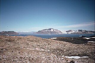
View Point is 150m long eastern tip of a promontory, on Antarctica, forming the west side of the entrance to Duse Bay on the south coast of Trinity Peninsula, on the northern portion of the Antarctic Peninsula. Situated 6.79 km east of Skomlya Hill and 6.45 km southeast of Boil Point. Discovered by a party under J. Gunnar Andersson of the Swedish Antarctic Expedition, 1901-04. So named by the Falkland Islands Dependencies Survey (FIDS) following their survey of the area in 1945 because from this promontory, good panoramic photographs were obtained.

<span class="mw-page-title-main">Victory Glacier</span> Glacier in Antarctica

Victory Glacier is a gently sloping glacier, 8 nautical miles (15 km) long, flowing east-southeast from the north end of Detroit Plateau on Trinity Peninsula to Prince Gustav Channel immediately north of Pitt Point. Bounded by Trakiya Heights to the north and Kondofrey Heights to the south. It was surveyed by the Falkland Islands Dependencies Survey (FIDS), and so named because the glacier was sighted in the week following the surrender of Japan in World War II, in August 1945.

References