Mikkelsen Bay is a bay, 27.8 kilometres (15 nmi) wide at its mouth and indenting 18.5 kilometres (10 nmi), entered between Bertrand Ice Piedmont and Cape Berteaux along the west coast of Graham Land, Antarctica. First seen from a distance in 1909 by the French Antarctic Expedition under Jean-Baptiste Charcot, but not recognized as a large bay. First surveyed in 1936 by the BGLE under Rymill, and resurveyed by the Falkland Islands Dependencies Survey in 1948–49. The name was proposed by members of BGLE for Ejnar Mikkelsen, Danish Arctic explorer and Inspector for East Greenland, 1934–50.

Northeast Glacier is a steep, heavily crevassed glacier on the west side of Hemimont Plateau, 21 km (13 mi) long and 8 km (5 mi) wide at its mouth, which flows from McLeod Hill westward and then south-westwards into Marguerite Bay between the Debenham Islands and Roman Four Promontory, on the west coast of Graham Land, Antarctica. Northeast Glacier was first surveyed in 1936 by the British Graham Land Expedition (BGLE) under John Riddoch Rymill. It was resurveyed in 1940 by members of the United States Antarctic Service (USAS), who first used the glacier as a sledging route, and so named by them because it lay on the north-eastern side of their base at Stonington Island.
Red Rock Ridge or Morro Roca Roja or Promontorio Roca Roja is a conspicuous reddish-colored ridge or promontory which rises to 690 m and projects from the west coast of Graham Land between Neny Fjord and Rymill Bay. Red Rock Ridge is located at 68°18′S67°08′W and has an elevation of 690 m. Red Rock Ridge was surveyed in 1936 by the British Graham Land Expedition (BGLE) under John Riddoch Rymill, who so named it because of its color. Further surveys in 1948 by the Falkland Islands Dependencies Survey (FIDS) have identified this ridge as the feature first sighted in 1909 and named "Île Pavie" or "Cap Pavie" by the French Antarctic Expedition under Jean-Baptiste Charcot, but the name Red Rock Ridge is now too firmly established to alter. The name Pavie Ridge has been assigned to the prominent rocky ridge at 68°34′S66°59′W.
Pavie Ridge or Cap Pavie or Île Pavie is a rocky ridge located at 68°34′S66°59′W in Antarctica which rises over 500 m. It extends south and west from Martin Glacier to Moraine Cove, and forms the southeastern limit of the Bertrand Ice Piedmont, on the west coast of Graham Land.

Millerand Island is a high rugged island 6 km (3 nmi) in diameter, lying 7 km (4 nmi) south of Cape Calmette, off the west coast of Graham Land. It was discovered by the French Antarctic Expedition (1908-1910) under Jean-Baptiste Charcot, who thought that it was a cape of the mainland and named it as such after Alexandre Millerand, French statesman.
Martin Glacier is a glacier, 3 nautical miles (6 km) wide and 9 nautical miles (17 km) long, which flows west and then northwest from the south side of Mount Lupa to the southeast corner of Rymill Bay where it joins Bertrand Ice Piedmont, on the west coast of Graham Land, Antarctica. It was first surveyed in 1936 by the British Graham Land Expedition (BGLE) under John Riddoch Rymill, and was resurveyed in 1948–1949 by the Falkland Islands Dependencies Survey. The glacier was named for James Hamilton Martin, a member of the British Australian and New Zealand Antarctic Research Expedition (1929–1931) under Sir Douglas Mawson, and first mate of the Penola during the BGLE.
Rymill Bay is a bay in Antarctica. It is 16.7 kilometres (9 nmi) wide at its mouth and indents 9.3 kilometres (5 nmi) between Red Rock Ridge and Bertrand Ice Piedmont along the west coast of Graham Land. Rymill Bay was probably first seen from a distance by the French Antarctic Expedition under Jean-Baptiste Charcot in 1909. The bay was first surveyed in 1936 by the British Graham Land Expedition (BGLE), and was resurveyed in 1948 by the Falkland Islands Dependencies Survey (FIDS). The name, proposed by members of the BGLE is for John Riddoch Rymill, Australian leader of the British Graham Land Expedition.
Bertrand Ice Piedmont is an ice piedmont about 20 kilometres (11 nmi) long and from 6 to 9 kilometres wide, lying between Rymill Bay and Mikkelsen Bay on the Fallières Coast of Graham Land.
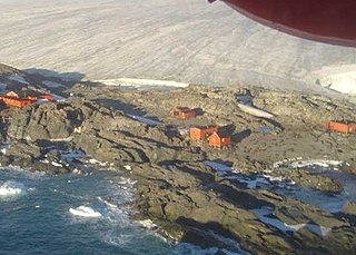
The Teniente Luis Carvajal Villaroel Antarctic Base is a seasonal Chilean Antarctic base on the south-west tip of Adelaide Island, in Graham Land off the west coast of the Antarctic Peninsula. The nearest land is the Magallanes – the station is in the Antarctic territory claimed by Chile.

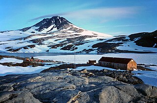
San Martín Base is a permanent, all year-round Argentine Antarctic base and scientific research station named after General José de San Martín, the Libertador of Argentina, Chile and Perú. It is located on Barry Island, Marguerite Bay, Antarctic Peninsula.
Blaiklock Island is a high and rugged, irregular-shaped island 17 kilometres (9 nmi) long, lying between Bigourdan Fjord and Bourgeois Fjord. It is separated from Pourquoi Pas Island by The Narrows and from the west coast of Graham Land by Jones Channel. The feature was partially surveyed in 1936 by the British Graham Land Expedition under Rymill, at which time it was charted as a promontory. It was determined to be an island in 1949 by Kenneth V. Blaiklock, a Falkland Islands Dependencies Survey (FIDS) surveyor for whom it is named.
Cape Jeremy is a cape marking the east side of the north entrance to George VI Sound and the west end of a line dividing Graham Land and Palmer Land, Antarctica. It was discovered by the British Graham Land expedition, 1934–37, under John Riddoch Rymill, who named it for Jeremy Scott, son of James Maurice Scott, who served as home agent for the expedition and was formerly a member of the British Arctic Air Route Expedition.
Cape Berteaux is a cape surmounted by a high rock peak between Mikkelsen Bay and Wordie Ice Shelf on the west coast of Graham Land. The French Antarctic Expedition under Charcot, 1908–1910, originally applied the name Berteaux to an island in essentially this position. The British Graham Land Expedition (BGLE) under Rymill, 1934–1937, identified the feature sighted by Charcot as the cape described above. It is named by Charcot for a Monsieur Berteaux who helped obtain funds for his expedition.
Daspit Glacier is a glacier 6 nautical miles (11 km) long, flowing east-northeast along the south side of Mount Shelby to the head of Trail Inlet, on the east coast of Graham Land, Antarctica. It was discovered by members of the East Base of the United States Antarctic Service, 1939–41, and was originally named Fleming Glacier after Rev. W.L.S. Fleming. It was photographed from the air in 1947 by the Ronne Antarctic Research Expedition under Finn Ronne, and charted in 1948 by the Falkland Islands Dependencies Survey. It was renamed by Ronne for Captain Lawrence R. Daspit, U.S. Navy, who assisted in obtaining Navy support for the Ronne expedition, the original name being transferred to Fleming Glacier on the Rymill Coast.
Bills Gulch is a glacier on the southeast side of Hemimont Plateau, the northern of two glaciers flowing east from the plateau upland into the head of Trail Inlet, on the east coast of Graham Land. This glacier was used by the sledge party under Paul H. Knowles which traversed the Antarctic Peninsula from the East Base of the United States Antarctic Service (USAS) on its way to Hilton Inlet in 1940. It was named by USAS for a lead dog that died at this point. The unlikely name has been approved because of its wide use on maps and in reports.
Hayrick Island is a small prominent rock mass, more than 150 metres (500 ft) high, between Lodge Rock and Twig Rock in the Terra Firma Islands, off the west coast of Graham Land, Antarctica. The Terra Firma Islands were first visited and surveyed in 1936 by the British Graham Land Expedition under John Rymill. Hayrick Island was surveyed in 1948 by the Falkland Islands Dependencies Survey and so named by them because, when seen from the east, its high mass has an appearance suggesting a hayrick.
Horseshoe Island is an island 12 km (6.5 nmi) long and 6 km (3 nmi) wide occupying most of the entrance to Square Bay, along the west coast of Graham Land, Antarctica. It was discovered and named by the British Graham Land Expedition under John Rymill who mapped the area by land and from the air in 1936–37. Its name is indicative of the crescentic alignment of the 600 to 900 m peaks which give a comparable shape to the island.
The Reference Islands is a group of rocky islands 2 nautical miles (3.7 km) west-northwest of the west tip of Neny Island and 1.5 nautical miles (2.8 km) southeast of Millerand Island, lying in Marguerite Bay off the west coast of Graham Land. First roughly charted in 1936 by the British Graham Land Expedition (BGLE) under Rymill. The islands were surveyed by the Falkland Islands Dependencies Survey (FIDS) in 1947, and so named by them because they served as a convenient reference point for survey work.

View Point is 150m long eastern tip of a promontory, on Antarctica, forming the west side of the entrance to Duse Bay on the south coast of Trinity Peninsula, on the northern portion of the Antarctic Peninsula. Situated 6.79 km east of Skomlya Hill and 6.45 km southeast of Boil Point. Discovered by a party under J. Gunnar Andersson of the Swedish Antarctic Expedition, 1901-04. So named by the Falkland Islands Dependencies Survey (FIDS) following their survey of the area in 1945 because from this promontory, good panoramic photographs were obtained.

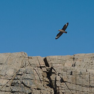
The Ryder Bay Islands Important Bird Area is a 520 ha designated site on the south-east coast of Adelaide Island, Antarctica. It has been identified as an Important Bird Area (IBA) by BirdLife International because it supports significant numbers of breeding seabirds, notably south polar skuas. The site encompasses the Léonie Islands lying at the mouth of Ryder Bay, as well as Rothera Point, the eastern headland of the bay.


