
The Nimrod Glacier is a major glacier about 135 km (85 mi) long, flowing from the polar plateau in a northerly direction through the Transantarctic Mountains into the Ross Ice Shelf, Antarctica.
Skelton Glacier is a large glacier flowing from the polar plateau into the Ross Ice Shelf at Skelton Inlet on the Hillary Coast, south of Victoria Land, Antarctica.

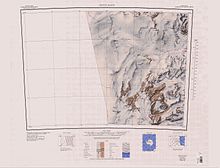
The Byrd Glacier is a major glacier in Antarctica, about 136 km (85 mi) long and 24 km (15 mi) wide. It drains an extensive area of the Antarctic plateau, and flows eastward to discharge into the Ross Ice Shelf.
The Churchill Mountains are a mountain range group of the Transantarctic Mountains System, located in the Ross Dependency region of Antarctica. They border on the western side of the Ross Ice Shelf, between Byrd Glacier and Nimrod Glacier.
The Cook Mountains is a group of mountains bounded by the Mulock and Darwin glaciers in Antarctica.

The Darwin Glacier is a large glacier in Antarctica. It flows from the polar plateau eastward between the Darwin Mountains and the Cook Mountains to the Ross Ice Shelf. The Darwin and its major tributary the Hatherton are often treated as one system, the Darwin–Hatherton.

Shackleton Glacier is a major Antarctic glacier, over 60 nautical miles long and from 5 to 10 nautical miles wide, descending from the Antarctic Plateau from the vicinity of Roberts Massif and flowing north through the Queen Maud Mountains to enter the Ross Ice Shelf between Mount Speed and Waldron Spurs. Discovered by the United States Antarctic Service (USAS) (1939–41) and named by the Advisory Committee on Antarctic Names (US-ACAN) for Sir Ernest Shackleton, British Antarctic explorer.
The Allan Hills are a group of hills, mainly ice free and about 12 nautical miles long, lying just north-west of the Coombs Hills near the heads of Mawson Glacier and Mackay Glacier in the Oates Land and Victoria Land regions of Antarctica.

Convoy Range is a broad range in Antarctica. Much of the range has a nearly flat plateau-like summit. It extends south from the Fry Saddle and ends at Mackay Glacier. The range has steep cliffs on its east side, but it slopes gently into the Cambridge Glacier on the western side. It is a peneplain, with an early Paleozoic granitic basement covered in sedimentary and igneous rocks from the Permian–Triassic to the Jurassic.
Wilson Hills is a group of scattered hills, nunataks and ridges that extend northwest–southeast about 70 nautical miles between Matusevich Glacier and Pryor Glacier in Antarctica.
The Worcester Range is a high coastal range, about 30 nautical miles long, in Antarctica. It stands between Skelton Glacier and Mulock Glacier on the western side of the Ross Ice Shelf.
The Willett Range is the range extending north from Mistake Peak and running for 20 nautical miles as a high shelf along the edge of the continental ice to the Mackay Glacier, in Victoria Land. The range is breached by several glaciers flowing east from the plateau.
Benson Glacier is a glacier about 12 nautical miles long, draining the east part of Flight Deck Névé and continuing east between Fry Glacier and Mackay Glacier into the north part of Granite Harbour where it forms a floating tongue.
Carapace Nunatak is a prominent isolated nunatak, the most westerly near the head of Mackay Glacier in Victoria Land, standing 8 nautical miles (15 km) southwest of Mount Brooke where it is visible for a considerable distance from many directions. It was so named by the New Zealand party of the Commonwealth Trans-Antarctic Expedition (1956–1958) because of the fossil carapaces of small crustaceans found in the exposed rocks.
The Darley Hills are a range of high, ice-covered coastal hills in the Churchill Mountains, Antarctica.
Fry Glacier is a glacier draining the slopes at the northeast corner of the Convoy Range and flowing along the south end of the Kirkwood Range into Tripp Bay, Victoria Land, Antarctica. It was first charted by the British Antarctic Expedition, 1907–09, and named for A.M. Fry, a contributor to the expedition.
The Kirkwood Range is a massive coastal mountain range in Antarctica, extending north–south between Fry Glacier and Mawson Glacier. A broad low-level platform on the seaward side of the range is occupied by the Oates Piedmont Glacier.
The Mawson Glacier is a large glacier on the east coast of Victoria Land, Antarctica, descending eastward from the Antarctic Plateau to the north of Trinity Nunatak and the Kirkwood Range, to enter the Ross Sea, where it forms the Nordenskjöld Ice Tongue. The glacier was first mapped by the British Antarctic Expedition (1907–09) and named for Douglas Mawson, the expedition physicist, who later led two other Antarctic expeditions, 1911–14, and 1929–31.

Mackay Glacier is a large glacier in Victoria Land, descending eastward from the Antarctic Plateau, between the Convoy Range and Clare Range, into the southern part of Granite Harbour. It was discovered by the South magnetic pole party of the British Antarctic Expedition, 1907–09, and named for Alistair Mackay, a member of the party. The glacier's tongue is called Mackay Glacier Tongue. First mapped by the British Antarctic Expedition, 1910–13 and named for Alistair F. Mackay, a member of the party. Its mouth is south of the Evans Piedmont Glacier and the Mawson Glacier. It is north of the Wilson Piedmont Glacier and the Ferrar Glacier.
Starshot Glacier is a glacier 50 nautical miles (90 km) long that flows through the Churchill Mountains to enter the Ross Ice Shelf in Antarctica.
