Schematic of the plate theory. Mid-blue: lithosphere; light-blue/green: inhomogeneous upper mantle; yellow: lower mantle; orange/red: core-mantle boundary. Lithospheric extension enables pre-existing melt (red) to rise.
The plate theory is a model of volcanism that attributes all volcanic activity on Earth, even that which appears superficially to be anomalous, to the operation of plate tectonics. According to the plate theory, the principal cause of volcanism is extension of the lithosphere. Extension of the lithosphere is a function of the lithospheric stress field. The global distribution of volcanic activity at a given time reflects the contemporaneous lithospheric stress field, and changes in the spatial and temporal distribution of volcanoes reflect changes in the stress field. The main factors governing the evolution of the stress field are:
Lithospheric extension enables pre-existing melt in the crust and mantle to escape to the surface. If extension is severe and thins the lithosphere to the extent that the asthenosphere rises, then additional melt is produced by decompression upwelling.
Origins of the plate theory
Developed during the late 1960s and 1970s, plate tectonics provided an elegant explanation for most of the Earth's volcanic activity. At spreading boundaries where plates move apart, the asthenosphere decompresses and melts to form new oceanic crust. At subduction zones, slabs of oceanic crust sink into the mantle, dehydrate, and release volatiles which lower the melting temperature and give rise to volcanic arcs and back-arc extensions. Several volcanic provinces, however, do not fit this simple picture and have traditionally been considered exceptional cases which require a non-plate-tectonic explanation.
Just prior to the development of plate tectonics in the early 1960s, the Canadian GeophysicistJohn Tuzo Wilson suggested that chains of volcanic islands form from movement of the seafloor over relatively stationary hotspots in stable centres of mantle convection cells.[2] In the early 1970s, Wilson's idea was revived by the American geophysicist W. Jason Morgan. In order to account for the long-lived supply of magma that some volcanic regions seemed to require, Morgan modified the hypothesis, shifting the source to a thermal boundary layer. Because of the perceived fixity of some volcanic sources relative to the plates, he proposed that this thermal boundary was deeper than the convecting upper mantle on which the plates ride and located it at the core-mantle boundary, 3,000km beneath the surface. He suggested that narrow convection currents rise from fixed points at this thermal boundary and form conduits which transport abnormally hot material to the surface.[3][4]
This, the mantle plume theory, became the dominant explanation for apparent volcanic anomalies for the remainder of the 20th century.[5][6] Testing the hypothesis, however, is beset with difficulties. A central tenet of the plume theory is that the source of melt is significantly hotter than the surrounding mantle, so the most direct test is to measure the source temperature of magmas. This is difficult as the petrogenesis of magmas is extremely complex, rendering inferences from petrology or geochemistry to source temperatures unreliable.[7]Seismic data used to provide additional constraints on source temperatures are highly ambiguous.[8] In addition to this, several predictions of the plume theory have proved unsuccessful at many locations purported to be underlain by mantle plumes,[9][7] and there are also significant theoretical reasons to doubt the hypothesis.[10][11]
The foregoing issues have inspired a growing number of geoscientists, led by American geophysicist Don L. Anderson and British geophysicist Gillian R. Foulger, to pursue other explanations for volcanic activity not easily accounted for by plate tectonics. Rather than introducing another extraneous theory, these explanations essentially expand the scope of plate tectonics in ways that can accommodate volcanic activity previously thought to be outside its remit. The key modification to the basic plate-tectonic model here is a relaxation of the assumption that plates are rigid. This implies that lithospheric extension occurs not only at spreading plate boundaries but throughout plate interiors, a phenomenon that is well supported both theoretically and empirically.[12][13]
Over the last two decades, the plate theory has developed into a cohesive research programme, attracting many adherents, and occupying researchers in several subdisciplines of Earth science. It has also been the focus of several international conferences and many peer-reviewed papers and is the subject of two major Geological Society of America edited volumes[14][15] and a textbook.[7]
Lithospheric extension
Digital terrain map of the Basin Range province of the Western USA, showing the fabric of the normal-fault-controlled, heavily extended continental crust.
Global-scale lithospheric extension is a necessary consequence of the non-closure of plate motion circuits and is equivalent to an additional slow-spreading boundary. Extension results principally from the following three processes.
Changes in the configuration of plate boundaries. These can result from various processes including the formation or annihilation of plates and boundaries and slab rollback (vertical sinking of subducting slabs causing oceanward migration of trenches).
Continental breakup begins with rifting. When extension is persistent and entirely compensated by magma from asthenospheric upwelling, oceanic crust is formed, and the rift becomes a spreading plate boundary. If extension is isolated and ephemeral it is classified as intraplate. Rifting can occur in both oceanic and continental crust and ranges from minor to amounts approaching those seen at spreading boundaries. All can give rise to magmatism.[20]
Various extensional styles are seen in the northeast Atlantic. Continental rifting began in the late Paleozoic and was followed by catastrophic destabilisation in the late Cretaceous and early Paleocene. The latter was possibly caused by rollback of the Alpine slab, which generated extension throughout Europe. More severe rifting occurred along the Caledonian Suture, a zone of pre-existing weakness where the Iapetus Ocean closed around 420 Ma. As extension became localised, oceanic crust began to form around 54 Ma, with diffuse extension persisting around Iceland.[21]
Some intracontinental rifts are essentially failed continental breakup axes, and some of these form triple junctions with plate boundaries. The East African Rift, for example, forms a triple junction with the Red Sea and the Gulf of Aden, both of which have progressed to the seafloor spreading stage. Likewise, the Mid-American Rift constitutes two arms of a triple junction along with a third which separated the Amazonian Craton from Laurentia around 1.1 Ga.[22]
Diverse volcanic activity resulting from lithospheric extension has occurred throughout the western United States. The Cascade Volcanoes are a back-arc volcanic chain extending from British Columbia to Northern California. Back-arc extension continues to the east in the Basin and Range Province, with small-scale volcanism distributed throughout the region.
The volume of magma that is intruded and/or erupted in a given area of lithospheric extension depends on two variables: (1) the availability of pre-existing melt in the crust and mantle; and (2) the amount of additional melt supplied by decompression upwelling. The latter depends on three factors: (a) lithospheric thickness; (b) the amount of extension; and (c) fusibility and temperature of the source.
There is abundant pre-existing melt throughout both the crust and the mantle. In the crust, melt is stored under active volcanoes in shallow reservoirs which are fed by deeper ones. In the asthenosphere, a small amount of partial melt is thought to provide a weak layer that acts as lubrication for the movement of tectonic plates. The presence of pre-existing melt means that magmatism can occur even in areas where lithospheric extension is modest such as the Cameroon and Pitcairn-Gambier volcanic lines.[20]
The rate of magma formation from decompression of the asthenosphere depends on how high the asthenosphere can rise, which in turn depends on the thickness of the lithosphere. From numerical modelling it is evident that the formation of melt in the largest flood basalts cannot be concurrent with its emplacement.[24] This means that melt is formed over a longer period, stored in reservoirs – most likely located at the lithosphere-asthenosphere boundary – and released by lithospheric extension. That large volumes of magma are stored at the base of the lithosphere is evinced in observations of large magmatic provinces such as the Great Dyke in Zimbabwe and the Bushveld Igneous Complex in South Africa. There, thick lithosphere remained intact during large-volume magmatism, so decompression upwelling on the scale required can be ruled out, implying that large volumes of magma must have pre-existed.[25]
If extension is severe and results in significant thinning of the lithosphere, the asthenosphere can rise to shallow depths, inducing decompression melting and producing larger volumes of melt. At mid-ocean ridges, where the lithosphere is thin, decompression upwelling produces a modest rate of magmatism. The same process can also produce small-volume magmatism on or near slowly extending continental rifts. Beneath continents, the lithosphere is up to 200km thick. If lithosphere this thick undergoes severe and persistent extension, it can rupture, and the asthenosphere can upwell to the surface, producing tens of millions of cubic kilometres of melt along axes hundreds of kilometres long. This occurred, for example, during the opening of the North Atlantic Ocean when the asthenosphere rose from base of the Pangaean lithosphere to the surface.[20]
Examples
The vast majority of volcanic provinces which are thought to be anomalous in the context of rigid plate tectonics have now been explained using the plate theory.[15][14] The type examples of this kind of volcanic activity are Iceland, Yellowstone, and Hawaii. Iceland is the type example of a volcanic anomaly situated on a plate boundary. Yellowstone, together with the Eastern Snake River Plain to its west, is the type example of an intra-continental volcanic anomaly. Hawaii, along with the related Hawaiian-Emperor seamount chain, is the type example of an intra-oceanic volcanic anomaly.[7]
Iceland
Regional map of the North East Atlantic. Bathymetry shown in colour; land topography in grey. RR: Reykjanes Ridge; KR: Kolbeinsey Ridge; JMMC: Jan Mayen Microcontinent; AR: Aegir Ridge; FI: Faroe Islands. Red lines: boundaries of the Caledonian orogen and associated thrusts, dashed where extrapolated into younger Atlantic Ocean.
Iceland is a 1km high, 450x300 km basaltic shield on the mid-ocean ridge in the northeast Atlantic Ocean. It comprises over 100 active or extinct volcanoes and has been extensively studied by Earth scientists for several decades.
Iceland must be understood in the context of the broader structure and tectonic history of the northeast Atlantic. The northeast Atlantic formed in the early Cenozoic when, after an extensive period of rifting, Greenland separated from Eurasia as Pangaea began to break up. To the north of Iceland's present location, the breakup axis propagated south along the Caledonian Suture. To the south, the breakup axis propagated north. The two axes were separated by around 100km from east to west and 300km from north to south. When the two axes developed to full seafloor spreading, the 100x300 km continental region between the two rifts formed the Iceland microcontinent which underwent diffuse extension and shear along several north-oriented rift axes, and basaltic lavas were emplaced in and on the stretched continental crust. This style of extension persists across parallel rift zones which frequently become extinct and are replaced with new ones.[17]
This model explains several distinct characteristics of the region:
Persistence of a subaerial land-bridge from Greenland to the Faroe Islands which was broken up when the northeast Atlantic was around 1,000km wide, older parts of which now form a shallow submarine ridge.
The instability and decoupling of spreading ridges to the north and south. To the north, the Aegir Ridge became extinct around 31-28 Ma and extension transferred to the Kolbeinsey Ridge around 400km to the west. In the Reykjanes Ridge to the south, after around 16 million years of spreading perpendicular to the ridge strike, the direction of extension changed, and the ridge became a ridge-transform system which later migrated eastward.
Properties of the crust beneath the Greenland-Iceland-Faroe Ridge. Here the crust is mostly 30–40km thick. Its combination of low seismic wave speed and high density defy classification as thick oceanic crust and indicate instead that it is magma-inflated continental crust. This suggests that Iceland is the result of persistent extension of continental crust which was structurally resistant to continued propagation of the new oceanic ridges. As a result, continental extension continued for an exceptionally long period and has not yet given way to true ocean spreading. Melt production is similar to the adjacent mid-ocean ridges which produces oceanic crust around 10km thick, though under Iceland, rather than forming oceanic crust, melt is emplaced into and on top of stretched continental crust.
Iceland's unusual petrology and geochemistry, which is around 10% silicic and intermediate, with geochemistry similar to such flood basalts as Karoo and Deccan which have undergone silicic assimilation of, or contamination by, continental crust.[17]
Yellowstone
Geological map of northwest USA showing Basin and Range faults and basalts and rhyolites <17 Ma. Blue lines represent approximate age contours of silicic volcanic centres across the Eastern Snake River Plain and a contemporaneous trend of oppositely propagating silicic volcanism across central Oregon.
Yellowstone and the Eastern Snake River Plain to the west comprise a belt of large, silicic caldera volcanoes that get progressively younger to the east, culminating in the currently active Yellowstone Caldera in northwest Wyoming. The belt, however, is covered with basaltic lavas that display no time progression. Being located on a continental interior, it has been studied extensively, though research has consisted largely of seismology and geochemistry aimed at locating sources deep in the mantle. These methods are not suitable for developing a plate theory, which holds that volcanism is associated with processes at shallow depths.
As with Iceland, volcanism in the Yellowstone-Eastern Snake River Plain region must be understood in its broader tectonic context. The tectonic history of the western United States is heavily influenced by the subduction of the East Pacific Rise under the North American Plate beginning around 17 Ma. A change in the plate boundary from subduction to shear induced extension across the western United States. This brought about widespread volcanism, commencing with the Columbia River Basalt Group which erupted through a 250-km-long zone of dikes that broadened the crust by several kilometres. The Basin and Range province then formed via normal faulting, producing scattered volcanism with especially abundant eruptions in three east–west zones: the Yellowstone-Eastern Snake River Plain, Valles, and St. George volcanic zones. Compared with the others, the Yellowstone-Eastern Snake River Plain zone is considered unusual because of its time-progressive silicic volcano chain and striking geothermal features.
The volcanoes’ silicic composition indicates a lower crustal source. If volcanism resulted from lithospheric extension, then extension along the Yellowstone-Eastern Snake River Plain zone must have migrated from west to east during the last 17 million years.[27] There is evidence that this is the case. Accelerated motion on nearby normal faults, which indicates extension in the Basin and Range province, migrates east coincidentally with migration of the silicic volcanism. This is corroborated by measurements of recent deformation from GPS surveying, which finds the most intense zones of extension in the Basin and Range province in the far east and far west and little extension in the central 500km.[28] The Yellowstone-Eastern Snake River Plain zone, therefore, likely reflects a locus of extension that has migrated from west to east.[27] This is further supported by analogous extension-driven silicic magmatism elsewhere in the Western United States, for example in the Coso Hot Springs[29] and Long Valley Caldera[30] in California.
That persistent basaltic volcanism results from simultaneous extension along the entire length of the Yellowstone-Eastern Snake River Plain zone is evident in GPS measurements recorded between 1987 and 2003, which record extension to both the north and south of the zone.[31] Evidence of historic extension can be found in northwest-oriented dike-fed rift zones responsible for basalt flows.[32] Analogy with similar volcanic activity in Iceland and on mid-ocean ridges indicates that periods of extension are brief and thus that basaltic volcanism along the Yellowstone-Eastern Snake River Plain zone occurs in short bursts of activity in between long inactive periods.[26]
Hawaii
The Hawaii-Emperor volcanic system is notoriously difficult to study. It is thousands of kilometres from any major continental landmass and surrounded by deep ocean, very little of it is above sea level, and it is covered in thick basalt which obscures its deeper structure. It is situated within the Cretaceous Magnetic Quiet Zone, a relatively long period of normal polarity in the Earth's magnetic field, so age variations in the lithosphere are difficult to determine with accuracy. Reconstructing the tectonic history of the Pacific Ocean more generally is problematic because earlier plates and plate boundaries, including the spreading ridge where the Emperor chain began, have been subducted. Because of these issues, geoscientists have yet to produce a fully developed theory of the system's origins which can be positively tested.
Observations that must be accounted for by any such theory include:
Hawaii's position in almost the exact geometric centre of the Pacific Plate, that is, at the middle point of a line dividing the western Pacific which is surrounded mainly by subduction zones and the eastern Pacific which is surrounded mainly by spreading ridges.
The increasing volume of melt. Over the last 50 million years, the rate of melt production has increased from a mere 0.001km3 per year to 0.25km3 per year, a factor of around 250. The current rate of magmatism responsible for the formation of the Big Island has been in operation for only 2 million years.
Non-movement of the volcanic centre relative to both the geomagnetic pole and geometry of the Pacific Plate for around 50 million years.
Continuity of the Hawaiian chain with the Emperor chain via a 60° “bend”. The latter formed over a 30-million-year period during which the volcanic centre migrated south-southeast. Migration ceased at the beginning of the Hawaiian chain. The 60° bend cannot be accounted for by a change in plate direction because no such change occurred.[33][34]
The lack of any regional heatflow anomaly detected around the extinct islands and seamounts indicates that the volcanoes are local thermal features.[35] According to the plate theory, the Hawaiian-Emperor system formed at a region of extension in the Pacific Plate. Extension in the plate is a consequence of deformation at plate boundaries, thermal contraction, and isostatic adjustment. Extension originated at a spreading ridge around 80 Ma. The plate's stress field evolved over the next 30 million years, causing the region of extension and consequent volcanism to migrate south-southeast. Around 50 Ma, the stress field stabilised and the region of extension became almost stationary. At the same time, the north-westerly motion of the Pacific Plate increased, and over the next 50 million years, the Hawaiian chain formed as the plate moved across a near-stationary region of extension.[20]
The increasing rate of volcanic activity in the Hawaiian-Emperor system reflects the availability of melt in the crust and mantle. The oldest volcanoes in the Emperor chain formed on young, and therefore thin, oceanic lithosphere. The size of the seamounts increases with the age of the seafloor, indicating that the availability of melt increases with the thickness of the lithosphere. This suggests that decompression melting may contribute, as this, too, is expected to increase with lithospheric thickness. The significant increase in magmatism during the last 2 million years indicates a major increase in melt availability, implying that either a larger reservoir of pre-existing melt or an exceptionally fusible source region has become available. Petrological and geochemical evidence suggests that this source may be old metamorphosed oceanic crust in the asthenosphere, highly fusible material which would produce far greater magma volumes than mantle rocks.[36][37]
Advantages of the plate theory
Representatives of this theory see as the major virtue of the plate theory is that it extends plate tectonics into a unifying account of the Earth's volcanism which dispenses with the need to invoke extraneous hypotheses designed to accommodate instances of volcanic activity which appear superficially to be exceptional.[1][38][12][13][20]
Related Research Articles
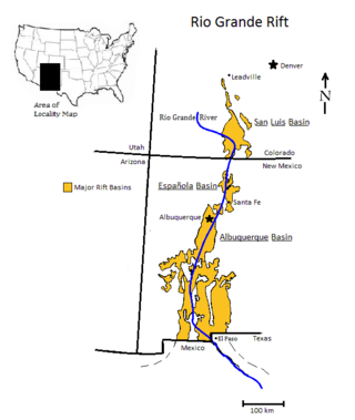
The Rio Grande rift is a north-trending continental rift zone. It separates the Colorado Plateau in the west from the interior of the North American craton on the east. The rift extends from central Colorado in the north to the state of Chihuahua, Mexico, in the south. The rift zone consists of four basins that have an average width of 50 kilometres (31 mi). The rift can be observed on location at Rio Grande National Forest, White Sands National Park, Santa Fe National Forest, and Cibola National Forest, among other locations.
A convergent boundary is an area on Earth where two or more lithospheric plates collide. One plate eventually slides beneath the other, a process known as subduction. The subduction zone can be defined by a plane where many earthquakes occur, called the Wadati–Benioff zone. These collisions happen on scales of millions to tens of millions of years and can lead to volcanism, earthquakes, orogenesis, destruction of lithosphere, and deformation. Convergent boundaries occur between oceanic-oceanic lithosphere, oceanic-continental lithosphere, and continental-continental lithosphere. The geologic features related to convergent boundaries vary depending on crust types.
A mantle plume is a proposed mechanism of convection within the Earth's mantle, hypothesized to explain anomalous volcanism. Because the plume head partially melts on reaching shallow depths, a plume is often invoked as the cause of volcanic hotspots, such as Hawaii or Iceland, and large igneous provinces such as the Deccan and Siberian Traps. Some such volcanic regions lie far from tectonic plate boundaries, while others represent unusually large-volume volcanism near plate boundaries.
In geology, a rift is a linear zone where the lithosphere is being pulled apart and is an example of extensional tectonics. Typical rift features are a central linear downfaulted depression, called a graben, or more commonly a half-graben with normal faulting and rift-flank uplifts mainly on one side. Where rifts remain above sea level they form a rift valley, which may be filled by water forming a rift lake. The axis of the rift area may contain volcanic rocks, and active volcanism is a part of many, but not all, active rift systems.
A craton is an old and stable part of the continental lithosphere, which consists of Earth's two topmost layers, the crust and the uppermost mantle. Having often survived cycles of merging and rifting of continents, cratons are generally found in the interiors of tectonic plates; the exceptions occur where geologically recent rifting events have separated cratons and created passive margins along their edges. Cratons are characteristically composed of ancient crystalline basement rock, which may be covered by younger sedimentary rock. They have a thick crust and deep lithospheric roots that extend as much as several hundred kilometres into Earth's mantle.
A large igneous province (LIP) is an extremely large accumulation of igneous rocks, including intrusive and extrusive, arising when magma travels through the crust towards the surface. The formation of LIPs is variously attributed to mantle plumes or to processes associated with divergent plate tectonics. The formation of some of the LIPs in the past 500 million years coincide in time with mass extinctions and rapid climatic changes, which has led to numerous hypotheses about causal relationships. LIPs are fundamentally different from any other currently active volcanoes or volcanic systems.
The Iceland hotspot is a hotspot which is partly responsible for the high volcanic activity which has formed the Iceland Plateau and the island of Iceland. It contributes to understanding the geological deformation of Iceland.
A passive margin is the transition between oceanic and continental lithosphere that is not an active plate margin. A passive margin forms by sedimentation above an ancient rift, now marked by transitional lithosphere. Continental rifting forms new ocean basins. Eventually the continental rift forms a mid-ocean ridge and the locus of extension moves away from the continent-ocean boundary. The transition between the continental and oceanic lithosphere that was originally formed by rifting is known as a passive margin.
Magmatism is the emplacement of magma within and at the surface of the outer layers of a terrestrial planet, which solidifies as igneous rocks. It does so through magmatic activity or igneous activity, the production, intrusion and extrusion of magma or lava. Volcanism is the surface expression of magmatism.
The East Australia hotspot is a volcanic province in southeast Australia which includes the Peak Range in central Queensland, the Main Range on the Queensland-New South Wales border, Tweed Volcano in New South Wales, and the Newer Volcanics Province (NVP) in Victoria and South Australia. A number of the volcanoes in the province have erupted since Aboriginal settlement. The most recent eruptions were about 5,600 years ago, and memories of them survive in Aboriginal folklore. These eruptions formed the volcanoes Mount Schank and Mount Gambier in the NVP. There have been no eruptions on the Australian mainland since European settlement.
A volcanic belt is a large volcanically active region. Other terms are used for smaller areas of activity, such as volcanic fields or volcanic systems. Volcanic belts are found above zones of unusually high temperature where magma is created by partial melting of solid material in the Earth's crust and upper mantle. These areas usually form along tectonic plate boundaries at depths of 10 to 50 kilometres. For example, volcanoes in Mexico and western North America are mostly in volcanic belts, such as the Trans-Mexican Volcanic Belt that extends 900 kilometres (560 mi) from west to east across central-southern Mexico and the Northern Cordilleran Volcanic Province in western Canada. In the case of Iceland, the geologist G.G. Bárdarson in 1929 identified clusters of volcanic belts while studying the Reykjanes Peninsula.
In geodynamics, delamination refers to the loss and sinking (foundering) of the portion of the lowermost lithosphere from the tectonic plate to which it was attached.
The Marquesas hotspot is a volcanic hotspot in the southern Pacific Ocean. It is responsible for the creation of the Marquesas Islands – a group of eight main islands and several smaller ones – and a few seamounts. The islands and seamounts formed between 5.5 and 0.4 million years ago and constitute the northernmost volcanic chain in French Polynesia.
Non-volcanic passive margins (NVPM) constitute one end member of the transitional crustal types that lie beneath passive continental margins; the other end member being volcanic passive margins (VPM). Transitional crust welds continental crust to oceanic crust along the lines of continental break-up. Both VPM and NVPM form during rifting, when a continent rifts to form a new ocean basin. NVPM are different from VPM because of a lack of volcanism. Instead of intrusive magmatic structures, the transitional crust is composed of stretched continental crust and exhumed upper mantle. NVPM are typically submerged and buried beneath thick sediments, so they must be studied using geophysical techniques or drilling. NVPM have diagnostic seismic, gravity, and magnetic characteristics that can be used to distinguish them from VPM and for demarcating the transition between continental and oceanic crust.
Volcanic passive margins (VPM) and non-volcanic passive margins are the two forms of transitional crust that lie beneath passive continental margins that occur on Earth as the result of the formation of ocean basins via continental rifting. Initiation of igneous processes associated with volcanic passive margins occurs before and/or during the rifting process depending on the cause of rifting. There are two accepted models for VPM formation: hotspots/mantle plumes and slab pull. Both result in large, quick lava flows over a relatively short period of geologic time. VPM's progress further as cooling and subsidence begins as the margins give way to formation of normal oceanic crust from the widening rifts.
Bimodal volcanism is the eruption of both mafic and felsic lavas from a single volcanic centre with little or no lavas of intermediate composition. This type of volcanism is normally associated with areas of extensional tectonics, particularly rifts.
The Society hotspot is a volcanic hotspot in the south Pacific Ocean which is responsible for the formation of the Society Islands, an archipelago of fourteen volcanic islands and atolls spanning around 720 kilometres (450 mi) of the ocean which formed between 4.5 and <1 Ma.
The Erebus hotspot is a volcanic hotspot responsible for the high volcanic activity on Ross Island in the western Ross Sea of Antarctica. Its current eruptive zone, Mount Erebus, has erupted continuously since its discovery in 1841. Magmas of the Erebus hotspot are similar to those erupted from hotspots at the active East African Rift in eastern Africa. Mount Bird at the northernmost end of Ross Island and Mount Terror at its eastern end are large basaltic shield volcanoes that have been potassium-argon dated 3.8–4.8 and 0.8–1.8 million years old.
The opening of the North Atlantic Ocean is a geological event that has occurred over millions of years, during which the supercontinent Pangea broke up. As modern-day Europe and North America separated during the final breakup of Pangea in the early Cenozoic Era, they formed the North Atlantic Ocean. Geologists believe the breakup occurred either due to primary processes of the Iceland plume or secondary processes of lithospheric extension from plate tectonics.
Intraplate volcanism is volcanism that takes place away from the margins of tectonic plates. Most volcanic activity takes place on plate margins, and there is broad consensus among geologists that this activity is explained well by the theory of plate tectonics. However, the origins of volcanic activity within plates remains controversial.
↑ Anderson, D.L.; Natland, J.H. (2005). "A brief history of the plume hypothesis and its competitors: Concept and controversy". In Foulger, G.R.; Natland, J.H.; Presnall, D.C.; Anderson, D.L. (eds.). Plates, plumes, and paradigms: Geological Society of America Special Paper 388. Geological Society of America. pp.119–145. doi:10.1130/0-8137-2388-4.119. ISBN9780813723884.
↑ Glen, W. (2005). "The origins and early trajectory of the mantle plume quasi-paradigm". In Foulger, G.R.; Natland, J.H.; Presnall, D.C.; Anderson, D.L. (eds.). Plates, plumes, and paradigms: Geological Society of America Special Paper 388. Geological Society of America. pp.91–117. doi:10.1130/0-8137-2388-4.91. ISBN9780813723884.
1 2 3 4 Foulger, G.R. (2010). Plates vs. plumes: A geological controversy. Oxford: Wiley-Blackwell. ISBN978-1-4443-3679-5.
↑ Anderson, D.L. (2005). "Scoring hotspots: The plume and plate paradigms". In Foulger, G.R.; Natland, J.H.; Presnall, D.C.; Anderson, D.L. (eds.). Plates, plumes, and paradigms: Geological Society of America Special Paper 388. Geological Society of America. pp.31–54. doi:10.1130/0-8137-2388-4.31. ISBN9780813723884.
1 2 Foulger, G.R. (2007). "The 'plate' model for the genesis of melting anomalies". In Foulger, G.R.; Jurdy, D.M. (eds.). Plates, plumes, and planetary processes: Geological Society of America Special Paper 430. The Geological Society of America. pp.1–28. ISBN978-0-8137-2430-0.
1 2 Foulger, G.R.; Natland, J.H.; Presnall, D.C.; Anderson, D.L., eds. (2005). Plates, plumes, and paradigms: Geological Society of America Special Paper 388. Geological Society of America. ISBN978-0-8137-2388-4.
1 2 Foulger, G.R.; Jurdy, D.M., eds. (2007). Plates, plumes, and planetary processes: Geological Society of America Special Paper 430. The Geological Society of America. ISBN978-0-8137-2430-0.
↑ Kuntz, M.A.; Covington, H.R.; Schorr, L.J. (1992). "An overview of basaltic volcanism of the Eastern Snake River Plain, Idaho". In Link, P.K.; Kuntz, M.A.; Piatt, L.B. (eds.). Regional Geology of Eastern Idaho and Western Wyoming. Geological Society of America. pp.227–268. doi:10.1130/MEM179-p227. ISBN978-0-8137-1179-9.
↑ DeLaughter, J.E.; Stein, C.A.; Stein, S. (2005). "Hotspots: A view from the swells". In Foulger, G.R.; Natland, J.H.; Presnall, D.C.; Anderson, D.L. (eds.). Plates, plumes, and paradigms: Geological Society of America Special Paper 388. Geological Society of America. pp.257–278. doi:10.1130/0-8137-2388-4.257. ISBN978-0-8137-2388-4.
↑ Stuart, W.D.; Foulger, G.R.; Barall, M. (2007). "Propagation of the Hawaiian-Emperor volcano chain by Pacific plate cooling stress". In Foulger, G.R.; Jurdy, D.M. (eds.). Plates, plumes, and planetary processes: Geological Society of America Special Paper 430. Geological Society of America. pp.497–506. doi:10.1130/2007.2430(24). ISBN978-0-8137-2430-0.
↑ Norton, I.O. (2007). "Speculations on Cretaceous tectonic history of the northwest Pacific and a tectonic origin for the Hawaii hotspot". In Foulger, G.R.; Jurdy, D.M. (eds.). Plates, plumes, and planetary processes: Geological Society of America Special Paper 430. Vol.430. Geological Society of America. pp.451–470. doi:10.1130/2007.2430(22). ISBN978-0-8137-2430-0.
Foulger, G.R. (2007). "The 'plate' model for the genesis of melting anomalies". In Foulger, G.R.; Jurdy, D.M. (eds.). Plates, plumes, and planetary processes: Geological Society of America Special Paper 430. The Geological Society of America. pp.1–28. ISBN978-0-8137-2430-0.
Foulger, G.R. (2010). Plates vs. plumes: A geological controversy. Oxford: Wiley-Blackwell. ISBN978-1-4443-3679-5.
Ivanov, A. (2007). "Evaluation of different models for the origin of the Siberian traps". In Foulger, G., G.R.; Jurdy, D.M. (eds.). Plates, plumes, and planetary processes: Geological Society of America Special Paper 430. Vol.430. Geological Society of America. pp.669–692. doi:10.1130/2007.2430(31). ISBN978-0-8137-2430-0.
Natland, J.H.; Winterer, E.L. (2005). "Fissure control on volcanic action in the Pacific". In Foulger, G.R.; Natland, J.H.; Presnall, D.C.; Anderson, D.L. (eds.). Plates, plumes, and paradigms: Geological Society of America Special Paper 388. Geological Society of America. pp.687–710. doi:10.1130/0-8137-2388-4.687. ISBN978-0-8137-2388-4.
Vogt, P.R.; Jung, W-Y. (2007). "Origin of the Bermuda volcanoes and Bermuda Rise: History, observations, models, and puzzles". In Foulger, G., G.R.; Jurdy, D.M. (eds.). Plates, plumes, and planetary processes: Geological Society of America Special Paper 430. Geological Society of America. pp.553–592. doi:10.1130/2007.2430(27). ISBN978-0-8137-2430-0.
This page is based on this Wikipedia article Text is available under the CC BY-SA 4.0 license; additional terms may apply. Images, videos and audio are available under their respective licenses.