Mahabaleshwar is a small town and a municipal council in Satara district, Maharashtra, India. It is a place of pilgrimage for Hindus because the Krishna River has its origin here. The British colonial rulers developed the town as a hill station, and it served as the summer capital of the Bombay Presidency during the British Raj.

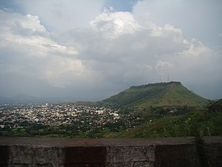
Lonavala-Khandala is a hill station and a Municipal Council in the Pune district, Maharashtra, India. It is about 64 km west of Pune and 96 km to the east of Mumbai. It is known for its production of the hard candy chikki and is also a major stop on the railway line connecting Mumbai and Pune. From the Pune suburbs, local trains are available from Pune Junction. The Mumbai-Pune Expressway and the Mumbai-Bengaluru highway both pass through Lonavala.
Satara is a city located in the Satara District of Maharashtra state of India, near the confluence of the river Krishna and its tributary, the Venna. The city was established in the 16th century and was the seat of the Chhatrapati of the Maratha Kingdom, Shahu I.

Alibag, also known as Alibaug, is a coastal city and a municipal council in Raigad district of Maharashtra, India. It is the headquarters of the Raigad district and is south of the city of Mumbai. Alibag is part of the Mumbai Metropolitan Region and is situated at a distance of about 96 km from Mumbai and 143 km from Pune. Alibag is a holy place for Goddess Shree Padmakshi Renuka. She is also known as goddess of Konkan.

Roha is a town and taluka in the Raigad district of the Maharashtra state of India. It is located 120 km southeast of Mumbai. It is the starting point of Konkan railways and end point of central railways (Mumbai). Many chemical industries have opened up their manufacturing bases in Roha. Roha is located between the banks of the Kundalika River and the hills of Kalasgiri. It has a population of over 20,849. Roha is connected to Mumbai by Panvel-Roha railway line. Roha is also the northern end of the Konkan Railway. Roha is off of the Mumbai Goa Highway, via the Kolad road.
Panvel is a city and taluka in Raigad district of Maharashtra, India. It is highly populated due to its closeness to Mumbai. Panvel is also governed for development purpose by the body of Mumbai Metropolitan Region. Panvel Municipal Corporation is the first Municipal Corporation in Raigad and the 27th Municipal corporation of Maharashtra State.

Pratapgad is a mountain fort located in Satara district, in the Western Indian state of Maharashtra. The fort is situated 24 kilometres from the Mahabaleshwar hill station. The fort is now a popular tourist destination.

Wai is a town in Satara district of Maharashtra state in India. Located on the Krishna River, Wai was a prominent town during the Peshwa era. Two important Marathi Brahmin from ruling families had their origins here: Rani Lakshmibai of Jhansi and Gopikabai, wife of Nanasaheb Peshwa.
Raigad district, previously Colaba district, is a district in the Konkan division of Maharashtra, India. The headquarters of the district is Alibag. Other major cities in the district are Panvel, Karjat, Navi Mumbai, Khopoli, Shrivardhan and Mahad.

Mahad ( [məɦaːɖ]) is a city in Raigad district situated in the North Konkan region of Maharashtra state, India. It is located 108.5 km (67.4 mi) from District Headquarters Alibag, and 167 km (104 mi) from Mumbai. Mahad is known for Raigad Fort, the capital of the Maratha Empire in Shivaji Maharaj's era and the revolutionary Mahad Satyagraha launched by at Chavdar Tale in the wake of modern India.

Chiplun ( [t͡ʃipɭuːɳ]) is a city in Ratnagiri district in the state of Maharashtra, India. It is one of the financial and commercial Hubs of Ratnagiri district, and the headquarters of Chiplun taluka. It is about 250 km south of Mumbai and 90 km North of Ratnagiri in the Konkan region of Maharashtra, on the Mumbai–Goa highway (NH-66). It has a long history and a strong cultural background. Recent decades have seen much industrial development in it and its and surrounding areas.
Nagothane is a census town in Roha Taluka, in the Raigad district of the Indian state of Maharashtra. The Kanyakumari-Panvel National Highway, famously known as Mumbai-Goa Highway (NH66) goes through this town.

Shrivardhan is a taluka, city, and local governing body in the Raigad district of the Indian state of Maharashtra. It is renowned as the birthplace of Balaji Vishwanath, the first Peshwa (1713–1720) and father of Bajirao I, who held the position of Deshmukh in the town. It has developed into a seaside resort, along with the nearby town of Harihareshwar, which also has a Shiva temple. Located on a peninsula, the town itself boasts many beaches, in addition to proximity to numerous other beach destinations such as Diveagar Beach and Kondivali Beach. People from across Maharashtra come to Shrivardhan and the nearby beaches all year round.
Devale is a small village located in Poladpur Tehsil, in Raigad district, Maharashtra, India.
Poladpur-Naneghol is a small village in Raigad District, Maharashtra, India.

Savitri River is one of the five rivers which originate from Mahabaleshwar in Maharashtra state in India. It originates at Savitri point near Mahabaleshwar and flows through the bankot village and directly goes to Arabian sea Raigad district and eventually meets Arabian Sea at Harehareshwar. It passes through rocky and hilly terrain of western ghats till Poladpur and further through the towns of Mahad, Mangaon and Shrivardhan Tehsil (taluka). There are a number of Shiva temples along the banks of river Savitri. Many other small rivers get merged into it at Kapade, Poladpur and Birwadi. Its major tributary is the Kal River which enters from the right (north) near Dasgaon.

Dhom Dam is an earthfill and gravity dam on Krishna River near Wai in state of Maharashtra in India.

Ambenali Ghat is a mountain road in Maharashtra, India cutting across the Northern Western Ghats or the Sahyadri mountain range. It connects the coastal Raigad District Konkan region of Maharashtra with the Satara District Desh region on the Deccan plateau. It is one of few link roads between the Konkan and Ghatmaatha in Maharashtra. The road, state highway 72, is at an average elevation of 625 m (2,051 ft). The ghat, or mountain road, is about 40 km long. Its characteristic feature is that it takes many turns without gaining/losing much height. It links the cities of Poladpur and Mahabaleshwar. It ends in Poladpur. The road ascends/descends around 1300m from Mahabaleshwar to Poladpur. It is the longest ghat in Maharashtra.This ghat travels through the Javali forest area. Many animals like leopards are seen here. This 40 km long ghat is known for its deadly road, where many accidents take place. It is very scenic and its picturesque landscape makes it an ideal location for tourists who flock around the ghat in crowds but it's known for being closed during the monsoon season sometimes due to "safety-issues".

Old Mahabaleshwar, also known as Kshetra Mahabaleshwar, is a historical village in Mahabaleshwar, of the Satara district in the Indian state of Maharashtra. It is a hill station located near the Western Ghats, seven kilometers from Mahabaleshwar. It is home to three temples: the Panchganga temple, Mahabaleshwar temple, and Krishna temple.
Chandragad Fort / Dhavalgad Fort is a fort located 182 km from Mumbai, in raigad district, of Maharashtra. This fort was an important fort in raigad district as a watch over for the Varandha Ghattrade routes from Bhor to kokan. The fort is surrounded by forest and hill slopes.

