Uran is a coastal town in Raigad District's Navi Mumbai, Maharashtra state in Konkan division. It lies to the east of Mumbai across the Dharamtar Creek. Uran is primarily a fishing and agriculture village, which has developed into the special economic zone of Uran. The primary languages spoken are Agri and Koli which is a dialect of Marathi-Konkani.

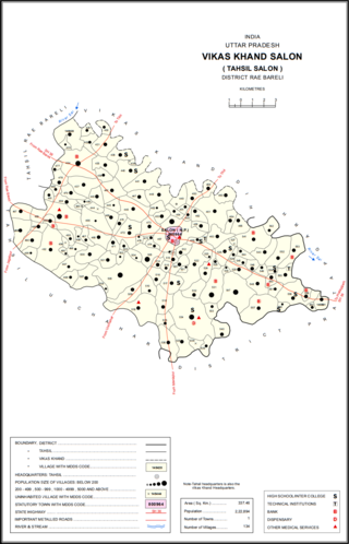
Salon is a town and nagar panchayat in Raebareli district in the Indian state of Uttar Pradesh. It serves as the headquarters of a tehsil as well as a community development block. Originally it was also the headquarters of the entire district, but they were moved after the Indian Rebellion of 1857. It is located a bit to the south of the Sai river, at the junction of the Raebareli-Pratapgarh and Jais-Khaga roads. Other roads lead to Dalmau, Manikpur, and Kunda. To the east is a large jhil.
Pirkon is an Indian village in the tehsil of Uran of the Raigad district of Maharashtra. Farming and Fishing are the most common occupations in Pirkon. The population of the village is 3,015. Pirkon village is mainly occupied by people of Agri caste, for whom farming and fishing are main occupations of people.

Pithupur is a village in Sareni block of Rae Bareli district, Uttar Pradesh, India. It is located 18 km from Lalganj, the tehsil headquarters. As of 2011, it has a population of 928 people, in 185 households. It has one primary school but no formal healthcare facilities. It belongs to the nyaya panchayat of Bhoremau.

Raipur is a village in Sareni block of Rae Bareli district, Uttar Pradesh, India. It is located 21 km from Lalganj, the tehsil headquarters. As of 2011, it has a population of 1,672 people, in 408 households. It serves as the headquarters of a nyaya panchayat which also includes 11 other villages.

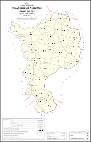
Lakhapur is a village in Chhatoh block of Rae Bareli district, Uttar Pradesh, India. It is located 32 km from Raebareli, the district headquarters. As of 2011, Lakhapur has a population of 2,490 people, in 426 households. It has one primary school and no healthcare facilities, and it does not host a permanent market or a weekly haat. It belongs to the nyaya panchayat of Chhatoh.

Ghatampur is a village in Dih block of Rae Bareli district, Uttar Pradesh, India. It is located 29 km from Raebareli, the district headquarters. As of 2011, it has a population of 1,059 people, in 177 households. It has one primary school and no healthcare facilities, and it does not host a permanent market or a weekly haat. It belongs to the nyaya panchayat of Birnawan.

Pirhi is a village in Dih block of Rae Bareli district, Uttar Pradesh, India. It is located 21 km from Raebareli, the district headquarters. As of 2011, it has a population of 794 people, in 141 households. It has one primary school and no healthcare facilities, and it does not host a permanent market or a weekly haat. It belongs to the nyaya panchayat of Khetaudhan.

Kachnawan is a village in Dih block of Rae Bareli district, Uttar Pradesh, India. It is located 21 km from Raebareli, the district headquarters. As of 2011, it has a population of 3,340 people, in 595 households. It has one primary school and no healthcare facilities, and it does not host a permanent market or weekly haat. It belongs to the nyaya panchayat of Dih.

Pure Bansi is a large village in Dih block of Rae Bareli district, Uttar Pradesh, India. It is located 21 km from Raebareli, the district headquarters. As of 2011, it has a population of 667 people, in 123 households. It has one primary school and no healthcare facilities. It hosts a permanent market but not a weekly haat. Pure Bansi belongs to the nyaya panchayat of Mau.

Kiya is a large village in Dih block of Rae Bareli district, Uttar Pradesh, India. It is located 33 km from Raebareli, the district headquarters. As of 2011, it has a population of 846 people, in 141 households. It has one primary school and no healthcare facilities, and does not host a weekly haat or a permanent market. It belongs to the nyaya panchayat of Mau.

Fakhruddinpur is a village in Lalganj block of Rae Bareli district, Uttar Pradesh, India. As of 2011, it has a population of 823 people, in 136 households. It has 2 primary schools and no healthcare facilities, and it hosts a permanent market but not a weekly haat. It belongs to the nyaya panchayat of Bahai.

Golhamau is a village in Lalganj block of Rae Bareli district, Uttar Pradesh, India. It is located 6 km from Lalganj, the block and tehsil headquarters. As of 2011, it has a population of 360 people, in 61 households. The village has no school, healthcare facilities, permanent market or weekly haat. It belongs to the nyaya panchayat of Bahuria Khera.

Ranjitpur is a village in Sareni block of Rae Bareli district, Uttar Pradesh, India. It is located 20 km from Lalganj, the tehsil headquarters. As of 2011, it has a population of 1,122 people, in 196 households. It has 2 primary schools and no healthcare facilities, and it hosts a regular market but not a weekly haat. It belongs to the nyaya panchayat of Rasulpur.

Rasigaon is a village in Sareni block of Rae Bareli district, Uttar Pradesh, India. As of 2011, it has a population of 1,727 people, in 340 households. It has one primary school and no healthcare facilities and does not host a weekly haat or a permanent market. It belongs to the nyaya panchayat of Malkegaon.

Gopali Khera is a village in Sareni block of Rae Bareli district, Uttar Pradesh, India. It is located 14 km from Lalganj, the tehsil headquarters. As of 2011, it has a population of 610 people, in 123 households. It has no healthcare facilities and does not host a weekly haat or a permanent market. It belongs to the nyaya panchayat of Sagar Khera.

Dhurai is a village in Khiron block of Rae Bareli district, Uttar Pradesh, India. It is located 19 km from Lalganj, the tehsil headquarters. As of 2011, it has a population of 4,481 people, in 867 households. It has 2 primary schools and no healthcare facilities and it hosts both a weekly haat and a permanent market. It belongs to the nyaya panchayat of Paho.

Deogaon is a village in Khiron block of Rae Bareli district, Uttar Pradesh, India.

Majhgawan, also spelled Majhigawan, is a village in Khiron block of Rae Bareli district, Uttar Pradesh, India. It is located 14 km from Lalganj, the tehsil headquarters. As of 2011, it has a population of 782 people, in 146 households. The village has no school, healthcare facilities, weekly haat or permanent market. It belongs to the nyaya panchayat of Deogaon.

Chak Nizam is a village in Rahi block of Rae Bareli district, Uttar Pradesh, India. It is located 8 km from Rae Bareli, the district headquarters. As of 2011, its population was 806 people, in 137 households. It has one primary school, no medical facilities and does not host a weekly haat or a permanent market. It belongs to the nyaya panchayat of Bhaon.


