
Alibag, also known as Alibaug, is a coastal town and a municipal council in Raigad district of Maharashtra, India. It is the headquarters of the Raigad district and is south of the city of Mumbai. Alibag is part of the Mumbai Metropolitan Region and is situated at a distance of about 96 km from Mumbai and 143 km from Pune. Alibag is a holy place for Goddess Shree Padmakshi Renuka, and thousands of people go there to worship every day. she also known as goddess of konkan
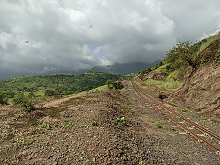
Matheran is an automobile-free hill station and a municipal council in the Karjat taluka of the Raigad district located in the Indian state of Maharashtra. Matheran is part of the Mumbai Metropolitan Region, and one of the smallest hill stations in India. It is located in the Western Ghats, at an elevation of around 800 m above sea level. It is about 90 km from Mumbai, and 120 km from Pune. This proximity to these urban areas makes it a weekend getaway for many. Matheran, which means "forest on the forehead" in Marathi, is an eco-sensitive region, declared by the Ministry of Environment, Forest and Climate Change, Government of India. It is Asia's only automobile-free hill station.

Navsari is an administrative district in the state of Gujarat in India, with its headquarters at the city of Navsari. The district covers an area of 2,211 square kilometres and was formed in 1997 after Valsad district was split into Valsad and Navsari districts. It is the largest producer of chikoos in India.

Khed is a municipal council in the Ratnagiri district of the state of Maharashtra, India. Khed town is situated on the Mumbai - Ratnagiri Highway.

Mumbai Metropolitan Region, is a metropolitan area consisting of Mumbai (Bombay) and its satellite towns in the northern Konkan division, of the Maharashtra state in western India. The region has an area of 6,355 square kilometres (2,454 sq mi) and with a population of over 26 million it is among the most populous metropolitan areas in the world.
Lonar is a town and municipal council in Buldhana district of Vidarbha region of the Indian state of Maharashtra. The town is the headquarter of Lonar taluka and is located near Mehkar.
Raigad district, previously Colaba district, is a district in the Konkan division of Maharashtra, India.
Lonere is a village in Raigad district, Maharashtra, India.

Basara is a census town in Nirmal district in the state of Telangana, India. It is located about 208 kilometres (129 mi) north of the state capital Hyderabad, 34 kilometres (21 mi) from Nizamabad and 73 kilometres (45 mi) from the district headquarters Nirmal.
Chichli is a census town in Narsimhapur district in the state of Madhya Pradesh, India.
Kasara is a census town in Thane district in the Indian state of Maharashtra. The town is on the busy Mumbai–Nashik route, which is one of the four major routes that lead into Mumbai. Kasara is served by a railway station on the Mumbai Suburban Railway, and is the final stop in the north-east sector of the Central Line and important railway station. That is for abbreviation for Kasara Local is set as "N" means North side Local's Last Station. Town is also known for the winding Kasara ghat pass.
Nagothana is a census town in Roha Taluka, in the Raigad district of the Indian state of Maharashtra. The Kanyakumari - Panvel National Highway # 66 (NH66) goes through this town.
Phulera is a town in Jaipur district in the Indian state of Rajasthan. It is lies nearly by Jaipur city, state capital. The DMIC project runs through Phulera. It is a major railway junction.
Shirwal is a census town in Satara district in the Indian state of Maharashtra.
Taloja is a census town in Raigad district of Navi Mumbai city in the Indian state of Maharashtra. It is an extension of the Kharghar node and governed by Panvel Municipal Corporation. Taloja has Navi Mumbai Metro Phase I starting origin point at Pendhar. Taloja is divided into two phases as Phase I and Phase II by CIDCO.
Vyara is a town and the district headquarters of the Tapi district in the Indian state of Gujarat. It is 65 kilometres from Surat.
Pali is a census town in Raigad District in the Indian state of Maharashtra.
Vasind is a city in Shahapur taluka of Thane district in the Indian state of Maharashtra. It is suburban city of Mumbai.Mumbai-Vasind distance is about 63.1 km. Vashind is a census town.

Irshalgad is a fortress located between Matheran and Panvel in Maharashtra, India. It is a sister fort to Prabalgad. The area of the fort is not large but there are several water cisterns cut from the rock. The nearest village is Irshalwadi.
Pandhurli is a village and a municipal council in Sinnar taluka of Nashik district in the Indian state of Maharashtra.

