Port Washington Branch

Last updated

Port Washington Branch
Plandome Station, Plandome, NY November 23, 2023 M.jpg
Port Washington Branch train enters the Plandome station.
Overview
StatusOperational
Owner Long Island Rail Road
Locale Queens and Nassau County, New York, USA
Termini
  • Woodside
  • Port Washington
Stations13
Service
Type Commuter rail
System Long Island Rail Road
Services
Operator(s) Metropolitan Transportation Authority
Daily ridership46,808 (average weekday, 2006)
Ridership8,321,271 (annual ridership, 2022)
History
Opened1854 (as Flushing Railroad)
Technical
Track gauge 4 ft 8+12 in (1,435 mm)
Electrification 750 V (DC) Third rail
Route map
Port Washington Branch
BSicon YRDe.svg
BSicon tdCONTg.svg
BSicon tdSTRa.svg
BSicon tdABZg+l.svg
BSicon tdSTRr.svg
BSicon tINTACC.svg
0.0 mi
0 km
Penn Station
BSicon SUBWAY.svg NJT logo.svg BSicon LOGO Amtrak2.svg
BSicon tSTR.svg
BSicon tKINTACCa.svg
Grand Central
BSicon SUBWAY.svg MTA NYC logo.svg
BSicon tKRZW.svg
BSicon tKRZW.svg
BSicon dCONTgq.svg
BSicon STRl.svg
BSicon PORTALg.svg
BSicon STRq.svg
BSicon PORTALg.svg
BSicon ABZg+r.svg
3.7 mi
1.8 mi
BSicon YRD.svg
BSicon ABZgl.svg
BSicon CONTfq.svg
BSicon INTACC.svg
3.1 mi
5 km
Woodside
NYCS-bull-trans-7-Std.svg NYCS-bull-trans-7d-Std.svg
BSicon STRc2.svg
BSicon eHST.svg
BSicon ABZg3.svg
BSicon CONT1.svg
BSicon STR+c4.svg
BSicon eHST.svg
Elmhurst (closed)
BSicon eHST.svg
Corona (closed)
BSicon eHST.svg
West Flushing (closed)
BSicon pINT.svg
6.7 mi
10.8 km
Mets–Willets Point
NYCS-bull-trans-7-Std.svg NYCS-bull-trans-7d-Std.svg
BSicon eABZgl.svg
BSicon exCONTfq.svg
BSicon STR+GRZq.svg
Zone 1
Zone 3
BSicon INTACC.svg
7.5 mi
12.1 km
Flushing–Main Street
NYCS-bull-trans-7-Std.svg NYCS-bull-trans-7d-Std.svg
BSicon HSTACC.svg
8.4 mi
13.5 km
Murray Hill
BSicon HSTACC.svg
9.2 mi
14.8 km
Broadway
BSicon HSTACC.svg
9.9 mi
15.9 km
Auburndale
BSicon HSTACC.svg
10.8 mi
17.4 km
Bayside
BSicon HSTACC.svg
12.1 mi
19.5 km
Douglaston
BSicon HSTACC.svg
12.7 mi
20.4 km
Little Neck
BSicon STR+GRZq.svg
Zone 3
Zone 4
BSicon ACC.svg
13.8 mi
22.2 km
Great Neck
BSicon hKRZWae.svg
BSicon HSTACC.svg
15.4 mi
24.8 km
Manhasset
BSicon HSTACC.svg
16.5 mi
26.6 km
Plandome
BSicon dSTR+l.svg
BSicon ABZgr.svg
BSicon dYRDa.svg
BSicon KACCe.svg
18.1 mi
29.1 km
Port Washington
[1]

The Port Washington Branch is an electrified, mostly double-tracked rail line and service owned and operated by the Long Island Rail Road in New York, in the United States. It branches north from the Main Line at the former Winfield Junction station, just east of the Woodside station in the New York City borough of Queens, and runs roughly parallel to Northern Boulevard past Mets-Willets Point (Citi Field), Flushing, Murray Hill, Broadway, Auburndale, Bayside, Douglaston, Little Neck, and then crosses into Nassau County for stops in Great Neck, Manhasset, and Plandome before terminating at Port Washington. [2] [3]

Contents

The Port Washington Branch is the only LIRR branch to not serve Jamaica, a major LIRR transportation hub, as it branches off the Main Line at Winfield Junction, several miles northwest of Jamaica. Thus, passengers seeking to switch to other LIRR services without going into Manhattan must instead transfer at Woodside station.

Route description

The Port Washington station from the corner of Main Street and Haven Avenue in Port Washington. Port Washington Station - Main Street & Haven Avenue.jpg
The Port Washington station from the corner of Main Street and Haven Avenue in Port Washington.
Winfield Junction Winfield Junction jeh.jpg
Winfield Junction
Manhasset Viaduct, viewed from East Shore Road Manhasset Valley trestle spruce jeh.jpg
Manhasset Viaduct, viewed from East Shore Road
Manhasset Viaduct, viewed from below Manhasset LIRR viaduct.jpg
Manhasset Viaduct, viewed from below

The line has two tracks from Woodside to Great Neck and one track from east of Great Neck past Manhasset and Plandome stations to Port Washington. This often causes slight delays during two-way rush hour operations. A second track cannot be added through Manhasset and Plandome due to the proximity of businesses to the narrow right-of-way in Manhasset, and the fact that the Manhasset Viaduct, which carries the line between Great Neck and Manhasset, has only one track. [4]

To reduce delays and provide consistent service along all portions of the line, most peak-hour trains are either local between Manhattan and Great Neck (making all stops) or express between Manhattan and Port Washington (making stops only at Bayside, Great Neck, Manhasset, Plandome station, and Port Washington, although several trains run nonstop between city terminals and Great Neck). [5]

Extra service is offered during the U.S. Open tennis tournament and for New York Mets home games, both of which are held in Flushing Meadows–Corona Park. These trains primarily pick up and discharge passengers at the Mets–Willets Point station between Woodside and Flushing Main Street; formerly a station used exclusively for events, Mets–Willets Point has been open full-time since April 2023. [6]

The route also runs over the Manhasset Viaduct, a high train trestle over the marshes at the southern end of Manhasset Bay. The bridge stands 81 feet (25 m) tall and runs 678 feet (207 m) across the bay, offering a view of the Manhasset Bay. Scenes from the Hearst-produced silent film serial "The Perils of Pauline" are said to have been shot on the trestle. [7]

There is only one grade crossing on the Port Washington Branch, located at Little Neck Parkway, at the west end of the Little Neck Station.

History

19th century

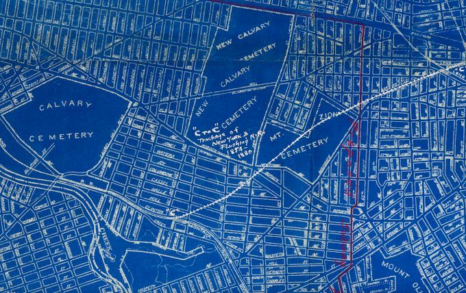
The Port Washington Branch was built by the Flushing Railroad, in 1854 from Hunters Point in Long Island City to Flushing, before the LIRR opened its line to Long Island City. It was the first non-LIRR line on Long Island. The company was reorganized in 1859 as the New York and Flushing Railroad, and established a subsidiary known as the North Shore Railroad to extend the line from Flushing to Great Neck in 1866.

Originally intending to run further east to Roslyn, Oyster Bay, and even Huntington, the NY&F's plans were thwarted by the LIRR who reached those destinations first, as well as poor service and competition with the 1868-established Flushing and North Side Railroad. In 1869, the New York State Legislature authorized the Flushing and North Side to buy the New York and Flushing east of the LIRR crossing at Winfield Station, while the segment between Hunters Point and Winfield was acquired by the South Side Railroad of Long Island until it was abandoned for passenger service east of what was to become the former Laurel Hill Station in 1875. Part of the right-of-way ran through what is today the Mount Zion Jewish Cemetery in Maspeth. [8]

By 1874, all branches of the Flushing and North Side Railroad, including the Main Line to Great Neck were incorporated into the Flushing, North Shore and Central Railroad, which included the Central Railroad of Long Island. Two years later, it would become part of the Long Island Rail Road, which closed the line east of Flushing in 1881 and reopened it a year later as subsidiary known as the Long Island City and Flushing Railroad. The LIC&F was merged with the LIRR on April 2, 1889. [9]

Despite a failed attempt to extend the line from Great Neck to Roslyn in 1882, wealthy Port Washington residents persuaded the LIRR to bring the terminus to their hometown in 1895. This required the construction of the Manhasset Viaduct over the marshes at the southern end of Manhasset Bay, which was authorized by an LIRR subsidiary called the Great Neck and Port Washington Railroad (GN&PW). [10] According to Manhasset's website, "in 1897, a contract was given to the Carnegie Steel Company and a subsidiary, the King Iron Company, undertook the job of constructing the bridge." The trestle bridge cost about $60,000, and the first train to cross it was on June 23, 1898. The GN&PW was disestablished as a subsidiary in 1902, and that segment simply became part of the Port Washington Branch.

20th century

Two other early 20th-century stations built on the Port Washington Branch were in Auburndale (1901) and Plandome (1909). The branch was electrified from the main line to Winfield Junction by June 23, 1910, to Whitestone Junction onto the Whitestone Branch to Whitestone Landing Station by October 22, 1912, and to its terminus in Port Washington by October 21, 1913. [11] In 1910, the Public Service Commission approved the LIRR's application to eliminate grade crossings along the line. These projects were prerequisites for the extension of the line's second track to Great Neck and Whitestone and the electrification of the line. [12] :21–22

Grade crossing elimination projects took place during the 1910s and 1920s in Queens and Nassau County. These grade elimination projects included unique station reconstruction in places such as Murray Hill which had a station house built over the tracks and Great Neck which had an elaborate plaza built around it. In 1929, the station at Winfield Junction was eliminated, making Woodside Station the transfer point between Main Line and Port Washington Branch trains.

Despite the elimination of the Whitestone Branch in 1932, as well as Flushing Bridge Street station, Flushing station kept the name "Flushing-Main Street Station." A new station was built just in time for the 1939 New York World's Fair then reused for the United Nations, and then the 1964 New York World's Fair and simultaneously Shea Stadium, for which it would be renamed in 1966. This was the last station to be built on the line. By 1985, when Elmhurst station closed, Shea Stadium station would also become the westernmost station on the Port Washington Branch before the junction with the Main Line.

In January 1987, the station building at the Plandome station was burned to the ground by vandals. [13] [14] Following the fire, the station building was rebuilt as a more modern version of the original. [14] [15]

21st century

In conjunction with the East Side Access project, the MTA is working on two readiness projects that will increase capacity on the Port Washington Branch. The pocket track east of Great Neck station, located between the station and where the line becomes single-tracked, was extended eastward by 1,200 feet (370 m) to allow for storage of two trainsets. The construction of the pocket track was originally scheduled for completion in December 2018 at a total cost of $45.2 million. [16] However, the completion date was pushed back several times; [17] :60 [18] :59 construction of the extended pocket track would ultimately be completed in December 2022. [19] Additionally, the Port Washington Yard, next to Port Washington station, was planned to be expanded to store two more ten-car trains. As of 2017, construction was scheduled to begin in late 2020 or early 2021 at a cost of $500,000. [16] [20] However, this project met significant community opposition, primarily because of proposed reduction of parking spaces near the station. [21] As of September 2022, the MTA has not come to an agreement with the Town of North Hempstead, [17] :65 resulting in the project being postponed indefinitely. [22] [18] :61

Alongside these construction projects, a new bridge was built at Colonial Road near Great Neck station; it opened in May 2016 and replaced a 114-year-old span. [23] [24] [25] [26] [27]

Stations

West of Woodside, all trips go on to terminate at Penn Station or Grand Central. [3]

Zone [28] LocationStation name Miles (km)
from Long Island City [1]
Date
opened
Date
closed
Connections and notes
1 Woodside, Queens Woodside Wheelchair symbol.svg 3.1 (5.0)1869 [29] Long Island Rail Road: City Terminal Zone
New York City Subway: 7 and <7> (at 61st Street–Woodside)
New York City Bus: Q32
MTA Bus: Q18 , Q53 SBS , Q70 SBS
Maspeth, Queens Winfield Junction 18541929
Elmhurst, Queens Elmhurst 18551985Originally named Newtown
Corona, Queens
Corona 18531964Originally named Fashion Race Course, then West Flushing
West Flushing 1854
Mets–Willets Point 6.7 (10.8)1939New York City Subway: 7 and <7> (at Mets–Willets Point)
New York City Bus: Q48
Originally named World's Fair, then United Nations, then World's Fair again, then Shea Stadium.
3 Flushing, Queens Flushing–Main Street Wheelchair symbol.svg 7.5 (12.1)1854 [29] New York City Subway: 7 and <7> (at Flushing–Main Street)
New York City Bus: Q12 , Q13 , Q15 , Q15A , Q16 , Q17 , Q20A , Q20B , Q26 , Q27 , Q28 , Q44 SBS , Q48 , Q58
MTA Bus: Q19 , Q25 , Q34 , Q50 , Q65 , Q66
Nassau Inter-County Express: n20G, n20x
Originally named Flushing
Murray Hill Wheelchair symbol.svg 8.4 (13.5)1889New York City Bus: Q12 , Q15 , Q15A
Nassau Inter-County Express: n20G, n20x
Broadway Wheelchair symbol.svg 9.2 (14.8)1866 [29] New York City Bus: Q12 , Q13 , Q28
MTA Bus: QM3
Nassau Inter-County Express: n20G, n20x
Originally named Flushing–Broadway
Auburndale, Queens Auburndale Wheelchair symbol.svg 9.9 (15.9)1901New York City Bus: Q12 , Q13 , Q28 , Q76
MTA Bus: QM3
Nassau Inter-County Express: n20G, n20x
Bayside, Queens Bayside Wheelchair symbol.svg 10.8 (17.4)1886 [29] New York City Bus: Q12 , Q13 , Q28
MTA Bus: QM3
Nassau Inter-County Express: n20G, n20x
Originally named Bay Side
Douglaston–Little Neck, Queens Douglaston Wheelchair symbol.svg 12.1 (19.5)1866 [29] New York City Bus: Q12
MTA Bus: QM3
Nassau Inter-County Express: n20G, n20x
Originally named Little Neck
Little Neck Wheelchair symbol.svg 12.7 (20.4)1870 [29] New York City Bus: Q12 , Q36
MTA Bus: QM3
Nassau Inter-County Express: n20G, n20x
4 Great Neck Great Neck Wheelchair symbol.svg 13.8 (22.2)1866 [29] Nassau Inter-County Express: n20G , n20H , n21 , n25 , n26 , n57 , n58
Originally named Brookdale
Manhasset Manhasset Wheelchair symbol.svg 15.4 (24.8)1899Nassau Inter-County Express: n20H , n21, n20x
Plandome Plandome Wheelchair symbol.svg 16.5 (26.6)1909
Port Washington Port Washington Wheelchair symbol.svg 18.1 (29.1)1898Nassau Inter-County Express: n23

Related Research Articles

<span class="mw-page-title-main">Long Island Rail Road</span> Commuter rail system on Long Island, New York

The Long Island Rail Road, often abbreviated as the LIRR, is a railroad in the southeastern part of the U.S. state of New York, stretching from Manhattan to the eastern tip of Suffolk County on Long Island. The railroad currently operates a public commuter rail service, with its freight operations contracted to the New York and Atlantic Railway. With an average weekday ridership of 354,800 passengers in 2016, it is the busiest commuter railroad in North America. It is also one of the world's few commuter systems that runs 24/7 year-round. It is publicly owned by the Metropolitan Transportation Authority, which refers to it as MTA Long Island Rail Road. In 2022, the system had a ridership of 70,342,700, or about 253,800 per weekday as of the third quarter of 2023.

<span class="mw-page-title-main">Woodside station (LIRR)</span> Long Island Rail Road station in Queens, New York

The Woodside station is a station on the Main Line and Port Washington Branch of the Long Island Rail Road (LIRR), located in the Woodside neighborhood of Queens in New York City. It is the first station passed by eastward trains from Penn Station and Grand Central Madison, and it is the only station in Queens shared by the Port Washington Branch and other LIRR branches. East of Woodside the two-track Port Washington Branch turns eastward, while the four-track Main Line continues southeast to Jamaica station.

<span class="mw-page-title-main">Mets–Willets Point station (LIRR)</span> Long Island Rail Road station in Queens, New York

Mets–Willets Point is a station on the Long Island Rail Road's Port Washington Branch in Flushing Meadows–Corona Park, Queens, New York City. Prior to 2021, the station would normally be open only during New York Mets home games, the U.S. Open tennis tournament, major events, and emergencies. The station has been served full-time since 2023.

<span class="mw-page-title-main">Flushing–Main Street station (LIRR)</span> Long Island Rail Road station in Queens, New York

Flushing–Main Street is a station on the Long Island Rail Road's Port Washington Branch in the Flushing neighborhood of Queens, New York City. The station is located at Main Street and 41st Avenue, off Kissena Boulevard.

<span class="mw-page-title-main">Little Neck station</span> Long Island Rail Road station in Queens, New York

Little Neck is a station on the Long Island Rail Road's Port Washington Branch in the Little Neck neighborhood of Queens, New York City. The station is at Little Neck Parkway and 39th Road, about half a mile north of Northern Boulevard. Little Neck station is 14.5 miles (23.3 km) from Penn Station in Midtown Manhattan, and is the easternmost station on the Port Washington Branch in New York City. The station house is located on the south (eastbound) side, unlike most station houses on the Port Washington Branch. The station is part of the CityTicket program and is in Zone 3.

<span class="mw-page-title-main">Great Neck station</span> Long Island Rail Road station in Nassau County, New York

Great Neck is a station on the Long Island Rail Road's Port Washington Branch in Great Neck Plaza, New York. It is the westernmost station on the branch in Nassau County. The station is located at Middle Neck Road and Station Plaza at Great Neck Road, 0.25 miles (0.40 km) north of Northern Boulevard and 15.9 miles (25.6 km) from Penn Station in Midtown Manhattan. From just east of the station, the line becomes single track to Port Washington.

<span class="mw-page-title-main">Manhasset station</span> Long Island Rail Road station in Nassau County, New York

Manhasset is a station on the Long Island Rail Road's Port Washington Branch in Manhasset, New York. It is 17.2 miles (27.7 km) from Penn Station in Midtown Manhattan.

<span class="mw-page-title-main">Plandome station</span> Long Island Rail Road station in Nassau County, New York

Plandome is a station on the Long Island Rail Road's Port Washington Branch in the villages of Plandome and Plandome Manor, in Nassau County, Long Island, New York. It is located off Stonytown Road and Rockwood Road, near West Circle Drive and Colonial Drive. The Plandome Post Office is located on the first floor, below the station's waiting room.

<span class="mw-page-title-main">Port Washington station</span> Long Island Rail Road station in Nassau County, New York

Port Washington is the terminus of the Long Island Rail Road's Port Washington Branch in Port Washington, New York. The station is located on Main Street, between Haven Avenue and South Bayles Avenue, just west of Port Washington Boulevard, and is 19.9 miles (32 km) from Pennsylvania Station in Midtown Manhattan. A pedestrian bridge exists between the platforms, and is in line with Franklin Avenue, ending at Haven Avenue.

<span class="mw-page-title-main">Main Line (Long Island Rail Road)</span> Long Island Rail Road branch

The Main Line is a rail line owned and operated by the Long Island Rail Road in the U.S. state of New York. It begins as a two-track line at Long Island City station in Long Island City, Queens, and runs along the middle of Long Island about 95 miles (153 km) to Greenport station in Greenport, Suffolk County. At Harold Interlocking approximately one mile east of Long Island City, the tracks from the East River Tunnels and 63rd Street Tunnel into Manhattan intersect with the Main Line, which most trains use rather than using the Long Island City station.

The North Shore Bus Company operated public buses in Queens, New York City. It was established in 1920 as the successor to the New York and North Shore Traction Company trolley system, and operated until 1947 when it went bankrupt, and its operations were taken over by the New York City Board of Transportation.

<span class="mw-page-title-main">Whitestone Branch</span> Former Long Island Rail Road branch

The Whitestone Branch was a branch of the Long Island Rail Road, running north and east along the left bank of the Flushing River from the Port Washington Branch near the modern Willets Point/Flushing sections of Queens, New York. It crossed the river on one of the three bridges that were later torn down for the Van Wyck Expressway, then ran north along Flushing Bay and east along the East River to Whitestone.

The Long Island Rail Road is a railroad owned by the Metropolitan Transportation Authority in the U.S. state of New York. It is the oldest United States railroad still operating under its original name and charter. It consolidated several other companies in the late 19th century. The Pennsylvania Railroad owned the Long Island Rail Road for the majority of the 20th century and sold it to the State in 1966.

<span class="mw-page-title-main">Roslyn station (LIRR)</span> Long Island Rail Road station in Nassau County, New York

Roslyn is a station on the Long Island Rail Road's Oyster Bay Branch. It is located at Lincoln Avenue and Railroad Avenue, west of Roslyn Road and south of Warner Avenue, in Roslyn Heights, in Nassau County, New York.

<span class="mw-page-title-main">Flushing and North Side Railroad</span> Former railway in New York City

The Flushing and North Side Railroad was a former railroad on Long Island built by Conrad Poppenhusen as a replacement for the former New York and Flushing Railroad. The railroad was established in 1868, was merged with the Central Railroad of Long Island in 1874 to form the Flushing, North Shore and Central Railroad, and was finally acquired by the Long Island Rail Road in 1876. Today the main line is known as the Port Washington Branch of the Long Island Rail Road.

The White Line was a short-lived branch of the Long Island Rail Road in western Queens County, New York. Officially known as the Newtown and Flushing Railroad, the line was chartered in 1871, but was only in service from 1873 to 1876.

<span class="mw-page-title-main">Manhasset Viaduct</span> Viaduct in Nassau County, New York

The Manhasset Viaduct is a railroad bridge located between the Village of Thomaston and the Hamlet of Manhasset, on Long Island, in the State of New York. It carries the Port Washington Branch of the Long Island Rail Road.

<span class="mw-page-title-main">Stonytown Road</span>

Stonytown Road is a 1.32-mile road in the incorporated villages of Flower Hill, Plandome, and Plandome Manor in the Town of North Hempstead, in Nassau County, on the North Shore of Long Island, in New York, United States. It serves as a major east-west through street across the Cow Neck Peninsula, between Plandome Road and North Plandome Road to the west and Port Washington Boulevard to the east – as well as forming portions of municipal boundaries.

<span class="mw-page-title-main">Plandome Road</span>

Plandome Road is a road in Manhasset and the incorporated villages of Plandome, Plandome Heights, and Plandome Manor in the Town of North Hempstead, in Nassau County, on the North Shore of Long Island, in New York, United States. It serves as a major north–south through street across the west side of the Cow Neck Peninsula, between Northern Boulevard to the south and Stonytown Road and North Plandome Road to the north, and is the main thoroughfare in downtown Manhasset.

References

  1. 1 2 Long Island Rail Road (May 14, 2012). "TIMETABLE No. 4" (PDF). p. III; VI. Retrieved August 4, 2022.
  2. "MTA Railroads Map". New York: Metropolitan Transportation Authority. March 16, 2023.
  3. 1 2 "LIRR Port Washington Branch Timetable". New York: Metropolitan Transportation Authority. May 23, 2023.
  4. Image of single track across Manhasset Viaduct
  5. "Changes to LIRR Port Washington Branch service in 2023" (Press release). Metropolitan Transportation Authority. Retrieved September 18, 2023.
  6. "MTA Long Island Rail Road Announces Around-the-Clock Service to Mets–Willets Point Beginning Monday, April 24" (Press release). Metropolitan Transportation Authority. April 21, 2023. Retrieved September 18, 2023.
  7. Sloan, Allan King (October 2005). "The Manhasset Viaduct". King Bridge Company. Archived from the original on March 3, 2006.
  8. 1924 Long Island Railroad Corporate Blueprint (Arrt's Arrchives)
  9. "Corporate Succession Long Island Railroad". pennsyrr.com.
  10. Historic American Engineering Record (HAER) No. NY-81, " Long Island Railroad, Manhasset Bridge, Manhasset Shore Road Vicinity, Flower Hill, Nassau County, NY ", 1 photo, 1 data page, 1 photo caption page
  11. "LIRR Branch Notes". trainsarefun.com.
  12. "The Long Island Railroad Twenty-Ninth Annual Report For The Year Ending December 31st, 1910". Report of ..., Trustee[S] of the Property of the Debtor, for the Year Ended ...1949-1953. Long Island Railroad Company. 1911.
  13. Goldberg, Nicholas (January 4, 1987). "Fire Guts Historic Station". Newsday . ProQuest   285440103.
  14. 1 2 "Port Washington Branch". www.trainsarefun.com. Retrieved January 21, 2021.
  15. Goldberg, Nicholas (February 26, 1988). "After Fire, Plandome, LIRR Still Haggling". Newsday . ProQuest   277892413.
  16. 1 2 "MTA Long Island Rail Road Committee Meeting" (PDF). mta.info . Metropolitan Transportation Authority. November 2017. p. 35. Archived (PDF) from the original on February 5, 2018. Retrieved May 24, 2018.
  17. 1 2 Joint Metro-North and Long Island Committees Meeting. mta.info (Report). November 2020. Archived from the original on October 13, 2021. Retrieved June 14, 2022.
  18. 1 2 Joint Metro-North and Long Island Committees Meeting. mta.info (Report). November 2021. Archived from the original on July 7, 2022. Retrieved June 15, 2022.
  19. Sweet, Jacqueline (December 6, 2022). "MTA Finishes Great Neck Pocket Track In Advance Of Grand Central Open". Patch. Great Neck, NY. Retrieved January 14, 2024.
  20. "L60601YL Port Washington Yard Reconfiguration". web.mta.info. Metropolitan Transportation Authority. Archived from the original on September 3, 2017. Retrieved September 3, 2017.
  21. Castillo, Alfonso A. (November 29, 2015). "Outta space: Few places to park at LIRR lots". Newsday. Archived from the original on June 15, 2022. Retrieved June 15, 2022.
  22. Kaplan, Anna M. (September 28, 2022). "Important LIRR Commuter Update: Express Trains Have Been Saved". nysenate.gov. Retrieved October 1, 2022.
  23. Kreitzman, Wendy Karpel (November 19, 2010). "MTA Announces Second Pocket Track Proposed for LIRR in Great Neck". Great Neck Record. Archived from the original on December 9, 2010. Retrieved May 24, 2018.
  24. "MTA LIRR Proposed Colonial Road Improvement Project". MTA Long Island Rail Road. March 23, 2011. Archived from the original on December 19, 2021. Retrieved November 18, 2011.
  25. "MTA LIRR - Colonial Road Improvement Project". web.mta.info. Archived from the original on October 24, 2016. Retrieved October 23, 2016.
  26. Zambuto, Sam; Arena, Salvatore (March 28, 2011). "LIRR Opens Info Center at Great Neck Station for Proposed Colonial Road Improvement Project". MTA Long Island Rail Road. Archived from the original on November 5, 2011. Retrieved November 18, 2011.
  27. "The Completion of Colonial Road Bridge". Great Neck Record. July 23, 2016. Archived from the original on October 17, 2021. Retrieved June 14, 2022.
  28. "New Fares — Effective April 21, 2019". Metropolitan Transportation Authority . Retrieved April 27, 2020.
  29. 1 2 3 4 5 6 7 Vincent F. Seyfried, The Long Island Rail Road: A Comprehensive History, Part Two: The Flushing, North Shore & Central Railroad, © 1963
Template:Attached KML/Port Washington Branch
KML is not from Wikidata

Commons-logo.svg Media related to Port Washington Branch ( category ) at Wikimedia Commons