Qena

Last updated • 2 min readFrom Wikipedia, The Free Encyclopedia
Qena
قنا
qn 2013.jpg
Egypt relief location map.jpg
Red pog.svg
Qena
Location within Egypt
Coordinates: 26°10′12″N32°43′38″E / 26.17000°N 32.72722°E / 26.17000; 32.72722
CountryFlag of Egypt.svg  Egypt
Governorate Qena
Area
[1]
  Total
31.60 km2 (12.20 sq mi)
Elevation
[1]
80 m (260 ft)
Population
 (2021) [1]
  Total
252,883
  Density8,000/km2 (21,000/sq mi)
Time zone UTC+2 (EET)
Area code (+20) 96
QenaQenaQenaQenaQena
šꜣbt [2]
in hieroglyphs

Qena (Arabic : قناQinā [ˈʔenæ] , locally:[ˈɡena]; Coptic : ⲕⲱⲛⲏKonē) is a city in Upper Egypt, and the capital of the Qena Governorate. Situated on the east bank of the Nile, it was known in antiquity as Kaine (Greek Καινή, meaning "new (city)"; Latinized transliteration: Caene) and Maximianopolis. [3] [4] Gauthier identifies Qena with ancient Shabt. [5] Qena meaning in Arabic "very red" of fertile land. [6]

Contents

Overview

Qena Mosque Qena mosque.jpg
Qena Mosque

This provincial capital is located about 95 km from El Balyana and 63 km north of Luxor. It is most famous for its proximity to the ruins of Dendara. It owes its modern prosperity to the opening of the Wadi Qena towards the Red Sea, which is a major traffic route between Upper Egypt and the Red Sea. Tourists traveling between Luxor and the Red Sea will assuredly pass through this city since there is only one good road connection. Qena is noted for its pottery. Qena is also known for its beautiful huge mountains and green nature.

South Valley University has a campus in Qena. [7]

Qena is a large market town on the River Nile situated next to the famous Greco-Roman temples of Dendera. Also on the Nile, Luxor is a long-time tourist hotspot that in large part attracts hundreds of thousands of visitors because of its temples, tombs and location on the site of the ancient capital of Thebes. Ancient Thebes is now a UNESCO World Heritage site.

Qena has one of the highest concentration of Coptic Christians in Egypt (approximately 35% of the total population).

History

In addition to its Ancient Egyptian heritage as the city of Caenepolis, [8] Qena has a considerable Islamic heritage and many unique architectural mosques. Qena has witnessed major restorations, and came third in the UNESCO City Beauty contest. [9]

Climate

Qena has a hot desert climate (BWh) according to Köppen climate classification, with very hot summers and very little precipitation year round. Winters are warm at days, but become cool at nights. The hottest months on average are equally July and August, while the coolest month is January. Luxor, Minya, Qena and Asyut have the widest difference of temperatures between days and nights of any city in Egypt, with almost 16 °C (29 °F) difference.

The hottest temperature recorded was on May 15, 1991 which was 50 °C (122 °F) and the coldest temperature was on January 6, 1989 which was −1 °C (30 °F). [10]

Climate data for Qena
MonthJanFebMarAprMayJunJulAugSepOctNovDecYear
Mean daily maximum °C (°F)22.7
(72.9)
25.3
(77.5)
30.5
(86.9)
35.3
(95.5)
38.8
(101.8)
41.0
(105.8)
41.0
(105.8)
40.7
(105.3)
38.1
(100.6)
35.1
(95.2)
30.1
(86.2)
24.4
(75.9)
33.6
(92.5)
Daily mean °C (°F)13.2
(55.8)
15.0
(59.0)
19.4
(66.9)
24.6
(76.3)
29.8
(85.6)
31.7
(89.1)
32.0
(89.6)
32.1
(89.8)
29.1
(84.4)
26.0
(78.8)
20.3
(68.5)
15.0
(59.0)
24.0
(75.2)
Mean daily minimum °C (°F)6.9
(44.4)
7.8
(46.0)
11.4
(52.5)
16.1
(61.0)
20.8
(69.4)
23.2
(73.8)
24.1
(75.4)
24.2
(75.6)
22.0
(71.6)
18.8
(65.8)
13.6
(56.5)
8.9
(48.0)
16.5
(61.7)
Average rainfall mm (inches)1
(0.0)
0
(0)
0
(0)
0
(0)
0
(0)
0
(0)
0
(0)
0
(0)
0
(0)
0
(0)
1
(0.0)
1
(0.0)
3
(0)
Average relative humidity (%)63564431272831324453596344
Source: Arab Meteorology Book [11]

Transportation

Qena has a network of streets, roads and highways with greenery and flowered pavements. From the city there is a road that crosses the Eastern Desert to port Safaga on the Red Sea.

The United States Air Force conducted classified operations from Wadi Qena airfield from the 1970s to the 1990s, under the code names Coronet Scabbard, Coronel Aspen, Coronet Drake, and Coronet Mallard. [12] The 4401st Combat Support Squadron (Provisional) maintained a near-constant CENTAF presence there. Part of these operations probably included Lockheed MC-130 flights during the Desert One rescue attempts for the U.S. hostages in Tehran in the late 1970s. [13]

See also

Related Research Articles

<span class="mw-page-title-main">Aswan</span> City in Egypt

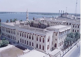
Aswan is a city in Southern Egypt, and is the capital of the Aswan Governorate.

<span class="mw-page-title-main">Thebes, Egypt</span> Ancient Egyptian city

Thebes, known to the ancient Egyptians as Waset, was an ancient Egyptian city located along the Nile about 800 kilometers (500 mi) south of the Mediterranean. Its ruins lie within the modern Egyptian city of Luxor. Thebes was the main city of the fourth Upper Egyptian nome and was the capital of Egypt for long periods during the Middle Kingdom and New Kingdom eras. It was close to Nubia and the Eastern Desert, with its valuable mineral resources and trade routes. It was a religious center and the most venerated city during many periods of ancient Egyptian history. The site of Thebes includes areas on both the eastern bank of the Nile, where the temples of Karnak and Luxor stand and where the city was situated; and the western bank, where a necropolis of large private and royal cemeteries and funerary complexes can be found. In 1979, the ruins of ancient Thebes were classified by UNESCO as a World Heritage Site.

<span class="mw-page-title-main">Kom Ombo</span> Place in Aswan Governorate, Egypt

Kom Ombo is an agricultural town in Egypt famous for the Temple of Kom Ombo. It was originally an Egyptian city called Nubt, meaning City of Gold. Nubt is also known as Nubet or Nubyt. It became a Greek settlement during the Greco-Roman Period. The town's location on the Nile, 50 kilometres (31 mi) north of Aswan (Syene), gave it some control over trade routes from Nubia to the Nile Valley, but its main rise to prominence came with the erection of the Temple of Kom Ombo in the 2nd century BC.

<span class="mw-page-title-main">Karnak</span> Ancient Egyptian temple complex

The Karnak Temple Complex, commonly known as Karnak, comprises a vast mix of temples, pylons, chapels, and other buildings near Luxor, Egypt. Construction at the complex began during the reign of Senusret I in the Middle Kingdom and continued into the Ptolemaic Kingdom, although most of the extant buildings date from the New Kingdom. The area around Karnak was the ancient Egyptian Ipet-isut and the main place of worship of the 18th Dynastic Theban Triad, with the god Amun as its head. It is part of the monumental city of Thebes, and in 1979 it was added to the UNESCO World Heritage List along with the rest of the city. Karnak gets its name from the nearby, and partly surrounded, modern village of El-Karnak, 2.5 kilometres north of Luxor.

<span class="mw-page-title-main">Luxor</span> City in southern Egypt

Luxor is a city in Upper Egypt, which includes the site of the Ancient Egyptian city of Thebes. Luxor had a population of 263,109 in 2020, with an area of approximately 417 km2 (161 sq mi) and is the capital of the Luxor Governorate. It is among the oldest inhabited cities in the world.

<span class="mw-page-title-main">Naqada</span> Place in Qena, Egypt

Naqada is a town on the west bank of the Nile in Qena Governorate, Egypt, situated ca. 20 km north of Luxor. It includes the villages of Tukh, Khatara, Danfiq, and Zawayda. According to the 1960 census, it is one of the most uninhabited areas and had only 3,000 inhabitants, mostly of Christian faith who preserved elements of the Coptic language up until the 1930s.

<span class="mw-page-title-main">Dendera</span> City in Qena, Egypt

Dendera, also spelled Denderah, ancient Iunet 𓉺𓈖𓏏𓊖 “jwn.t”, Tentyris,(Arabic: Ewan-t إيوان-ة ), or Tentyra is a small town and former bishopric in Egypt situated on the west bank of the Nile, about 5 kilometres (3 mi) south of Qena, on the opposite side of the river. It is located approximately 60 kilometres (37 mi) north of Luxor and remains a Latin Catholic titular see. It contains the Dendera Temple complex, one of the best-preserved temple sites from ancient Upper Egypt.

<span class="mw-page-title-main">Thebaid</span> Administrative region in Aegyptus

The Thebaid or Thebais was a region in ancient Egypt, comprising the 13 southernmost nomes of Upper Egypt, from Abydos to Aswan.

<span class="mw-page-title-main">Esna</span> City in Luxor, Egypt

Esna is a city of Egypt. It is located on the west bank of the Nile some 55 km (34 mi) south of Luxor. The city was formerly part of the modern Qena Governorate, but as of 9 December 2009, it was incorporated into the new Luxor Governorate.

<span class="mw-page-title-main">Qift</span> Town in Egypt

Qift is a city in the Qena Governorate of Egypt about 43 km (27 mi) north of Luxor, situated a little south of latitude 26° north, on the east bank of the Nile. In ancient times its proximity to the Red Sea made it an important trading emporium between India, Punt, Arabia Felix and the North. It was important for nearby gold and quartzite mines in the Eastern Desert, and as a starting point for expeditions to Punt by way of the path through the Wadi Hammamat to the Red Sea port at Tjau.

<span class="mw-page-title-main">El-Tarif</span> Village and archaeological site in Egypt

El-Tarif is a necropolis on the West Bank of the Nile, at the site of ancient Thebes (Luxor), Egypt. It is located in the northwestern outskirts of Luxor and southeast of the Valley of the Kings, opposite Karnak, just to the southwest of the modern village of At-Tarif. It is the oldest of West Thebes' necropolises. It is a small mortuary temple, and the farthest north of the Tombs of the Nobles, and contains tombs of the late First Intermediate Period, Second Intermediate Period and early Middle Kingdom. Old Kingdom mastabas are possibly attributed to local rulers of the Fourth or Fifth Dynasty. Eleventh Dynasty tombs of local rulers have also been noted in the form of a series of rock-cut tombs dated to 2061–2010 BCE, the largest of which are Intef I to Intef III, who were kings of this dynasty.

<span class="mw-page-title-main">Armant, Egypt</span> Town in Luxor Governorate, Egypt

Armant, also known as Hermonthis, is a town located about 19 km south of Thebes. It was an important Middle Kingdom town, which was enlarged during the Eighteenth Dynasty. It is located today in the Luxor Governorate on the west bank of the Nile.

<span class="mw-page-title-main">Asyut</span> City in Egypt

Asyut is the capital of the modern Asyut Governorate in Egypt. It was built close to the ancient city of the same name, which is situated nearby. The modern city is located at 27°11′00″N31°10′00″E, while the ancient city is located at 27°10′00″N31°08′00″E. The city is home to one of the largest Coptic Catholic churches in the country.

<span class="mw-page-title-main">Sohag</span> City in Egypt

Sohag, also spelled as Suhag or Suhaj, is a city on the west bank of the Nile in Egypt. It has been the capital of Sohag Governorate since 1960, before which the capital was Girga and the name of the governorate was Girga Governorate. It also included Esna Governorate.

Articles related to Modern Egypt include:

<span class="mw-page-title-main">Wadi El Natrun</span> Geographic depression in Beheira, Egypt

Wadi El Natrun is a depression in northern Egypt that is located 23 m (75 ft) below sea level and 38 m (125 ft) below the Nile River level. The valley contains several alkaline lakes, natron-rich salt deposits, salt marshes and freshwater marshes.

Qus is a city in the modern Qena Governorate, Egypt, located on the east bank of the Nile.

<span class="mw-page-title-main">Wadi Hammamat</span> Dry river bed in Egypt

Wadi Hammamat is a dry river bed in Egypt's Eastern Desert, about halfway between Al-Qusayr and Qena. It was a major mining region and trade route east from the Nile Valley in ancient times, and three thousand years of rock carvings and graffiti make it a major scientific and tourist site today.

Tourism is one of the leading sources of income, crucial to Egypt's economy. At its peak in 2010, the sector employed about 12% of workforce of Egypt, serving approximately 14.7 million visitors to Egypt, and providing revenues of nearly $12.5 billion as well as contributing more than 11% of GDP and 14.4% of foreign currency revenues.

References

  1. 1 2 3 "Qinā (Kism (fully urban), Egypt) - Population Statistics, Charts, Map and Location". www.citypopulation.de. Retrieved 17 June 2023.
  2. Gauthier, Henri (1926). Dictionnaire des Noms Géographiques Contenus dans les Textes Hiéroglyphiques Volume 3. p.  147.
  3. Trismegistos, "Kaine (Qena)"
  4. Alan B. Lloyd (editor), A Companion to Ancient Egypt (John Wiley & Sons 2010), p. 459 ISBN   978-1-44432006-0
  5. Gauthier (1926) p. 147
  6. "معنى قنا meaning of Qena". Arabic Dictionaries (in Arabic). qena is extreme red color قنا لون أحمر شديد
  7. "TISC Directory: Egypt - Qena (TICO- South Valley University)". www.wipo.int. Retrieved 2023-03-09.
  8. "Explore Qena", tripadvisor.com, retrieved 30 June 2020
  9. "UNESCO-Qena [Egyptian National UNESCO Commission]", whc.unesco.org, retrieved 30 June 2020
  10. "Qena, Egypt". Voodoo Skies. Archived from the original on 22 April 2016. Retrieved 22 June 2013.
  11. "Appendix I: Meteorological Data" (PDF). Springer. Archived from the original (PDF) on March 4, 2016. Retrieved 14 October 2024.
  12. William Arkin, Code Names, 325.
  13. Thigpen, Col. Jerry L. (2001). The Praetorian STARShip: The Untold Story of the Combat Talon, Air University Press/Diane Publishing. ISBN   1-58566-103-1, p. 196, 213-215.

26°10′N32°43′E / 26.167°N 32.717°E / 26.167; 32.717