Quepem taluka

Last updated

Quepem
Quepem taluka in South Goa district.png
Location of Quepem in South Goa district in Goa
Coordinates: 15°12′45″N74°04′24″E / 15.212450°N 74.07323°E / 15.212450; 74.07323
CountryFlag of India.svg  India
State Goa
District South Goa district
Headquarters Quepem
Settlements (as of 2011)2 Cities
1 Town
35 Villages
Government
   Tehsildar Rohit Kadam
   Lok Sabha constituency na
   Assembly constituency na
   MLA na
Population
 (2011)
   Taluka 81,193
   Urban
55.37%
Demographics
   Literacy rate na
  Sex rationa
PIN
4037XX
Vehicle registration GA-09
Rainna

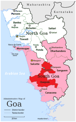
Quepem is a taluka of South Goa district in the state of Goa, India. It is an administrative region of Goa, India.

Contents

Demographics

At the time of the 2011 Census of India, Quepem had a population of 81,193 with sex ratio of 994 females to 1,000 males. Quepem Taluka has an average literacy rate of 82.93%, higher than the national average of 74.04%: male literacy is 87.5% and female literacy is 78.35%. Scheduled Castes and Scheduled Tribes make up 1.15% and 31.15% of the population, respectively. 55.37% of the population lives in urban areas. [1]

Religion

Religion in Quepem Taluka (2011) [2]
ReligionPercent
Hinduism
63.78%
Christianity
29.45%
Islam
6.53%
Other or not stated
0.24%

Hinduism is followed by the majority of population of Quepem Taluka. Christians form a significant minority. At the time of the 2011 Census of India 63.78% of the population of the Taluka followed Hinduism, 29.45% Christianity, 6.53% Islam and 0.24% of the population followed other religions or did not state their religious affiliation. [2]

Languages

Konkani and Marathi are among the most commonly spoken languages in Quepem Taluka.

Languages of Quepem Taluka (2011) [3]

   Konkani (75.63%)
   Marathi (8.25%)
   Hindi (6.06%)
   Kannada (4.13%)
   Urdu (2.00%)
  Others (3.93%)

At the time of 2011 Census of India, 75.63% of the population of Quepem Taluka spoke Konkani, 8.25% Marathi, 6.06% Hindi, 4.13% Kannada and 2.00% Urdu as their first language. [3]

Settlements

'Bhattlem' (Coconut-palm grovet), a common sight throughout the taluka Bhattlem.png
Bhattlem’ (Coconut-palm grovet), a common sight throughout the taluka

Cities

Quepem has 2 cities: Curchorem, Quepem

Towns

Quepem has 1 town: Xeldem

Villages

Quepem has 35 villages: Adnem, Ambaulim, Assolda, Avedem, Bali, Barcem, Bendordem, Cavorem, Cazur, Chaifi, Cordem, Corla, Cotombi, Fatorpa, Gocoldem, Maina, Mangal, Molcarnem, Molcopona, Morpila, Nagvem, Naquerim, Odar, Padi, Pirla, Quedem, Quisconda, Quitol, Sirvoi, Sulcorna, Tiloi, Undorna, Xelvona, Xic-Xelvona, Zanodem

See also

Related Research Articles

<span class="mw-page-title-main">Canacona taluka</span> Taluka (city) of Goa

Canacona is an administrative region in the district of South Goa, Goa state, India.

<span class="mw-page-title-main">Salcete</span> Taluka in South Goa, India

Salcete is a subdivision of the district of South Goa, in the state of Goa, situated by the west coast of India. The Sal River and its backwaters dominate the landscape of Salcete. Historically, the sixty-six settlements south of the Zuari River formed the original Salcette territory. Salcete forms a part of the bigger Konkan region that stretches along the western shoreline of peninsular India.

<span class="mw-page-title-main">South Goa district</span> District of Goa in India

South Goa district is one of two districts that together constiitue the state of Goa, India, within the region known as the Konkan. It is bounded by North Goa district to the north, the Uttara Kannada district of Karnataka state to the east and south, while the Arabian Sea forms its western coast.

<span class="mw-page-title-main">Bardez</span> Taluka in North Goa, India

Bardez is a taluka of the North Goa district in the Indian state of Goa.

<span class="mw-page-title-main">Pernem taluka</span> Sub-District in Goa, India

Pernem is a northmost administrative region or sub-district in North Goa in India. It acts as the Gateway of Goa from Maharashtra side. It is also the name of the town of Pernem, which is its headquarters. It has a Municipal Council. Geographically, Pernem is surrounded by Sawantwadi sub-district on East, Arabian Sea on West, Bardez and Bicholim sub-district on south and Sawantwadi sub-district on north. The two rivers which decide the boundary of this sub-district are Terekhol River and Chapora River. Terekhol river acts as a border of Maharashtra and Goa while Chapora river acts as a border of Pernem sub-district and Bardez sub-district.

<span class="mw-page-title-main">Tiswadi</span> Taluka in North Goa, India

Tiswadi, formerly known as Ilhas, is a taluka in the district of North Goa, situated in the Indian coastal state of Goa. It is an estuarine island situated on the confluence of the Mandovi and Zuari rivers. It was one of the first territories to be annexed by the Portugese in the 16th century. Both the state capital Panaji, and the erstwhile capital Old Goa lie within the sub-district. It is the biggest and the most populated of the six major islands between the Mandovi and Zuari rivers.

Joida is a town located in the Uttara Kannada district in the Indian state of Karnataka. The town is the headquarters of the eponymous taluk. Earlier it was known as Supa taluka but as Supa village got submerged due to dam built across river Kali, Joida taluka came into existence. Joida town has a Post office, branch of nationalised banks and a Police station.

<span class="mw-page-title-main">Sanguem taluka</span> Taluka in Goa, India

Sanguemtaluka is an administrative region of Goa state, India.

<span class="mw-page-title-main">Ponda taluka</span> Taluka in Goa, India

Pondataluka is a subdivision of the district of South Goa, in the Indian state of Goa. Its administrative headquarters is the township of Ponda.

Bicholim is a sub-district, also known as Taluka, located in the Northeastern part of North Goa district of Goa, India. There are 2 cities, 2 towns and 22 villages in Bicholim Taluka.

Jat is a town and taluka headquarters in Miraj subdivision of Sangli district in southern Maharashtra.

Khanapur (Vita) is a village and taluka and a subdivision of Sangli district of Maharashtra in India.

Kadegaon is a village and taluka of Sangli district of Maharashtra in India.

<span class="mw-page-title-main">Jamkhed taluka</span> Tehsil in Maharashtra, India

Jamkhed taluka, is a taluka in Karjat subdivision of Ahmednagar district in Maharashtra State of India.

<span class="mw-page-title-main">Akole taluka</span> Tehsil in Maharashtra, India

Akole taluka is a taluka in Ahmednagar district in Maharashtra state of India. Akole consists of many places like Harishchandragad, Kalsubai, Bhandardara (Wilson) Dam, Sandhan Valley, Vishramgad etc. which attract tourists. Akole is not only famous for its natural scenery but, many historical events are also associated with it. The Western Akole is a part of Sahyadri ranges which increase its important.

<span class="mw-page-title-main">Karjat taluka</span> Taluka in Maharashtra, India

Karjat taluka is a taluka in Karjat subdivision of Ahmednagar district in Maharashtra state of western India.

<span class="mw-page-title-main">Kopargaon taluka</span> Tehsil in Maharashtra, India

Kopargaon taluka is a taluka in Shirdi subdivision of Ahmednagar district in Maharashtra state of India.

<span class="mw-page-title-main">Barshi taluka</span> Tehsil in Maharashtra, India

Barshi Taluka is one of the 11 talukas of Solapur District in the Indian state of Maharashtra. This tehsil occupies the Northeast corner of the district and is bordered by Osmanabad District to the north and east, Madha Taluka to the west, Mohol Taluka to the southwest and North Solapur Taluka to the south. The tehsil headquarters is located at Barshi, which is also the largest city in the tehsil.

<span class="mw-page-title-main">Karmala Taluka</span> Taluka in Maharashtra, India

Karmala Taluka is one of the 11 talukas of Solapur district in the Indian state of Maharashtra. Parts of the movie Sairat were shot in this taluka. Its headquarters are in the town of Karmala.

<span class="mw-page-title-main">Mormugao taluka</span> Tehsil in Goa, India

Morumugaotaluka is an administrative subdivision of South Goa district, Goa state, India, headquartered at Mormugao city. It is the state's only subdistrict to have all four modes of transport—air, road, rail, and sea.

References

  1. "District Census Hand Book – South Goa" (PDF). Census of India . Registrar General and Census Commissioner of India.
  2. 1 2 "Table C-01 Population by Religion: Goa". censusindia.gov.in. Registrar General and Census Commissioner of India. 2011.
  3. 1 2 "Table C-16 Population by Mother Tongue: Goa". censusindia.gov.in. Registrar General and Census Commissioner of India.