

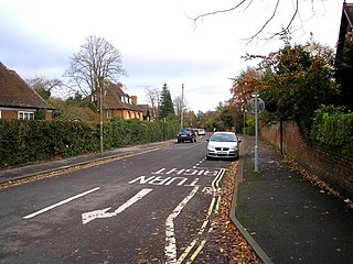
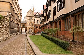
Rawlinson Road is a residential road in North Oxford, England. [1]
Rawlinson Road is a residential road in North Oxford, England. [1]
At the western end of the road is a junction with Woodstock Road (A4144) and at the eastern end is a junction with Banbury Road (A4165), the two major arterial roads out of Oxford to the north. Opposite slightly to the south at the western end is Polstead Road. Opposite slightly to the north at the eastern end is Linton Road. Parallel to the south is St Margaret's Road and to the north is Staverton Road.
Just to the south at 90 Woodstock Road is the Junior School (nursery to year 1) of the Oxford High School [2] (formerly the Squirrel School [3] ). Just to the north at 111 Banbury Road is the Swan Building, the main teaching centre for the Sixth Form of d'Overbroeck's College. Balliol College, one of the colleges of Oxford University, operates a day nursery located in Rawlinson Road. [4]
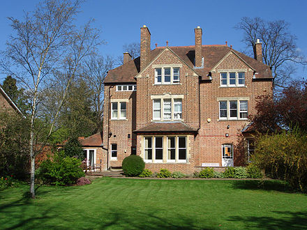
The area where Rawlinson Road is located was originally owned by St John's College, Oxford. The road was named after Dr Richard Rawlinson FRS (1690–1755), an antiquarian and divine. [5] Houses in the road were first leased by the college between 1888 and 1893. [1] They were designed by the architects Harry Wilkinson Moore and Herbert Quinton. The houses are in a late Victorian style and of brick construction. [6]
The Irish-born mathematician John Edward Campbell (1862–1924) lived at 14 Rawlinson Road. [7] Harriet Shaw Weaver (1876–1961), political activist and magazine editor, lived at 4 Rawlinson Road. [8] The Hungarian-born member of the House of Lords and economist Thomas Balogh, Baron Balogh (1905–1985) lived in Rawlinson Road with his family. [9]
Derbyshire House Hotel was located at 18 Rawlinson Road. [10] [11]
The poet John Betjeman (1906–1984) wrote of Rawlinson Road: [12]
Too much, too many! so fetch the doctor,
This dress has grown such a heavier load
Since Jack was only a Junior Proctor,
And rents were lower in Rawlinson Road.
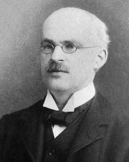
Sir Richard Doll (1912–2005), the epidemiologist and cancer pioneer, lived at 12 Rawlinson Road and a blue plaque was installed on his house in 2015. [13] [14] He lived here with his wife Joan Faulkner after his retirement in 1983. [15]

North Oxford is a suburban part of the city of Oxford in England. It was owned for many centuries largely by St John's College, Oxford and many of the area's Victorian houses were initially sold on leasehold by the College.
Park Town is a small residential area in central North Oxford, a suburb of Oxford, England. It was one of the earliest planned suburban developments in the area and most of the houses are Grade II listed.

Broad Street is a wide street in central Oxford, England, just north of the former city wall. The street is known for its bookshops, including the original Blackwell's bookshop at number 50, located here due to the University. Locally the street is traditionally known as The Broad.

Banbury Road is a major arterial road in Oxford, England, running from St Giles' at the south end, north towards Banbury through the leafy suburb of North Oxford and Summertown, with its local shopping centre. Parallel and to the west is the Woodstock Road, which it meets at the junction with St Giles'. To the north, Banbury Road meets the Oxford Ring Road at a roundabout. The road is designated the A4165. Prior to the building of the M40 motorway extension in 1990, the road formed part of the A423 from Maidenhead to Coventry.

Summertown in North Oxford is a suburb of Oxford, England.

Woodstock Road is a major road in Oxford, England, running from St Giles' in the south, north towards Woodstock through the leafy suburb of North Oxford. To the east is Banbury Road, which it meets at the junction with St Giles'.

Parks Road is a road in Oxford, England, with several Oxford University colleges along its route. It runs north-south from the Banbury Road and Norham Gardens at the northern end, where it continues into Bradmore Road, to the junction with Broad Street, Holywell Street and Catte Street to the south.
Belbroughton Road is a residential road in the suburb of North Oxford, England. The road runs east from Banbury Road. At the other end is Oxford High School, a girls' school. South from the road about halfway along is Northmoor Road, where J. R. R. Tolkien lived for a while in the 1930s. At the eastern end is Charlbury Road.

Keble Road is a short road running east–west in central Oxford, England. To the west is the southern end of the Banbury Road with St Giles' Church opposite. To the east is Parks Road with the University Parks opposite. Blackhall Road leads off the road to the south near the western end.

Linton Road is a road in North Oxford, England.

Bevington Road is a residential road in central North Oxford, England.
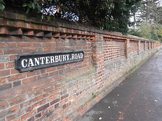
Canterbury Road is a road in North Oxford, England. It runs between Woodstock Road to the west and Banbury Road to the east. Winchester Road leads south from halfway along Canterbury Road, linking with Bevington Road that runs parallel to the south. Also to the south are North Parade and Church Walk.

Winchester Road is a road in North Oxford, England. It runs north–south between and roughly parallel with Woodstock Road to the west and Banbury Road to the east. It is in a desirable area with high house prices.

St Margaret's Road is a road in North Oxford, England.

Shipton-on-Cherwell is a village on the River Cherwell about 2 miles (3 km) north of Kidlington in Oxfordshire, England. The village is part of the civil parish of Shipton-on-Cherwell and Thrupp.
Harry Wilkinson Moore, FRIBA (1850–1915) was a Victorian and Edwardian architect. He was the son of Arthur Moore (1814–1873) and Mary Wilkinson (1821–1904), and a nephew of the architects George Wilkinson and William Wilkinson.

Lathbury Road is a residential road in north Oxford, England.

Moreton Road is a residential road in the Oxford suburb of North Oxford, Oxfordshire, United Kingdom.

Bradmore Road is a residential road in North Oxford, England.

Crick Road is a road in North Oxford, England, an area characterised by large Victorian Gothic villas.
|publisher= (help)Coordinates: 51°46′07″N1°15′51″W / 51.7687°N 1.2641°W
| This Oxfordshire location article is a stub. You can help Wikipedia by expanding it. |
| This England road or road transport-related article is a stub. You can help Wikipedia by expanding it. |