River Alt

Last updated

River Alt
River Alt, Gillmoss- geograph.org.uk - 117904.jpg
River Alt in Croxteth
Merseyside UK relief location map.jpg
Red pog.svg
Location of river mouth (Hightown)
Location
CountryEngland
County Merseyside
City Liverpool
Physical characteristics
Source 
  coordinates 53°24′52.6″N2°49′55.5″W / 53.414611°N 2.832083°W / 53.414611; -2.832083
  elevation98 feet (30 m)
Mouth  
  coordinates
53°31′25.1″N3°03′50.4″W / 53.523639°N 3.064000°W / 53.523639; -3.064000
  elevation
0 feet (0 m)
Length17 miles (28 km)
Basin size40 square miles (103 km2)
Discharge 
  average105.4 cu ft/s (2.984 m3/s) [1]

The River Alt is an urban river that flows across Merseyside in England. The river has suffered from heavy pollution from industry and sewage upstream and run-off from farmland in its lower reaches. It empties into the River Mersey, near to where the Mersey itself flows into the Irish Sea. The river has benefited from clean-up schemes and a de-culverting process to improve its water quality and provide a better environment for wildlife.

Contents

Etymology

The river's name might be of Latin origin (meaning muddy river) [2] but the banks of the river are lined by villages and places with names of Old Norse derivation. [3] The name Alt could also be derived from Brittonic alt, which can either mean 'cliff' or as is more likely in this case, 'burn, mountain stream' (Welsh allt, Irish ált). [4] Thirdly, the obscure Celtic element *al-, suffixed with the Brittonic nominal suffix -ed may underlie this name. [4]

Route

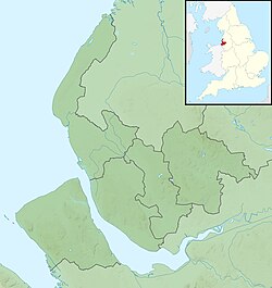
The Alt runs from Hag Plantation in Huyton at 125 ft (38 m), through Croxteth Park, roughly follows the M57 motorway south of Kirkby, then flows north of Aintree and south of Maghull. It then runs south of Formby and empties into the Irish Sea, near the edge of the River Mersey estuary at Hightown. [5]

The Alts upper waters deriving from small streams and, in particular, one arising at Hag Plantation in Huyton. This is the location of the primary source of the river and is also the Huyton Wetlands Site of Biological Interest (SBI). [6] [7] The Alt then flows at a low gradient across an alluvium plain in a northwesterly direction before turning southwards and emptying into the River Mersey at Hightown between Crosby and Formby. [8]

The Alt's catchment boundary reaches as far as Banks and Crossens in the north and out to Burscough and Kirkby in the east. It drains a catchment area of 40 square miles (103 km2) [9] [10] [11] and flows a distance of 17 miles (28 km) from source to the Mersey Estuary. [12]

The river flows through varying types of land: Sherwood Sandstone in the Huyton area, Coal Measures in the West Derby area and eventually Mercia Mudstone in the Maghull/North Sefton area. [13] [14] The estuary forms part of the Ribble and Alt Estuaries Special Protection Area for wildlife. [15]

Before the installation of tidal floodgates at Hightown in the 18th Century, the river was once called a "troublesome little river" its ever changing course cutting through the field boundaries, threatening roads and bridges and was rumoured to have wiped out the hamlet of Altmouth sometime between 1577 and 1713. However, studies of mapping have shown that there was never a village symbol at Altmouth on the maps, [8] although one mapman stated there was a village there, but was unclear as to if it was on the north or south side of the river mouth. [16] Flooding along the river was a problem until the 1960s when work to straighten and canalise the river, plus the opening of pumping stations at Crossens in 1959 and Altmouth in 1972, ended the regular inundation of fields by water from the sources and from the sea. [17] [18] The river downstream of Maghull is rich agricultural land, but 20 square miles (52 km2) of it is below sea level and so requires the pumping stations to prevent tidal incursions into the river. [19] The river was once well known for its fish and large quantities of eels were trapped upstream and in its tributaries. Flatfish like dabs, plaice and flounder were caught in the estuary and the tidal reaches, vast cockle beds were worked in the estuary.

The river began to change in the early 20th century as Liverpool expanded and industry, then new housing began to grow along its banks. By the 1970s, the pollution had affected the river so much, it was listed as being class 3 or 4, which meant that apart from bloodworms, [20] there was no life in the river. Part of this problem lies with when the river was culverted and housing was erected near to and over the river, the wastewater pipes from the dwellings were wrongly connected to discharge their water directly into the river. [21]

New sewage farms at Croxteth and Hillhouse plus modernisation to existing sewage farms and the decrease in heavy industry in Knowsley, Kirkby and Aintree began to clean up the river and by the early 1990s freshwater fish began to colonise the river from tributaries like Sudell Brook and Downholland Brook. [22] By 2000, the river was well known among local anglers for its healthy population of pike, chub, bream, roach [23] and sticklebacks. Herons, kingfishers and, in summer, egrets can often be seen in the water. In 2016, the Environment Agency released 9,000 fish into the river to replenish stocks. [24]

The Alt is still not clean due to its heritage as a handy dumping ground for sewage and industrial waste. Currently it has a moderate ecological rating but a fail rating for chemicals due to heavy metals in its silt. However, in 2006, the amount of wildlife that lived in and around the river earned it a clean bill of health from the Environment Agency. [25]

Improvements

In 1996, a 460-foot (140 m) long, and a 98-foot (30 m) wide section of the river flowing through Knowsley, was rehabilitated from a straight, narrow stretch of water into a low floodplain where the water would spread out into several courses over the plain. The main channel was diverted and several smaller channels were created by the addition of berms to separate them. This has allowed plants to thrive and offers a floodplain where there was not one before. [26]

In June 2014, a new section of the river was de-culverted and was lengthened through the addition of bends to improve the river's quality and also provide a greenspace for the nearby residents of Croxteth. Initially tied in with a development plan connected with Stonebridge Cross, the 980-foot (300 m) section was opened to daylight to create a meandering riverside that stretched to 2,850-foot (870 m) and would help when the river was in flood as well as improve the area for wildlife. [27] [28] [29]

Settlements

Tributaries

Related Research Articles

<span class="mw-page-title-main">Merseyside</span> County of England

Merseyside is a metropolitan and ceremonial county in North West England. It borders Lancashire to the north, Greater Manchester to the east, Cheshire to the south, the Welsh county of Flintshire across the Dee Estuary to the southwest, and the Irish Sea to the west. The largest settlement is Liverpool.

<span class="mw-page-title-main">Metropolitan Borough of Sefton</span> Metropolitan borough in England

The Metropolitan Borough of Sefton is a metropolitan borough of Merseyside, England. It was formed on 1 April 1974 under the Local Government Act 1972, by the amalgamation of the county boroughs of Bootle and Southport, the municipal borough of Crosby, the urban districts of Formby and Litherland, and part of West Lancashire Rural District. It consists of a coastal strip of land on the Irish Sea which extends from Southport in the north to Bootle in the south, and an inland part to Maghull in the south-east, bounded by the city of Liverpool to the south, the Metropolitan Borough of Knowsley to the south-east, and West Lancashire to the east.

<span class="mw-page-title-main">Maghull</span> Town in England

Maghull is a town and civil parish in Sefton, Merseyside. The town is north of Liverpool and west of Kirkby. The area also contains Ashworth Hospital.

<span class="mw-page-title-main">Croxteth</span> Human settlement in England

Croxteth is a suburb of Liverpool, Merseyside, England, and a Liverpool City Council Ward. Although housing in the area is predominantly modern, the suburb has some notable history. At the United Kingdom 2011 Census it had a population of 14,561.

<span class="mw-page-title-main">West Derby Hundred</span>

The West Derby Hundred is one of the six subdivisions of the historic county of Lancashire, in northern England. Its name alludes to its judicial centre being the township of West Derby.

<span class="mw-page-title-main">Aintree Racecourse</span> Horse racing venue in Liverpool, England

Aintree Racecourse is a racecourse in Aintree, Metropolitan Borough of Sefton, Merseyside, England, bordering the city of Liverpool. The racecourse is the venue for the Grand National steeplechase, which takes place annually in April over three days. Aintree also holds meetings in May and June, October (Sunday), November and December.

Merseytravel is the passenger transport executive, responsible for the coordination of public transport in the Liverpool City Region in North West England. Merseytravel was established on 1 December 1969 as the Merseyside Passenger Transport Executive. From 1 April 2014, with the creation of the Liverpool City Region, Merseytravel expanded its area of operation from the metropolitan county of Merseyside to also include the Borough of Halton.

<span class="mw-page-title-main">Hightown, Merseyside</span> Village in England

Hightown is a village and civil parish in the Metropolitan Borough of Sefton in Merseyside, England, located midway between the city of Liverpool and the coastal resort of Southport. It is 8 miles north of Liverpool city centre and is located on the coast near the boundary of the Mersey Estuary and Liverpool Bay. The River Alt joins the sea at this point and forms an estuary. There is a pumping station on the River Alt at Altmouth, built 1972, as part of a programme to alleviate flooding in the area. This is on the Altcar Rifle Range, a Territorial Army base originally established in 1860 by Lt. Col. Gladstone.

<span class="mw-page-title-main">Knowsley North and Sefton East (UK Parliament constituency)</span> Parliamentary constituency in the United Kingdom, 1997–2010

<span class="mw-page-title-main">Sefton Central (UK Parliament constituency)</span> Parliamentary constituency in the United Kingdom, 2010 onwards

Sefton Central is a constituency represented by Bill Esterson of the Labour Party since 2010.

<span class="mw-page-title-main">Liverpool Built-up Area</span> Human settlement in United Kingdom

The Liverpool Built-up Area is a term used by the Office for National Statistics (ONS) to denote the urban area around Liverpool in England, to the east of the River Mersey. The contiguous built-up area extends beyond the area administered by Liverpool City Council into adjoining local authority areas, particularly parts of Sefton and Knowsley. As defined by ONS, the area extends as far east as St Helens, Haydock, and Ashton-in-Makerfield in Greater Manchester.

<span class="mw-page-title-main">Ormskirk (UK Parliament constituency)</span> Parliamentary constituency in the United Kingdom, 1885–1983

Ormskirk was a county constituency represented in the House of Commons of the Parliament of the United Kingdom. It elected one Member of Parliament (MP) by the first past the post system of election. It was created by the Redistribution of Seats Act 1885 as a division of the parliamentary county of Lancashire. The constituency boundaries were changed in 1918, 1950, 1955 and 1974.

<span class="mw-page-title-main">Knowsley United F.C.</span> Football club

Knowsley United was an English football club based in the town of Huyton, Knowsley Merseyside. Originally named Kirkby Town they folded in 1997.

<span class="mw-page-title-main">Kirkby Brook</span> River in Merseyside, England

Kirkby Brook is the name for Simonswood Brook in Kirkby, a minor river (brook) in Merseyside, England, that is a tributary to the River Alt in the Alt catchment. It is located entirely within the town of Kirkby in the Metropolitan Borough of Knowsley.

References

  1. "Pollution control on the River Alt" (PDF). environmentdata.org. Environment Agency. March 1995. p. 2. Retrieved 16 February 2018.
  2. Ekwall, Eilert (1960). The concise Oxford dictionary of English place-names (4 ed.). Oxford: Clarendon Press. p. 8. ISBN   0-19-869103-3.
  3. Philbin-SOU, Paul; Lopez, Jamie (16 January 2016). "Norse placenames in Sefton and West Lancashire". Southport Visiter. Retrieved 16 February 2018.
  4. 1 2 James, Alan. "A Guide to the Place-Name Evidence" (PDF). SPNS - The Brittonic Language in the Old North. Retrieved 25 November 2018.
  5. "A Troublesome Little River". Mike Royden's Local History Pages. Archived from the original on 11 October 2012. Retrieved 28 March 2010.
  6. "Alt Crossens action plan 2000-2005" (PDF). environmentdata.org. Environment Agency. September 2000. p. 9. Retrieved 16 February 2018.
  7. "Local Wildlife Sites and Local Geological Sites" (PDF). knowsley.gov.uk. July 2013. p. 61. Retrieved 16 February 2018.
  8. 1 2 "River Alt, Historic Liverpool". historic-liverpool.co.uk. 23 October 2014. Retrieved 16 February 2018.
  9. "Alt". environment.data.gov.uk. Retrieved 16 February 2018.
  10. "Alt US Bull Bridge". environment.data.gov.uk. Retrieved 16 February 2018.
  11. "Alt DS Bull Bridge". environment.data.gov.uk. Retrieved 16 February 2018.
  12. "Alt Crossens action plan 2000-2005" (PDF). environmentdata.org. Environment Agency. September 2000. p. 5. Retrieved 16 February 2018.
  13. "Alt Crossens action plan" (PDF). environmentdata.org. Environment Agency. October 1996. p. 28. Retrieved 16 February 2018.
  14. "Sefton Coastal Road, Southport" (PDF). floodready.co.uk. Sefton Council. p. 1. Retrieved 16 February 2018.
  15. "Ribble and Alt Estuaries". jncc.defra.gov.uk. Retrieved 16 February 2018.
  16. "Townships: Formby | British History Online". www.british-history.ac.uk. Retrieved 16 February 2018.
  17. "Altmouth Pumping Station" (PDF). formbycivicsociety.org.uk. Formby Civic News. August 2008. p. 1. Retrieved 16 February 2018.
  18. "Crossens Pumping Station" (PDF). floodready.co.uk. Sefton Council. Retrieved 16 February 2018.
  19. "Alt Crossens action plan" (PDF). environmentdata.org. Environment Agency. October 1996. p. 12. Retrieved 16 February 2018.
  20. TRAFF 1996, p. 2.
  21. "NCA Profile: 57 Sefton Coast - NE531" (PDF). publications.naturalengland.org.uk. 26 February 2014. p. 46. Retrieved 16 February 2018.
  22. "cde". environment.data.gov.uk. Retrieved 26 March 2019.
  23. "Roy bags 65lb net of roach on River Alt". Liverpool Echo. 14 September 2005. Retrieved 16 February 2018.
  24. "Almost 2 million fish released into England's rivers - GOV.UK". www.gov.uk. 11 February 2016. Retrieved 16 February 2018.
  25. "Clean bill of health". Liverpool Echo. 16 March 2006. Retrieved 16 February 2018.
  26. "Radical redesign from uniform, straight channel to a sinuous multi-channel river" (PDF). therrc.co.uk. pp. 1–6. Retrieved 16 February 2018.
  27. Bartlett, David (9 January 2013). "Merseyside's River Alt diverted ... for the Amazon". Liverpool Echo. Retrieved 16 February 2018.
  28. "River Alt Restoration | Our work | The Mersey Forest". www.merseyforest.org.uk. Retrieved 16 February 2018.
  29. "The River Alt Project: Creation of a new river channel in a linear park" (PDF). ecorestorationsolutions.co.uk. Retrieved 16 February 2018.

Sources