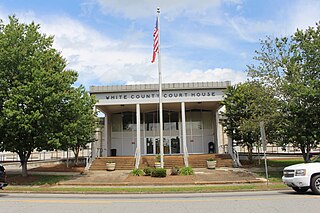
White County is a county located in the northeastern part of the U.S. state of Georgia. As of the 2020 census, the population was 28,003. The county seat is Cleveland. The county was created on December 22, 1857, formerly a part of Habersham County and most likely was named for Newton County Representative David T. White, who helped a Habersham representative successfully attain passage of an act creating the new county.

Union County is a county located in the north central portion of the U.S. state of Georgia. As of the 2020 census, the population was 24,632. The county seat is Blairsville.

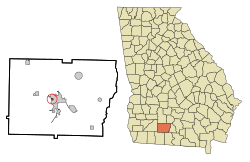
Towns County is a county located in the northeastern part of the U.S. state of Georgia. As of the 2020 census, the population was 12,493. Its county seat is Hiawassee. The county was created on March 6, 1856, and named for lawyer, legislator, and politician George W. Towns.

Riverside is a city in St. Clair County, Alabama, United States. It incorporated in 1886. At the 2010 census the population was 2,208, up from 1,564 in 2000.

Fellows is a census-designated place (CDP) in Kern County, California, United States. Fellows is located 5 miles (8 km) west-northwest of Taft, at an elevation of 1,316 feet (401 m). The population was 106 at the 2010 census, down from 153 at the 2000 census. Fellows is surrounded on all sides by the enormous Midway-Sunset Oil Field, the third-largest oil field in the United States, and the oil and gas industry accounts for much of the area's economic activity.
Carl is a town in Barrow County, Georgia, United States. The population was 269 at the 2016 census.

Tallulah Falls is a town in Habersham and Rabun counties in the U.S. state of Georgia near the Tallulah River. The population was 199 at the 2020 census.

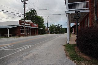
Bowersville is a town in Hart County, Georgia, United States. As of the 2020 census, the town had a population of 444.

Hoschton is a city in Jackson County, Georgia, United States. The population was 1,377 at the 2010 census. As of 2018 the estimated population was 1,916.

Talmo is a town in Jackson County, Georgia, United States. The population was 257 at the 2020 census.
Bostwick is a city in Morgan County, Georgia, United States. As of the 2020 census, the city had a population of 378.

Buckhead is a town in Morgan County, Georgia, United States. As of the 2020 census, the town had a population of 194.

Newborn is a town in Newton County, Georgia, United States. The population was 696 at the 2010 census.

Sycamore is a city in Turner County, Georgia, United States. The population was 692 in 2020.

Woodhull is a village in Henry County, Illinois. As of the 2010 census, the village had a population of 811, up from 809 in 2000.

Marcus is a city in Cherokee County, Iowa, United States. The population was 1,079 at the time of the 2020 census.

Galeville is a hamlet in Onondaga County, New York, United States. The population was 4,617 at the 2010 census.

Riverside is a town in Okanogan County, Washington, United States. The population was 280 at the 2010 census, and increased to 329 at the 2020 census.

Grant Town is a town in Marion County, West Virginia, in the eastern United States. The population was 690 at the 2020 census.

New Post is a census-designated place (CDP) in the town of Hunter, Sawyer County, Wisconsin, United States. The population was 305 at the 2010 census.