Omega, Georgia

Last updated

Omega, Georgia
OmegaCityHall.JPG
Omega City Hall
Tift County Georgia Incorporated and Unincorporated areas Omega Highlighted.svg
Location in Tift County and the state of Georgia
Coordinates: 31°20′23″N83°35′42″W / 31.33972°N 83.59500°W / 31.33972; -83.59500
Country United States
State Georgia
Counties Tift, Colquitt
Area
[1]
  Total
1.80 sq mi (4.67 km2)
  Land1.78 sq mi (4.62 km2)
  Water0.02 sq mi (0.06 km2)
Elevation
322 ft (98 m)
Population
 (2020)
  Total
1,318
  Density739.20/sq mi (285.42/km2)
Time zone UTC-5 (Eastern (EST))
  Summer (DST) UTC-4 (EDT)
ZIP code
31775
Area code 229
FIPS code 13-58184 [2]
GNIS feature ID0332576 [3]

Omega is a city in Tift and Colquitt counties in the U.S. state of Georgia. The population was 1,318 in 2020.

Contents

History

Omega was originally called Surrey, and under the latter name was founded ca. 1889 when the railroad was extended to that point. [4]

Geography

Omega is located at 31°20′23″N83°35′42″W / 31.33972°N 83.59500°W / 31.33972; -83.59500 (31.339684, -83.595036). [5]

According to the United States Census Bureau, the city has a total area of 1.8 square miles (4.7 km2), of which 1.8 square miles (4.7 km2) is land and 0.56% is water.

Demographics

Historical population
CensusPop.Note
1910 274
1920 32920.1%
1930 324−1.5%
1940 60887.7%
1950 96658.9%
1960 940−2.7%
1970 835−11.2%
1980 99619.3%
1990 912−8.4%
2000 1,34046.9%
2010 1,221−8.9%
2020 1,3187.9%
U.S. Decennial Census [6]
1850-1870 [7] 1870-1880 [8]
1890-1910 [9] 1920-1930 [10]
1940 [11] 1950 [12] 1960 [13]
1970 [14] 1980 [15] 1990 [16]
2000 [17] 2010 [18]
Omega racial composition as of 2020 [19]
RaceNum.Perc.
White (non-Hispanic)43332.85%
Black or African American (non-Hispanic)20015.17%
Native American 20.15%
Asian 70.53%
Other/Mixed 251.9%
Hispanic or Latino 65149.39%

At the 2020 United States census, there were 1,318 people, 440 households, and 326 families residing in the city.

Circa 2023 its population was 1,221. 1,209 of those people lived in Tift County, and 12 of them lived in Colquitt County. [20]

Education

All residents of Tift County are in the Tift County School District. [21]

All residents of Colquitt County are in the Colquitt County School District. [22]

Related Research Articles

<span class="mw-page-title-main">Worth County, Georgia</span> County in Georgia, United States

Worth County is a county located in the south-central portion of the U.S. state of Georgia. As of the 2020 census, the population was 20,784. The county seat is Sylvester. Worth County is included in the Albany, GA metropolitan statistical area.

<span class="mw-page-title-main">Tift County, Georgia</span> County in Georgia, United States

Tift County is a county located in the south central portion of the U.S. state of Georgia. As of the 2020 census, the population was 41,344. The county seat is Tifton.

<span class="mw-page-title-main">Cook County, Georgia</span> County in Georgia, United States

Cook County is a county located in the south central portion of the U.S. state of Georgia. As of the 2020 census, the population was 17,229. The county seat is Adel. The constitutional amendment to create the county was proposed July 30, 1918, and ratified November 5, 1918. It is named for former Civil War general Philip Cook of the Confederate States Army.

<span class="mw-page-title-main">Colquitt County, Georgia</span> County in Georgia, United States

Colquitt County is a county in the U.S. state of Georgia. As of the 2020 census, the population was 45,898. The county seat is Moultrie. The county was created on February 25, 1856, and is named for Walter Terry Colquitt, a U.S. senator. Colquitt County comprises the Moultrie, GA micropolitan statistical area.

<span class="mw-page-title-main">Barwick, Georgia</span> City in Georgia, United States

Barwick is a city divided by the county line between Brooks and Thomas counties, Georgia, United States. It is part of the Valdosta metropolitan statistical area. As of the 2020 census, the city had a population of 363.

<span class="mw-page-title-main">Pavo, Georgia</span> City in Georgia, United States

Pavo is a city that is divided by the county line between Brooks and Thomas counties in the U.S. state of Georgia. It is part of the Valdosta, Georgia Metropolitan Statistical Area. The population was 622 in 2020.

<span class="mw-page-title-main">Lakeview, Georgia</span> Place in Georgia, United States

Lakeview is an unincorporated community and census-designated place (CDP) in Catoosa and Walker counties in the U.S. state of Georgia. The population was 4,820 at the 2000 census and 4,777 at the 2020 census. It is part of the Chattanooga, TN–GA Metropolitan Statistical Area.

<span class="mw-page-title-main">Berlin, Georgia</span> Town in Georgia, United States

Berlin is a city in Colquitt County, Georgia, United States. As of the 2020 census, the city had a population of 511.

<span class="mw-page-title-main">Doerun, Georgia</span> City in Georgia, United States

Doerun is a city in Colquitt County, Georgia, United States. The population was 738 in 2020.

<span class="mw-page-title-main">Ellenton, Georgia</span> Town in Georgia, United States

Ellenton is a town in Colquitt County, Georgia, United States. Its population was 281 at the 2010 census. It was incorporated in 1970 by the Georgia General Assembly. It is located at 31°10′36″N83°35′17″W.

<span class="mw-page-title-main">Funston, Georgia</span> Town in Georgia, United States

Funston is a town in Colquitt County, Georgia, United States. The population was 402 in 2020.

<span class="mw-page-title-main">Moultrie, Georgia</span> City in Georgia, United States

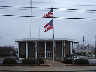
Moultrie is the county seat and largest city of Colquitt County, Georgia, United States. It is the third largest city in Southwest Georgia, behind Thomasville and Albany. As of the 2020 census, Moultrie's population was 14,638. It was originally known as Ochlockoney until it was incorporated by the Georgia General Assembly in 1859. Moultrie is an agricultural community set in the Southern Rivers part of Georgia.

<span class="mw-page-title-main">Norman Park, Georgia</span> City in Georgia, United States

Norman Park is a city in Colquitt County, Georgia, United States. The population was 963 in 2020.

<span class="mw-page-title-main">Union City, Georgia</span> City in Georgia, United States

Union City is a city in Fulton County, Georgia, United States. The population was 26,830 at the 2020 census.

<span class="mw-page-title-main">Colquitt, Georgia</span> City in Georgia, United States

Colquitt is a city and the county seat of Miller County, in the southwestern portion of the U.S. state of Georgia. The population was 2,001 at the 2020 census. Colquitt has been the county seat of Miller County since Miller County was incorporated by the Georgia Legislature in 1856. The city formally incorporated on December 19, 1860, and is Miller County's only incorporated municipality. Colquitt is named for U.S. Congressman and Senator Walter Terry Colquitt.

<span class="mw-page-title-main">Forsyth, Georgia</span> City in Georgia, United States

Forsyth is a city in and the county seat of Monroe County, Georgia, United States. The population was 4,384 at the 2020 census, up from 3,788 in 2010. Forsyth is part of the Macon metropolitan statistical area.

<span class="mw-page-title-main">Tifton, Georgia</span> City in Georgia, United States

Tifton is a city in and the county seat of Tift County, Georgia, United States. The population was 17,045 at the 2020 census.

<span class="mw-page-title-main">Ty Ty, Georgia</span> City in Georgia, United States

Ty Ty is a city in Tift County, Georgia, United States. The population was 725 at the 2010 census. The community takes its name from nearby Ty Ty Creek.

<span class="mw-page-title-main">Danville, Georgia</span> Town in Georgia, United States

Danville is a town in Twiggs and Wilkinson counties in the U.S. state of Georgia. The population was 238 at the 2010 census, down from 373 in 2000.

<span class="mw-page-title-main">Jeffersonville, Georgia</span> City in Georgia, United States

The city of Jeffersonville is the largest city and county seat of Twiggs County, Georgia, United States. The population was 1,035 at the 2010 census, down from 1,209 in 2000.

References

  1. "2020 U.S. Gazetteer Files". United States Census Bureau. Retrieved December 18, 2021.
  2. "U.S. Census website". United States Census Bureau . Retrieved January 31, 2008.
  3. "US Board on Geographic Names". United States Geological Survey. October 25, 2007. Retrieved January 31, 2008.
  4. Krakow, Kenneth K. (1975). Georgia Place-Names: Their History and Origins (PDF). Macon, GA: Winship Press. p. 167. ISBN   0-915430-00-2.
  5. "US Gazetteer files: 2010, 2000, and 1990". United States Census Bureau. February 12, 2011. Retrieved April 23, 2011.
  6. "Decennial Census of Population and Housing by Decade". United States Census Bureau.
  7. "1870 Census of Population - Georgia - Population of Civil Divisions less than Counties" (PDF). United States Census Bureau. 1870.
  8. "1880 Census of Population - Georgia - Population of Civil Divisions less than Counties" (PDF). United States Census Bureau. 1880.
  9. "1910 Census of Population - Georgia" (PDF). United States Census Bureau. 1910.
  10. "1930 Census of Population - Georgia" (PDF). United States Census Bureau. 1930. pp. 251–256.
  11. "1940 Census of Population - Georgia" (PDF). United States Census Bureau. 1940.
  12. "1950 Census of Population - Georgia" (PDF). United States Census Bureau. 1950.
  13. "1960 Census of Population - Population of County Subdivisions - Georgia" (PDF). United States Census Bureau. 1960.
  14. "1970 Census of Population - Population of County Subdivisions - Georgia" (PDF). United States Census Bureau. 1970.
  15. "1980 Census of Population - Number of Inhabitants - Georgia" (PDF). United States Census Bureau. 1980.
  16. "1990 Census of Population - Summary Social, Economic, and Housing Characteristics - Georgia" (PDF). United States Census Bureau. 1990.
  17. "2000 Census of Population - General Population Characteristics - Georgia" (PDF). United States Census Bureau. 2000.
  18. "2010 Census of Population - General Population Characteristics - Georgia" (PDF). United States Census Bureau. 2010.
  19. "Explore Census Data". data.census.gov. Retrieved December 18, 2021.
  20. "General Highway Map Colquitt County Georgia" (PDF). Georgia Department of Transportation . Retrieved September 25, 2024.
  21. "2020 CENSUS - SCHOOL DISTRICT REFERENCE MAP: Tift County, GA" (PDF). U.S. Census Bureau . Retrieved September 25, 2024. - Text list
  22. "2020 CENSUS - SCHOOL DISTRICT REFERENCE MAP: Colquitt County, GA" (PDF). U.S. Census Bureau . Retrieved September 25, 2024. - Text list