
Fort Frederica National Monument, on St. Simons Island, Georgia, preserves the archaeological remnants of a fort and town built by James Oglethorpe between 1736 and 1748 to protect the southern boundary of the British colony of Georgia from Spanish raids. About 630 British troops were stationed at the fort.

Padanaram is a coastal village in South Dartmouth, Massachusetts, United States. The village is located on Buzzards Bay, more specifically near the inlet of Apponagansett Bay.

Fort Halifax is a former British colonial outpost on the banks of the Sebasticook River, just above its mouth at the Kennebec River, in Winslow, Maine. Originally built as a wooden palisaded fort in 1754, during the French and Indian War, only a single blockhouse survives. The oldest blockhouse in the United States, it is preserved as Fort Halifax State Historic Site, and is open to the public in the warmer months. The fort guarded Wabanaki canoe routes that reached to the St. Lawrence and Penobscot Valleys via the Chaudière-Kennebec and Sebasticook-Souadabscook rivers. The blockhouse was declared a National Historic Landmark and added to the National Register of Historic Places in 1968.

Yuchi Town Site, or Yuchi Town, is a late prehistoric and historic era archaeological site showing occupation of both the Apalachicola and of Yuchi tribes. The site is located in a remote area of Fort Benning, Russell County, Alabama. The Yuchi Town Site is an example of historic Native American cultures adopting various strategies to maintain their cultural integrity in the face of European colonization and the expansion of the United States. It was declared a National Historic Landmark in 1996.

The Cushnoc Archeological Site, also known as Cushnoc or Koussinoc or Coussinoc, is an archaeological site in Augusta, Maine that was the location of a 17th-century trading post operated by English colonists from Plymouth Colony in present-day Massachusetts. The trading post was built in 1628 and lies on the Kennebec River. The English primarily traded with bands of the Abenaki nation.

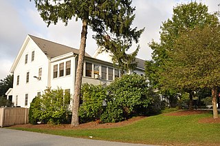
Liberty Farm is a National Historic Landmark at 116 Mower Street in Worcester, Massachusetts. Built c. 1810, it was the home for most of their married life of Abby Kelley Foster (1810–1887) and Stephen Symonds Foster (1809-1881), early vocal abolitionists and women's rights activists. The Fosters used their house as a shelter on the Underground Railroad, and famously refused to pay taxes on the property because Abby was unable to vote. The property, a private residence not open to the public, was designated a National Historic Landmark in 1974. In 2018 the building was sold off to a local family.

The Barneyville Historic District is a predominantly residential historic district on Old Providence and Barneyville Roads in northwestern Swansea, Massachusetts. The area was the site of a successful shipbuilding operation during the early 19th century, and then became a local center for jewelry making. The district was added to the National Register of Historic Places in 1990.

The Hadley Center Historic District is an expansive, 2,500-acre (1,000 ha) historic district encompassing the village center of Hadley, Massachusetts. When it was first listed on the National Register of Historic Places in 1977, the district encompassed the town green and 17 buildings that faced it, at the junction of Russell Street and Middle Street. The district was expanded significantly in 1994, adding more than 400 buildings representative of the village's growth from colonial days into the first decades of the 20th century. This expansion encompasses the entirety of a tongue of land extending west from East Street and bounded by a bend in the Connecticut River, which separates Hadley from Northampton. Its oldest property, the Samuel Porter House on West Street, was built in 1713.

The Russell Center Historic District is a historic district encompassing the historic village center of Russell, Massachusetts. It is centered at the junction of Main Street and Lincoln Avenue, and is bordered by the Westfield River to the east, and the rising foothills of The Berkshires to the west. The village's 19th century development was spurred by the railroad and sustained by local papermaking businesses. It was listed on the National Register of Historic Places in 1996, and was named as one of the 1,000 places to visit in Massachusetts by the Great Places in Massachusetts Commission.

Fort Lee is a historic American Revolutionary War fort in Salem, Massachusetts. The site, located at a high point next to Fort Avenue on Salem Neck, is a relatively rare fortification from that period whose remains are relatively unaltered. It is an irregular 5-pointed star fort. Although there is some documentary evidence that the Neck was fortified as early as the 17th century, the earthworks built in 1776 are the first clear evidence of the site's military use. Reportedly, the fort had a garrison of 3 officers and 100 artillerymen with 16 guns. The site, of which only overgrown earthworks and a stone magazine survive, was repaired in the 1790s, and rebuilt for the American Civil War. A state cultural resource document states that the fort has not been much modified since the Revolution, and has not been built over. It was garrisoned by the Massachusetts militia in the War of 1812, abandoned afterwards, and rebuilt with four 8-inch columbiads in the Civil War. An Army engineer drawing dated 1872 depicts the fort's five-pointed trace and the four Civil War gun positions. It was also garrisoned during the Spanish–American War.

Fort Pickering is a 17th-century historic fort site on Winter Island in Salem, Massachusetts. Fort Pickering operated as a strategic coastal defense and military barracks for Salem Harbor during a variety of periods, serving as a fortification from the Anglo-Dutch Wars through World War II. Construction of the original fort began in 1643 and it saw use as a military installation into the 20th century. Fort Miller in Marblehead also defended Salem's harbor from the 1630s through the American Civil War. Fort Pickering is a First System fortification named for Colonel Timothy Pickering, born in Salem, adjutant general of the Continental Army and secretary of war in 1795. Today, the remains of the fort are open to the public as part of the Winter Island Maritime Park, operated by the City of Salem.

Fort Sewall is a historic coastal fortification in Marblehead, Massachusetts. It is located at Gale's Head, the northeastern point of the main Marblehead peninsula, on a promontory that overlooks the entrance to Marblehead Harbor. Until 1814 it was called Gale's Head Fort.
The Almshouse is a historic almshouse in Stoneham, Massachusetts. Built in 1852, it is one of the few surviving buildings of this type in the Greater Boston area. It is now part of the Stoneham Senior Center, and was listed on the National Register of Historic Places in 1984.

The Spot Pond Archeological District is a historic archaeological site near Spot Pond in Stoneham, Massachusetts. It is located in the Virginia Woods section of the Middlesex Fells Reservation, a state park. The district encompasses sites along Spot Pond Brook that were mill sites dating from the 17th to the 19th centuries. At its height, in the mid-19th century the Hayward Rubber Works was located in the area, giving it the name "Haywardville". One of the park's trails runs through the area, and a park pamphlet provide a self-guided tour joining the major remnants of the industries that once flourished there.

The Brookline Town Green Historic District encompasses the historic colonial heart of the town of Brookline, Massachusetts. Centered on a stretch of Walnut Street between Warren and Chestnut Streets, this area is where the town's first colonial meeting house and cemetery were laid out, and was its center of civic life until the early 19th century. The district was listed on the National Register of Historic Places in 1980.

War Memorial Park is a public park in West Bridgewater, Massachusetts. It is located south of the town center, bounded by River Street, Arch Street and the Town River. The park was established in the 1930s and was constructed in part with funding from the Works Progress Administration. The park is located at the site of West Bridgewater's earliest industrial activities, a mill site dating to the 17th century. This early use spawned a variety of other water-powered industrial uses in the 18th and 19th centuries, and was notably the site of Ames Shovel Company's first factory. The 1936 creation of the park resulted in the donation of a large number of historic industrial artifacts, which are displayed on its grounds.

Fort William Henry is located in the village of New Harbor in the town of Bristol, Maine. The fort was, in its time, the largest in New England. The fort was originally built in 1692 but destroyed four years later by New France in the Siege of Pemaquid (1696). A reconstruction was built in 1908. The fort was added to the National Register of Historic Places on December 1, 1969. Fort William Henry is now operated as a museum about the fort's history.

The Exeter Waterfront Commercial Historic District encompasses the historic commercial and residential waterfront areas of Exeter, New Hampshire. The district extends along the north side of Water Street, roughly from Main Street to Front Street, and then along both sides of Water and High streets to the latter's junction with Portsmouth Street. It also includes properties on Chestnut Street on the north side of the Squamscott River. This area was where the early settlement of Exeter took place in 1638, and soon developed as a shipbuilding center. The district was listed on the National Register of Historic Places in 1980. It was enlarged in 1986 to include the mill complex of the Exeter Manufacturing Company on Chestnut Street.
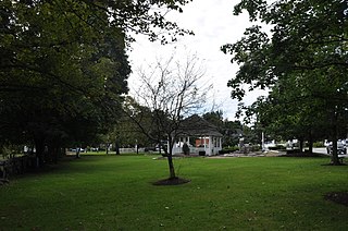
The Salem Common Historic District encompasses the early colonial center of Salem, New Hampshire. The district dates to the earliest period of settlement of Salem, and includes the historic common, old town hall, fire station, and library. The town hall was built in 1738 and extensively altered in 1838 and 1899; it served as a place for town meetings until 1958. The district was listed on the National Register of Historic Places in 2011.

Upton State Forest is a publicly owned forest with recreational features primarily located in the town of Upton, Massachusetts, with smaller sections in the towns of Hopkinton and Westborough. The state forest encompasses nearly 2,800 acres (1,100 ha) of publicly accessible lands and includes the last remaining Civilian Conservation Corps (CCC) camp in Massachusetts, built in Rustic style. The CCC campground was listed on the National Register of Historic Places in 2014.


