
Galileo is a global navigation satellite system (GNSS) created by the European Union through the European Space Agency (ESA) and operated by the European Union Agency for the Space Programme (EUSPA). It is headquartered in Prague, Czechia, with two ground operations centres in Oberpfaffenhofen, Germany, and in Fucino, Italy,. The €10 billion project went live in 2016. It is named after the Italian astronomer Galileo Galilei.

The Indian National Satellite System or INSAT, is a series of multipurpose geostationary satellites launched by the Indian Space Research Organisation (ISRO) to satisfy telecommunications, broadcasting, meteorology, and search and rescue operations. Commissioned in 1983, INSAT is the largest domestic communication system in the Indo-Pacific Region. It is a joint venture of the Department of Space, Department of Telecommunications, India Meteorological Department, All India Radio and Doordarshan. The overall coordination and management of INSAT system rests with the Secretary-level INSAT Coordination Committee.
The Indian Space Research Organisation is India's national space agency. It serves as the principal research and development arm of the Department of Space (DoS), overseen by the Prime Minister of India, with the Chairman of ISRO also serving as the chief executive of the DoS. It is primarily responsible for space-based operations, space exploration, international space cooperation and the development of related technologies. The agency maintains a constellation of imaging, communication and remote sensing satellites. It operates the GAGAN and IRNSS satellite navigation systems. It has sent three missions to the Moon and one mission to Mars.

The GSAT satellites are India's indigenously developed communications satellites, used for digital audio, data and video broadcasting. As of 5 December 2018, 20 GSAT satellites manufactured by ISRO have been launched, out of which 14 are in service.

GSAT-2 was an experimental communication satellite built by the Indian Space Research Organisation (ISRO) and launched on one of the first GSLVs. The satellite was positioned at 48 deg east longitude in the geo-stationary orbit.
Paksat-1,, was a geosynchronous and communications satellite built and owned by the Boeing Company, leased to the Space & Upper Atmosphere Research Commission (SUPARCO) and renamed Paksat-1. It was successfully put on orbit on 1 February 1996 as Palapa-C1 for Indonesia as its original customer. But, after the technical problems, the satellite was leased to SUPARCO at an orbital location of 38° East longitude in December 2002. Paksat-1 offers the C-band and Ku-band coverage in over 75 countries across Europe, Africa, Middle East, South and Central Asia. Its customers included government organizations, television broadcasters, telecommunications companies, data and broadband internet service providers.

ELA-3 is a launch complex at the Guiana Space Centre in French Guiana. The complex was first used in June 1996 in support of the now retired Ariane 5 rocket. It is currently being refurbished to support Vega E launches. The complex is 21 square kilometres (8.1 sq mi) in size.
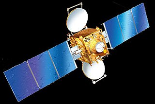
INSAT 3E is a defunct communication satellite built by Indian Space Research Organisation. It was launched on September 28, 2003, from the European Space Agency's spaceport in French Guiana on board the Ariane rocket. The satellite had a launch mass of 2750 kilograms. It is the 4th satellite launched in the INSAT-3 series for INSAT. It was designed for providing high-speed communication, Television, VSAT & Tele-education services and was an important landmark in Indian Space Programme.
GSAT-5P, or GSAT-5 Prime, was an Indian communications satellite which was lost in a launch failure in December 2010. Part of the Indian National Satellite System, it was intended to operate in geosynchronous orbit as a replacement for INSAT-3E.
GSAT-8 or INSAT-4G is communication satellite. It was constructed by the Indian Space Research Organisation, as part of INSAT system. GSAT-8 was launched on May 21, 2011, from Kourou, French Guiana. The rocket, an Ariane 5 was the carrier, marketed by the European Arianespace. First satellite to carry GAGAN payload followed up by GSAT-10 and in-orbit spare GSAT-15.
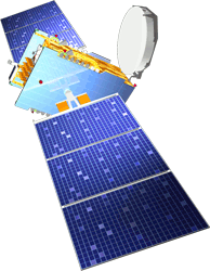
INSAT-4CR was a communications satellite operated by ISRO as part of the Indian National Satellite System. Launched in September 2007, it replaced the INSAT-4C satellite which had been lost in a launch failure the previous year. The satellite was initially stationed in geostationary orbit at a longitude of 74 degrees east, with expected operational life of at least ten years, however this may have been reduced by the underperformance of the Geosynchronous Satellite Launch Vehicle which placed it into orbit. INSAT-4CR is planned to be replaced by GSAT-31, which was launched on February 6, 2019.
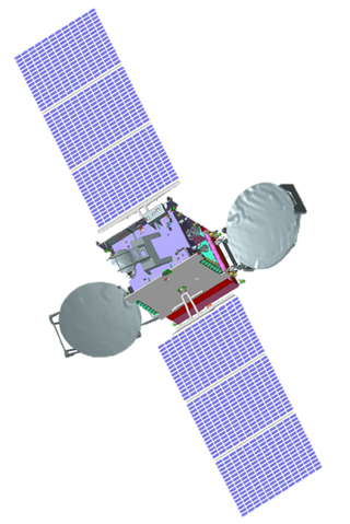
GSAT-10 is an Indian communication satellite which was launched by Ariane-5ECA carrier rocket in September 2012. It has 12 KU Band, 12 C Band and 6 lower extended c band transponders, and included a navigation payload to augment GAGAN capacity. Following its launch and on-orbit testing, it was placed in Geosynchronous orbit at 83.0° East, from where it will provide communication services in India.

INSAT-4E, also known as GSAT-6, is a member of the INSAT family and is a multimedia communication satellite that will offer a Satellite Digital Multimedia Broadcasting (S-DMB) service across several digital multimedia terminals or consoles which can be used to provide information services to vehicles on the fly and to the mobile phones. The satellite can be used for other social and strategic applications.
GSAT-7 or INSAT-4F is a multi-band military communications satellite developed by the Indian Space Research Organisation. The Indian Navy is the user of the multi-band communication spacecraft, which has been operational since September 2013. According to defense experts, the satellite will enable the navy to extend its blue water capabilities and stop relying on foreign satellites like Inmarsat, which provide communication services to its ships.
INSAT-4B was an Indian communications satellite which forms part of the Indian National Satellite System. Launched in 2007, it was placed in geostationary orbit at a longitude of 93.48° East.

The South Asia Satellite, formerly known as SAARC Satellite, is a geostationary communications and meteorology satellite operated by the Indian Space Research Organisation for the South Asian Association for Regional Cooperation (SAARC) region. The satellite was launched on 5 May 2017. During the 18th SAARC summit held in Nepal in 2014, Indian Prime Minister Narendra Modi mooted the idea of a satellite serving the needs of SAARC member nations as a part of his neighbourhood first policy. Afghanistan, Bangladesh, Bhutan, Maldives, Nepal and Sri Lanka are the users of the multi-dimensional facilities provided by the satellite.

GSAT-18 is an Indian communications satellite. Built by ISRO and operated by INSAT, it carries 24 C-band, 12 extended C-band, and 12 Ku-band transponders.
GSAT-30 is a telecommunications satellite developed by the Indian Space Research Organisation (ISRO).