San Gregorio, Chile

Last updated
San Gregorio
Estancia San Gregorio, Magallanes.jpg
Estancia San Gregorio


Escudo de San Gregorio.png
Comuna de San Gregorio.svg
Chile location map.svg
Red pog.svg
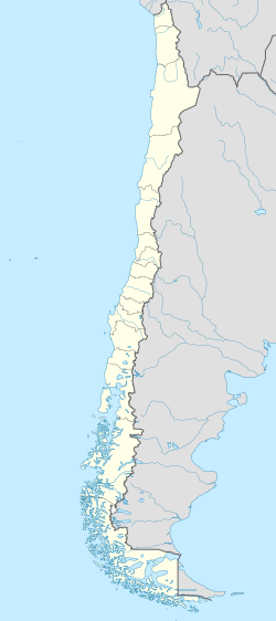
San Gregorio
Location in Chile
Coordinates: 52°18′56″S69°41′17″W / 52.31556°S 69.68806°W / -52.31556; -69.68806 Coordinates: 52°18′56″S69°41′17″W / 52.31556°S 69.68806°W / -52.31556; -69.68806
Country Flag of Chile.svg  Chile
Region Flag of Magallanes, Chile.svg  Magallanes y Antártica Chilena
Province Magallanes
Government
  Type Municipality
   Alcalde Edgar Cárcamo Alderete (Ind)
Area
[3]
  Total6,883.7 km2 (2,657.8 sq mi)
Elevation
51 m (167 ft)
Population
 (2012 Census) [3]
  Total384
  Density0.056/km2 (0.14/sq mi)
   Urban
0
   Rural
1,158
Sex
[3]
  Men886
  Women272
Time zone UTC-4 (CLT [4] )
  Summer (DST) UTC-3 (CLST [5] )
Area code(s) 56 + 61
Website www.sangregorio.cl

San Gregorio is a commune in the far south of Chile. It is part of Magallanes Region and Province, and is administered by the municipality of the same name located in Punta Delgada, the principal town in the commune (the coordinates are those of Punta Delgada).

Contents

The comuna is on the north shore of the Strait of Magellan; between the Strait, to the south, and the border with Argentina, to the north. At the Primera Angostura, south of the town of Punta Delgada, there is a ferry crossing to Primavera commune on Tierra del Fuego Island. The good wind resource attracted a wind power project, scheduled for 2025. [6]

Features

In the settlement of Estancia San Gregorio ( 52°34′01″S70°04′12″W / 52.566944°S 70.07°W / -52.566944; -70.07 ), some 40 km (25 mi) southwest of Punta Delgada, there is an estancia, and several imposing buildings dating from 1882.

Nearby are wrecks of two 19th-century cargo ships. [7] Ambassador was a sailing tea clipper, built in London in 1869 and beached at San Gregorio in 1896. [8] Amadeo was a steamship, built in Liverpool in 1884 and beached at San Gregorio in 1932. [9]

Demographics

According to the 2002 census of the National Statistics Institute, San Gregorio spans an area of 6,883.7 km2 (2,658 sq mi) and has 1,158 inhabitants (886 men and 272 women), making the commune an entirely rural area. The population fell by 29.5% (485 persons) between the 1992 and 2002 censuses. [3]

The population is mostly descended from Croatian, Spanish and other Europeans. [10]

Administration

As a comuna, San Gregorio is a third-level administrative division of Chile administered by a municipal council, headed by an alcalde who is directly elected every four years. The 2012–2016 alcalde is Edgar Cárcamo Alderete. [1] [2]

Within the electoral divisions of Chile, San Gregorio is represented in the Chamber of Deputies by Juan Morano (PDC) and Gabriel Boric (Ind.) as part of the 60th electoral district, which includes the entire Magallanes y la Antártica Chilena Region. The commune is represented in the Senate by Carlos Bianchi Chelech (Ind.) and Carolina Goic (PDC) as part of the 19th senatorial constituency (Magallanes y la Antártica Chilena Region).

Related Research Articles

Magallanes Region Region of Chile

The Magallanes Region, officially the Magallanes and Chilean Antarctica Region, is one of Chile's 16 first order administrative divisions. It is the southernmost, largest, and second least populated region of Chile. It comprises four provinces: Última Esperanza, Magallanes, Tierra del Fuego, and Antártica Chilena.

Porvenir, Chile Town and Commune in Magallanes y Antártica Chilena, Chile

Porvenir is the capital of both the homonymous commune and the Chilean Province of Tierra del Fuego of the Magallanes y la Antártica Chilena Region. It is one of Chile's southernmost towns, and has 4,734 inhabitants, including several thousand soldiers. It is the largest settlement in the Chilean half of the island of Tierra del Fuego.

Antártica Chilena Province Province in Magallanes y Antártica Chilena, Chile

Antártica Chilena Province is the southernmost and one of four provinces in Chile's southernmost region, Magallanes and Antártica Chilena Region (XII). The capital is Puerto Williams. The province comprises the extreme southern part of Isla Grande de Tierra del Fuego, the islands south and west of Isla Grande, and Chile's claims in Antarctica. The province is administratively divided into two communes (comunas): Cabo de Hornos, located at the southern tip of South America, and Antártica, a wedge-shaped claim of Antarctica, which is not internationally recognized. Its total area of 1,265,853.7 km2 (488,749 sq mi) makes it almost twice as large as all other provinces of Chile combined.

Pedro Aguirre Cerda, Chile City and Commune in Santiago Metro., Chile

Pedro Aguirre Cerda is a commune of Chile located in Santiago Province, Santiago Metropolitan Region. It is named after President Pedro Aguirre Cerda.

Peñalolén City and Commune in Santiago Metro., Chile

Peñalolén is a Chilean commune in Santiago Province, Santiago Metropolitan Region. It was founded on November 15, 1984.

San Joaquín City and Commune in Santiago Metro., Chile

San Joaquín is a commune of Chile located in Santiago Province, Santiago Metropolitan Region. It is part of Greater Santiago.

Puerto Natales City in Magallanes y Antártica Chilena, Chile

Puerto Natales is a city in Chilean Patagonia. It is the capital of both the commune of Natales and the province of Última Esperanza, one of the four provinces that make up the Magallanes and Antartica Chilena Region in the southernmost part of Chile. Puerto Natales is the only city in the province. It is located 247 km (153 mi) northwest of Punta Arenas. It is the final passenger port of call for the Navimag ferry sailing from Puerto Montt into the Señoret Channel as well as the primary transit point for travellers to Torres del Paine National Park, Chile.

Punta Arenas Place in Magallanes y Antártica Chilena, Chile

Punta Arenas is the capital city of Chile's southernmost region, Magallanes and Antartica Chilena. The city was officially renamed as Magallanes in 1927, but in 1938 it was changed back to "Punta Arenas". It is the largest city south of the 46th parallel south, and at the same time the most populous southernmost city in Chile and in the Americas, and due to its location, the coldest coastal city with more than 100,000 inhabitants in Latin America. It is also one of the most populous sites so far south in the world.

Magallanes Province Province in Magallanes y Antártica Chilena, Chile

Magallanes Province is one of four provinces in the southern Chilean region of Magallanes and Antártica Chilena. The provincial capital is the city of Punta Arenas.

Primavera, Chile Commune in Magallanes y Antártica Chilena, Chile

Primavera is a Chilean commune in Tierra del Fuego Province, Magallanes and Antartica Chilena Region, Chile. It is located on the north of Tierra del Fuego Island. Its main settlement is Cerro Sombrero.

San Pedro de la Paz City and Commune in Biobío, Chile

San Pedro de la Paz is a Chilean city and commune located in the Concepción Province, Biobío Region. It has some 80,447 inhabitants according to the 2002 national census. In 2005, the Pedro Aguirre Cerda avenue, the main avenue in the city, was completed. Most of the inhabitants of this comuna commute daily to Concepción - either by car, bus or train - over the Biobío River. It is considered to be part of Greater Concepción conurbation.

Galvarino, Chile Town and Commune in Araucanía, Chile

Galvarino is a Chilean town and commune, part of Cautín Province, in the Araucanía Region.

Cabo de Hornos, Chile Commune in Magallanes y Antártica Chilena, Chile

Cabo de Hornos is a Chilean commune located in the south of Tierra del Fuego archipelago, in Antártica Province, Magallanes Region. The municipality of Cabo de Hornos, located in the town of Puerto Williams, also administers the Antártica commune. It is named for Cabo de Hornos, or "Cape Horn", the southern tip of South America.

Timaukel Commune in Magallanes y Antártica Chilena, Chile

Timaukel is a commune located in the Chilean part of Tierra del Fuego Island. It is part of Tierra del Fuego Province in Magallanes Region. The commune is administered by the municipality in Villa Cameron, which is the main port and settlement within the commune.

Torres del Paine, Chile Commune in Magallanes y Antártica Chilena, Chile

Torres del Paine is a Chilean commune located in the inland of Última Esperanza Province and Magallanes Region. The commune is administered by the municipality in Cerro Castillo, the major settlement in the commune. Torres del Paine National Park lies within the commune. Paine means "blue" in the native Tehuelche (Aonikenk) language and is pronounced PIE-nay.

Laguna Blanca, Chile Commune in Magallanes y Antártica Chilena, Chile

Laguna Blanca is a Chilean commune located in Magallanes Province and Region. The commune is administered by the municipality in Villa Tehuelches, that is the major settlement in the whole commune.

Río Verde, Chile Commune in Magallanes y Antártica Chilena, Chile

Río Verde is a Chilean commune and settlement in Magallanes Province and Region. The commune is located in the area surrounding Seno Skyring, a sea inlet north of Riesco Island.

Natales Commune in Magallanes y Antártica Chilena, Chile

Natales is a commune of the Última Esperanza Province in the Magallanes and Antartica Chilena Region of extreme southern Chile. Its capital and only port city is Puerto Natales.

Carolina Goic Chilean politician

Carolina Nevenka Goić Borojević is a Chilean politician, currently serving as president of the Chilean Christian Democratic Party (PDC). She is a Senator for Magallanes, former Deputy for the 60th district, which includes the communities of Rio Verde, Laguna Blanca, Cape Horn, Porvenir, Primavera, Punta Arenas, San Gregorio, Timaukel and Torres del Paine.

<i>Antártica</i> (commune) Commune in Magallanes Region, Chile

Antártica is a Chilean commune in Antártica Chilena Province, Magallanes y la Antártica Chilena Region, which covers all the Chilean Antarctic Territory. It ranges from 53°W to 90°W and from the South Pole to 60°S, overlapping the Argentine and British Antarctic claims, and is the largest and least populated commune in Chile, being over 25 times the size of the next largest commune, Natales. It is administered by the Cabo de Hornos municipality in the South American mainland.

References

Beached wreck of the 1884 steamship Amadeo Amadeo, Primer vapor de Chile. San Gregorio, Patagonia, Chile.jpg
Beached wreck of the 1884 steamship Amadeo
  1. 1 2 "Asociación Chilena de Municipalidades" (in Spanish). Retrieved 27 January 2011.
  2. 1 2 "Municipality of San Gregorio" (in Spanish). Retrieved 27 January 2011.
  3. 1 2 3 4 "National Statistics Institute" (in Spanish). Retrieved 27 January 2010.
  4. "Chile Time". WorldTimeZones.org. Archived from the original on 11 September 2007. Retrieved 26 September 2010.
  5. "Chile Summer Time". WorldTimeZones.org. Archived from the original on 11 September 2007. Retrieved 26 September 2010.
  6. "Minister Jobet announces new green hydrogen project in Magallanes that will be the largest in Chile". 7 December 2021.
  7. Graham, Melissa (2003). Rough Guide to Chile. p. 470. ISBN   1-84353-062-7.
  8. Seidel, Guido. "Last port: Ultimo Puerto de Amarre – Ambassador" (in Spanish). Histarmar – Historia y Arqueologia Marítima. Retrieved 5 February 2015.
  9. Heaton, Paul M (2004). Lamport & Holt Line. Abergavenny: P.M. Heaton Publishing. pp. 29, 34, 35. ISBN   1-872006-16-7.
  10. "San Gregorio" (in Spanish). Archived from the original on 2007-05-15.