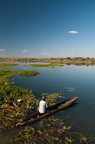
Sofia is a region in northern Madagascar. It is named for the Sofia River. It is the second largest Malagasy region with an area of 50,100 km², and had a population of 1,500,227 in 2018. The administrative capital is Antsohihy.

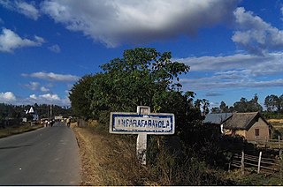
Amparafaravola is a rural municipality in Madagascar. It belongs to the district of Amparafaravola, which is a part of Alaotra-Mangoro Region. The population of the municipality was 33,299 in 2018 that are distributed in 21 Fokontany (villages) that are: Marotaolana, Antanambao, Ambohimandroso, Ambohipeno, Maritampona, Ampasimbola, Ambalamirahona, Analamiranga, Amparafaravola, Ambodihasina, Besarety, Ambalafarisoa, Ampilahoana, Antsakoana, Morarano-Nord, Ambodimanga, Ambondrona, Andilana Sud, Sahamamy, Ambondroala and Ambohivorikely. It is situated at 65 km from Ambatondrazaka.

Vakinankaratra is a region in central Madagascar. The capital of the region is Antsirabe. Vakinankaratra covers an area of 16,599 kilometres, and had a population of 2,074,358 in 2018.

Fitovinany is a region located in southeast Madagascar. Its capital is Manakara. It is inhabited by the Antemoro people.

Diana is a region in Madagascar at the northern part of the island. It borders the regions of Sava to the southeast and Sofia to the southwest. It covers an area of 19,266 km2, and had a population of 889,736 in 2018. The regional capital is Antsiranana.

Marivorahona or Tanambao Marivorahona is a municipality in northern Madagascar. It belongs to the district of Ambilobe, which is a part of Diana Region.
Maromandia is a town and commune in Madagascar. It belongs to the district of Analalava, which is a part of Sofia Region. The population of the commune was estimated to be approximately 34,000 in 2001 commune census.
Ambodimandresy is a rural municipality in Madagascar. It belongs to the district of Antsohihy, which is a part of Sofia Region. The population of the commune was estimated to be approximately 10,000 in 2001 commune census.

Atsinanana is a coastal region in eastern Madagascar. It borders Analanjirofo region in the north, Alaotra-Mangoro in the west, Vakinankaratra and Amoron'i Mania in the southwest, and Vatovavy in the south. The region contains over 285km of coastline, which includes many beaches and cultural heritage sites.

Manambina is a town and commune in Madagascar. It belongs to the district of Miandrivazo, which is a part of Menabe Region. The population of the commune was estimated to be approximately 7,000 in 2001 commune census.

Andasibe is a rural municipality in Madagascar. It belongs to the district of Moramanga, which is a part of Alaotra-Mangoro Region. The population of the commune was estimated to be approximately 13,493 in 2006.
Imerintsiatosika is a municipality in Madagascar. It belongs to the district of Arivonimamo, which is a part of Itasy Region. It is localized at 30 km west from the capital of Antananarivo on the National Road No.1. The population of the commune was estimated to be 69,953 in a 2019.
Vohiposa is a rural municipality in Madagascar. It belongs to the district of Ambohimahasoa, which is a part of Haute Matsiatra Region. The population of the commune was estimated to be approximately 16,000 in 2001 commune census.
Mahatalaky is a rural commune in Madagascar. It belongs to the district of Taolanaro, which is a part of Anosy Region. It is situated at 35 km from Fort Dauphin. The population of the commune was estimated to be approximately 25,000 in 2001 commune census.
Ambovombe Afovoany is a municipality in Madagascar. It belongs to the district of Manandriana, which is a part of Amoron'i Mania Region. The population of the commune was estimated to be approximately 18,000 in 2001 commune census.
Ambatolaona is a rural municipality in Madagascar. It belongs to the district of Manjakandriana, which is a part of Analamanga Region. The population of the commune was estimated to be approximately 5,000 in 2001 commune census.
Angossas is a town and commune in Cameroon.
Antenina is a rural municipality in the district of Toamasina II (district), in the region of Atsinanana, on east coast of Madagascar.

The Madagascar women's national rugby union sevens team is Madagascar's representative in women's rugby sevens.


