
The Sauk or Sac are a group of Native Americans of the Eastern Woodlands culture group, who lived primarily in the region of what is now Green Bay, Wisconsin, when first encountered by the French in 1667. Their autonym is oθaakiiwaki, and their exonym is Ozaagii(-wag) in Ojibwe. The latter name was transliterated into French and English by colonists of those cultures. Today they have three federally recognized tribes, together with the Meskwaki (Fox), located in Iowa, Oklahoma and Kansas.

Sauk County is a county in Wisconsin. It is named after a large village of the Sauk people. As of the 2020 census, the population was 65,763. Its county seat and largest city is Baraboo. The county was created in 1840 from Wisconsin Territory and organized in 1844. Sauk County comprises the Baraboo, WI Micropolitan Statistical Area and is included in the Madison metropolitan area.

Saginaw County, officially the County of Saginaw, is a county located in the U.S. state of Michigan. As of the 2020 Census, the population was 190,124. The county seat is Saginaw. The county was created by September 10, 1822, and was fully organized on February 9, 1835. The etymology of the county's name is uncertain. It may be derived from Sace-nong or Sak-e-nong, as the Sauk tribe is believed by some to have once lived there. A more likely possibility is that it comes from Ojibwe words meaning "place of the outlet" –sag and ong. See List of Michigan county name etymologies.

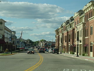
Sauk City is a village in Sauk County, Wisconsin, United States, North America. The population was 3,518 as of the 2020 census. The first incorporated village in the state, the community was founded by Agoston Haraszthy and his business partner, Robert Bryant. The village is adjacent to Prairie du Sac; together, these twin villages are referred to as Sauk Prairie.
Belgium is a town in Ozaukee County, Wisconsin, United States. The population was 1,513 at the 2000 census. The Village of Belgium is surrounded on all sides by the town, and the unincorporated communities of Decker, Holy Cross, Lake Church, and Sauk Trail Beach are located in the town, as is the ghost town of Stonehaven. The unincorporated community of Dacada is also partially located in the town. The ghost town of Stonehaven is also located in the town.
Prairie du Sac is a village in Sauk County, Wisconsin, United States. The population was 4,420 at the 2020 census. The village is surrounded by the Town of Prairie du Sac, the Wisconsin River, and the village of Sauk City; together, Prairie du Sac and Sauk City are referred to as Sauk Prairie.

Reedsburg is a city in Sauk County, Wisconsin, United States. Located along the Baraboo River, it was founded in 1868, and was named for early settler David C. Reed. The city is surrounded by the Town of Reedsburg. It is part of the Baraboo Micropolitan Statistical Area.

Taum Sauk Mountain in the Saint Francois Mountains is the highest natural point in the U.S. state of Missouri at 1,772 feet . The topography of Taum Sauk is that of an elongated ridge with a NNW-SSE orientation rather than a peak.

The Elroy-Sparta State Trail is a 32.5-mile (52.3 km) Wisconsin State rail trail between Elroy and Sparta, Wisconsin. Considered to be the first rail trail when it opened in 1967, it was designed for foot, bicycle, equestrian and light motorized traffic. Designated a multi-use trail, it offers recreational access to the routes and is open to the public. The trail is part of the larger Wisconsin bike trail system operated by the state of Wisconsin. It passes through rural scenery and three tunnels. It is one of six connecting trails in west-central Wisconsin. It was added to the Rails-to-Trails Conservancy hall of Fame in September 2008. It is one of the most popular trails in Wisconsin.
The Bad Axe Massacre was a massacre of Sauk (Sac) and Fox Indians by United States Army regulars and militia that occurred on August 1–2, 1832. This final scene of the Black Hawk War took place near present-day Victory, Wisconsin in the United States. It marked the end of the war between white settlers and militia in Illinois and Michigan Territory, and the Sauk and Fox tribes under warrior Black Hawk.
Mazo Beach is the colloquial name for Mazomanie Bottoms State Natural Area, located in Sauk County in the U.S. state of Wisconsin. Property along the river was acquired in parcels by the State of Wisconsin since the 1950s to provide a full range of nature based activities including hiking, wildlife viewing, hunting, fishing, and wildlife habitat. Since 1978, the beach and surrounding nature preserve have attracted picnickers and swimming day-trippers to its open and expansive shoreline.

Taum Sauk Mountain State Park is a Missouri state park located in the St. Francois Mountains in the Ozarks. The park encompasses Taum Sauk Mountain, the highest point in the state. The Taum Sauk portion of the Ozark Trail connects the park with nearby Johnson's Shut-ins State Park and the Bell Mountain Wilderness Area, which together are part of a large wilderness area popular with hikers and backpackers.

Mirror Lake State Park is a 2,179-acre (882 ha) Wisconsin state park in the Wisconsin Dells region. The process of establishing the park began in 1962 and the park officially opened on August 19, 1966. It contains Mirror Lake, a narrow reservoir with steep sandstone sides up to 50 feet (15 m) tall. The lake has a surface area of 137 acres (55 ha) and an average depth of 10 to 14 feet. Recessed out of the wind, the water of Mirror Lake is usually calm and often as glassy-smooth as a mirror, hence the name. Situated in a major tourist area, the state park has an extensive campground and other visitor amenities. Also located within the park is the Seth Peterson Cottage, a Frank Lloyd Wright-designed building available for public rental.

The Battle of Wisconsin Heights was the penultimate engagement of the 1832 Black Hawk War, fought between the United States state militia and allies, and the Sauk and Fox tribes, led by Black Hawk. The battle took place in what is now Dane County, near present-day Sauk City, Wisconsin. Despite being vastly outnumbered and sustaining heavy casualties, Black Hawk's warriors managed to delay the combined government forces long enough to allow the majority of the Sauk and Fox civilians in the group to escape across the Wisconsin River. This reprieve was temporary; when the militia finally caught up with the fleeing band it resulted in the Bad Axe massacre at the mouth of the Bad Axe River.
The Wisconsin Heights Battlefield is an area in Dane County, Wisconsin where the penultimate battle of the 1832 Black Hawk War occurred. The conflict was fought between the Illinois and Michigan Territory militias and Sauk chief Black Hawk and his band of warriors, who were fleeing their homeland following the Fox Wars. The Wisconsin Heights Battlefield is the only intact battle site from the Indian Wars in the U.S. Midwest. Today, the battlefield is managed and preserved by the state of Wisconsin as part of the Lower Wisconsin State Riverway. In 2002, it was listed on the U.S. National Register of Historic Places.

The British Band was a mixed-nation group of Native Americans commanded by the Sauk leader Black Hawk, which fought against Illinois and Michigan Territory militias during the 1832 Black Hawk War. The band was composed of about 1,500 men, women, and children from the Sauk, Meskwaki, Fox, Kickapoo, Potawatomi, Ho-Chunk, and Ottawa nations; about 500 of that number were warriors. Black Hawk had an alliance with the British that dated from the War of 1812, giving them their colloquial name. The band crossed the Mississippi River from Iowa into Illinois in an attempt to reclaim their homeland and in violation of several treaties. Subsequently, both the Illinois and Michigan Territory militia were called up and the Black Hawk War ensued.
Loreto is an unincorporated community in the town of Bear Creek, Sauk County, Wisconsin, United States. The community center was once located on Highway G in Town 10N Range3E in Section 14 with a public school in Joint District 9, a cheese factory, tavern, store and post office. The village name is sometimes spelled "Loretto" or "Loreta." The school closed in 1962 and the businesses no longer exist. Remaining is the Catholic parish of St. Patrick's with a brick church and rectory and parish cemetery. It was named after Loreto, Italy in 1900 by Rev. Felix Andrew Byrne, the postmaster at Loreto and pastor of St. Patrick Catholic Church.
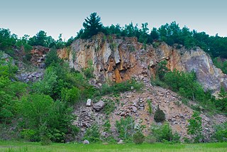
Ableman's Gorge is a 127 acres (51 ha) Wisconsin State Natural Area located near Rock Springs, Wisconsin. This 200 to 400-foot wide and 200-foot high gorge is cut by about 1 mile (1.6 km) of the Baraboo River in an "L" shape. The Natural Area is named after George Ableman who settled Rock Springs in 1851 and named the community after the gorge area.
The Baraboo Air Line Railroad was a railroad chartered in Wisconsin to join Madison, Wisconsin to Winona, Minnesota in 1870. It became part of the Chicago and North Western Railroad route from Chicago to Winona, Minnesota. After abandonment by the C&NW, part of the Baraboo Air Line route became the first rail trail, the Elroy-Sparta State Trail. Currently, the line from Madison to Reedsburg is operated by the Wisconsin and Southern Railroad. The portion from Reedsburg to Elroy is now the 400 State Trail. The portion from Sparta through Medary is now the La Crosse River Trail.


