Waubeka, Wisconsin

Last updated

Waubeka, Wisconsin
USA Wisconsin location map.svg
Red pog.svg
Waubeka
Location in Wisconsin
Coordinates: 43°28′12″N87°59′31″W / 43.47000°N 87.99194°W / 43.47000; -87.99194
Country United States
State Wisconsin
County Ozaukee
Settled1840s
Area
[1]
  Total2.416 sq mi (6.26 km2)
  Land2.343 sq mi (6.07 km2)
  Water0.073 sq mi (0.19 km2)
Elevation
[2]
840 ft (256 m)
Population
 (2010)
  Total657
Time zone UTC-6 (Central (CST))
  Summer (DST) UTC-5 (CDT)
Area code 262

Waubeka is an unincorporated census-designated place in the Town of Fredonia, Ozaukee County, Wisconsin, United States. Located on the Milwaukee River, the community is part of the Milwaukee metropolitan area. As of the 2010 census, its population is 657. [3]

Contents

Inhabited by Native Americans into the mid-1800s, Waubeka was named for a Potawatomi chief who was friendly with the first white settlers who arrived in the area in the 1840s. Waubeka was the site of the first formal observance of Flag Day in 1885, and today the community is home to the National Flag Day Foundation's Americanism Center, which serves as the organization's headquarters and contains a museum.

History

The land that became the Waubeka was originally inhabited by Native Americans, including the Potawatomi tribe, who surrendered the land to the United States government in the 1833 Treaty of Chicago. While many people moved west of the Mississippi River to Kansas, a few chose to remain, and were referred to as "strolling Potawatomi" in contemporary documents because many of them were migrants who subsisted by squatting on their former lands, now owned by White settlers. One such group was led by Chief Waubeka, who maintained a winter camp on the south bank of the Milwaukee River in present-day Waubeka as late as 1845. [4] The chief's wigwam was located near the present site of the Gerald Joose house. In the Potawatomi language, "Waubeka" means "metal." [5] Eventually the Potawatomi gathered in northern Wisconsin, where they formed the Forest County Potawatomi Community. [6]

In the 1840s, Waubeka was the largest settlement in the Town of Fredonia. The first European civilization was from settlers who were English, Irish, Scottish, and Yankees from the East Coast. In 1848, a group of German immigrants arrived from Prussia and settled in the northern part of Waubeka. Luxemburger and Belgian newcomers settled in eastern Waubeka, and others from Bavaria and Saxony settled in the northwest. [7]

Geography

Waubeka is 840 feet (256 m) above sea level and is located at 43°28′30″N87°59′25″W / 43.47500°N 87.99028°W / 43.47500; -87.99028 (43.4749994, -87.9903696). [8] According to the United States Census Bureau, the community has a total area of 2.416 square miles (6.26 km2): 2.343 square miles (6.07 km2) land and 0.073 square miles (0.19 km2) water. Waubeka is located in the Town of Fredonia, and borders to the Village of Fredonia to the east and the Town of Saukville to the south.

The community is located in the Southeastern Wisconsin glacial till plains that were created by the Wisconsin glaciation during the most recent ice age. The area has some subterranean Silurian limestone formations that are part of the Racine Dolomite that stretches through eastern Wisconsin and Illinois. [9]

Before Europeans arrived in and civilized the area, the Waubeka area was an upland forest dominated by American beech and sugar maple trees. There were also white cedars growing along the Milwaukee River, which flows along the community and provided a power source for the community's early industries. Much of the original forest was cleared to prepare the land for agriculture. [9]

Large mammals, including white-tailed deer, coyotes, North American river otters and red foxes can be seen in the village. Many birds, including great blue herons and wild turkeys are found in the community. [10]

The region struggles with many invasive species, including the emerald ash borer, common carp, reed canary grass, the common reed, purple loosestrife, garlic mustard, Eurasian buckthorns, and honeysuckles. [10]

Flag Day

Stony Hill School Stony Hill School 3Jun09.jpg
Stony Hill School

United States Flag Day was first formally observed in Waubeka. On June 14, 1885, Stony Hill School teacher and Waubeka-native Bernard J. Cigrand instructed his students to write essays about what the flag of the United States meant to them to commemorate the Continental Congress's 1777 adoption of the flag as a national symbol. It was the first formal observance of Flag Day. [11]

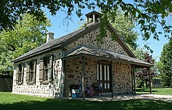
In 1995, the National Flag Day Foundation constructed the Americanism Center in Waubeka. A 13,000-square-foot facility on fifteen acres of land, the center serves as the foundation's headquarters and also houses a museum with an extensive collection of patriotic memorabilia, military uniforms, and artifacts from the life of Bernard J. Cigrand. The foundation organizes a parade in Waubeka each Flag Day. [12]

Notable residents

Related Research Articles

<span class="mw-page-title-main">Ozaukee County, Wisconsin</span> County in Wisconsin, United States

Ozaukee County is a county in the U.S. state of Wisconsin. As of the 2020 census, the population was 91,503. Its county seat is Port Washington. Ozaukee County is included in the Milwaukee–Waukesha–West Allis, WI Metropolitan Statistical Area.

<span class="mw-page-title-main">Mequon, Wisconsin</span> City in Ozaukee County, Wisconsin

Mequon is the largest city in Ozaukee County, in the U.S. state of Wisconsin, and the third-largest city in Wisconsin by land area. Located on Lake Michigan's western shore with significant commercial developments along Interstate 43, the community is a suburb in the Milwaukee metropolitan area. Despite being an incorporated city, approximately half of Mequon's land is undeveloped and agriculture plays a significant role in the local economy. At the time of the 2020 census the population was 25,142.

<span class="mw-page-title-main">Thiensville, Wisconsin</span> Village in Ozaukee County, Wisconsin

Thiensville is a village in Ozaukee County, Wisconsin, United States. Located on the west bank of a bend in the Milwaukee River, the community is bordered on all sides by the City of Mequon and is a suburb in the Milwaukee metropolitan area. The population was 3,235 at the 2010 census.

<span class="mw-page-title-main">Polk, Wisconsin</span> Town in Washington County, Wisconsin

Polk is a town in Washington County, Wisconsin, United States. The population was 3,938 at the 2000 census. The unincorporated communities of Ackerville, Cedar Creek, Cedar Lake, Diefenbach Corners, Mayfield, and Rugby Junction are located in the town. The town derives its name from James K. Polk, 11th U.S. president, who was in office when the town incorporated in 1846.

<span class="mw-page-title-main">Bayside, Wisconsin</span> Village in Milwaukee and Ozaukee counties, Wisconsin

Bayside is a village in Milwaukee and Ozaukee counties in the U.S. state of Wisconsin. The population was 4,482 at the 2020 census. Of this, 4,378 were in Milwaukee County, and only 104 were in Ozaukee County.

<span class="mw-page-title-main">Belgium (town), Wisconsin</span> Town in Ozaukee County, Wisconsin

Belgium is a town in Ozaukee County, Wisconsin, United States. The population was 1,513 at the 2000 census. The Village of Belgium is surrounded on all sides by the town, and the unincorporated communities of Decker, Holy Cross, Lake Church, and Sauk Trail Beach are located in the town, as is the ghost town of Stonehaven. The unincorporated community of Dacada is also partially located in the town.

<span class="mw-page-title-main">Belgium, Wisconsin</span> Village in Ozaukee County, Wisconsin

Belgium is a village in Ozaukee County, Wisconsin, United States. Located along Interstate 43, the village is one of the northernmost communities in the Milwaukee metropolitan area. The population was 2,245 at the 2010 census.

<span class="mw-page-title-main">Cedarburg (town), Wisconsin</span> Town in Ozaukee County, Wisconsin

Cedarburg is a town in Ozaukee County, Wisconsin, United States, and is in the Milwaukee metropolitan area. The town was created in 1849 and at the time of the 2020 census had a population of 6,162.

<span class="mw-page-title-main">Cedarburg, Wisconsin</span> City in Ozaukee County, Wisconsin

Cedarburg is a city in Ozaukee County, Wisconsin, United States. Located about 20 miles (32 km) north of Milwaukee and in close proximity to Interstate 43, it is a suburban community in the Milwaukee metropolitan area. The city incorporated in 1885, and at the time of the 2020 census the population was 12,121.

<span class="mw-page-title-main">Fredonia, Wisconsin</span> Village in Ozaukee County, Wisconsin

Fredonia is a village in Ozaukee County, Wisconsin, United States. Located on the Milwaukee River, the village is in the Milwaukee metropolitan area. The population was 2,160 at the 2010 census.

<span class="mw-page-title-main">Fredonia (town), Wisconsin</span> Town in Ozaukee County, Wisconsin

Fredonia is a town in Ozaukee County, Wisconsin, United States. The population was 2,903 at the 2000 census. The Village of Fredonia is surrounded by the town. The unincorporated communities of Little Kohler and Waubeka are also located in the town.

<span class="mw-page-title-main">Grafton (town), Wisconsin</span> Town in Ozaukee County, Wisconsin

The Town of Grafton is a town located in Ozaukee County, Wisconsin, United States, and is in the Milwaukee metropolitan area. The town was created in 1846 and at the time of the 2020 Census had a population of 4,157.

<span class="mw-page-title-main">Grafton, Wisconsin</span> Village in Ozaukee County, Wisconsin

Grafton is a village in Ozaukee County, Wisconsin, United States. Located about 20 miles (32 km) north of Milwaukee and in close proximity to Interstate 43, it is a suburban community in the Milwaukee metropolitan area. The village incorporated in 1896, and at the time of the 2020 census the population was 12,094.

<span class="mw-page-title-main">Port Washington (town), Wisconsin</span> Town in Ozaukee County, Wisconsin

Port Washington is a town in Ozaukee County in the U.S. state of Wisconsin. It surrounds the northern and western side of the city of Port Washington. As of the 2020 census, the town population was 1,538. The unincorporated communities of Druecker and Knellsville are also located in the town.

<span class="mw-page-title-main">Port Washington, Wisconsin</span> City and county seat of Ozaukee County, Wisconsin

Port Washington is the county seat of Ozaukee County, Wisconsin, United States. Located on Lake Michigan's western shore east of Interstate 43, the community is a suburb in the Milwaukee metropolitan area 27 miles (43 km) north of Milwaukee. The city's artificial harbor at the mouth of Sauk Creek was dredged in the 1870s and was a commercial port until the early 2000s. The population was 12,353 at the 2020 census.

<span class="mw-page-title-main">Saukville (town), Wisconsin</span> Town in Ozaukee County, Wisconsin

Saukville is a town in Ozaukee County, Wisconsin, United States. The Village of Saukville is located in the town's southeast quadrant. The population was 1,755 at the 2000 census.

<span class="mw-page-title-main">Saukville, Wisconsin</span> Village in Ozaukee County, Wisconsin

Saukville is a village in Ozaukee County, Wisconsin, United States. Located on the Milwaukee River with a district along Interstate 43, the community is a suburb in the Milwaukee metropolitan area. The population was 4,258 at the 2020 census.

<span class="mw-page-title-main">Kewaskum (town), Wisconsin</span> Town in Washington County, Wisconsin

Kewaskum is a town in Washington County, Wisconsin, United States. The population was 1,119 at the 2000 census. The incorporated community of Village of Kewaskum is surrounded geographically by the Town of Kewaskum. The unincorporated community of Saint Michaels is located partially in the town.

<span class="mw-page-title-main">West Bend (town), Wisconsin</span> Town in Washington County, Wisconsin

West Bend is a town in Washington County, Wisconsin, United States. The population was 4,834 at the 2000 census. The City of West Bend is located partially within the town. The unincorporated community of Nabob is located in the town.

<span class="mw-page-title-main">Milwaukee metropolitan area</span> Metropolitan area in Wisconsin, United States

The Milwaukee metropolitan area is a major metropolitan area located in Southeastern Wisconsin, consisting of the city of Milwaukee and some of the surrounding area. There are several definitions of the area, including the Milwaukee–Waukesha–West Allis metropolitan area and the Milwaukee–Racine–Waukesha combined statistical area. It is the largest metropolitan area in Wisconsin, and the 39th largest metropolitan area in the United States.

References

  1. "2018 U.S. Gazetteer Files". United States Census Bureau. Retrieved February 15, 2020.
  2. "US Board on Geographic Names". United States Geological Survey. October 25, 2007. Retrieved January 31, 2008.
  3. "U.S. Census website". U.S. Census Bureau . Retrieved April 20, 2011.
  4. "Village of Bayside: History". Village of Bayside. Retrieved January 10, 2020.
  5. "Newland Became Cedarburg". The Milwaukee Sentinel . September 4, 1967. pp. Part 5, Page 5. Retrieved April 23, 2015.
  6. "Potawatomi History". Milwaukee Public Museum. Retrieved February 20, 2020.
  7. "Early history of Ozaukee County, Wisconsin". University of Wisconsin-Madison Libraries. Retrieved January 3, 2020.
  8. U.S. Geological Survey Geographic Names Information System: Waubeka, Wisconsin
  9. 1 2 "Inventory of Agricultural, Natural, and Cultural Resources". Ozaukee County. Retrieved January 20, 2020.
  10. 1 2 "Ecological Landscapes of Wisconsin" (PDF). Wisconsin Department of Natural Resources. Retrieved February 13, 2020.
  11. "History". National Flag Day Foundatation. Retrieved May 18, 2020.
  12. "National Flag Day Foundation". National Flag Day Foundation. Retrieved May 18, 2020.
  13. "National Flag Day Foundation - B. J. CiGrand". www.nationalflagday.com.