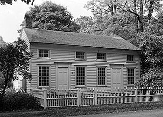
Rensselaer County is a county in the U.S. state of New York. As of the 2010 census, the population was 159,429. Its county seat is Troy. The county is named in honor of the family of Kiliaen van Rensselaer, the original Dutch owner of the land in the area.
U.S. Route 9 is a north–south United States highway in the states of Delaware, New Jersey, and New York in the Northeastern United States. It is one of only two U.S. Highways with a ferry connection ; the other is US 10. US 9 is signed east–west in Delaware and north–south on the rest of its route. The southern terminus of the route is in Laurel, Delaware, at an intersection with US 13, while the highway's northern terminus is at a junction with Interstate 87 (I-87) in Champlain, New York, where the roadway continues north as the unsigned NY 971B, which ends in a cul-de-sac just short of the Canada–US border.

Schodack is a town in Rensselaer County, New York, United States. The population was 12,794 at the 2010 census. The town name is derived from the Mahican word, Escotak. The town is in the southwestern part of the county. Schodack is southeast of Albany, New York.

Chatham is a town in Columbia County, New York, United States. The population was 4,128 at the 2010 census.

East Greenbush is a census-designated place (CDP) in Rensselaer County, New York, United States. The population was 4,487 at the 2010 census.

East Greenbush is a town in Rensselaer County, New York, United States. It is a suburb of Albany, New York. The population was 16,473 at the 2010 census. The word Greenbush is derived from the Dutch het groen bosch, referring to the pine woods that originally covered the land. The first settlement of the land now known as East Greenbush was made by tenants under patroon Kiliaen van Rensselaer circa 1630. The town was established in 1855 as Clinton, and was renamed in 1858. It is mostly suburban along its major highways and rural in the southwestern and northeastern corners.

Nassau is a village located in the Town of Nassau in Rensselaer County, New York, United States. The population was 1,133 at the 2010 census.

U.S. Route 20 or U.S. Highway 20 (US 20) is an east–west United States highway that stretches from the Pacific Northwest all the way to New England. The "0" in its route number indicates that US 20 is a major coast-to-coast route. Spanning 3,365 miles (5,415 km), it is the longest road in the United States, and the route is roughly parallel to that of the newer Interstate 90 (I-90), which is in turn the longest Interstate Highway in the U.S. There is a discontinuity in the official designation of US 20 through Yellowstone National Park, with unnumbered roads used to traverse the park.

Schodack Island State Park is a 1,052-acre (4.26 km2) state park that spans portions of Rensselaer, Greene, and Columbia counties, New York. The park is located between the Hudson River and Schodack Creek, and was opened in 2002.
New York State Route 151 (NY 151) is an 8.23-mile (13.24 km) state highway located in Rensselaer County, New York, in the United States. Its western terminus is at an interchange with U.S. Route 9 (US 9) and US 20 in Rensselaer, and its eastern terminus is at a junction with NY 150 in Shivers Corners, a hamlet in the town of Schodack. It also has an intersection with US 4 in East Greenbush. NY 151 was assigned to most of its current alignment as part of the 1930 renumbering of state highways in New York. In Rensselaer, NY 151 has been altered several times, with the most recent change coming in the late 1990s. The current western terminus of NY 151 was once the western terminus of NY 43.

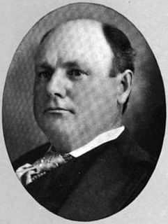
George William Palmer was a United States Representative from New York. Born in Hoosick, he attended the common schools, the Schodack Academy and Yale College. He studied law, was admitted to the bar about 1840 and commenced practice in Plattsburgh. He was surrogate of Clinton County, New York.
U.S. Route 20 (US 20) is a part of the U.S. Highway System that runs from Newport, Oregon, to Boston, Massachusetts. In the U.S. state of New York, US 20 extends 372.32 miles (599.19 km) from the Pennsylvania state line at Ripley to the Massachusetts state line in the Berkshire Mountains. US 20 is the longest surface road in New York. It runs near the Lake Erie shore from Ripley to Buffalo and passes through the southern suburbs of Buffalo, the Finger Lakes, the glacial moraines of Central New York, and the city of Albany before crossing into Massachusetts. US 20 connects to all three major north–south Interstate Highways in Upstate New York: Interstate 390 (I-390) near Avon, I-81 south of Syracuse, and I-87 in Albany by way of Fuller Road Alternate.

The Albany Post Road was a post road – a road used for mail delivery – in the U.S. state of New York. It connected New York City and Albany along the east side of the Hudson River, a service now performed by U.S. Route 9 (US 9).
New York State Route 9J (NY 9J) is a north–south state highway in the Hudson Valley region of New York in the United States. It begins at an intersection with US 9 in the Columbia County town of Stockport and extends for 22.35 miles (35.97 km) to an interchange with US 9 and US 20 in the Rensselaer County city of Rensselaer. The route parallels the Hudson River for its entire length, and several parts of the highway run directly alongside the river. NY 9J was assigned to its current alignment as part of the 1930 renumbering of state highways in New York.
New York State Route 150 (NY 150) is a north–south state highway in Rensselaer County, New York, in the United States. The southern terminus of the route is at NY 9J in Castleton-on-Hudson. Its northern terminus is at a junction with NY 66 in the hamlet of Wynantskill, located within the town of North Greenbush.
The Schodack Subdivision is a railroad line owned by CSX Transportation in the U.S. state of New York. The line runs from Stuyvesant north to Schodack along a former New York Central Railroad line. At its south end, it merges with the Hudson Subdivision; its north is at a junction with the Berkshire Subdivision, and the Castleton Subdivision at the east end of the Alfred H. Smith Memorial Bridge.
Interstate 90 (I-90) is a part of the Interstate Highway System that runs from Seattle, Washington, to Boston, Massachusetts. In the U.S. state of New York, I-90 extends 385.88 miles (621.01 km) from the Pennsylvania state line at Ripley to the Massachusetts state line at Canaan, and is the second-longest highway in the state after NY 17. Although most of the route is part of the tolled New York State Thruway, two non-tolled sections exist along I-90. Within New York, I-90 has a complete set of auxiliary Interstates, which means that there are interstates numbered I-190 through I-990 in the state, with no gaps in between. For most of its length in New York, I-90 runs parallel to the former Erie Canal route, New York State Route 5 (NY 5), U.S. Route 20 (US 20) and the CSX railroad mainline that traverses the state.

George McClellan was a member of the United States House of Representatives from New York.
East Schodack, New York is a hamlet in Rensselaer County. It comprises the ZIP code of 12063.


