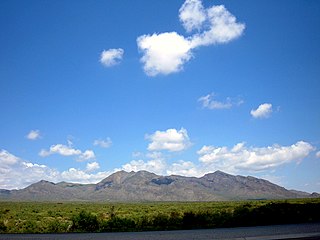
Socorro County is a county in the U.S. state of New Mexico. As of the 2020 census, the population was 16,595. The county seat is Socorro. The county was formed in 1852 as one of the original nine counties of New Mexico Territory. Socorro was originally the name given to a Native American village by Don Juan de Oñate in 1598. Having received vitally needed food and assistance from the native population, Oñate named the pueblo Socorro.

Socorro is a city in Socorro County in the U.S. state of New Mexico. It is in the Rio Grande Valley at an elevation of 4,579 feet (1,396 m). At the 2020 census, the population was 8,707. It is the county seat of Socorro County. Socorro is located 74 miles (119 km) south of Albuquerque and 146 miles (235 km) north of Las Cruces.

The Southwestern United States, also known as the American Southwest or simply the Southwest, is a geographic and cultural region of the United States that includes Arizona and New Mexico, along with adjacent portions of California, Colorado, Nevada, Oklahoma, Texas, and Utah. The largest cities by metropolitan area are Phoenix, Las Vegas, El Paso, Albuquerque, and Tucson. Before 1848, in the historical region of Santa Fe de Nuevo México as well as parts of Alta California and Coahuila y Tejas, settlement was almost non-existent outside of Nuevo México's Pueblos and Spanish or Mexican municipalities. Much of the area had been a part of New Spain and Mexico until the United States acquired the area through the Treaty of Guadalupe Hidalgo in 1848 and the smaller Gadsden Purchase in 1854.

The Chihuahuan Desert is a desert ecoregion designation covering parts of northern Mexico and the southwestern United States. It occupies much of far West Texas, the middle to lower Rio Grande Valley and the lower Pecos Valley in New Mexico, and a portion of southeastern Arizona, as well as the central and northern portions of the Mexican Plateau. It is bordered on the west by the Sonoran Desert, the Colorado Plateau, and the extensive Sierra Madre Occidental range, along with northwestern lowlands of the Sierra Madre Oriental range. Its largest, continual expanse is located in Mexico, covering a large portion of the state of Chihuahua, along with portions of Coahuila, north-eastern Durango, the extreme northern part of Zacatecas, and small western portions of Nuevo León. With an area of about 501,896 km2 (193,783 sq mi), it is the largest hot desert in North America. The desert is fairly young, existing for only 8000 years.

The Bosque del Apache National Wildlife Refuge is a National Wildlife Refuge located in southern New Mexico. It was founded in 1939 and is administered by the U.S. Fish and Wildlife Service. It is a favorite spot to observe sandhill cranes, which spend the fall and winter in the area. The reserve is open year-round and provides safe harbor for its varied wildlife. Visitors to the refuge also enjoy partaking in activities such as hiking, cycling, driving tours on the 12-mile scenic auto route, and participating in educational programs offered on site.
The Piro people were a Native American tribe who lived in New Mexico during the 16th and 17th century. The Piros lived in a number of pueblos in the Rio Grande Valley around modern Socorro, New Mexico, USA. The now extinct Piro language may have been a Tanoan language. Numbering several thousand at the time of first contact with the Spanish, by the time of the Pueblo Revolt in 1680 the Piro had been decimated by European-introduced diseases and Apache attacks and most of the survivors resettled near El Paso, Texas.

The Cibola National Forest is a 1,633,783 acre United States National Forest in New Mexico, US. The name Cibola is thought to be the original Zuni Indian name for their pueblos or tribal lands. The name was later interpreted by the Spanish to mean "buffalo". The forest is disjointed with lands spread across central and northern New Mexico, west Texas and Oklahoma. The Cibola National Forest is divided into four Ranger Districts: the Sandia, Mountainair, Mt. Taylor, and Magdalena. The Forest includes the San Mateo, Magdalena, Datil, Bear, Gallina, Manzano, Sandia, Mt. Taylor, and Zuni Mountains of west-central New Mexico. The Forest also manages four National Grasslands that stretch from northeastern New Mexico eastward into the Texas Panhandle and western Oklahoma. The Cibola National Forest and Grassland is administered by Region 3 of the United States Forest Service from offices in Albuquerque, New Mexico. Elevation ranges from 5,000 ft to 11,301 ft. The descending order of Cibola National Forest acres by county are: Socorro, Cibola, McKinley, Catron, Torrance, Bernalillo, Sandoval County, New Mexico, Lincoln, Sierra, and Valencia counties in New Mexico. The Cibola National Forest currently has 137,701 acres designated as Wilderness. In addition to these acres, it has 246,000 acres classified as Inventoried Roadless Areas pursuant to the Roadless Area Conservation Rule.

Carson National Forest is a national forest in northern New Mexico, United States. It encompasses 6,070 square kilometers and is administered by the United States Forest Service. The Forest Service's "mixed use" policy allows for its use for recreation, grazing, and resource extraction.

El Camino Real de Tierra Adentro, also known as the Silver Route, was a Spanish 2,560-kilometre-long (1,590 mi) road between Mexico City and San Juan Pueblo, New Mexico, that was used from 1598 to 1882. It was the northernmost of the four major "royal roads" that linked Mexico City to its major tributaries during and after the Spanish colonial era.

With a total area of 121,590 square miles (314,900 km2), New Mexico is the fifth-largest state, after Alaska, Texas, California, and Montana. Its eastern border lies along 103°W longitude with the state of Oklahoma, and 2.2 miles west of 103°W longitude with Texas. On the southern border, Texas makes up the eastern two-thirds, while the Mexican states of Chihuahua and Sonora make up the western third, with Chihuahua making up about 90% of that. The western border with Arizona runs along the 109° 03'W longitude. The southwestern corner of the state is known as the Bootheel. The 37°N parallel forms the northern boundary with Colorado. The states of New Mexico, Colorado, Arizona, and Utah come together at the Four Corners in New Mexico's northwestern corner. Its surface water area is about 292 square miles (760 km2).

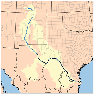
The Rio Grande Trail is a proposed long distance trail along the Rio Grande in the U.S. state of New Mexico. The river extends over 1,800 total miles, some 700 miles (1,100 km) of which pass through the heart of New Mexico. It is the state's primary drainage feature and most valuable natural and cultural resource. The river and its bosque provide a wide variety of recreation, including hunting and fishing, birdwatching, river rafting, hiking, biking, and horseback riding. The river also flows through or beside numerous spectacular and geologically interesting landforms, the result of extensive volcanism and erosion of the valley within the Rio Grande Rift. Although some trail advocates would like to see the trail extended the full distance through New Mexico, from the Colorado border to the United States–Mexico border, the portion proposed for initial development extends 300 miles (480 km), from Bernalillo south to Las Cruces.
Polvadera is an unincorporated community and census-designated place in Socorro County in central New Mexico, United States. It is located on the west bank of the Rio Grande, near the mouth of the Rio Salado, and on the western spur of El Camino Real de Tierra Adentro.

The San Andres National Wildlife Refuge is located in the southern San Andres Mountains of southcentral New Mexico, USA. The refuge, which lies within the northernmost extension of the Chihuahuan Desert, has elevations ranging from 4,200 feet (1,300 m) to 8,239 feet (2,511 m) feet. Refuge habitats vary from creosote and Chihuahuan desert grasslands in the bajadas to pinyon-juniper woodlands at higher elevations. A few springs, seeps, and seasonal streams provide water for wildlife and riparian habitats in the refuge.

The Lower Rio Grande Valley National Wildlife Refuge is a 90,788-acre (367.41 km2) National Wildlife Refuge located in the Lower Rio Grande Valley region of southern Texas.
The Manso Indians were an Indigenous people who lived along the Rio Grande, from the 16th to the 17th century. Present-day Las Cruces, New Mexico developed in this area. The Manso were one of the indigenous groups to be resettled at the Guadalupe Mission in what is now Ciudad Juarez, Mexico. Some of their descendants remain in the area to this day.

The Bear Mountains lie just north of the village of Magdalena and north of the Magdalena Mountains in New Mexico. The Bear Mountains are located within the Magdalena Ranger District of the Cibola National Forest. There are two Inventoried Roadless Areas (IRA) within the Bear Mountains: the Scott Mesa IRA and the Goat Spring IRA. The Bureau of Land Management’s Sierra Ladrones Wilderness Study Area stretches to the northeast of the Bear Mountains and connects the Bear Mountains with the 230,000-acre Sevilleta National Wildlife Refuge to the east. The world-renowned Very Large Array lies to the southwest of the Bear Mountains.

Bosque del Apache Wilderness is a designated Wilderness Area on the Bosque del Apache National Wildlife Refuge in Socorro County, New Mexico. Managed by the U.S. Fish and Wildlife Service, the Wilderness, established in 1975, contains 30,427 acres distributed between three units.
The Camino Real in New Mexico was the northern part of a historic roadway known as the Camino Real de Tierra Adentro that from 1598 ran from Mexico City northward through central and northern Mexico and the Trans-Pecos part of what is now Texas to San Juan Pueblo in Santa Fe de Nuevo Mexico, now the state of New Mexico.
San Pascual Pueblo was a Piro pueblo south and east of Socorro, in Socorro County, New Mexico, United States. Its ruins lie on the east bank of the Rio Grande, on a butte, on the western slope of the Little San Pascual Mountain, overlooking the river, near the eastern boundary of the Bosque del Apache National Wildlife Refuge.

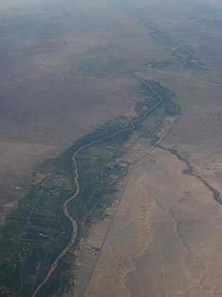
The Rio Grande Valley is the river valley carved out by the Rio Grande as it flows through the American Southwest and northeastern Mexico, forming a part of the border region. In the US state of New Mexico, the river flows mostly north to south, and forms a valley near Cochiti Pueblo to the state line near El Paso, Texas along the floors of the large sedimentary basins of the Rio Grande Rift, and includes the narrow sections between the basins. It has been historically settled first by the Pueblo peoples, the Spanish, the Mexicans, and finally Anglo-Americans. As the largest river in the state, some of its most populous cities are located wholly or partially in the valley, including Albuquerque, New Mexico's largest city.


