Brantley Lake State Park | |
---|---|
Sunset at Brantley Lake State Park, October 2012 | |
Location | Eddy, New Mexico, United States |
Coordinates | 32°33′5″N104°23′2″W / 32.55139°N 104.38389°W Coordinates: 32°33′5″N104°23′2″W / 32.55139°N 104.38389°W |
Area | 3,000 acres (12 km2) |
Elevation | 3,300 ft (1,000 m) |
Established | 1989 [1] |
Named for | Brantley Lake |
Governing body | New Mexico State Parks Division |
Brantley Lake State Park is a state park of New Mexico, United States, located approximately 12 miles (19 km) north of Carlsbad. [2] The park takes its name from Brantley Lake, a man-made reservoir created when Brantley Dam was built across the Pecos River in the 1980s. The lake is the southernmost lake in New Mexico, and it is popular for boating and fishing. It has a surface area of approximately 4,000 acres (16 km2), but that varies due to the inconsistent flow of the Pecos River and the arid climate in which the lake is located.
State parks are parks or other protected areas managed at the sub-national level within those nations which use "state" as a political subdivision. State parks are typically established by a state to preserve a location on account of its natural beauty, historic interest, or recreational potential. There are state parks under the administration of the government of each U.S. state, some of the Mexican states, and in Brazil. The term is also used in the Australian state of Victoria. The equivalent term used in Canada, Argentina, South Africa and Belgium, is provincial park. Similar systems of local government maintained parks exist in other countries, but the terminology varies.
New Mexico is a state in the Southwestern region of the United States of America; its capital and cultural center is Santa Fe, which was founded in 1610 as capital of Nuevo México, while its largest city is Albuquerque with its accompanying metropolitan area. It is one of the Mountain States and shares the Four Corners region with Utah, Colorado, and Arizona; its other neighboring states are Oklahoma to the northeast, Texas to the east-southeast, and the Mexican states of Chihuahua to the south and Sonora to the southwest. With a population around two million, New Mexico is the 36th state by population. With a total area of 121,590 sq mi (314,900 km2), it is the fifth-largest and sixth-least densely populated of the 50 states. Due to their geographic locations, northern and eastern New Mexico exhibit a colder, alpine climate, while western and southern New Mexico exhibit a warmer, arid climate.
Carlsbad is a city in and the county seat of Eddy County, New Mexico, United States. As of the 2010 census, the city population was 26,138. Carlsbad is centered at the intersection of U.S. Routes 62/180 and 285, and is the principal city of the Carlsbad-Artesia Micropolitan Statistical Area, which has a total population of 55,435. Located in the southeastern part of New Mexico, Carlsbad straddles the Pecos River and sits at the eastern edge of the Guadalupe Mountains.
The lake is stocked with bass, white bass, walleye, catfish, bluegill, carp, and crappie, however officials have recently detected high levels of DDT in the fish and the State Parks Department is recommending that the fish not be eaten.
Bass is a name shared by many species of fish. The term encompasses both freshwater and marine species, all belonging to the large order Perciformes, or perch-like fishes. The word bass comes from Middle English bars, meaning "perch".
The white bass, silver bass, or sand bass is a freshwater fish of the temperate bass family Moronidae. It is the state fish of Oklahoma.
The walleye, also called the yellow pike, is a freshwater perciform fish native to most of Canada and to the Northern United States. It is a North American close relative of the European zander, also known as the pikeperch. The walleye is sometimes called the yellow walleye to distinguish it from the blue walleye, which is a subspecies that was once found in the southern Ontario and Quebec regions, but is now presumed extinct. However, recent genetic analysis of a preserved (frozen) 'blue walleye' sample suggests that the blue and yellow walleye were simply phenotypes within the same species and do not merit separate taxonomic classification.
The park has 51 developed campsites with electricity, shower facilities, a playground, a visitor center, and other amenities.
The Pecos River originates in north-central New Mexico and flows into Texas, emptying into the Rio Grande. Its headwaters are on the eastern slope of the Sangre de Cristo mountain range in Mora County north of Pecos, NM, at an elevation of over 12,000 feet (3,700 m) feet. The river flows for 926 miles (1,490 km) before reaching the Rio Grande near Del Rio. Its drainage basin encompasses about 44,300 square miles (115,000 km2).
Bitter Lake National Wildlife Refuge is a United States National Wildlife Refuge located in two separate sections in central Chaves County, New Mexico, United States, a few miles northeast of the city of Roswell. Both sections lie on the banks of the Pecos River. The refuge was established in 1937 to provide habitat for migratory birds such as the sandhill crane and the snow goose, but it is also notable for rare native fish and the over 90 species of dragonflies and damselflies that inhabit the refuge.
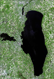
Lake Winnebago is a shallow freshwater lake in the north central United States, located in east central Wisconsin. At 137,700 acres it is the largest lake entirely within the state, covering an area of about 30 by 10 miles, with 88 miles (142 km) of shoreline, an average depth of 15.5 feet (4.7 m), and a maximum depth of 21 feet (6.4 m). It has many shallow reefs along the west shore, and a drop-off type shoreline on the east. There are several islands along the west shore.
The Sangre de Cristo Mountains are the southernmost subrange of the Rocky Mountains. They are located in southern Colorado and northern New Mexico in the United States. The mountains run from Poncha Pass in South-Central Colorado, trending southeast and south, ending at Glorieta Pass, southeast of Santa Fe, New Mexico. The mountains contain a number of fourteen thousand foot peaks in the Colorado portion, as well as all the peaks in New Mexico which are over thirteen thousand feet.
Deep Creek Lake is the largest inland body of water in the U.S. state of Maryland. It covers approximately 3,900 acres (16 km2) and has 69 miles (111 km) of shoreline. Like all lakes in Maryland, it is man-made by the state. The lake is home to a wide variety of freshwater fish and aquatic birds. The Wisp ski resort is located nearby.
Amistad Reservoir is a reservoir on the Rio Grande at its confluence with the Devils River 12 miles (19 km) northwest of Del Rio, Texas. The lake is bounded by Val Verde County on the United States side of the international border and by the state of Coahuila on the Mexican side of the border; the American shoreline forms the Amistad National Recreation Area. The reservoir was formed in 1969 by the construction of Amistad Dam. The dam and lake are managed jointly by the governments of the United States and Mexico through the International Boundary and Water Commission. The name of the dam and lake is the Spanish word for "friendship". The reservoir is also known as Lake Amistad.
Red Bluff Reservoir is a reservoir on the Pecos River 40 miles (64 km) north of Pecos, Texas. The reservoir extends into Loving and Reeves Counties in Texas, and Eddy County in New Mexico. The northern shoreline of the reservoir is the lowest point in the state of New Mexico. The reservoir was formed in 1936 by the construction of a dam by the Red Bluff Water Control District to provide water for irrigation and hydroelectric power. The reservoir is also used for recreational activities.
Luna Lake is a natural body of water that covers approximately 75 acres (0.30 km2) of land. It is located about three miles (5 km) southeast of Alpine, Arizona, at the elevation of 7,890 ft (2,400 m), and is the centerpiece of the Luna Lake Wildlife Area.
Goose Pond is a 625-acre (2.5 km2) water body located in Grafton County in western New Hampshire, United States, in the towns of Canaan and Hanover. It is considered a great pond by the state of New Hampshire. The lake has 6.3 miles (10.1 km) of shoreline, and is approximately 3 miles (5 km) long by 0.5 miles (0.8 km) wide. All but the northernmost end of the pond is in the town of Canaan. The average depth of the pond is approximately 10 feet (3.0 m), with the deepest part approximately 35 feet (11 m). The lake is part of the Mascoma River watershed, flowing to the Connecticut River.
Canobie Lake is a 375-acre (1.52 km2) body of water located in Rockingham County in southern New Hampshire, United States, in the towns of Salem and Windham. It is approximately 1.5 miles (2.4 km) long, and on average 0.4 miles (0.64 km) wide, though two arms of the lake combine to produce a width of 1 mile (1.6 km) at the lake's center. Canobie Lake Park, an amusement park, is located on the lake's east shore. The lake is the water supply for the town of Salem, New Hampshire.
Barren River Lake State Resort Park is a 1,053-acre (426 ha) park located in Barren County, Kentucky and extending into parts of Allen County and Monroe County. Barren River Lake, its major feature, is an artificial lake created with the building of a 146-foot-high (45 m) dam by the U.S. Army Corps of Engineers begun in 1960. It covers approximately 10,000 acres (4,000 ha) and has 141 miles (227 km) of shoreline. The park was dedicated in 1965.
Brantley Lake is a reservoir on the Pecos River located within Brantley Lake State Park approximately 12 miles (19 km) north of Carlsbad, New Mexico off US 285.
Bottomless Lakes State Park is a state park in the U.S. state of New Mexico, located along the Pecos River, about 15 miles (24 km) southeast of Roswell. Established in 1933, it was the first state park in New Mexico. It takes its name from nine small, deep lakes located along the eastern escarpment of the Pecos River valley. The escarpment is an ancient limestone reef, similar to the limestone mountains around Carlsbad Caverns, 80 miles (130 km) to the south. Caves formed within the limestone, and as the Pecos River eroded the escarpment, the caves eventually collapsed, leaving behind several deep, almost circular lakes known as cenotes.
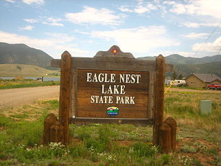
Eagle Nest Lake State Park is a state park in New Mexico, United States. The park is located outside Eagle Nest, approximately 30 miles (48 km) east of Taos. It was established on July 3, 2004. Its main attraction is a 2,400-acre (9.7 km2) lake which is popular for fishing and boating in the summer, and ice fishing and snowmobiling in the winter. The lake itself is a man-made reservoir created when the Cimarron River was impounded by the Eagle Nest Dam in 1918. The lake is home to several species of fish, including rainbow trout, brown trout, cutthroat trout, kokanee salmon, smallmouth bass, yellow perch, common carp, white sucker, channel catfish, sunfish, and northern pike, which were accidentally introduced into Eagle Nest Lake . Eagle Nest Lake is at an elevation of 8,300 feet (2,500 m), making it an alpine lake, and it is situated in a glacial valley on the slopes of Wheeler Peak, New Mexico's highest mountain. The surrounding mountains are rich in wildlife such as elk, deer, turkeys and bears.
Sumner Lake State Park is a state park of New Mexico, United States, located on the eastern plains about 8 miles (13 km) northwest of Fort Sumner.
Ute Lake State Park is a state park in New Mexico, USA, located on the eastern plains.
Villanueva State Park is a state park of New Mexico, United States, located on the banks of the Pecos River. The park features red and yellow sandstone cliffs, cottonwood trees, and other native plants. The park elevation is 5,600 feet (1,700 m) above sea level. The park is located 35 miles (56 km) southwest of the town of Las Vegas, New Mexico.
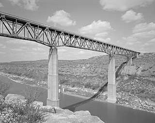
Brantley Dam is a flood control and irrigation water storage dam on the Pecos River in Eddy County, New Mexico about 13 miles (21 km) north of Carlsbad, New Mexico and 10 miles (16 km) upstream from Avalon Dam.
The Little Salmon River is a tributary of Lake Ontario located in Oswego County, New York. The river enters Lake Ontario approximately four miles (6.4 km) southwest from the mouth of the Salmon River.
Salt Creek Wilderness is a designated Wilderness Area located on the Pecos River approximately 12 miles north-east of Roswell, New Mexico. Established in 1970 as a unit of the Bitter Lake National Wildlife Refuge, the 9,621 acre Wilderness is administered by the U. S Fish and Wildlife Service. Combining the scrub lands of the Chihuahuan Desert with the riparian environment of the Pecos River and the Artesian basin of eastern New Mexico, Salt Creek represents a rare convergence of desert and wetlands.