Torrance County is a county located in the center of the U.S. state of New Mexico. As of the 2010 census, the population was 16,383. The county seat is Estancia.

Scouting in New Mexico has had a rich and colorful history, from the 1910s to the present day, serving thousands of youth in programs that suit the environment in which they live. The state is home to the Philmont Scout Ranch.

The Chihuahuan Desert is a desert and ecoregion designation covering parts of northern Mexico and the southwestern United States. It occupies much of West Texas, parts of the middle and lower Rio Grande Valley and the lower Pecos Valley in New Mexico, and a portion of southeastern Arizona, as well as the central and northern portions of the Mexican Plateau. It is bordered on the west by the extensive Sierra Madre Occidental range, along with northwestern lowlands of the Sierra Madre Oriental range. On the Mexican side, it covers a large portion of the state of Chihuahua, along with portions of Coahuila, north-eastern Durango, the extreme northern part of Zacatecas, and small western portions of Nuevo León. With an area of about 362,000 km2 (139,769 sq mi), it is the third largest desert of the Americas and the second largest in North America, after the Great Basin Desert.

The Cibola National Forest is a 1,633,783 acre United States National Forest in New Mexico, USA. The name Cibola is thought to be the original Zuni Indian name for their pueblos or tribal lands. The name was later interpreted by the Spanish to mean, "buffalo." The forest is disjointed with lands spread across central and northern New Mexico, west Texas and Oklahoma. The Cibola National Forest is divided into four Ranger Districts: the Sandia, Mountainair, Mt. Taylor, and Magdalena. The Forest includes the San Mateo, Magdalena, Datil, Bear, Gallina, Manzano, Sandia, Mt. Taylor, and Zuni Mountains of west-central New Mexico. The Forest also manages four National Grasslands that stretch from northeastern New Mexico eastward into the Texas Panhandle and western Oklahoma. The Cibola National Forest and Grassland is administered by Region 3 of the United States Forest Service from offices in Albuquerque, New Mexico. Elevation ranges from 5,000 ft to 11,301 ft. The descending order of Cibola National Forest acres by county are: Socorro, Cibola, McKinley, Catron, Torrance, Bernalillo, Sandoval County, New Mexico, Lincoln, Sierra, and Valencia counties in New Mexico. The Cibola National Forest currently has 137,701 acres designated as Wilderness. In addition to these acres, it has 246,000 acres classified as Inventoried Roadless Areas pursuant to the Roadless Area Conservation Rule.
The Sandia–Manzano Mountains are a substantial mountain area that defines the eastern edge of the middle Rio Grande valley of central New Mexico. They are not only an attractive backdrop to greater Albuquerque, the largest metropolitan area in New Mexico, but their elevation changes provide recreational opportunities including winter skiing and cool summer hiking or picnicing, as compared to the desert grasslands, foothills, and valley below. The entire mountain chain comprises three parts, arranged north to south: the Sandia Mountains, the Manzanita Mountains, and the Manzano Mountains. The Manzanita Mountains are a series of low-lying foothills that separate the Sandias from the Manzanos.

The Manzano Mountains are a small mountain range in the central part of the US State of New Mexico. They are oriented north-south and are 30 miles long. The center of the range lies due east of the town of Belen. The name "Manzano" is Spanish for "apple tree"; the mountains were named for apple orchards planted at the nearby town of Manzano.

Manzano Peak is the highest peak in the Manzano Mountains, a mountain range in the central part of the US State of New Mexico. It lies 7 miles (11 km) southwest of the town of Manzano and 18 miles (29 km) east-southeast of the town of Belen, in the Manzano Wilderness Area, part of the Mountainair Ranger District of the Cibola National Forest. It forms the striking southern anchor of the range, rising 3,900 feet (1,189 m) in 3 miles (5 km) above its western base. The summit is below the tree line, but has views to the east, south, and west.

Sandia Mountain Wilderness, part of Cibola National Forest, is located east of Albuquerque, New Mexico, and comprises much of Sandia Mountains. It became part of the National Wilderness Preservation System in 1978 by an act of the United States Congress and has a total of 37,877 acres (15,328 ha).
Manzano is a Spanish word used for apple trees, Malus domestica, and is also used as a patronymic name. Manzano can refer to any of the following:

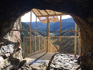
Sandia Cave, also called the Sandia Man Cave, is an archaeological site near Bernalillo, New Mexico, within Cibola National Forest. First discovered and excavated in the 1930s, the site exhibits evidence of human use from 9,000 to 11,000 years ago. It was declared a National Historic Landmark in 1961. The site is open to the public, up a difficult half-mile trail off New Mexico State Road 165.

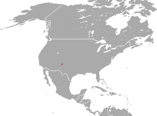
The Manzano mountain cottontail is a species of cottontail rabbit endemic to the Manzano Mountains in New Mexico, United States. It occurs in coniferous forests in high elevation. It was previously thought to be a subspecies of the Eastern cottontail.

The New Mexico shrew is a species of mammal in the family Soricidae. It is found only in New Mexico in the Capitan, Manzano, and Sandia mountains. Its total length is 103 to 121 millimeters. Its tail length is 39 to 54 millimeters. It weighs 6 to 8 grams. It was included in Sorex monticolus until 1996. It is distinguished from Sorex monticolus by its teeth. The row of unicuspid teeth is longer in Sorex neomexicanus than in Sorex monticolus, and Sorex neomexicanus has a wider space between its first upper unicuspid and second upper unicuspid than Sorex monticolus does.

Manzano Mountain Wilderness is a designated Wilderness Area within the Cibola National Forest, located about 50 miles (80 km) south-southeast of Albuquerque. It is located in western Torrance County and eastern Valencia County. The Wilderness area includes 36,875 acres (14,923 ha) with elevations ranging from 6,100 feet (1,900 m) to 10,098 feet (3,078 m) at Manzano Peak.

Cedro is a census-designated place (CDP) in Bernalillo County, New Mexico, United States. The population was 430 at the 2010 census. It is part of the Albuquerque Metropolitan Statistical Area.
The Sandia Formation is a geologic formation in New Mexico. The formation was first named by C.L. Herrick in 1900 for exposures in the Sandia Mountains of New Mexico. It is also found in the Jemez, Sangre de Cristo, and Manzano Mountains as well as the Las Vegas Basin. It is mostly shale with some sandstone and conglomerate but only minor limestone beds, with the coarser sediments towards its base. Fossils found in the formation range from Morrowan brachiopods at its base to Atokan fusinilids at its top, making it a lower to middle Pennsylvanian formation. However, the Morrowan section is missing in the Manzanos.
The Madera Formation is a geologic formation in northern New Mexico. The formation is a marine limestone, with minor arkosic sandstone, prominently exposed in the western Jemez Mountains, the Sangre de Cristo Mountains, the Lucero Uplift, atop Sandia Crest, and in the Manzano Mountains. The exposures near Jemez Springs include some of the richest brachiopod fossil beds in North America. Crinoid stems and bryozoans are also part of the fossil assemblage. The formation is also exposed in the canyon of Rio Grande del Rancho south of Talpa, New Mexico, where brachiopods, crinoids, rugose coral, and graptolite fossils can be found. The fossil assemblage dates the Madera Formation to the middle to late Pennsylvanian.
State Road 131 (NM 131) is a 2.4-mile-long (3.9 km) state highway in the US state of New Mexico. NM 131's southern terminus is at the end of state maintenance near Manzano Mountains State Park entrance, and the northern terminus is at NM 55 in Manzano.


