
Demographic features of the population of Botswana include population density, ethnicity, education level, health of the populace, economic status, religious affiliations and other aspects.

Gaborone is the capital and largest city of Botswana with a population of 246,325 based on the 2022 census, about 10% of the total population of Botswana. Its agglomeration is home to 534,842 inhabitants at the 2022 census.

Maun is the fifth-largest town in Botswana. As of 2011, it had a population of 55,784. Maun is the "tourism capital" of Botswana and the administrative centre of Ngamiland district. Francistown and Maun are linked by the A3 highway. Maun is also the headquarters of numerous safari and air-charter operations who run trips into the Okavango Delta.

Palapye is a growing town in Botswana, situated about halfway between Francistown and Gaborone. Over the years its position has made it a convenient stopover on one of Southern Africa's principal north–south rail and road routes.
Mochudi is one of the larger villages in Botswana with a population of 50,321 people in 2022. It is situated in the Bakgatla tribal region, in Kgatleng District, about 37 km (23 mi) northeast of Gaborone. The village lies several kilometres from the main Gaborone–Francistown road, and can be accessed through a short turn at Pilane. Mochudi was settled by the Tswana people in 1871. The main attraction in Mochudi is the Phuthadikobo Museum which is perched at the top of a hill and holds a rich history of Bakgatla tribe and Batswana in general.

Francistown is the second-largest city in Botswana, with a population of about 103,417 and 147,122 inhabitants for its agglomeration at the 2022 census. It is located in eastern Botswana, about 400 kilometres (250 mi) north-northeast from the capital, Gaborone. Francistown is located at the confluence of the Tati and Ntshe rivers, and near the Shashe River and 90 kilometres (56 mi) from the international border with Zimbabwe.
Orapa is a town located in the Central District of Botswana. It is the site of the Orapa diamond mine, the largest diamond-producing mine in the world, and is considered to be the diamond capital of the country. Nearby is another kimberlite mine owned by Lucara Diamond, thought to have very large reserves of diamonds.

Lobatse is a town in south-eastern Botswana, 70 kilometres south of the capital Gaborone, situated in a valley running north towards Gaborone and close to the border with South Africa. Lobatse has a population of 29,772 as of 2022. The town is an administrative district, with a town council.

Southern is one of the districts of Botswana. The capital of Southern district is Kanye, home to the Bangwaketse and Barolong in Botswana. The Southern district is home to Botswana's second largest beef farmers where there are large privately owned ranges, and several government run beef ranges which provide agricultural support to the local farmers. Maize and sorghum, Botswana's staple crop, are also raised in the area. Southern district is where the third diamond mine of Botswana was found, which buoys Botswana's economic state of prosperity. It was the first district to house the capital city before being moved to Gaborone after independence.
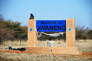
Jwaneng is a town located in the Southern District of Botswana, but it is not part of this, being a separate district, with its own Town Council.

Kanye is a village in southern Botswana, located 83 kilometres (52 mi) south-west of the capital, Gaborone. It is the administrative centre of the Southern District, and had a population of 48,028 as of the 2022 Population and Housing Census. This is an increase compared to the 45,196 of the 2011 census, making it the ninth-largest village in the country. Kanye is the traditional capital of the Ngwaketse tribe, who first settled in the area in the 1790s. The village is the longest continuously-occupied tribal capital in the country.
Shoshong is a town in Botswana, formerly the chief settlement of the eastern Bamangwato.

Shakawe is a village located in the northwest corner of Botswana at the beginning of the Okavango Delta, close to Namibia and Angola. Shakawe is awakening from its former status as a sleepy little outpost on the Okavango. For travellers, Shakawe means a Botswana entry or exit stamp or a staging post for a visit to the Tsodilo Hills, 40 km away. For Southern African holiday-makers, it is most often the start of a fishing trip in the Okavango Panhandle. It also provides access to the Caprivi Strip. The record high temperature ever registered in Shakawe was 39.6 °C (103.3 °F). The lowest temperature registered in Shakawe was −6.1 °C (21.0 °F).
Nata is a village in the Central District of Botswana. Located in the north of the district about 200km from the city of Francistown, the village is served by Nata Airport. The population was 7,713 at the 2022 census with a growth rate of 1.3% from 6714 at the 2011 census. The village of Nata lies along the Nata River, which carries its rainy season flow to the Makgadikgadi Pans, a seasonal hypersaline lake.The village serves as a crossroads for routes to Maun and Kasane, providing essential services to travelers.
Gabane is a village in Kweneng District of Botswana. It is located 15 km (10 mi) west of Gaborone, the capital of Botswana. The population was 10,399 in 2001 census, making it the fourth largest settlement in Kweneng. Its population was 14,842 at the 2011 census. It's now part of Gaborone agglomeration home to 421,907 inhabitants at the 2011 census.
Kopong is a small village in Kweneng District of Botswana. It is located around 25 km north of Gaborone, the capital of Botswana. The population was 5,571 in 2001 census and 9,520 at the 2011 census, making it the sixth largest settlement in Kweneng. It is now becoming a suburb of Gaborone agglomeration home to 421,907 inhabitants at the 2011 census.

Christianity is the largest religion in Botswana with Christians forming 86.5% of the population according to the latest census. However, the country is officially secular and allows freedom of religious practice.
The Botswana Population and Housing Census is a decennial census which is the once-a-decade population and housing count of all people in Botswana. This census is carried out by the Statistics Botswana.
Maitengwe is a large village located in the Central District of Botswana. It had 5,890 inhabitants at the 2011 census. It is one of many developing villages in the country and best known for its festive celebrations.
