The Lahaul and Spiti district is a high-altitude district in Himachal Pradesh, north India. This entirely mountainous district consists of two geographically distinct as well as formerly separate political-administrative units, called Lahaul and Spiti. Lahaul and Spiti is the largest district by area in Himachal Pradesh, and one of the least populous districts in the whole of India. Kyelang in Lahaul is the headquarters of the whole district, while Spiti also has a subdivisional headquarters, at Kaza.

Tabo is a small town in the Lahaul and Spiti district on the banks of the Spiti River in Himachal Pradesh, India. The town lies on the road between Rekong Peo and Kaza, the sub-divisional headquarters of Spiti. The town surrounds a Buddhist monastery which, according to legend, is said to be over a thousand years old. The Dalai Lama has expressed his desire to retire to Tabo, since he maintains that the Tabo Monastery is one of the holiest. In 1996, the Dalai Lama conducted the Kalachakra initiation ceremony in Tabo, which coincided with the millennium anniversary celebrations of the Tabo monastery. The ceremony was attended by thousands of Buddhists from across the world. Tabo Monastery's spiritual head is Tsenshap Serkong Rinpoche.

Kullu is a municipal council town that serves as the administrative headquarters of the Kullu district of the Indian state of Himachal Pradesh. It is located on the banks of the Beas River in the Kullu Valley about 10 kilometres (6.2 mi) north of the airport at Bhuntar, Kullu.

Dhankar Gompa is a village and also a Gompa, a Buddhist temple in the district of Lahaul and Spiti in India. It is situated at an elevation of 3,894 metres in the Spiti Valley above Dhankar Village, between the towns of Kaza and Tabo. The complex is built on a 1000-foot (300-metre) high spur overlooking the confluence of the Spiti and Pin Rivers - one of the world's most spectacular settings for a gompa. Dhang or dang means cliff, and kar or khar means fort. Hence Dhangkar means fort on a cliff.

Spiti is a high-altitude region of the Himalayas, located in the north-eastern part of the northern Indian state of Himachal Pradesh. The name "Spiti" means "The middle land", i.e. the land between Tibet and India. Spiti incorporates mainly the valley of the Spiti River, and the valleys of several rivers that feed into the Spiti River. Some of the prominent side-valleys in Spiti are the Pin valley and the Lingti valley. Spiti is bordered on the east by Tibet, on the north by Ladakh, on the west and southwest by Lahaul, on the south by Kullu, and on the southeast by Kinnaur. Spiti has a cold desert environment. The valley and its surrounding regions are among the least populated regions of India. The Bhoti-speaking local population follows Tibetan Buddhism.

Kye Gompa is a Tibetan Buddhist monastery of the Gelugpa sect located on top of a hill at an altitude of 4,166 metres (13,668 ft) above sea level, close to the Spiti River, in the Spiti Valley of Himachal Pradesh, Lahaul and Spiti district, India.

Kaza, also spelled Kaze, Karze, Karzey, is a town and the subdivisional headquarters of the remote Spiti Valley in the western Himalayas in the Lahaul and Spiti district of the northern Indian state of Himachal Pradesh. Spiti is a high altitude or cold desert having close similarities to the neighbouring Tibet and Ladakh regions in terms of terrain, climate and the Buddhist culture. Kaza, situated along the Spiti River at an elevation of 3,650 m (11,980 ft) above mean sea level, is the largest township and commercial center of the Spiti valley.

Karsha Monastery or Karsha Gompa is a Buddhist monastery in the Padum Valley of the Zanskar region of the union territory of Ladakh in northern India. The Doda River flows past the monastery from its source at the Drang Drung Glacier of the Pensi La. It was founded by the translator Phagspa Shesrab. The monastery, also known by the name Karsha Chamspaling, was founded by Phagspa Shesrab, under the Gelugpa Order or Yellow Hats. It is 11 km north of Padum in Zanskar River valley.
Kardang Monastery or Gompa is a famous Drukpa Lineage monastery, and is the most important monastery in the Lahaul valley, India. The associated village of Kardang was once the capital of Lahaul.
Gondhla is a village in the Lahaul and Spiti district, Himachal Pradesh, India. It is located about 18 kilometres (11 mi) before Keylong on the road from Manali, Himachal Pradesh, and lies at 3,160 m (10,370 ft) above sea level. The village is famous for the Guru Ghantal monastery and the Gondhla fort. In former times, this village was the seat of the Thakurs of Gondhla, who ruled the valley of the Chandra river in Lahaul at the behest of the Rajas of Kullu.

Jispa is a village in Lahaul, in the Indian state of Himachal Pradesh.

Gemur Monastery is a Buddhist gompa, above the village of Gemur, Lahaul and Spiti district, Himachal Pradesh, northern India. The monastery dates from the first half of the 17th century.

Buddhism in the Himachal Pradesh state of India of has been a long-recorded practice. The spread of Buddhism in the region has occurred intermediately throughout its history. Starting in the 3rd century BCE, Buddhism was propagated by the Maurya Empire under the reign of Ashoka. The region would remain an important center for Buddhism under the Kushan Empire and its vassals. Over the centuries the following of Buddhism has greatly fluctuated. Yet by experiencing revivals and migrations, Buddhism continued to be rooted in the region, particularly in the Lahaul, Spiti and Kinnaur valleys.

Koksar is one of the villages in Lahaul Mandal in Lahaulspiti District in Himachal Pradesh state in Northern India. Koksar meaning is Alpine, Big, Colossal, Gigantic, Highland, Huge, Mammoth, Tall and Towering. Koksar is about 19 km from Rohtang Pass, and 7 km from North Portal of Atal Tunnel Rohtang. Koksar is the coldest place in Lahaul. It is mostly snowed-in during winters but during the summer months, the PWD Rest House and Eating places are in business. It is a mountainous area from which views and pathways for hiking can be seen. It is 340 km from its state capital Shimla and 70 km from Manali.
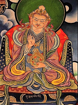
Yeshe-Ö was the first notable lama-king in Tibet. Born as Khor-re, he is better known as Lhachen Yeshe-Ö, his spiritual name.

Phunchog Rai is a politician from Himachal Pradesh, India, and a member of the Indian National Congress Party.

National Highway 505, commonly called NH 505, is a national highway in India. It is a spur road of National Highway 5. NH 505 traverses the state of Himachal Pradesh in India. NH 505 is a high elevation road, covering the Kinnaur and Lahaul and Spiti districts of Himachal Pradesh, mainly running along the Spiti River in the Spiti Valley. The highway from Kaza to Gramphu remains closed for 6–9 months in a year due to heavy snowfall and the closure of Kunzum La pass at an elevation of 4,550 m (14,930 ft).
Lata Thakur was an Indian politician. She was an MLA from the Lahaul and Spiti Assembly Constituency in the 1972 Himachal Pradesh Legislative Assembly. She belonged to the Indian National Congress. Lata Thakur was the first female legislator from Lahaul and Spiti, and the first female Scheduled Tribe MLA in all of Himachal Pradesh.
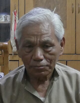
Tobdan is a historian and linguist from Himachal Pradesh, India. He is noted for his work on the cultural traditions, histories, and languages of the Lahaul and Spiti district, and some neighboring regions.
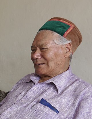
Tshering Dorje was a cultural historian from Himachal Pradesh, India. He was regarded as an authority on the cultural traditions and histories of the Lahaul and Spiti district and some neighboring regions. He also played an important role in bringing about the construction of the 9.02 km-long, high-altitude Atal Tunnel.