Shawbirch

Last updated

Shawbirch
534faaa221f40-woolpack.l.m.jpg
The Woolpack pub in Shawbirch
TelfordParishes.png
Shawbirch is the 29th ward of Telford and Wrekin
Shropshire UK location map.svg
Red pog.svg
Shawbirch
Location within Shropshire
Population2,919 (2021)
OS grid reference SJ 643 135
Unitary authority
Ceremonial county
Region
Country England
Sovereign state United Kingdom
Post town TELFORD
Postcode district TF5
Dialling code 01952
Police West Mercia
Fire Shropshire
Ambulance West Midlands
UK Parliament
List of places
UK
England
Shropshire
52°43′05″N2°31′48″W / 52.718°N 2.530°W / 52.718; -2.530

Shawbirch is a residential area in the ceremonial county of Shropshire, in the Unitary Authority of Telford and Wrekin. It is located west of Admaston, north of Wellington and east of Hortonwood.

Contents

History

Throughout the second millennium, Shawbirch was mostly covered by woodland, which later was repurposed for farmland within the township of Eyton upon the Weald Moors. [1] The development of Shawbirch as it is known today was created on predominantly agricultural land during the 1980s as part of the evolution of Telford new town. Designated for such in 1968 along with Hortonwood, the first phase of the Shawbirch scheme was completed in 1982, at which point the Telford new town had a surplus of new housing and regarded Shawbirch as the final necessary development scheme. [2]

Since then, there have been numerous developments in Shawbirch. The Maxell/Elements Europe factory in Apley is to be demolished to meet new housing demands, with 375 homes to be built to incorporate into the community of Shawbirch. [3] New developments have not always been welcome, however; Mark Pritchard MP, who represents Shawbirch as part of Wrekin constituency, has said the local councils responsible for Shawbirch developments have committed "environmental vandalism", adding that the scale of new developments such as housing is neither proportionate nor sustainable. [4] Furthermore, in 2019, strong local opposition forced the backdown of the building of a 40m high toilet paper factory on 80,000 square metres of land, that was meant to be part of a larger planned industrial estate, in Shawbirch. [5]

Services

Shawbirch Community Centre Shawbirch community centre.jpg
Shawbirch Community Centre

Shawbirch has a veterinary centre [6] and a pub. [7] Shawbirch also includes a 24-hour service station, with a Travelodge hotel [8] and a Toby Carvery restaurant. [9]

Shawbirch Community Centre

Shawbirch Community Centre consists of a Boots pharmacy, [10] a dental centre, and a hair and beauty salon. Shawbirch Medical Centre also used to co-occupy this space but has now moved to a purpose-built venue in Admaston. [11] There is also a SPAR store, which was refurbished and expanded in November 2020 to incorporate a Greggs bakery and a Post Office. [12]

Attractions

Behind the Shawbirch Community Centre there are the Rough Pits - a wood with two man-made lakes. [13] [14] Also located in the Shawbirch borough are the Beanhill Woods and the Dothill Nature Reserve. [14] Apley Woods is located one mile away. Also located in Shawbirch is the Brockwood Copse playground. [15]

Politics

The Shawbirch ward falls under The Wrekin constituency which currently has a Conservative seat in Parliament, held since 2005 by Mark Pritchard.

The polling station for Shawbirch is located at the back of the Shawbirch Community Centre in the Little Chicks Preschool. [14] The member of Telford and Wrekin Council for Shawbirch is Liberal Democrat Cllr Bill Tomlinson. He was elected in 2003, [16] 2007, [17] 2011 [18] 2015, [19] 2019, [20] and 2023.

Demography

In the 2021 census, the population was recorded as 2,919, with 52% of residents being female and 48% being male. [21] This is a decrease from 2011 where the population was recorded as 3,239. [22]

90.9% of residents were born in England, the next biggest percentage was Wales with 2.3%. The mean age in Shawbirch is 38.1, which is lower than the national average. [23]

100% of people in Shawbirch speak English, higher than the Telford and Wrekin borough average of 99.8%. [24] 98.5% of people in Shawbirch speak English as their main language. Of the 1.5% whose main language is not English, 1.2% speak English well and 0.3% do not speak English well. The next biggest language spoken was 0.2% who speak Czech as their main language. 0.1% also speak British Sign Language.

93.7% of residents are White British, and Other White make up 1.5% for a total white population of 95.2% - lower than that of Shropshire's average at 98% [25] and higher than that of Telford and Wrekin's average at 92.7%. The largest non-white ethnic group in Shawbirch is Asian British with 2.2% of the population. 1.3% of residents are mixed race, 0.9% are Black British and 0.3% are in another ethnic group.

In Shawbirch, 54.7% of residents are married. 12.6% live with a partner of the opposite sex, while 0.4% live with a partner of the same sex. 20.5% are single, have never been married and have never been partnered with the same sex. 7.9% are divorced/separated and there are 155 widows living in Shawbirch.

67.6% of people who live in Shawbirch identify themselves as a Christian. 22.8% identify as non-religious and the next biggest religion was Islam with 0.9%. Out of the 3,239 residents, 230 did not answer and 12 identified as a Jedi Knight.

74.7% of Shawbirch residents are employed, with the most common occupation category being "Professional occupations" at 19.5% of the employed population.

Education

Little Chicks Preschool Little chicks.jpg
Little Chicks Preschool

Little Chicks Preschool is located at the back of the Shawbirch Community Centre, and Ercall Day Nursery is located at the nearby Princess Royal Hospital.

St. Peter's Church of England Primary is the nearest primary school to Shawbirch, located in nearby Bratton. Dothill Primary School is less than one mile from Shawbirch, with other primary schools including Old Hall, St. Patrick's Roman Catholic and Wrekin View Primary located in the nearby town of Wellington.

Health services

There is a medical centre, a pharmacy and a dental practice located in the Shawbirch Community Centre, and a veterinary centre is also located in Shawbirch. The Princess Royal Hospital is located in the neighbouring village of Apley.

Transport

Bus

The 15 bus route from Telford to Arleston [26] and 16 bus route from Telford to High Ercall [27] run through Shawbirch and are both operated by Arriva Midlands.

Train

The nearest train station is the Wellington, which operates services to places like Birmingham New Street and Shrewsbury Station. Other nearby stations include Telford Central.

Car

The B5063 and B4394 runs through Shawbirch. The A442 Queensway is located at the Shawbirch roundabout opposite the service station. The M54 motorway is at the back of the nearby Wrekin Retail Park.

Related Research Articles

<span class="mw-page-title-main">Shropshire</span> County of England

Shropshire is a ceremonial county in the West Midlands of England, on the Welsh border. It is bordered by Wrexham County Borough and Cheshire to the north, Staffordshire to the east, Worcestershire to the south-east, Herefordshire to the south and Powys to the west. The largest settlement is Telford, and Shrewsbury is the county town.

<span class="mw-page-title-main">Telford</span> Town in Shropshire, England

Telford is a town in Shropshire, England. It is the administrative centre of Telford and Wrekin borough, a unitary authority which covers the town, its suburbs and surrounding settlements. The town is close to the county's eastern boundary, and near the River Severn.

<span class="mw-page-title-main">Newport, Shropshire</span> Human settlement in England

Newport is a market town in the borough of Telford and Wrekin in Shropshire, England. It lies 7 miles (11 km) north-east of Telford town centre, 12 miles (19 km) west of Stafford, and is near the Shropshire-Staffordshire border. The 2001 census recorded 10,814 people living in the town's parish, which rose to 11,387 by the 2011 census.

<span class="mw-page-title-main">Telford and Wrekin</span> Borough in Shropshire, England

Telford and Wrekin is a borough and unitary authority in Shropshire, England. In 1974, a non-metropolitan district of Shropshire was created called The Wrekin, named after a prominent hill to the west of Telford. In 1998, the district became a unitary authority and was renamed "Telford and Wrekin", which remains part of the Shropshire ceremonial county and shares institutions such as the Fire and Rescue Service and Community Health with the rest the county.

<span class="mw-page-title-main">The Wrekin</span> Hill in Shropshire, England

The Wrekin is a hill in east Shropshire, England. It is located some five miles (8 km) west of Telford, on the border between the unitary authorities of Shropshire and Telford and Wrekin. Rising above the Shropshire Plain to a height of 407 metres (1,335 ft) above sea level, it is a prominent and well-known landmark, signalling the entrance to Shropshire for travellers westbound on the M54 motorway. The Wrekin is contained within the northern salient of the Shropshire Hills AONB. The hill is popular with walkers and tourists and offers good views of Shropshire. It can be seen well into Staffordshire and the Black Country, and even as far as the Beetham Tower in Manchester, Winter Hill in Lancashire and Cleeve Hill in Gloucestershire.

<span class="mw-page-title-main">Wellington, Shropshire</span> Human settlement in England

Wellington is a constituent market town of Telford and a civil parish in the borough of Telford and Wrekin, Shropshire, England. It is situated 3 miles (4.8 km) northwest of Telford town centre and 12 miles (19 km) east of Shrewsbury. The summit of The Wrekin lies 3 miles southwest of the town. The population of the town was 25,554 in 2011.

<span class="mw-page-title-main">The Wrekin (UK Parliament constituency)</span> Parliamentary constituency in the United Kingdom, 1918 onwards

The Wrekin is a constituency in the House of Commons of the British Parliament, located in the county of Shropshire in the West Midlands of England. It has existed continuously since its creation by the Representation of the People Act 1918, and is named after a prominent landmark hill in the area, The Wrekin. It has been represented by the Labour and Conservative parties since the 1920s, a post held since 2005 by Conservative MP Mark Pritchard.

<span class="mw-page-title-main">Wolverhampton–Shrewsbury line</span> Railway line serving between Wolverhampton and Shrewsbury

The Wolverhampton–Shrewsbury line is the railway line from Wolverhampton to Shrewsbury via Wellington; it was originally built by the Shrewsbury and Birmingham Railway. The line is double track throughout, with rarely used relief sidings at Cosford and four tracks through Wellington station.

<span class="mw-page-title-main">Admaston, Shropshire</span> Human settlement in England

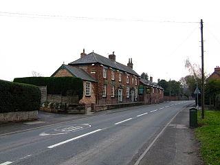
Admaston is a village in the English ceremonial county of Shropshire, in the borough of Telford & Wrekin. It is located northwest of Wellington and close to the village of Wrockwardine. It now forms part of the Telford new town.

<span class="mw-page-title-main">Wrekin College</span> Public school in Shropshire, England

Wrekin College is an independent co-educational boarding and day school located in Wellington, Shropshire, England. It was founded by Sir John Bayley in 1880. It is now co-located with a preparatory school, The Old Hall School, founded by 1835. The two schools merged their governance and formed one trust in 2007.

<span class="mw-page-title-main">Princess Royal Hospital, Telford</span> Hospital in Shropshire, England

The Princess Royal Hospital is a teaching hospital located in Apley Castle, Telford, England. It forms the Telford site of the Shrewsbury and Telford Hospital NHS Trust and serves patients in Telford and Wrekin, the rest of Shropshire, and Powys, in conjunction with the Royal Shrewsbury Hospital.

Sir William Forester KB, of Dothill Park, Apley Castle, and Watling Street in Wellington, Shropshire was a Whig politician who sat in the English and British House of Commons between 1679 and 1715.

<span class="mw-page-title-main">Telford and Wrekin Council</span> English unitary authority council in the West Midlands

Telford and Wrekin Council is the local authority of Telford and Wrekin in Shropshire, England. It is a unitary authority, having the powers of a county council and district council combined.

<span class="mw-page-title-main">Telford International Railfreight Park</span>

Telford International Railfreight Park is rail freight depot and construction development site located in Donnington to the north of Telford, on the former route of the Stafford–Shrewsbury line. The terminal was opened in 2009.

<span class="mw-page-title-main">Telford Shopping Centre</span> Shopping mall in Shropshire, England

Telford Centre, previously branded as Telford Shopping Centre, is a 52-acre (210,000 m2) indoor shopping centre in Telford, Shropshire, England, housing the streets North Sherwood Street, Sherwood Square, Sherwood Street, Wyre Hall, Sherwood Row, Southwater, The Border, Kielder Square, New Street, Chase Telford, Wrekin Square, New Row, Dean Street, Dean Square and Ashdown Row.

The 2015 Telford and Wrekin Council election took place on 7 May 2015 to elect members of the Telford and Wrekin Council in England. It was held on the same day as other local elections and the UK General Election 2015.

<span class="mw-page-title-main">Stirchley Chimney</span> Chimney located in Telford Town Park

Stirchley Chimney is a chimney located in Telford Town Park. The chimney also marks a notable waypoint on the South Telford Heritage Trail. Measuring 209 feet (64 m) high, construction of the chimney was completed in 1873.

References

  1. "Eyton upon the Weald Moors: Economic history | British History Online". www.british-history.ac.uk. Retrieved 15 August 2022.
  2. "Wellington: Growth of settlement | British History Online". www.british-history.ac.uk. Retrieved 15 August 2022.
  3. Austin, Sue. "New development on former Maxell factory site will have 118 affordable homes". www.shropshirestar.com. Retrieved 15 August 2022.
  4. Andrews, Mark. "'Environmental vandalism': MP Mark Pritchard launches blistering attack on Shropshire planning authorities". www.shropshirestar.com. Retrieved 15 August 2022.
  5. Growcott, Matthew. "Giant Telford factory plan 'a monstrosity'". www.shropshirestar.com. Retrieved 15 August 2022.
  6. "Shawbirch | Ashcroft Veterinary Centre | Medivet". www.medivet.co.uk. Retrieved 11 June 2016.
  7. "Woolpack". The Woolpack. Retrieved 11 June 2016.
  8. "Travelodge | Telford Shawbirch hotel - Telford Shawbirch hotels". Travelodge. Retrieved 11 June 2016.
  9. "Telford". Toby Carvery. Retrieved 11 June 2016.
  10. "Boots Telford Shawbirch - Store Locator - Boots". www.boots.com. Retrieved 11 June 2016.
  11. "New Telford GP surgery to serve growing demand". BBC News. 25 July 2022. Retrieved 15 August 2022.
  12. "SPAR Shawbirch". www.spar.co.uk. Retrieved 11 June 2016.
  13. "Rough Pits | Explore woods | The Woodland Trust". www.woodlandtrust.org.uk. Retrieved 20 April 2019.
  14. 1 2 3 Council, Telford & Wrekin. "Telford & Wrekin Council download - Borough Ward Maps 2015 About my council". www.telford.gov.uk. Retrieved 19 April 2017.
  15. "Brockwood Copse". Telford and Wrekin Council. Retrieved 20 April 2019.
  16. "Local Elections Archive Project - 2003 - Telford and Wrekin". www.andrewteale.me.uk. Retrieved 12 June 2016.
  17. "Local Elections Archive Project - 2007 - Telford and Wrekin". www.andrewteale.me.uk. Retrieved 12 June 2016.
  18. Council, Telford & Wrekin. "Telford & Wrekin Council download - Local election results About my council | Elections". www.telford.gov.uk. Retrieved 12 June 2016.
  19. Council, Telford & Wrekin. "Telford & Wrekin Council download - Borough election results 2015 About my council | Elections". www.telford.gov.uk. Retrieved 12 June 2016.
  20. Taylor, Emily. "Shawbirch ward results 2019". www.telford.gov.uk. Retrieved 3 May 2019.
  21. "Shawbirch (Ward, United Kingdom) - Population Statistics, Charts, Map and Location". citypopulation.de. Retrieved 30 March 2023.
  22. "Shawbirch Demographics (Telford and Wrekin, England)". shawbirch.localstats.co.uk. Retrieved 11 June 2016.
  23. "Socio-economic statistics for Shawbirch, Shropshire". iLiveHere. 1 June 2012. Retrieved 29 November 2019.
  24. "Shawbirch 2011 Census Profile" (PDF). Telford and Wrekin.
  25. "Shrewsbury Profile 2011 Census" (PDF). Telford and Wrekin.
  26. "15 - Telford to Arleston". www.arrivabus.co.uk. Retrieved 11 June 2016.
  27. "16 - Telford to High Ercall". www.arrivabus.co.uk. Retrieved 11 June 2016.