Shieldsville, Minnesota

Last updated
Shieldsville, Minnesota
USA Minnesota location map.svg
Red pog.svg
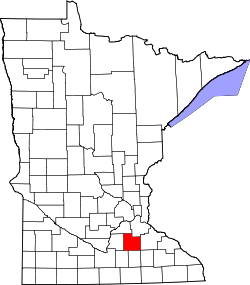
Shieldsville, Minnesota
Location of the community of Shieldsville
within Shieldsville Township, Rice County
Usa edcp location map.svg
Red pog.svg
Shieldsville, Minnesota
Shieldsville, Minnesota (the United States)
Coordinates: 44°21′58″N93°24′32″W / 44.36611°N 93.40889°W / 44.36611; -93.40889 Coordinates: 44°21′58″N93°24′32″W / 44.36611°N 93.40889°W / 44.36611; -93.40889
Country United States
State Minnesota
County Rice County
Township Shieldsville Township
Elevation
1,093 ft (333 m)
Time zone UTC-6 (Central (CST))
  Summer (DST) UTC-5 (CDT)
ZIP code
55021 and 56052
Area code(s) 507
GNIS feature ID651981 [1]

Shieldsville is an unincorporated community in Shieldsville Township, Rice County, Minnesota, United States.

Contents

The center of Shieldsville is generally considered near the junction of State Highway 21 (MN 21) and Rice County Road 10 (Dodd Road). Other routes include County Roads 37, 38, and 67.

Nearby places include Faribault, Kilkenny, Waterville, and Montgomery. Shieldsville is located in section 1 of Shieldsville Township.

ZIP codes 55021 (Faribault), 56052 (Kilkenny), 56096 (Waterville), and 56069 (Montgomery) all meet near Shieldsville.

Historical population
CensusPop.
1870 110
U.S. Decennial Census [2]

History

Shieldsville, named after its founder, American politician and U.S. Army officer, James Shields, was platted in 1856. [3] It was founded around the Irish St. Patrick Catholic Church. [4]

In the settlement's early years, land within the area was sold for $2.00 per acre with the mission of attracting Irish immigrants to settle in the area.

On July 29, 2002, The St. Patrick Church of Shieldsville was hit by lightning for the second time in its history and was severely destroyed. It was rebuilt 2 years later on August 1, 2004. [5]

Culture

Shieldsville holds a Fall Festival for the town and the surrounding area every September 29.

Related Research Articles

Waseca County, Minnesota County in Minnesota, United States

Waseca County is a county in the U.S. state of Minnesota. As of the 2020 census, the population was 18,968. Its county seat is Waseca.

Rice County, Minnesota County in Minnesota, United States

Rice County is a county located in the south central portion of the U.S. state of Minnesota. As of the 2020 census, the population was 67,097. Its county seat is Faribault.

Mower County, Minnesota County in Minnesota, United States

Mower County is a county in the U.S. state of Minnesota. As of the 2020 census, the population was 40,029. The county seat is Austin. Mower County comprises the Austin Micropolitan Statistical Area and is included in the Rochester-Austin Combined Statistical Area. Lake Louise State Park is in the southeastern Mower County, near Le Roy.

Martin County, Minnesota County in Minnesota, United States

Martin County is a county in Minnesota, United States. As of the 2020 census, the population was 20,025. Its county seat is Fairmont.

Le Sueur County, Minnesota County in Minnesota, United States

Le Sueur County is a county located in the south central portion of the U.S. state of Minnesota. As of the 2020 census, the population was 28,674. Its county seat is Le Center.

Freeborn County, Minnesota County in Minnesota, United States

Freeborn County is a county in the state of Minnesota. As of the 2020 United States Census, the population was 30,895. Its county seat is Albert Lea. Freeborn County comprises the Albert Lea Micropolitan Statistical Area.

Faribault County, Minnesota County in Minnesota, United States

Faribault County is a county in the U.S. state of Minnesota. As of the 2020 census, the population was 13,921. Its county seat is Blue Earth.

Blue Earth County, Minnesota County in Minnesota, United States

Blue Earth County is a county in the State of Minnesota. As of the 2020 census, the population was 69,112. Its county seat is Mankato. The county is named for the Blue Earth River and for the deposits of blue-green clay once evident along the banks of the Blue Earth River.

Shelby Township is a township in Blue Earth County, Minnesota, United States. The population was 294 as of the 2000 census.

Montgomery, Minnesota City in Minnesota, United States

Montgomery is a city in Le Sueur County, Minnesota, United States, 45 miles south of Minneapolis. It was named after Richard Montgomery, an Irish-American soldier who served as a major general in the Continental Army during the Revolutionary War. The population was 2,956 at the 2010 census.

Faribault, Minnesota City in Minnesota, United States

Faribault is a city in, and the county seat of, Rice County, Minnesota, United States. The population was 23,352 at the 2010 census. Faribault is approximately 50 miles (80 km) south of Minneapolis–Saint Paul.

Canosia Township is a township in Saint Louis County, Minnesota, United States. Canosia is a name derived from the Algonquian language meaning "pike fish". The population was 2,158 at the 2010 census.

Rice Lake is a city in Saint Louis County, Minnesota, United States. The population was 4,099 at the 2010 census.

Cannon River (Minnesota)

The Cannon River a tributary of the Mississippi River flows 112 miles (180 km) from Shields Lake near Shieldsville to Red Wing in the U.S. state of Minnesota, where it joins the Mississippi River. It drains a watershed approximately 1460 square miles (3,780 km²) in size. The river flows through the counties of Le Sueur, Rice, Dakota, and Goodhue.

Ruskin is an unincorporated community in Rice County, Minnesota, United States.

Warsaw, Minnesota Unincorporated community in Minnesota, US

Warsaw is an unincorporated community and census-designated place (CDP) in Warsaw Township, Rice County, Minnesota, United States. As of the 2010 census, its population was 627.

Cordova is an unincorporated community in Cordova Township, Le Sueur County, Minnesota, United States.

Veseli, Minnesota Unincorporated community in Minnesota, United States

Veseli is an unincorporated community in Wheatland Township, Rice County, Minnesota, United States. The community was incorporated in 1889. It was named after Veselí nad Lužnicí, in the Czech Republic, a city whence its early settlers came. Veseli was one of the four largest communities in Minnesota originally settled by Czech immigrants.

Epsom is an unincorporated community in Richland Township, Rice County, Minnesota, United States.

References

  1. "Shieldsville, Minnesota". Geographic Names Information System . United States Geological Survey.
  2. United States Census Bureau. "Census of Population and Housing".
  3. Upham, Warren (1920). Minnesota Geographic Names: Their Origin and Historic Significance. Minnesota Historical Society. p.  463.
  4. "Rice County, MN, Faribault City, County Seat".
  5. "St. Patrick Church Shieldsville".