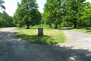
Dana was a town located in Worcester County, Massachusetts, United States. Dana was lost as a result of the formation of the Quabbin Reservoir.

The Chelmsford Center Historic District is a historic district encompassing the historic heart of the town of Chelmsford, Massachusetts. It extends from the town's central square in the east, where the intersection of Billerica Road and Chelmsford Street is located, west beyond the junction of Littleton and North Roads with Westford Street, and from there north along Worthen Road. It includes the area that was the 17th-century heart of the town, including its common and first burying ground, and has been the town's civic heart since its founding.

The Brookfield Common Historic District encompasses a historically significant portion of the town center of Brookfield, Massachusetts. It is focused on the town common, which extends south from Main Street to Lincoln Street, and includes a dense cluster of houses on roads to its east, as well as properties on Main Street and the Post Road. The district includes more than 100 properties, including the Colonial Revival Town Hall, Banister Memorial Hall, and Romanesque Revival Congregation Church. The district was added to the National Register of Historic Places in 1990.

The Lunenburg Historic District is a historic district encompassing the historic center of Lunenburg, Massachusetts. The district is centered on a stretch of Main Street which connects two triangular intersections. It includes many of the town's oldest buildings, including the c. 1724 Cushing House, and the c. 1730 Stillman Stone House. Three of the town's most significant institutional buildings were built before 1850: the town hall, the Congregational church, and the Methodist church. The district was added to the National Register of Historic Places in 1988.

The Old Centre Historic District is a historic district encompassing the historic town center of Winchendon, Massachusetts. It includes the town's first cemetery, the First Congregational Church, and the oldest surviving house in town, and only one building constructed after 1850. The district was added to the National Register of Historic Places in 1987.
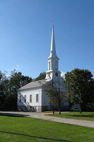
Royalston Common Historic District is a historic district encompassing the historic village center of Royalston, Massachusetts. Centered on a long town common laid out in 1752, it is one of the best surviving examples of an 18th-century town center in the state. The district was listed on the National Register of Historic Places in 1976. The common was named as one of the 1,000 places to visit in Massachusetts by the Great Places in Massachusetts Commission.

The Harvard Center Historic District is a historic district encompassing the traditional village center of Harvard, Massachusetts, USA. The district is centered on the town common, a triangular grassy space bounded by Elm Street, Still River Road, and Ayer Road. The common is ringed by residences, civic and religious buildings, and a small commercial area. The common was laid out when the town was founded in 1732, and has grown, mainly in periods of growth at the late 18th and late 19th/early 20th centuries. Most of the village's buildings post-date 1831. The district was added to the National Register of Historic Places in 1997.
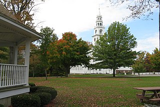
The Templeton Common Historic District encompasses the historic town center of Templeton, Massachusetts. Laid out in the 1750s, the area has been the focus of the town's civic and economic affairs since, and includes its finest assortment of 18th and early 19th-century architecture. The district was added to the National Register of Historic Places in 1983. The district was in 2010 named as one of the 1,000 places to visit in Massachusetts by the Great Places in Massachusetts Commission.

The Princeton Center Historic District is a historic district encompassing the 19th century center of Princeton, Massachusetts. The district is centered at the junction of Hubbardston and Mountain Roads, and includes the town common, town hall, public library, and First Congregational Church. When first listed on the National Register of Historic Places in 1999, the district encompassed 11 acres (4.5 ha), and included only the common, town hall, and library; it was expanded in 2006 to 165 acres (67 ha), and included much of the village of Princeton Center.

The Cohasset Common Historic District is a historic district encompassing the historic town center of Cohasset, Massachusetts. It is centered on the town common, which is bounded by Highland Ave., N. Main St., William B. Long, Jr., Rd. and Robert E. Jason Road. The district was added in 1996 to the National Register of Historic Places.

The Heath Center Historic District encompasses a rural village with predominantly 18th- and 19th-century structures in Heath, a small agricultural town in hills of northwestern Franklin County, Massachusetts, United States. The district is centered on the junction of several roads, around which the center of the town grew. South Road arrives from the south, East Main Street and Bray Road from the east, Ledge Road from the north, and West Main Street from the west.

The Wendell Town Common Historic District encompasses the historic heart of the small town of Wendell, Massachusetts. Centered on a town common established in 1782, it includes a significant number of well preserved Greek Revival buildings. The district was listed on the National Register of Historic Places in 1992.

The Brimfield Center Historic District is a historic district encompassing the historic center of Brimfield, Massachusetts. The district is centered on the town common, and includes properties radiating out from that center on Main Street, Brookfled, Wales, Sturbridge and Warren Roads. Brimfield Center was first laid out in 1721 along a Native American trail that ran through the area, and developed over the years into what is now US Route 20, or Main Street. The district includes properties ranging from early colonial houses to the town hall, built in 1878. The center has retained some coherence because the Brimfield Fair, a major antiques market that takes place three times a year, takes up significant open space in the areas near the center. The district was listed on the National Register of Historic Places in 2006.

The Bedford Center Historic District encompasses the historic heart of the town of Bedford, Massachusetts. It extends along Great Road between Bacon and Concord Roads, and includes primarily residential areas on adjacent side streets. The area includes the town's main civic buildings, its first cemetery, and a diverse array of residential architecture spanning more than two centuries. The district was listed on the National Register of Historic Places in 1977; its boundaries were adjusted in 2014 and its period of significance extended.
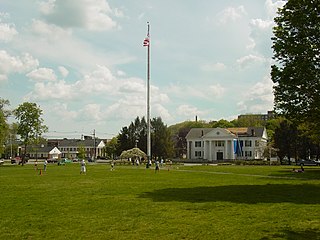
The Framingham Centre Common Historic District encompasses the historic early center of Framingham, Massachusetts. It is centered on the old town common, which is west of Edgell Road, a short way north of the busy commercial corridor of Massachusetts Route 9. The district includes 28 buildings, among them important early civic structures such as the Village Hall, old Edgell Memorial Library, First Parish Church, and the former Framingham Academy building.

The Shirley Village Historic District encompasses the main commercial and industrial village of Shirley, Massachusetts. It is located in the southern part of the town, and grew up around a series of mills that were located along Catacoonamug Brook, and then the railroad, which was built through the area in the 1840s. The district contains 441 properties. It is roughly bounded by Center, Harvard, Leominster and Shaker Roads. The district was listed on the National Register of Historic Places in 1992.

The Common District encompasses the main civic center of Wakefield, Massachusetts. It is centered on the historic town common, just south of Lake Quannapowitt, which was laid in 1644, when it became the heart of Old Reading. The area was separated from Reading as South Reading in 1818, and renamed Wakefield in 1868. The 25 acre district includes the buildings that line the common on Common Street and Main Street, which include the town hall, public library, YMCA, post office, and several churches. It was listed on the National Register of Historic Places in 1990.

The Amherst Village Historic District encompasses the historic village center of Amherst, New Hampshire. Centered on the town's common, which was established about 1755, Amherst Village is one of the best examples of a late-18th to early-19th century New England village center. It is roughly bounded on the north by Foundry Street and on the south by Amherst Street, although it extends along some roads beyond both. The western boundary is roughly Davis Lane, the eastern is Mack Hill Road, Old Manchester Road, and Court House Road. The district includes the Congregational Church, built c. 1771-74, and is predominantly residential, with a large number of Georgian, Federal, and Greek Revival houses. Other notable non-residential buildings include the Farmer's Bank, a Federal-style brick building built in 1806, and the Amherst Brick School, a brick Greek Revival structure that has served as the School Administrative Unit 39 offices since 1997.
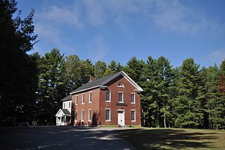
The Newington Center Historic District encompasses the historic civic heart of Newington, New Hampshire. It consists of a section of Nimble Hill Road between its junction with Little Bay Road, and a gate at the southern end marking the start of territory formerly associated with Pease Air Force Base. This area includes the town common, laid out in 1640, a cluster of civic buildings, and several private residences, as well as remnants of the state's oldest town forest. The district was listed on the National Register of Historic Places in 1987; in 1991 an additional 69 acres (28 ha) of former town forest, now part of the airfield, were added to the district.

The Town Center Historic District encompasses the historic village center of South Hampton, New Hampshire. Centered around the Barnard Green, the town common, on New Hampshire Route 107A, it includes architectural reminders of the town's growth and change over time. The district was listed on the National Register of Historic Places in 1983.


